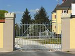
Haselmühl
|
Haselmühl
community Kümmersbruck
Coordinates: 49 ° 25 ′ 9 ″ N , 11 ° 52 ′ 39 ″ E
|
|
|---|---|
| Height : | 371 (369-420) m above sea level NHN |
| Residents : | 2837 (1987) |
| Postal code : | 92245 |
| Area code : | 09621 |
|
The Haselmühl district of Kümmersbruck
|
|
Haselmühl is a Bavarian village that belongs to the municipality of Kümmersbruck .
geography
The eastern region of the Upper Palatinate Jura located village is one of ten officially designated community parts of the Upper Palatinate municipality Kümmersbruck. The center of Haselmühl is a little less than a kilometer southwest of the center of Kümmersbruck at an altitude of 371 m above sea level. NHN .
history
As a result of the administrative reforms in the Kingdom of Bavaria at the beginning of the 19th century , Haselmühl became part of the rural community of Köfering , which also included the parish of Lengenfeld , with the Second Community Edict in 1818 . The administrative seat of this municipality was in Haselbühl. In the course of the municipal territorial reform in Bavaria in the 1970s, the municipality of Köfering was merged with the municipalities of Gärmersdorf and Theuern , whereby Kümmersbruck, the previous administrative seat of the municipality of Gärmersdorf, became the seat of the newly formed large municipality. The new parish was named after this place. In 1987 Haselmühl had 2837 inhabitants and was thus the most populous district of the municipality of Kümmersbruck before the main town of Kümmersbruck (which had around 2100 residents at that time).
traffic

State road 2165 coming from the north-west of Amberg crosses the town and continues in an east-south-east direction to Lengenfeld. In local public transport, Kümmersbruck is served by the city bus (Citybus) on line 409 and by various bus routes operated by the RBO company.
In the western area of Haselmühl there was a railway stop on the completely dismantled Amberg – Schmidmühlen line from 1910 to 1985 . A cycle path has been set up on the route of this former railway line.
Attractions
In Haselmühl there is a listed property, namely a former Hammergut, which is located directly on the western edge of Vils .
literature
- Federal Statistical Office (Hrsg.): Historical municipality register for the Federal Republic of Germany. Name, border and key number changes in municipalities, counties and administrative districts from May 27, 1970 to December 31, 1982 . W. Kohlhammer, Stuttgart / Mainz 1983, ISBN 3-17-003263-1 .
Web links
- Bavarian authorities guide for Haselmühl , accessed on April 13, 2020
- Haselmühl in the BayernAtlas , accessed on April 13, 2020
- Haselmühl on a historical map , accessed on April 13, 2020
Individual evidence
- ↑ a b Bavarian State Office for Statistics and Data Processing (Ed.): Official local directory for Bavaria, territorial status: May 25, 1987 . Issue 450 of the articles on Bavaria's statistics. Munich November 1991, DNB 94240937X , p. 246 ( digitized version ). Retrieved April 13, 2020
- ^ Haselmühl in the local database of the Bayerische Landesbibliothek Online . Bavarian State Library, accessed on April 13, 2020.
- ↑ Geographical location of Haselmühl in the Bavaria Atlas , accessed on April 13, 2020
- ^ Official register of places for Bavaria 1964 . S. 511-512 ( Digitale-sammlungen.de [accessed April 13, 2020]).


