Wood (Bergisch Gladbach)
|
Wood
City of Bergisch Gladbach
Coordinates: 50 ° 56 ′ 43 ″ N , 7 ° 10 ′ 17 ″ E
|
||
|---|---|---|
|
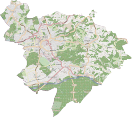
Location of wood in Bergisch Gladbach |
||
The hamlet of wood was a district of Bensberg . It was located in the area of today's Bockenberg district of Bergisch Gladbach .
location
Wood was in the Königsforst in a clearing where the Wahlbach crosses under the road from Bensberg to Forsbach on the eastern side.
history
In the original cadastre , the hamlet of Holz is registered as Aufm Holz in 1827 . There were eight buildings here at the time. They suggest a total of three farms. The parcel boundaries as well as the area designation Auf dem Holz have been preserved to this day. The clearing is popularly called Holzer Wieschen . The location is still shown on the hiking map of Königsforst and the subsequent Bergisches Land from 1941. However, it is not known when the last buildings were cleared.
The Topographia Ducatus Montani by Erich Philipp Ploennies , Blatt Amt Porz , shows that the residential area was categorized as two common courtyards in 1715 and was designated as Hols .
Carl Friedrich von Wiebeking names the court on his charter of the Duchy of Berg in 1789 as Holtz . It shows that at that time wood was part of the Bensberg community in the parish of Bensberg .
Under the French administration between 1806 and 1813, the Porz office was dissolved and wood was politically assigned to Mairie Bensberg in the canton of Bensberg . In 1816 the Prussians converted the Mairie to the mayor's office in Bensberg in the Mülheim am Rhein district .
The place is recorded on the topographical survey of the Rhineland from 1824 and on the Prussian first survey of 1840. From the Prussian new recording from 1892 he is on Ordnance Survey regularly than wood listed or with no name. On the TK25 from 1936 there are no longer any houses at this point.
Due to the Cologne Act , the city of Bensberg was merged with Bergisch Gladbach to form the city of Bergisch Gladbach with effect from January 1, 1975. The area of Holz also became part of Bergisch Gladbach.
| year | Residents | Residential buildings | category | Political / Church affiliation |
|---|---|---|---|---|
| 1822 | 12 | Farm | Bensberg mayor's office, Bensberg parish | |
| 1830 | 15th | Farm | Bensberg Mayor's Office, Bensberg Parish | |
| 1845 | 13 | 3 | Farm estates | Bensberg mayor's office, Bensberg parish |
| 1871 | 15th | 2 | Yard | Mayor's office Bensberg |
| 1885 | 25th | 3 | Locality | Bensberg mayor's office, Bensberg parish |
| 1895 | 8th | 1 | Locality | Bensberg mayor's office, Bensberg parish |
| 1905 | 10 | 2 | Locality | Bensberg mayor's office, Bensberg Catholic parish |
Individual evidence
- ↑ a b Herbert Nicke : Tütberg, An example for the downfall of a settlement area , in: Forsbach, from the life of a village between Königsforst and Sülztal, series of the history association Rösrath eV, Volume 26, Rösrath 2004, p. 214, ISBN 3-922413- 39-X
- ^ Wilhelm Fabricius : Explanations for the Historical Atlas of the Rhine Province ; Second volume: The map of 1789. Division and development of the territories from 1600 to 1794 ; Bonn; 1898
- ↑ Alexander A. Mützell: New topographical-statistical-geographical dictionary of the Prussian state . tape 1 . Karl August Künnel, Halle 1821.
- ↑ Friedrich von Restorff : Topographical-statistical description of the Royal Prussian Rhine Province , Nicolai, Berlin and Stettin 1830
- ↑ Overview of the components and list of all the localities and individually named properties of the government district of Cologne: by districts, mayor's offices and parishes, with information on the number of people and the residential buildings, as well as the Confessions, Jurisdictions, Military and former state conditions. / ed. from the Royal Government of Cologne [Cologne], [1845]
- ↑ Royal Statistical Bureau Prussia (ed.): The communities and manor districts of the Prussian state and their population . The Rhine Province, No. XI . Berlin 1874.
- ↑ Königliches Statistisches Bureau (Prussia) (Ed.): Community encyclopedia for the Rhineland Province, based on the materials of the census of December 1, 1885 and other official sources, (Community encyclopedia for the Kingdom of Prussia, Volume XII), Berlin 1888.
- ↑ Königliches Statistisches Bureau (Prussia) (Ed.): Community encyclopedia for the Rhineland Province, based on the materials of the census of December 1, 1895 and other official sources, (Community encyclopedia for the Kingdom of Prussia, Volume XII), Berlin 1897.
- ↑ Königliches Statistisches Bureau (Prussia) (Ed.): Community encyclopedia for the Rhineland Province, based on the materials of the census of December 1, 1905 and other official sources, (Community encyclopedia for the Kingdom of Prussia, Issue XII), Berlin 1909.
