Horburg
|
Horburg
Barum municipality
Coordinates: 53 ° 21 '28 " N , 10 ° 23' 48" E
|
|
|---|---|
| Height : | 4 m above sea level NN |
| Area : | 3.2 km² |
| Residents : | 434 (Jul 1, 2012) |
| Population density : | 136 inhabitants / km² |
| Incorporation : | March 1, 1974 |
| Postal code : | 21357 |
| Area code : | 04133 |
Horburg is a district of the municipality of Barum in the district of Lüneburg , Lower Saxony ( Germany ).
geography
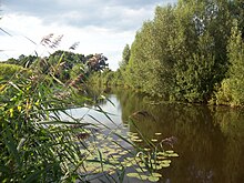
Horburg is a village in the middle of the Lüneburg Elbmarsch . It is not far from the city of Lüneburg (about 17 km). After Hamburg is about 40 km away. Horburg is embedded in a cultural landscape that the first settlers had wrested from the water around 1000 years ago. Numerous watercourses still shape the landscape today. The Neetze runs north of the village .
Until the end of the 19th century, this river flowed into the Ilmenau on the western edge of the village . Since the completion of the Ilmenau Canal in 1888, the Ilmenau no longer flows through Horburg. The previous river bed of the Ilmenau now belongs to the Neetze.
history
Horburg was first mentioned in a document in 1318. Around 1450 the village had five farms and belongs to the Bardowick Bailiwick .
A school already existed in Horburg in 1659, but it was hardly used at the time because the parents needed their children to work in agriculture .
In 1902 the Horburg Voluntary Fire Brigade was founded. Shortly before the end of the Second World War , the residents had to evacuate the village on the instructions of the English occupiers and make it available to foreign prisoners of war and foreign workers who were collected here before they were transported home. Only on September 1, 1945 could the residents move back to Horburg.
On March 1, 1974, Horburg lost its independence. The place became part of the municipality of Barum as part of the regional reform . Since then it has also been part of the Bardowick municipality .
Place name
Until 1931 the village was still called Dreckharburg . The name comes from the Low German term "trecken" = to pull, as the Ilmenau ships had to be pulled upstream here. By decree of the Prussian State Ministry of May 22, 1931, Horburg got its current name.
education
In Horburg there is a primary school , a kindergarten and a day care center . There are then secondary schools in Bardowick , Scharnebeck and Lüneburg . A youth center has existed in the adjacent building from the kindergarten since 2007 .
traffic
Horburg is connected to the regional transport network by the bus line 5402 ( Marschacht - Tespe -Horburg-Barum- Wittorf - Bardowick -Lüneburg) of the Hamburg transport association. There is also line 5904 (Horburg- Brietlingen - Scharnebeck school center ) for school transport.
literature
- Ernst Reinstorf: History of the villages of Bütlingen, Barum, Brietlingen, Horburg, Lüdershausen and St. Dionys . Self-published, Alvern / Krs. Soltau 1951
Individual evidence
- ^ Federal Statistical Office (ed.): Historical municipality directory for the Federal Republic of Germany. Name, border and key number changes for municipalities, counties and administrative districts from May 27, 1970 to December 31, 1982 . W. Kohlhammer GmbH, Stuttgart and Mainz 1983, ISBN 3-17-003263-1 , p. 234 .


