Huaylillas District
| Huaylillas District | |
|---|---|
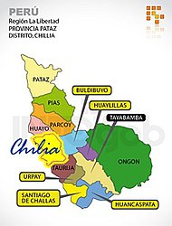
 The Huaylillas District (purple) is centrally located in the Pataz Province |
|
| Basic data | |
| Country | Peru |
| region | La Libertad |
| province | Pataz |
| Seat | Huaylillas |
| surface | 92.8 km² |
| Residents | 1228 (2017) |
| density | 13 inhabitants per km² |
| ISO 3166-2 | PE-LAL |
| politics | |
| Alcalde District | Luis Jesús Coronel Valdiviezo (2019-2022) |
| Political party | Alianza para el Progreso |
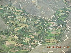
| View of Huaylillas | |
Coordinates: 8 ° 11 ′ S , 77 ° 21 ′ W
The Huaylillas district is located in the Pataz province in the La Libertad region in western Peru . The district has an area of 92.8 km². The 2017 census counted 1228 inhabitants. In 1993 the population was 1049, in 2007 it was 2338. The district administration is located in the village of Huaylillas, which is about 2500 m high and has 477 inhabitants (as of 2017). Huaylillas is 11 km north-northwest of the provincial capital Tayabamba .
Geographical location
The Huaylillas district is located on the western flank of the Peruvian Central Cordillera in the center of the Pataz province. The Río Cajas , a right tributary of the Río Marañón , flows along the southwestern district boundary to the northwest and drains the area. The eastern district boundary runs along the watershed to the catchment area of the Río Huallaga further east .
The district of Huaylillas borders in the south and southwest on the district Tayabamba , in the northwest on the district Buldibuyo and in the east on the district Ongón .
Web links
- Peru: Region La Libertad (provinces and districts) at www.citypopulation.de
- INEI Perú
