
Mauthaus drinking water reservoir
| Mauthaus drinking water reservoir | |||||||
|---|---|---|---|---|---|---|---|
 |
|||||||
|
|||||||
|
|||||||
| Coordinates | 50 ° 20 ′ 18 ″ N , 11 ° 29 ′ 21 ″ E | ||||||
| Data on the structure | |||||||
| Construction time: | 1968-1972 | ||||||
| Height above valley floor: | 56.6 m | ||||||
| Height above foundation level : | 60.6 m | ||||||
| Height of the structure crown: | 451.60 m | ||||||
| Building volume: | 950,000 m³ | ||||||
| Crown length: | 290 m | ||||||
| Crown width: | 9 m | ||||||
| Slope slope on the air side : | 1: 1.5 / 1: 1.75 | ||||||
| Slope slope on the water side : | 1: 1.5 / 1: 1.75 | ||||||
| Power plant output: | 685 kW | ||||||
| Data on the reservoir | |||||||
| Altitude (at congestion destination ) | 448.85 m | ||||||
| Water surface | 92 ha | ||||||
| Storage space | 20.7 million m³ | ||||||
| Total storage space : | 21.0 million m³ | ||||||
| Catchment area | 38.8 km² | ||||||
| Design flood : | 130 m³ / s | ||||||
 |
|||||||

| Pre-lock | |||
|---|---|---|---|
 |
|||
|
|
|||
|
|||
| Coordinates | 50 ° 21 ′ 18 ″ N , 11 ° 29 ′ 16 ″ E | ||
| Data on the structure | |||
| Construction time: | - 1975 | ||
| Height above foundation level : | 17 m | ||
| Building volume: | 45,000 m³ | ||
| Crown length: | 120 m | ||
| Data on the reservoir | |||
| Water surface | 14 ha | ||
| Storage space | 0.7 million m³ | ||
The Mauthaus drinking water dam - also known as the Ködeltalsperre - is a dam in Bavaria that was built near Kronach from 1968 to 1972 to provide drinking water . As a secondary purpose, it is used for flood protection , low water elevation and electricity generation from hydropower . It was put into operation in 1975 and was the first Bavarian drinking water reservoir.
The dam is a rubble dam with a clay core inner seal with transition zones on both sides and was founded on rock. The dam has a longitudinal control tunnel , a sealing curtain and a berm on the water and air side .
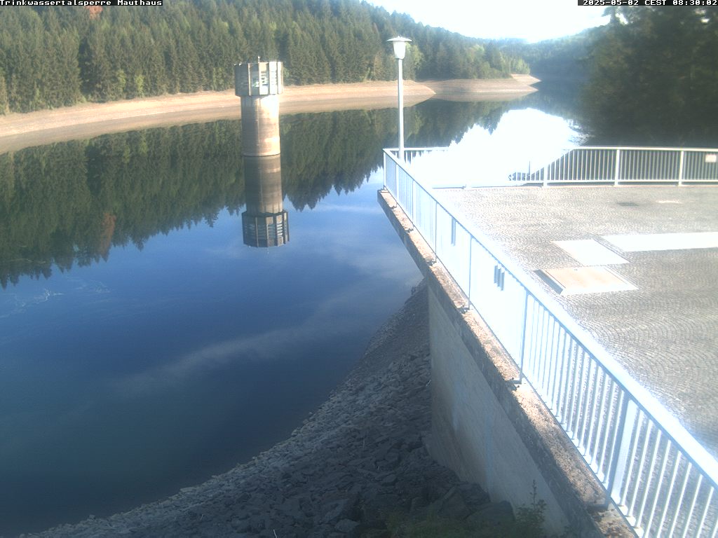
The water is withdrawn via a withdrawal tower. An overflow with two weir flaps on the left slope with a chute over the ridge serves as flood relief .
history
From 1900 the royal Bavarian district administrator in Kronach, Jakob Degen , dealt with the idea and design of three dams in the Franconian Forest. These were to be located in Wallenfels on the Wilder Rodach , in Mauthaus on the Nurner Ködel and in Gifting on the Kremnitz and, above all, should be used to generate electrical energy; however, its use for flood reduction and drinking water supply has also already been considered in order to make the project more profitable. The plans commissioned by Degen remained unrealized during his lifetime for reasons of cost.
After the First World War , the plans were discussed again. A diversion of the Rodach was also considered in order to use it in addition to the Nordhalbener and Tschirner Ködel to feed the reservoir. However, the project was discontinued due to inflation in the 1920s and its economic consequences.
The planning for the construction of today's dam began in the mid-1950s. The Mauthaus drinking water reservoir was intended to ensure the drinking water supply of the Upper Franconia region , which is disadvantaged compared to the southern parts of Bavaria due to the distribution of precipitation and the extensive lack of rocks that can store larger amounts of water.
After around 85 hectares of forest had been cleared in the previous two years , the actual construction work for the dam began on August 26, 1968 with the diversion of the Nurner Ködel and the construction of three tunnels : a 263 m long access tunnel to the extraction tower , a 280 m long one Control tunnel, which runs under the main axis of the dam, and a smaller inclined tunnel, which is used for ventilation. Most of the concrete structures, including the 67 m high extraction tower, which is divided into 16 floors, were completed in 1969. The embankment filling work, the underground grouting, which was carried out at the same time, and the building construction and assembly work extended into 1971. In spring 1971 the pre- dam and in 1972 the main lake were dammed on a test basis. At the same time, a power house with a control room and three turbines for generating electricity and the stilling basin were built at the entrance to the valley near Mauthaus . The Mauthaus drinking water dam was officially put into operation on May 21, 1973 by the Bavarian Minister of the Interior, Bruno Merk ; the first drinking water was drawn in 1975. The construction of the dam cost around 48 million D-Marks . Another 132 million D-Marks had to be spent on building the 485 km pipeline network in the supply area, the Rieblich drinking water treatment plant and several pumping stations.
Damaged sampling line
On January 25, 2020, an automatic control system reported leaks in one of the two pipelines that lead from the extraction tower to the operations building at the valley entrance, which is why the pipeline was taken out of service. A camera inspection showed that the 300 m long pipe, which has a diameter of 140 cm and was last checked in 2019, was damaged over a length of around 25 m. Due to the redundant design of the pipelines, the drinking water supply was not directly affected by the failure of the damaged pipeline, and the stability of the dam was also not impaired. By the beginning of February 2020, the technical relief organization installed a provisional replacement for the leaky pipe with hose lines in order to be able to maintain the water supply during the repair work in the event of a failure of the second line.
At the end of March 2020, a hose liner was installed in the damaged pipeline in order to use this inflatable plastic hose to seal the damaged areas from the inside. If the repair measure is successful, the disused pipe should be put back into operation so that the second pipe can then be checked for damage. The cause of the damage was still unclear at the end of March 2020.
Pre-lock
The dam has a large pre- dam . This is 4.5 km above the main barrier. The pre-lock is used for pre-cleaning, as a settling basin and to keep the water level constant. Its tributaries are the Tschirner and the Nordhalbener Ködel.
The dam of the pre- dam is a 120 m long and 17 m high stone embankment dam with an asphalt concrete inner seal. In the middle of the embankment at the level of the foundation floor , there is a hearth wall , from which a 10 m deep sealing curtain was created in the subsoil by means of grouting .
The reservoir of the pre-dam has a volume of 0.7 million m³ and a surface of 14 ha.
In addition to its utility use, the dam is also very popular as a local recreation area. A 12.5 km long, continuously paved circular path leads around the reservoir.
Drinking water
In 2014, 12,181,930 m³ / a of raw water for drinking water treatment were taken from the dam. The highest drinking water discharge of 40,140 m³ / d took place on July 3, 2014. Dam water always contains organic and inorganic substances in dissolved form and as fine suspended particles, which is why the raw water has to be treated as drinking water before it is forwarded . The Fernwasserversorgung Oberfranken FWO built the first treatment plant for drinking water from dams in Bavaria between 1972 and 1975 near the reservoir near Rieblich.
The raw water is taken from the dam via the extraction tower and fed to a multi-stage treatment. In the first step, the strong oxidizing agent ozone is added to the water via an injector . The aim of the admixture is to oxidize organic compounds that are difficult to break down and to sterilize the water. Then flocculants are added to bind the fine particles suspended in the water to form larger flakes that can be filtered off more easily. A multilayer filter is the first filter stage and filters out flakes and contaminants. Carbon dioxide is added to the now pre-cleaned water to harden it. The acid reacts with the calcium carbonate (Jurassic lime) of the second filter stage to form calcium hydrogen carbonate and thereby increases the hardness of the water . The treated water is distributed across the whole of Upper Franconia via pipelines and passed on to many local water suppliers .
Freetime activities
For hikers, cyclists and inline skaters, a 12.5 km long, paved and almost flat circular path has been created. This is connected to a network of hiking trails and a nature trail .
See also
literature
- Peter Franke, Wolfgang Frey: Dams in the Federal Republic of Germany . Ed .: National Committee for Large Dams in the Federal Republic of Germany [DNK], German Association for Water Management and Cultivation e. V. [DVWK]. Systemdr.-GmbH, Berlin 1987, ISBN 3-926520-00-0 .
Web links
- Webcam Mauthaus / Koedelsee drinking water reservoir
- Water for Upper Franconia: the Ködeltalsperre in the district of Kronach - Frankenschau - BR
Individual evidence
- ↑ a b c supplement “50 years of long-distance water supply in Upper Franconia” in Fränkischer Tag (Edition K) from 6 July 2016
- ↑ a b “Dam project gains new life. The supreme building authority is paying attention to fifty-year-old plans - three reservoirs with power stations planned in the Franconian Forest - the design comes from the late Upper Government Council. ”In: Volksblatt. November 7, 1955.
- ^ Carlo Fehn: Fascination Ködeltalsperre. A building for eternity . In: Kronicher. The information brochure for the city and district of Kronach . No. 1 . Verlag Carlo Fehn, Kronach June 2011, p. 6-9 ( issuu.com ).
- ↑ Michael Wunder: Even after 50 years a blessing for the region . In: New Press Coburg . Local edition Kronach. August 25, 2018, p. 13 .
- ↑ Gerd Fleischmann: Drinking water for 400,000 people . In: New Press Coburg . Local edition Kronach. June 4, 2011, p. 18 .
- ↑ Petra Bordasch: large-scale operation on the Ködeltalsperre . In: New Press Coburg . January 27, 2020, p. 7 .
- ↑ Sandra Hackenberg: Small leak at the Ködeltalsperre, great effect. In: inFranken.de. January 27, 2020, accessed February 25, 2020 .
- ↑ Bianca Hennings: The dam is safe . In: New Press Coburg . January 28, 2020, p. 7 .
- ^ Sandra Hackenberg: After a major alarm at the Ködeltalsperre: Unsafe days at the dam in Upper Franconia. In: inFranken.de. January 30, 2020, accessed February 25, 2020 .
- ↑ Julia Knauer: The dam becomes a permanent construction site . In: New Press Coburg . February 18, 2020, p. 7 .
- ↑ Sandra Hackenberg: After a major alarm and leaks: Environment Minister Glauber inspects the Ködeltalsperre. In: inFranken.de. February 18, 2020, accessed February 25, 2020 .
- ↑ Julia Knauer: The water should flow again soon . In: New Press Coburg . March 26, 2020, p. 13 ( Online [accessed March 26, 2020]).
- ↑ Sandra Hackenberg: "The coming days are crucial": Big test planned at the Ködeltalsperre. In: inFranken.de. March 24, 2020, accessed March 26, 2020 .
- ↑ Internet presence of the long-distance water supply Upper Franconia
- ↑ belocal.de ( Memento of the original from September 25, 2008 in the Internet Archive ) Info: The archive link was inserted automatically and has not yet been checked. Please check the original and archive link according to the instructions and then remove this notice.