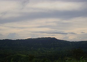
Keokradong
| Keokradong | ||
|---|---|---|
| height | 980 m (984 m) | |
| location | Chittagong , Bangladesh | |
| Mountains | Mizo Hills | |
| Dominance | 13 km → Dumlong | |
| Notch height | 110 m | |
| Coordinates | 21 ° 57 '0 " N , 92 ° 30' 52" E | |
| Topo map | ACME Mapper | |
|
|
||
| particularities | was formerly the highest mountain in Bangladesh at 1230 m | |
|
Refuge on the summit of Keokradong |
||
The Keokradong (also: Keokradang ) is a mountain in Bangladesh .
location
The mountain is located in southeast Bangladesh in the north of the Upazila Thanchi in the Bandarban district belonging to the Chittagong Hill Tracts of the Chittagong Division in the Mizo Hills , a range of hills that forms a southern foothill of the Himalayas , about ten kilometers west of the border with Myanmar .
height
For a long time the Keokradong was considered the highest mountain in Bangladesh with a height of 1230 m . This information is still widespread, even if various measurements have since confirmed that the altitude is less than 1000 meters. A sign on the refuge on the top of the mountain indicates the altitude at 3172 feet (967 m). A GPS measurement and an independent Russian topographical survey based on the SRTM data recorded during the STS-99 Shuttle Radar Topography Mission in February 2000 determined its altitude at 974 m . The correct position of the Keokradong height was also disputed; a Russian map indicated an elevation of 883 m , located about 5 kilometers northwest in the Upazila Ruma .
During an excursion with the BD Explorer in December 2012, the height of the Keokradong was measured using GPS at 3229 feet (984 meters). ACME Mapper states the height of the mountain as 980 meters. Thus, the Keokradong is now the fourth highest elevation in Bangladesh after the Mowdok Mual ( 1045 m ), the Zow Tlang ( 999 m ) and the Dumlong ( 997 m ).
The nearest mountain that is higher than Keokradong is Dumlong, 13 kilometers northeast. Within a radius of about 10 kilometers from the Keokradong are other mountains that, with a height of over 900 meters, are among the highest peaks in Bangladesh, including the Maithaijama Haphong ( 966 m ), the Mukhra Thuthai Haphong ( 954 m ), the Thingdawl Te Tlang ( 944 m ), the Capital Hill ( 933 m ) and the Kreikung Taung ( 925 m ).
literature
- Sanzida Murshed: Keokradong . In: Asiatic Society of Bangladesh (Ed.): Banglapedia - the National Encyclopedia of Bangladesh . 2nd Edition. 2012 (English, banglapedia.org ).
Web links
- Keokradong. In: Peakbagger. (English).
Individual evidence
- ↑ a b Keokradong. In: ACME Mapper 2.2. Retrieved May 9, 2019 .
- ^ A b Expedition: Scaling unknown Heights By-BD Explorer. In: Wikiloc. December 31, 2012, accessed May 11, 2019 .
- ↑ Sanzida Murshed: Keokradong . In: Banglapedia . 2nd Edition. 2012 (English, banglapedia.org ).


