Kerrier
| Kerrier District | |
|---|---|
 Location in Cornwall |
|
| status | District |
| region | South West England |
| Administration County | Cornwall |
| Administrative headquarters | Camborne |
| surface | 473.52 km² (106.) |
| Residents | 98,800 (228.) |
| ONS code | 15UD |
| Website | - |
| founding | 1974 |
| resolution | 2009 |
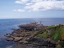
Kerrier was a district in the county of Cornwall in England . The Lizard peninsula with the southernmost point ( Lizard Point ) of the island of Great Britain also belonged to Kerrier . The administrative seat was the city of Camborne . Other important places in the former district are Helston and Redruth . Most people live in the merged cities of Camborne, Redruth and Pool (a little over 39,000 inhabitants in total).
history
The current district was formed on April 1, 1974 and was created from the merger of Borough Helston, Urban District Camborne-Redruth and Rural District Kerrier. On April 1, 2009, in addition to Kerrier, all other districts in Cornwall were abolished and combined into a single unitary authority.
Parishes
At the time of the dissolution of the district its territory included 32 municipalities ( Parish )
Web links
- Official website ( Memento of March 17, 2009 in the Internet Archive )
Individual evidence
- ↑ Town and Parish Councils within Kerrier District on the district's website ( August 8, 2007 memento in the Internet Archive )
Coordinates: 50 ° 13 ′ N , 5 ° 18 ′ W

