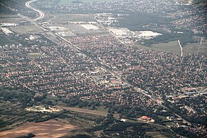
Kistarcsa
| Kistarcsa | ||||
|
||||
| Basic data | ||||
|---|---|---|---|---|
| State : | Hungary | |||
| Region : | Central Hungary | |||
| County : | pest | |||
| District since 1.1.2013 : | Gödöllő | |||
| Coordinates : | 47 ° 33 ' N , 19 ° 16' E | |||
| Area : | 11.02 km² | |||
| Residents : | 11,703 (Jan. 1, 2011) | |||
| Population density : | 1,062 inhabitants per km² | |||
| Telephone code : | (+36) 28 | |||
| Postal code : | 2143 | |||
| KSH kódja: | 34157 | |||
| Structure and administration (status: 2014) | ||||
| Community type : | city | |||
| Mayor : | Sándor Solymosi ( FIDESZ - KDNP ) | |||
| Postal address : | Szabadság út 48 2143 Kistarcsa |
|||
| Website : | ||||
| (Source: A Magyar Köztársaság helységnévkönyve 2011. január 1st at Központi statisztikai hivatal ) | ||||
Kistarcsa is a Hungarian town in the district Gödöllő in Pest County .
geography
Kistarcsa extends over an area of 11.02 km². The city is located on the north-eastern city limits of Budapest.
history
The first written mention was in 1352 as Tarcsa . But it can be assumed that the place is older. At the beginning of the Turkish occupation there were no casualties among the local population but during the Long Turkish War (1593-1606) the place was depopulated. After the Turkish occupation and after the end of the Kuruc War , German and Slavic settlers came to the region. At the instigation of Count Anton Grassalkowich , many Tóthens were settled from the Trenčín and Neutra counties in 1727 , so that the number of Slavs exceeded that of Hungarians.
In 1882 the HÉV railway line from Budapest Ostbahnhof to Kerepes was built. In 1911 the line to Gödöllő was extended and electrified.
In 1880 the construction of today's Catholic Church began. The stones from the ruins of the churches from the Middle Ages were used as building material. The church belonged to the parish of Kerepes, in 1913 the Vácer Bishop Károly Emmánuel de Csáky approved a local parish vicar .
In 1908 a machine and railway factory was founded as a joint stock company ( Gép- és Vasútfelszerelési Gyár Részvénytársaság ). During the economic crisis, the factory went bankrupt and was sold in 1828. Some buildings were demolished. In the 1930s, parts of the factory property came into the possession of the Interior Ministry, which set up an internment camp here.
After the German occupation in March 1944, the camp was used as a collection camp for the deportations to Auschwitz.
From 1950 the camp was operated by the ÁVH . From the beginning of the 1960s to the beginning of the 1990s the property was used as a police barracks, later it served as a refugee camp for many years. Currently, some buildings are owned by the local authority, but most of the buildings in the complex are unused.
From 1979 to 1994 Kistarcs and Kerepes were a municipality under the name Kerepestarcsa . Kistarcsa has had town charter since September 1st, 2005.
Attractions
- The reformed church ruins
- The Catholic Church
- Statue of József Simándy
- Statue of Prince Emmerich
- Tomb of László Bódi
traffic
The place has the three stops Kistarcsa (kórház / hospital), Kistarcsa and Zsófialiget on line 8 of the HÉV . On the southwest border of the city is the ramp 60 of the M0 motorway . The main road 3 goes through the village.
sons and daughters of the town
- József Simándy (1916–1997), Hungarian opera singer.
Twin cities
The partner communities are:
-
 Slovakia - Bellus / Beluša (2005)
 -
 Romania - Torja (2006)
 -
 Poland - Radomyśl nad Sanem (2013)
 -
 Ukraine - Fantschykowo (2015)
Web links
- Website of the city of Kistarcsa (Hungarian)
Individual evidence
- ^ Kistarcsa települési választás eredményei ( Hungarian ) Nemzeti Választási Iroda. October 12, 2014. Retrieved July 27, 2018.
- ↑ Testvértelepüléseink | Kistarcsa ( Hungarian ) In: kistarcsa.asp.lgov.hu . Retrieved July 27, 2018.


