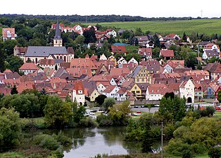
Kitzinger Main Valley
The Kitzinger Maintal is a small-scale natural spatial unit (5th order) with the order number 133.05 in the area of the Lower Franconian communities Albertshofen , Dettelbach , Kitzingen , Mainstockheim , Marktsteft and Sulzfeld am Main in the Kitzingen district .
location
The Kitzinger Maintal (133.05) forms a sub-unit within the nameless main unit 133.0 . It is part of the Middle Main Valley (133) and thus a natural area in the main unit group of the Mainfränkische Platten . The natural area includes a long stretch of the Main and around Kitzingen also the eastern hinterland of the river. In the north, around Dettelbach, the Gäuf area in the northern Main Triangle (134.10) and in the west the plateaus in the southern Main Triangle (134.11) join. The Schwarzacher valley widening (133.06) is located along the Main in the northeast . The east is dominated by the natural areas of the Kitzinger Main Plain (137.0). From north to south these are the Albertshofener drift sand area (137.01) and the Mainbernheimer level (137.00). The Main merges into the Würzburg-Ochsenfurt Main Valley (133.04) in the southwest .
The natural area is located on a section of the Main in the Lower Franconian district of Kitzingen. It includes areas in the communities of Albertshofen, Dettelbach, Kitzingen, Mainstockheim, Marktsteft and Sulzfeld am Main. The eponymous center is the city of Kitzingen with its districts on the river. The easternmost point is the district of Hoheim . In the north, the district of Mainsondheim or the city of Dettelbach delimits the natural area, in the south this is the area around Marktsteft.
Landscape characteristics
The Kitzinger Maintal presents itself as a river valley section with a steep western slope and a flat eastern slope, which widens like a bay towards the east near the town of Kitzingen. In this section the main tributaries Sickersbach , Repperndorfer Mühlbach and Bimbach flow into the river, so that a wide bay has emerged here against the Lettenkeuper area of the Steigerwald foreland. The potential natural vegetation (without human intervention) would produce riparian forests with ash and elm trees .
Protected areas
The main valley around Kitzingen has several protected areas of almost all protection categories. A long section of the fauna and flora habitat “Mainaue between Grafenrheinfeld and Kitzingen” stretches along the Main . There is also a larger fauna and flora habitat at the Kitzingen airfield . The only nature reserve is the Marktstefter Tännig in the southern part of the natural area. Areas on the Marktstefter district were also classified as a bird sanctuary “Southern Steigerwaldvorland”.
Climate, geology and tectonics
The climate of the Kitzinger Main section has some special features. Overall, there is relatively little annual rainfall here along the Main , and at the same time the area has a very high temperature mean in summer . Both components lead to a very dry local climate . At the same time, the region is exposed to a high risk of frost in summer. This can also be attributed to the low frequency of fog in this area of the main valley.
The two banks of the Main have very different soil compositions. Loess blankets predominate on the west side , while drifting sands can be found in the east .
See also
literature
- Karl-Albert Habbe: The natural space units on sheet 153 Bamberg 1: 200,000 - A bundle of problems and a suggested structure. In: Mitteilungen der Fränkische Geographische Gesellschaft Vol. 50/51 for 2003/2004 . Erlangen 2004. pp. 55-102.
- Horst Mensching, Günter Wagner: The natural spatial units on sheet 152 Würzburg (= geographical land survey 1: 200,000 natural spatial structure of Germany) . Bad Godesberg 1963.
Web links
Individual evidence
- ↑ Geography Giersbeck: Map 152 Würzburg , PDF file, accessed on January 8, 2019.
- ↑ Mensching, Horst (among others): The natural space units on sheet 152 Würzburg . P. 24.
- ^ Habbe, Karl-Albert: The natural space units on sheet 153 Bamberg 1: 200,000 . P. 85 (map).
- ↑ Mensching, Horst (among others): The natural space units on sheet 152 Würzburg . P. 24.

