Albeni Falls power plant
| Albeni Falls power plant | ||
|---|---|---|
| location | ||
|
|
||
| Coordinates | 48 ° 10 '48 " N , 116 ° 59' 59" W | |
| country |
|
|
| place | Bonner County , Idaho | |
| Waters | Pend Oreille | |
| power plant | ||
| operator | USACE | |
| construction time | 1951 to 1955 | |
| Start of operation | 1955 | |
| technology | ||
| Bottleneck performance | 42.6 megawatts | |
| Expansion flow | 990 m³ / s | |
| Standard work capacity | 200 million kWh / year | |
| Turbines | 3 Kaplan turbines | |
| Others | ||
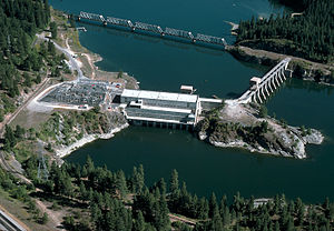
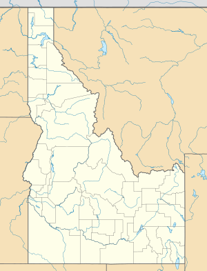
The Albeni Falls power plant ( Albeni Falls Dam in English ) is a run-of-river power plant in Bonner County , Idaho , USA . It is the first power plant in the chain of five hydropower plants on the Pend Oreille River , a left tributary of the Columbia River . About three miles upriver is the village of Priest River and about two kilometers downriver is the parish of Newport .
Construction work began in January 1951. They were completed in December 1955. The power plant was built by the United States Army Corps of Engineers (USACE) and is also operated by the USACE. In addition to generating electricity, it is also used for flood protection.
The power station is named after Peter Albeni Poirier , one of the first settlers in the area.
Barrier structure
The barrier structure consists of a weir system with ten weir fields on the left side of the river and a machine house on the right side. In between there is a small island. 104,000 m³ (136,000 yd ³) of concrete was used for the structure . The height of the structure is given as 27 m (90 ft) or 20 m (65 ft). Its total length is 236 m (775 ft), of which 120 m (400 ft) are accounted for by the weir system.
The barrier was built on the site of the Albeni Falls . This bottleneck obstructed the runoff during high tide in spring and therefore led to flooding upstream and at Lake Pend Oreille . The bottleneck was removed by the power plant. After severe flooding in the Columbia River basin in 1948, the Flood Control Act in 1950 laid the foundations for the construction of the power plant.
Lake Pend Oreille
The Pend Oreille River is the natural outflow from Lake Pend Oreille , which is located approximately 40 km (25 mi ) upstream from the power plant. The power plant dams the river and also serves to regulate the water level of the lake. The lake's storage targets vary depending on the season: the minimum storage target is 624.7 m (2,049.7 ft), the maximum is 628.6 m (2,062.5 ft) above sea level .
power plant
The Albeni Falls power plant has an installed capacity of 42.6 MW . The average annual production is 200 million kWh. The three Kaplan turbines are located in an engine house on the right side of the river. The electricity generated is marketed by the Bonneville Power Administration (BPA).
The maximum flow is 990 m³ / s (35,000 ft / s).
Others
Construction costs were $ 34 (or 46) million USD .
Web links
- Albeni Falls Dam Visitor Center. www.visitidaho.org, accessed on September 19, 2015 (English).
Individual evidence
- ↑ a b c d e Albeni Falls Dam. USACE , accessed September 16, 2015 .
- ^ A b Project History. USACE, accessed September 19, 2015 .
- ↑ a b c d Albeni Falls Dam Flexible Winter Power Operations Bonner County, Idaho - Final Environmental Assessment. (PDF 2.6 MB, p. 11 (1–1), 22 (3–2) -24 (3–4)) energy.gov, October 2011, accessed on September 16, 2015 (English).
- ↑ a b Albeni Falls Dam. www.northidaho.org, accessed on September 19, 2015 .
- ↑ Albeni Falls Dam. nwdams.com, accessed September 19, 2015 .
- ↑ Idaho. (PDF 798 KB, p. 2) (No longer available online.) Damsafety.org, formerly in the original ; accessed on September 16, 2015 . ( Page no longer available , search in web archives ) Info: The link was automatically marked as defective. Please check the link according to the instructions and then remove this notice.
- ^ The Completed Dam. www.ccrh.org, accessed on September 17, 2015 (English).

