L'Île-Perrot
| L'Île-Perrot | ||
|---|---|---|
 |
||
| Location in Quebec | ||
|
|
||
| State : |
|
|
| Province : | Quebec | |
| Administrative region : | Montérégie | |
| MRC or equivalent : | Vaudreuil-Soulanges | |
| Coordinates : | 45 ° 24 ′ N , 73 ° 57 ′ W | |
| Height : | 25 m | |
| Area : | 5.56 km² | |
| Residents : | 10,503 (as of 2011) | |
| Population density : | 1,889 inhabitants / km² | |
| Time zone : | Eastern Time ( UTC − 5 ) | |
| Municipality number: | 71060 | |
| Postal code : | J7V | |
| Area code : | +1 514 | |
| Mayor : | Marc Roy | |
| Website : | www.ile-perrot.qc.ca | |
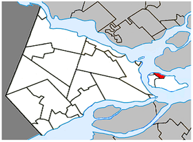
 Location in the MRC Vaudreuil-Soulanges |
||
L'Île-Perrot is a city in the southwest of the Canadian province of Quebec . It is located in the Montérégie administrative region , about 35 kilometers west of central Montreal . L'Île-Perrot belongs to the regional county municipality (municipalité régionale du comté) Vaudreuil-Soulanges , has an area of 5.56 km² and has 10,503 inhabitants (2011).
geography
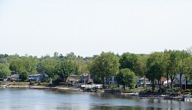
The municipality of L'Île-Perrot is located in the northern part of the Île Perrot . Two branches of the Ottawa River flow around this island in the Hochelaga Archipelago . The municipality also includes several offshore islands in Lac des Deux Montagnes , of which Île Claude and Île Bellevue are also populated. On the opposite bank of the eastern branch of the estuary is the Île de Montréal . Neighboring communities on the island are Notre-Dame-de-l'Île-Perrot in the east, Pincourt in the southwest and Terrasse-Vaudreuil in the west. Across the eastern branch of the Ottawa River is the community of Sainte-Anne-de-Bellevue .
history
Jean Talon , the first general manager of New France , transferred the island as seigneurie to the officer François-Marie Perrot , then governor of Montreal . Since Perrot had no time to take care of the fur trade on the island because of his work as regimental commander, he gave the northern part as a fief to his lieutenant Antoine de La Frenaye de Brucy. Because of this, this part of the island was called Brucy until the middle of the 20th century . In 1856 the Grand Trunk Railway was opened between Montreal and Toronto , which triggered a surge in development.
In 1855, the parish of Sainte-Jeanne-Chantal-de-l'Isle-Perrot was founded, which included the entire island. In 1946 this became the entire municipality of Île-Perrot, which only existed for a few years. Notre-Dame-de-l'Île-Perrot split off in 1949, Pincourt in 1950 and finally Terrasse-Vaudreuil in 1952. In 1955, the municipality was granted city status, and since 2000 it has been a member of the Communauté métropolitaine de Montréal association .
population
According to the 2011 census, L'Île-Perrot had 10,503 inhabitants, which corresponds to a population density of 1889 inhabitants / km². 65.7% of the population stated French as their main language, the share of English was 20.5%. 1.8% said they were bilingual (French and English), other languages and multiple answers accounted for 12.0%. Only French spoke 28.1%. In 2001, 82.5% of the population were Roman Catholic , 5.1% Protestant and 7.7% non-denominational.
traffic
L'Île-Perrot is cut through by Autoroute 20 ( Montreal - Toronto ). In the central area, this motorway is classified as a main road, as there are three level crossings with traffic lights . The Autoroute 20 reaches the Île de Montréal via the Pont Galipeault , about 5 km further north there is an intersection-free motorway with the Autoroute 40 . Side roads connect to the neighboring communities on the island.
On the northern outskirts of the city run two parallel, double-track railroad lines of the Canadian National Railway and the Canadian Pacific Railway , each with a separate bridge over the Ottawa River. L'Île-Perrot has a station on the suburban railway line of the Agence métropolitaine de transport , which runs from the Montrealer Lucien-L'Allier station to Vaudreuil-Dorion and Hudson . Several bus routes operated by the CIT La Presqu'Île company are responsible for fine-tuning the island .
Web links
- Official website of L'Île-Perrot (French)
Individual evidence
- ↑ Pointe de Brucy. Commission du toponymie du Québec, 2013, accessed December 12, 2013 (French).
- ↑ L'Île-Perrot. Commission du toponymie du Québec, 2013, accessed December 12, 2013 (French).
- ↑ Population profile of the municipality of L'Île-Perrot. In: 2011 Census. Statistics Canada , 2011, accessed December 12, 2013 (French).
- ↑ Population profile of the municipality of L'Île-Perrot. In: 2001 Census. Statistics Canada , 2001, accessed December 12, 2013 (French).
