Laconia, New Hampshire
| Laconia | ||
|---|---|---|
 |
||
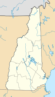
| Location in New Hampshire | ||
|
|
||
| Basic data | ||
| Foundation : | 1855 | |
| State : | United States | |
| State : | New Hampshire | |
| County : | Belknap County | |
| Coordinates : | 43 ° 35 ′ N , 71 ° 29 ′ W | |
| Time zone : | Eastern ( UTC − 5 / −4 ) | |
| Residents : | 15,951 (as of 2010) | |
| Population density : | 307.3 inhabitants per km 2 | |
| Area : | 68.8 km 2 (approx. 27 mi 2 ) of which 51.9 km 2 (approx. 20 mi 2 ) is land |
|
| Height : | 153 m | |
| Postcodes : | 03246, 03247, 03249 | |
| Area code : | +1 603 | |
| FIPS : | 33-40180 | |
| GNIS ID : | 0867917 | |
| Website : | www.cityoflaconianh.org | |
| Mayor : | Matthew J. Lahey | |
Laconia is a city in the United States and the administrative seat of the borough of Belknap County in the state of New Hampshire .
history
A large Abenaki settlement once existed in the place where Laconia is today. Early explorers from Europe had followed the Piscataqua River north of Lake Champlain to discover the great lakes mentioned in Native American folklore. In 1746 a fort was built on the site of Laconia, but permanent settlement under the name Meredith Bridge did not take place until 1761 because of the tense situation between the Indians, British and French.
In 1822 a courthouse was built. The Belknap Mill was built in 1823 and commissioned in 1828. The Laconia Car Company began production in 1848 and maintained it until the 1930s. In 1849 Laconia was connected to the railway network.
In 1860 a fire destroyed parts of the settlement. Laconia received city rights in 1893.
geography
Laconia, named after the Greek Λακωνία Lakonía ( Laconia ), includes the town as well as Lakeport and Weirs Beach . The city is bordered to the southwest by Lake Winnisquam and to the northeast by Lake Winnipesaukee , New Hampshire's largest lake. Laconia is located in the catchment area of the Winnipesaukee River , which flows into the Merrimack River . The highest point in the urban area is a 293 m high hill southwest of the district Weirs Beach in the northern urban area.
traffic
The city lies on the Concord – Wells River railway line , which opened in 1848 and was operated by passengers until 1965. Since the 1970s, only tourist trains have been running on the route. A branch line to Alton Bay branched off from this line from 1890 to 1942 in the Lakeport district. From 1882 to 1925 the Laconia tram ran from the center of Laconia to Lakeport and from 1899 on to Weirs Beach.
US Highway 3 (Daniel Webster Highway) runs through Laconia . There is no direct connection to the interstate highway network, but Interstate 93 runs around ten kilometers west of the city. The city's airfield, Laconia Airport , is currently not operated on a scheduled basis. The nearest airport with scheduled flights is in Manchester .
sons and daughters of the town
- Pearl Chertok (1918–1981), harpist, music teacher and composer
- Alex Howe (* 1989), biathlete
- Katrina Howe (* 1986), biathlete and former cross-country skier
- Thomas J. McIntyre (1915–1992), politician, US Senator
- Joe Pitman (1924-2018), weightlifter
- Claude Rains (1889–1967), actor (died there)
