Manchester (New Hampshire)
| Manchester | ||
|---|---|---|
| Nickname : Queen City, Manch Vegas | ||
 Downtown Manchester |
||
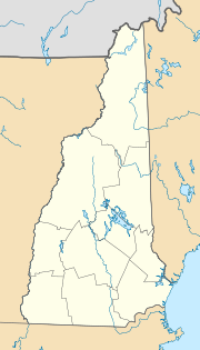
| Location in New Hampshire | ||
|
|
||
| Basic data | ||
| Foundation : | 1751 | |
| State : | United States | |
| State : | New Hampshire | |
| County : | Hillsborough County | |
| Coordinates : | 42 ° 59 ′ N , 71 ° 28 ′ W | |
| Time zone : | Eastern ( UTC − 5 / −4 ) | |
|
Inhabitants : - Metropolitan Area : |
110,505 (as of 2016) 400,721 (as of 2010) |
|
| Population density : | 1,292.5 inhabitants per km 2 | |
| Area : | 90.4 km 2 (approx. 35 mi 2 ) of which 85.5 km 2 (approx. 33 mi 2 ) are land |
|
| Height : | 64 m | |
| Postcodes : | 03101 - 03109 | |
| Area code : | +1 603 | |
| FIPS : | 33-45140 | |
| GNIS ID : | 0868243 | |
| Website : | www.manchesternh.gov | |
| Mayor : | Joyce Craig (since 2018) | |
Manchester is the largest city in the US state of New Hampshire . The city has an area of 90.4 km² and a population of 109,565 ( 2010 US census ).
geography
|
||||||||||||||||||||||||||||||||||||||||||||||||||||||||||||||||||||||||||||||||||||||||||||||||||||
The city is located in southern New Hampshire in Hillsborough County on the Merrimack River .
history
The first settlers came to the area of the Penacook Indians in 1722. The first name of the settlement was from 1727 Tyngstown , which then became Derryfield in 1751 .
In 1810 Derryfield - now a district of Manchester - was renamed Manchester. The Amoskeag Manufacturing Company wanted to create an industrial center modeled on the English industrial city of Manchester . Around 1900 the place was dubbed the American Manchester . The Amoskeag Falls of the Merrimack provided ample hydropower for industry, which in 1900 produced goods for $ 26,607,600 in 577 factories employing 19,032 workers (including four large cotton mills with 10,616 workers for $ 11,723,508 in 6 Shoe factories with 2,002 workers sold for $ 4,052,204.) The Amoskeag Manufacturing Company closed its doors in 1935, causing the city to suffer temporary economic decline. The city of Manchester had a tram service from 1877 to 1940. The network, which is around 50 kilometers long, consisted of urban and intercity lines.
In 1884 the Roman Catholic Diocese of Manchester was established in the city. The main church is St. Joseph's Cathedral, built in 1869 .
Demographics
In 1773, a good fifty years after the arrival of the first settlers, the place had 279 inhabitants. On July 1, 2015, the city had 110,229 residents, according to an estimate by the United States Census Bureau ; this means that the city's growth has fallen to a low level in the past few decades. As in many other US states in the north with low immigration, the old age of the baby boomer generation is noticeable.
education
The University of New Hampshire has a college in Manchester. In addition, the private Southern New Hampshire University is located on the northeastern outskirts . A number of other universities and colleges offer a wide range of education.
traffic
The Manchester-Boston Regional Airport is a fast growing airport in Manchester.
The road Interstate 93 connects the city to Boston , Massachusetts .
sons and daughters of the town
- Robert Choquette (1905–1991), writer and diplomat
- Robert W. Cone (1957-2016), United States Army General
- Channing H. Cox (1879–1968), politician
- Matt Czuchry (born 1977), actor
- Charlie Davies (born 1986), soccer player
- Joshua Grenier (* 1979), soccer player
- Pierre Jalbert (* 1967), composer and university professor
- John W. King (1918–1996), politician
- Thomas Kopache (* 1945), actor
- Hubie McDonough (born 1963), ice hockey player
- Grace Metalious (1924-1964), author
- Lee ME Morin (* 1952), astronaut
- Chris Pappas (* 1980), politician, member of parliament
- Thomas Joseph Shahan (1857–1932), auxiliary bishop in Baltimore
- John L. Sullivan (1899–1982), politician
- George Underwood (1884–1943), track and field athlete and sports journalist
- James A. Weston (1827–1895), politician
- Edward Whittemore (1933-1995), writer
Individual evidence
- ^ Meyers Großes Konversations-Lexikon, Volume 13. Leipzig 1908, p. 204. ( [1] )
- ↑ Quickfacts: Manchester, New Hampshire
Web links

