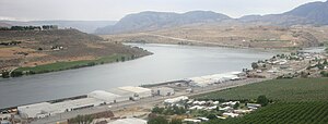
Lake Pateros
| Lake Pateros | |||||||||
|---|---|---|---|---|---|---|---|---|---|
| Lake Pateros near Pateros (Washington) | |||||||||
|
|||||||||
|
|
|||||||||
| Coordinates | 47 ° 56 '51 " N , 119 ° 51' 56" W | ||||||||
| Data on the structure | |||||||||
The Lake Pateros is an artificial lake on the Columbia River in the US state of Washington . It was created in 1967 with the construction of Wells Dam . The reservoir is almost entirely in Douglas and Okanogan Counties , but the dam itself is partly in the easternmost part of Chelan County . The reservoir extends upstream from this dam to the Chief Joseph Dam . Towns on the waterfront include Pateros and Brewster .
Lake Pateros is known by many different names, including Butler Lake, Chief Long Jim Lake, Fort Okanogan Lake, and Lake Azwell.

