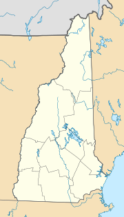
Lancaster, New Hampshire
| Lancaster | ||
|---|---|---|
|
Location in New Hampshire
|
||
| Basic data | ||
| Foundation : | 1763 | |
| State : | United States | |
| State : | New Hampshire | |
| County : | Coös County | |
| Coordinates : | 44 ° 28 ′ N , 71 ° 33 ′ W | |
| Time zone : | Eastern ( UTC − 5 / −4 ) | |
| Residents : | 3,507 (as of 2010) | |
| Population density : | 27.2 inhabitants per km 2 | |
| Area : | 131.4 km 2 (approx. 51 mi 2 ) of which 129.1 km 2 (approx. 50 mi 2 ) is land |
|
| Height : | 324 m | |
| Postal code : | 03584 | |
| Area code : | +1 603 | |
| FIPS : | 33-40420 | |
| GNIS ID : | 0873640 | |
| Website : | www.LancasterNH.org | |
Lancaster is a city ( town ) in the US -Bundesstaat New Hampshire and administrative center of Coös County with 3507 inhabitants. Lancaster is known as the gateway to the Great North Woods Region . The eastern urban area is partly part of the White Mountain National Forest .
geography
The place has an area of 131.4 square kilometers, of which 129.1 square kilometers are land and 2.3 square kilometers (1.75%) are water. Lancaster is drained by the Israel River , which drains into the Connecticut River .
The place is 324 meters above sea level, the highest point in the municipality is Mount Cabot with 1,003 meters.
Lancaster Station is on the Quebec Junction – Lime Ridge railway line .
history
In 1763 the town was settled by Captain David Page from Petersham . It was the first settlement north of Haverhill , which is 80 km south of Lancaster and was originally in land that is now Vermont on the Connecticut River , which forms the border between the two states. The place was named after Lancaster , Massachusetts , a resident's hometown.
Known residents
- Jared W. Williams (1796–1864), Governor
- Jacob Benton (1814-1892), member of the US House of Representatives for New Hampshire
- John Gould Stephenson (1828–1882), medical doctor and director of the Library of Congress
- Ossian Ray (1835-1892), member of the US House of Representatives for New Hampshire
- Chester B. Jordan (1839–1914), Governor of New Hampshire
- John Wingate Weeks (1860–1926), Senator and Secretary of War
- GG Allin (1956-1993), punk singer
