Langenschlage
|
Langenschlage
municipality Black
Coordinates: 53 ° 14 ′ 22 ″ N , 12 ° 45 ′ 1 ″ E
|
|
|---|---|
| Height : | 96 m above sea level NHN |
| Postal code : | 17252 |
| Area code : | 039827 |
|
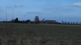
Langenschlage, seen from the L25
|
|
Langenschlage is a residential area in the community of Schwarz in the Mecklenburg Lake District in Mecklenburg-Western Pomerania .
geography
Langenschlage is located west of the Old Mühlenberg about one kilometer from the main town of Schwarz and about three kilometers from Buschhof on Landesstraße 25. The town consists of two courtyards that are about 200 m apart. The LPG " Fritz Reuter " Schwarz, which existed in GDR times , was also obvious. The LPG silage was located directly on site .
The Wittenberge – Strasburg railway line, which has already been dismantled here, runs north.
Transport links
The L 25 leads to Buschhof (where a train station was in operation until 1998) and to Wittstock . In the other direction you can get to Diemitz and Mirow via Schwarz and via the B198 to Wesenberg and Neustrelitz . The next train station, which is still in operation, is in Mirow (railway line Mirow-Neustrelitz). The bus traffic is operated by the MVVG . The bus stop is at the junction to Langenschlage.
Web links
- Langenschlage in the genealogical index of places
Individual evidence
- ^ Main statute of the community of Schwarz . July 28, 2014, § 2, p. 1 ( verwaltungsportal.de [PDF; 1.7 MB ; accessed on December 28, 2017]).
- ↑ Geodata viewer of the Office for Geoinformation, Surveying and Cadastre of Mecklenburg-Western Pomerania ( information )
