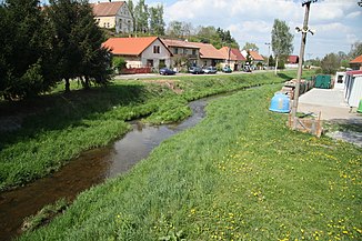
Ležák
|
Ležák Holetínka |
||
|
The Ležák in Bítovany |
||
| Data | ||
| Water code | CZ : 1-03-03-082 | |
| location | Pardubický kraj , Czech Republic | |
| River system | Elbe | |
| Drain over | Novohradka → Chrudimka → Elbe → North Sea | |
| source | in Horni Holetín 49 ° 46 '58 " N , 15 ° 55' 19" O |
|
| Source height | 599 m nm | |
| muzzle | at xxx in the Novohradka coordinates: 49 ° 57 ′ 59 " N , 15 ° 54 ′ 50" E 49 ° 57 ′ 59 " N , 15 ° 54 ′ 50" E |
|
| Mouth height | 236 m nm | |
| Height difference | 363 m | |
| Bottom slope | 12 ‰ | |
| length | 31 km | |
| Catchment area | 110.1 km² | |
| Drain |
MQ |
590 l / s |
| Small towns | Hrochův Týnec | |
The Ležák , on the upper reaches of Holetínka , is a left tributary of the Novohradka in the Czech Republic .
course
The Ležák rises at the transition between the Saar Mountains and the Iron Mountains ( Železné hory ) at the western foot of the Medkovy kopce (638 m nm) in the upper village of Horní Holetín. The villages Horní Holetín, Dolní Holetín, Střítež, Příkrakov and Tisovec are located along its north-leading upper course, on which the brook Holetínka is called ; in Horní Holetín it is bridged by the Havlíčkův Brod – Pardubice railway line.
The middle course leads past Ležáky , Dachov, Dubová, Miřetice and Havlovice to the northwest. At Smrček-Na sádkách a pond area with the ponds Petráň, Hořička and Žďár extends to the right of the stream. Other places on Ležák are Na Perku, Podbošovký Mlýn, Žumberk and Vížky. Between the castle ruins Žumberk and Kočičí hrádek, the Ležák to Bítovany forms a deep valley through the Schumberg granite mountains, in which red granite was mined in several quarries.
On its lower reaches, the Ležák initially flows in a north-easterly direction through the Hrochotýnecká tabule ( Hrochowteinitzer Tafel ). Along the stream lie Zaječice - where the Ležák is crossed again by the Havlíčkův Brod – Pardubice railway line - Řestoky , Trojovice , Zájezdec and Přestavlky . The last section of the stream leads north through Hrochův Týnec . After 31 km, the Ležák flows north of Hrochův Týnec in the Novohradka . Its catchment area covers 110.1 km², the mean flow rate at the mouth is 0.59 m³ / s.
water sports
The Ležák is - depending on the water level - to max. 23 km from Ležáky passable. The stream is divided into two whitewater sections.
Tributaries
- Babákovský potok (l), in Příkrakov
- Dřevešský potok (r), near Ležáky
- Bystřička (l), in Ležáky
- Havlovický potok (r), near Dubová from the Petráň pond
- Oběšinka (l), near Podbošovký Mlýn
- Bratroňovský potok (l), near Žumberk
- Kvítecký potok (l), near Žumberk
- Bítovanka (r), near Zaječice
