Miřetice u Nasavrk
| Miřetice | ||||
|---|---|---|---|---|
|
||||
| Basic data | ||||
| State : |
|
|||
| Region : | Pardubický kraj | |||
| District : | Chrudim | |||
| Area : | 1714 ha | |||
| Geographic location : | 49 ° 51 ' N , 15 ° 53' E | |||
| Height: | 390 m nm | |||
| Residents : | 1,288 (Jan 1, 2019) | |||
| Postal code : | 538 25 - 539 55 | |||
| License plate : | E. | |||
| traffic | ||||
| Street: | Skuteč - Nasavrky | |||
| structure | ||||
| Status: | local community | |||
| Districts: | 8th | |||
| administration | ||||
| Mayor : | Jaroslav Chour (as of 2018) | |||
| Address: | Miřetice 66 539 55 Miřetice |
|||
| Municipality number: | 571831 | |||
| Website : | www.miretice.cz | |||
Miřetice (German Miřetitz , 1939–1945 Mirschetitz ) is a municipality in the Czech Republic . It is nine kilometers north of Hlinsko and belongs to the Okres Chrudim .
geography
Miřetice is located in the northeast of the Iron Mountains between the valleys of the Ležák and Oběšinka streams. The Bartošky (478 m nm) rise to the southwest.
Neighboring towns are Bošov, Holčí and Račany in the north, Havlovice and Dubová in the north-east, Dachov in the east, Tisovec in the south-east, Paseky, Nouzov and Včelákov in the south, Majlant in the south-west, Čekov in the west and Švihov in the north-west.
history
Miřetice was created at the transition from the 12th to the 13th century during the colonization of the Iron Mountains by the Podlažice monastery . The first written mention of the place took place in 1325 as the property of the Chotěbor von Miřetice. There was a festival in Miřetice, which was the seat of the noble family of the same name. In 1650, the captain of the Chrudim district Hynek Talatzko von Gestetitz ( Talacko z Ještětic ) acquired the Miřetice manor and added it to his Přestavlky manor . From 1704 the estate belonged to Kolowrat -Liebsteinsky, from 1717 to Josef Bartholotti von Partenfeld, and from 1747 to Prince Auersperg .
In 1835 the village of Miřetitz , located in the Chrudim district , consisted of 26 houses in which 167 people, including an Israelite family, lived. In the village there was a yard, a liquor house, an inn, a forester's house and a mill with a board saw. The parish was Wčelakow . The mining of granite can be documented from 1837 , and carp farming also played an important role at this time. Until the middle of the 19th century Miřetitz remained subordinate to the allodial estate Přestawlk.
After the abolition of patrimonial Miřetice formed from 1849 with the districts Čekov and Dachov a municipality in the judicial district Nassaberg . From 1868 the municipality belonged to the political district of Chrudim . In 1900 there were already 1246 people in the villages of Miřetice, Dubová and Havlovice. Miřetice was thus the village with the highest number of taxable residents in the entire judicial district.
During the time of the German occupation, the Gestapo found a refuge for Czechoslovak paratroopers after the assassination attempt on Reich Protector Reinhard Heydrich in Ležáky . On June 24, 1942, the hamlet was occupied and burned down by 500 men from the SS, Feldgendarmerie and Schutzpolizei under the leadership of Hauptsturmführer Gerhard Clages. A year later the ruins were razed to the ground.
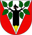
1981 the incorporation of Švihov including its districts Bošov, Krupín and Krupínské Paseky. Today, with 100 jobs, Eltop Praha sro is the largest local employer. Since 2004 the community has had a coat of arms and a banner.
Community structure
The Miřetice municipality consists of the districts Bošov ( Boschow ), Čekov ( Chekau ), Dachov ( Dachau ), Dubová ( Dubowa ), Havlovice ( Hawlowitz ), Krupín ( Krupin ), Miřetice ( Mirschetitz ) and Švihov ( Schwihau ). Miřetice also includes the residential areas Cikánka, Dachovské Paseky, Havlovický Dvůr, Holčí, Janovičky, Krupínské Paseky, Majlant, Na Barboře, Na Kovárně, Na Perku ( mountain ), Na Požárech, Nouzov, Podbošovský Mlýn, Ravičany. U Kapličky and V Dvoře and part of the Ležáky ( Lezaky ) desert . Basic settlement units are Bošov, Čekov, Dachov, Dachovské Paseky, Dubová, Havlovice, Holčí, Krupín, Krupínské Paseky, Majlant, Miřetice, Švihov and Švihůvek.
The municipality is divided into the cadastral districts Havlovice u Miřetic, Miřetice u Nasavrk and Švihov.
Attractions
- National cultural monument Ležáky memorial
- Chapel of St. Trinity in Miřetice, built in 1761
- Narrow valley of the Ležák brook between Ležáky and Miřetice
- Petráň, Hořička and Žďár fish ponds near Havlovice, part of the Iron Mountains Protected Landscape Area
- Einödhof "Na Perku", two kilometers north, with a sundial on the gable
- Kovárenský rybník natural monument with a moor meadow north of the village
- several flooded granite quarries near Švihov, Dubová and Dachov
Web links
Individual evidence
- ↑ http://www.uir.cz/obec/571831/Miretice
- ↑ Český statistický úřad - The population of the Czech municipalities as of January 1, 2019 (PDF; 7.4 MiB)
- ^ Johann Gottfried Sommer : The Kingdom of Bohemia; Represented statistically and topographically. Volume 5: Chrudimer Kreis. Prague 1837, p. 91
- ↑ https://www.miretice.cz/obec-7/soucasnost-obce/znak-obce/
- ↑ http://www.uir.cz/casti-obce-obec/571831/Obec-Miretice
- ↑ http://www.uir.cz/zsj-obec/571831/Obec-Miretice
- ↑ http://www.uir.cz/katastralni-uzemi-obec/571831/Obec-Miretice

