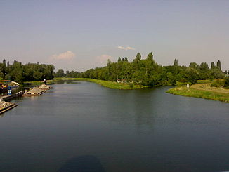
Chrudimka
| Chrudimka | ||
|
The Chrudimka flows into the Elbe |
||
| Data | ||
| location | Czech Republic | |
| River system | Elbe | |
| Drain over | Elbe → North Sea | |
| source | Between Svratouch , Filipov, Paseky and Chlumětín | |
| Source height | 700 m | |
| muzzle | In Pardubice in the Elbe coordinates: 50 ° 2 ′ 40 ″ N , 15 ° 46 ′ 38 ″ E 50 ° 2 ′ 40 ″ N , 15 ° 46 ′ 38 ″ E |
|
| Mouth height | 216 m nm | |
| Height difference | 484 m | |
| Bottom slope | 4.6 ‰ | |
| length | 104.4 km | |
| Catchment area | 870 km² | |
| Left tributaries | Okrouhlický potok, Podhůra | |
| Right tributaries | Novohradka | |
| Reservoirs flowed through | Hamry Dam, Seč I Dam, Seč I Dam, Křížanovice I Dam, Práčov Dam | |
| Medium-sized cities | Chrudim , Pardubice | |
| Small towns | Hlinsko v Čechách , Seč u Nasavrk , Nasavrky , Slatiňany | |
The Chrudimka is a left tributary of the Elbe in the Czech Republic .
course
The Chrudimka, also known as Kamenice or Ohebka in ancient scripts , rises in the north of the Saar mountains . Its main source is 700 m at the northern foot of the U Oběšeného hill (737 m) between Svratouch , Filipov, Paseky and Chlumětín . A second spring is located between Filipov, Ovčín and Dědová . After the union of the two source streams, the Chrudimka flows through Kameničky on its way west and is dammed in the Hamry dam between Hamry and Studnice . The Chrudimka then flows through Hlinsko and crosses the Iron Mountains in numerous river loops to the northwest. The towns of Vítanov , Vysočina , Trhová Kamenice , Horní Bradlo and Klokočov are located on the river . After that, the river meanders through the mountains in narrow valleys. At Seč it is dammed in the Seč I and II dams . The river runs through Bojanov and Křižanovice first to the east and turns north at Nasavrky , where it flows from the Iron Mountains via Svídnice and Lukavice near Slatiňany into the Chrudimská tabule. The further course of the Chrudimka leads via Chrudim , Vestec , Tuněchody , Úhřetice , Úhřetická Lhota to Hostovice, where it turns to the west and finally flows again in a northerly direction through the town of Pardubice , where after 104.4 km it flows at 216 m. ü. M. the Elbe flows.
The catchment area of the Chrudimka is 870 km².
During the Pleistocene , the Chrudimka flowed through the Zlatý potok valley and flowed into the Doubrava at the location of the town of Třemošnice .
Significant tributaries
- Okrouhlický potok (l), near Svídnice
- Podhůra (l), above Chrudim
- Novohradka (r), near Úhřetická Lhota
Dams
- Hamry Dam, built in 1912
- Seč I dam , built in 1935
- Seč I dam, built in 1947
- Křížanovice I dam, built in 1954
- Práčov Dam (Křížanovice II), built in 1954
