
Love tip
| Love tip | ||
|---|---|---|
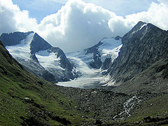
 View of the Liebenerspitze from the southwest |
||
| height | 3399 m above sea level A. | |
| location | Tyrol , Austria and South Tyrol , Italy | |
| Mountains | Ötztal Alps | |
| Dominance | 0.8 km → Hochfirst | |
| Notch height | 162 m ↓ Gaisbergjoch | |
| Coordinates | 46 ° 49 '13 " N , 11 ° 4' 29" E | |
|
||
| First ascent | July 26, 1872 by Victor Hecht and Johann Pinggera | |

The Liebenerspitze (also Liebenerspitze , Italian Cima della Chiesa ) is 3399 m above sea level. A. high double summit between Obergurgl and Pfelders in the Gurgler Kamm in the Ötztal Alps . It is named after Leonhard von Liebener . The Austrian-Italian border runs over the summit, the South Tyrolean parts are protected in the Texel Group Nature Park .
The first ascent took place on July 26, 1872 by Victor Hecht and Johann Pinggera . They reached the summit via the west ridge and descended via the east ridge.
The Zwickauer Hut to the southwest serves as a base for mountaineers . From there the easiest ascent is over the west ridge in about 2½ hours.
View of the Gaisbergferner with the Hochfirst on the left, the Liebenerspitze on the right of the middle in the background and the Kirchenkogel on the right

literature
- Walter Klier: Alpine Club Guide Ötztal Alps. Bergverlag Rudolf Rother, Munich 2006, ISBN 978-3-7633-1123-1 .
Web links
Individual evidence
- ↑ a b Eduard Richter (ed.): The development of the Eastern Alps , Volume 2 ( The Central Alps west of the Brenner ). Publishing house of the German and Austrian Alpine Club, Berlin 1894