List of architectural monuments in Gelsenkirchen
The list of architectural monuments in Gelsenkirchen contains the listed buildings in the area of the city of Gelsenkirchen in North Rhine-Westphalia (as of April 29, 2020). These architectural monuments are entered in the monument list of the city of Gelsenkirchen; The basis for the admission is the Monument Protection Act North Rhine-Westphalia (DSchG NRW).
| image | designation | location | description | construction time | Registered since |
Monument number |
|---|---|---|---|---|---|---|
 more pictures |
House mountains | Buer Adenauerallee 103 map |
1785-1788 | 07/19/1988 |
181
|
|

|
Residential and commercial building | Buer Agathagasse 2 map |
1908 | March 24, 1988 |
159
|
|

|
Residential and commercial building | Buer Agathagasse 6 map |
1905 | 07/04/1988 |
174
|
|

|
Half-timbered building | Resse Ahornstrasse 188 map |
1887 | 02/12/1990 |
241
|
|
 more pictures |
Schüngelberg settlement | Buer Albrechtstrasse 1–42, Westfalenstrasse 1–32, Holthauser Strasse 20, 22–31, Schüngelbergstrasse 2–48 (even) and 37–91 (odd), Gertrudstrasse 1–33 (odd) and 2–42 (even), Ostfalenstrasse 20–40 (even) card |
1900-1916 | 06/26/1987 |
122
|
|

|
Schievenfeld settlement | Erle Alleestraße 1, 2, 9, 31, 33 / Middelicher Straße 77 / Schievenstraße 28, 30, 32, 34 / Steigerstraße 2 map |
⊙ ⊙ ⊙ | 1910-1915 | 04/01/1992 |
260
|
 more pictures |
former administration building of the Alma coking plant | Ückendorf Almastraße (between 79 and 91) map |
based on a design by Fritz Schupp and Martin Kremmer | 1927 | 10/08/1987 |
141
|

|
Jewish Cemetery | Map of Ückendorf Am Dördelmannshof / Günnigfelder Straße |
see below | 1926-1927 | 04/07/1995 | 294 ( see below )
|
| Former miners' settlement Dahlbusch colliery | Feldmark Am Eichenbusch 1–16 / Hördeweg 45-64 map |
see below | 1873 1882 |
03/30/1987 | 96 ( see below )
|
|

|
former half-timbered yard "Im Krammwinkel" | Erle Am Hüttekotten 3a, 3b card |
1722 | 10/16/1984 |
13
|
|

|
Kaiser Wilhelm Monument | Resse am Markt card |
Fountain donated by the local national associations in 1913 for the 25th anniversary of the reign of Kaiser Wilhelm II, known as the “Jubilee Fountain”. Description: In the center of a circular fountain basin, an octagonal fountain shaft rises above a base with the reliefs of four ibex heads. This is crowned by four putti, symbolizing the German kingdoms, who hold the imperial crown with their backs. Artist: Design: Schulte-Umberg (Buer); Execution: Rudolf Zisenis (Düsseldorf). Source: Karin Schwarz: Bourgeois self-portrayal in the Ruhr area between 1871 and 1918. The communal monuments of an industrial region. Dissertation, Volume II: List of communal monuments between 1838 and 1916. Trier 2004, p. 226 (object no. 221). | 1913 | 07/22/1992 |
249
|

|
Evangelical Paulus Church | Resse Am Markt 15 Card |
1914-1916 | 07/09/1981 |
1
|
|
 more pictures |
Evangelical old town church | Altstadt Am Rundhöfchen 1 card |
1954-1956 | 01/08/1999 |
297
|
|

|
former municipal slaughterhouse | Hessler Am Schlachthof / Grothusstraße map |
⊙ ⊙ | 1910-1912 | 09/24/1987 |
131
|

|
Settlement Am Schlagbaum | Hassel Am Schlagbaum 1–56 map |
1920 | 08/25/1997 |
303
|
|
|
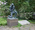
Memorial for the victims of the mining accidents of October 14, 1937 and June 26, 1955 at the Nordstern colliery | Horst Am Schleusengraben / Gelsenbergstrasse Map |
1937 | 09/02/2008 |
337
|
|

|
Path chapel "Kreuz-Kapelle" | Buer Am Spritzenhaus / Röckstrasse / Urbanusstrasse map |
1931 | 05/10/1989 |
221
|
|

|
Savings bank building | Horst An der Rennbahn 2 map |
1930 | 05/12/2000 |
310
|
|

|
Residential and commercial building | Old town Augustastraße 11 map |
1902 | October 29, 1986 |
59
|
|

|
Residential group | Bulmke-Hüllen Augustastraße 33–57 (odd) card |
1905-1906 | 05/10/1989 |
217
|
|

|
school-building | Bulmke-Hüllen Augustastraße 52/54 map |
Vocational college for business and administration in the city of Gelsenkirchen | 1923-1925 | 05/12/1989 |
219
|
 more pictures |
Catholic Provost Church of St. Augustine | Altstadt Bahnhofstrasse 4 map |
1873 | 09/05/1986 |
40
|
|
|
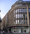
former WEKA department store | Altstadt Bahnhofstrasse 55-65 / Augustastrasse 1 / Weberstrasse map |
1908 1926 expanded |
12/02/1986 |
63
|
|

|
Windows of the old main station and some facade elements at the south exit of today's station | Old town in front of Bahnhofstrasse 78–84 and south exit of the station map |
⊙ | 1949 | 07/13/2005 |
334
|

|
Street facade of the residential and commercial building | Altstadt Bahnhofstrasse 85 map |
formerly: Hotel Berliner Hof | 1906 | 08/21/1986 |
38
|

|
Street facade of the residential and commercial building | Altstadt Bahnhofstrasse 85a map |
1904 | 08/21/1986 |
39
|
|
 more pictures |
former main post office | Altstadt Bahnhofsvorplatz 3 map |
now administrative court Gelsenkirchen | 1908-1910 | 09/14/1984 |
8th
|

|
Semi-detached house with wall-mounted equipment, front garden, rear garden area without internal structure and plants as well as fencing and tool shed | Buer Beckeradstrasse 23 map |
1922 1926 |
339
|
||

|
Semi-detached house | Buer Beckeradstrasse 25 map |
around 1922 |
339
|
||
| Catholic parish church Mariae Himmelfahrt, rectory and former chaplain | Rotthausen Beethovenstrasse 11 / Richard-Wagner-Strasse 1 / Haydnstrasse 16/18 map |
⊙ ⊙ | 1893-1894 | 08/23/1993 |
280
|
|

|
War memorial | Rotthausen Beethovenstrasse map |
1937 | 12/10/1987 |
152
|
|
 more pictures |
former Bergmannsglück colliery : hoisting machine house to shaft 2 with twin steam hoisting machine (III) and traction sheave | Hassel Bergmannsglückstrasse 13 map |
1911 |
340
|
||

|
Residential building | Old town Beskenstrasse 27 map |
Building from the founding phase of Alt-Gelsenkirchen | 1860-1870 | 12/08/1987 |
151
|

|
Residential building | Old town Beskenstrasse 38 map |
⊙ Building from the founding phase of Alt-Gelsenkirchen | 1860-1870 | 04/11/1987 |
145
|

|
Evangelical parish center of the Markus parish with church including principals and bells, tower, parish hall and kindergarten | Hassel Biele 1 card |
1954-1955 | 07/06/2004 |
326
|
|

|
Residential building | Old town Bismarckstrasse 39 map |
bourgeois apartment buildings around the turn of the century | 1902 | 02/27/1987 |
91
|

|
Residential building | Old town Bismarckstrasse 41 map |
bourgeois apartment buildings around the turn of the century | 1905 | 02/23/1987 |
90
|

|
Residential building | Old town Bismarckstrasse 43 map |
bourgeois apartment buildings around the turn of the century | 1904 | 02/27/1987 |
92
|

|
Residential and commercial building | Old town Bismarckstrasse 49–51 / Hauptstrasse 80 map |
Residential and commercial building "Friese" by architect Theodor Waßer ( brick expressionism ) at the "Stern" (five-way street crossing on Bismarckstrasse) | 1926-1927 | 07/07/1987 |
124
|

|
former post office building | Bismarck Bismarckstrasse 177 map |
Post office from the imperial era | 1891 | 05/06/1988 |
163
|

|
Residential and commercial building with practice | Bismarck Bismarckstrasse 192 / Christinenstrasse 1 map |
Former doctor's house (no.192 is the corner house, house no.194 to the left of it belonged to the doctor's house ensemble) | 1912 | October 21, 1988 |
187
|

|
Residential and commercial building | Bismarck Bismarckstrasse 194 map |
now district office Bismarckstraße of the Gelsenkirchen police (picture as before, left house) | 1912 | October 21, 1988 |
188
|
 more pictures |
Double strut frame shaft system Consolidation shaft 9 and two twin steam hoisting machines | Bismarck Bismarckstrasse / Klarastrasse 6, 8 (machine houses) map |
1922 | 02/23/1987 |
83
|
|
 more pictures |
Rope support structure above shaft 4 of the Consolidation colliery with machine house and hoisting machine | Bismarck Bismarckstrasse 238 map |
1958 | 04/20/2001 |
316
|
|
 more pictures |
Ev. Bleckkirche | Bismarck Bleckstrasse / Grimberger Allee map |
1735 | 01/24/1989 |
209
|
|

|
Zoo entrance with outbuildings | Bismarck Bleckstrasse 64 map |
1949 | 05/20/2000 |
313
|
|

|
Residential group | Schalke Blumendelle 26/28 / Liebfrauenstrasse 43–55 map |
Apartment buildings of the so-called "Siedlung Blumendelle" by architect Josef Franke ( brick expressionism ) | 1926 | 04/21/1989 |
220
|

|
Thyssen foundry | Uckendorf Bochumer Strasse 86 map |
former administration building of Gelsenkirchener Gußstahl- und Eisenwerke AG (later Thyssen) by architect Theodor Waßer; from 1993 to January 2016 seat of the labor court in Gelsenkirchen | 1916-1919 | 02/28/1985 |
17th
|

|
Parts of a commercial street around the turn of the century | Ückendorf Bochumer Strasse 96, 98 map |
Residential and commercial building | 1888 | December 15, 1986 |
70
|

|
Parts of a commercial street around the turn of the century | Uckendorf Bochumer Strasse 100 map |
Residential and commercial building | 1888 | December 15, 1986 |
71
|

|
Parts of a commercial street around the turn of the century | Uckendorf Bochumer Strasse 102 map |
Residential and commercial building | 1898 | December 15, 1986 |
72
|

|
Parts of a commercial street around the turn of the century | Uckendorf Bochumer Strasse 104 map |
Residential and commercial building | 1897 | December 15, 1986 |
73
|

|
Parts of a commercial street around the turn of the century | Uckendorf Bochumer Strasse 106 map |
Residential and commercial building | 1896 | December 15, 1986 |
74
|

|
Parts of a commercial street around the turn of the century | Uckendorf Bochumer Strasse 108 map |
Residential and commercial building | 1897 | December 15, 1986 |
75
|
| Parts of a commercial street around the turn of the century | Uckendorf Bochumer Strasse 110 map |
Residential and commercial building | 1898 | December 15, 1986 |
76
|
|
| Parts of a commercial street around the turn of the century | Uckendorf Bochumer Strasse 114 map |
Residential and commercial building | 1902 | December 15, 1986 |
78
|
|
 more pictures |
Catholic Parish Church of the Holy Cross | Uckendorf Bochumer Strasse 115 map |
1927-1929 | 09/22/1986 |
43
|
|

|
former villa of the waterworks director | Uckendorf Bochumer Strasse 207 map |
by architect Josef Franke | 1911 | 01/09/1987 |
67
|

|
Former director's villa of Gelsenkirchener Bergwerks-AG | Uckendorf Bochumer Strasse 209 map |
1906 | 12/18/1986 |
66
|
|

|
Former director's villa of the Rheinelbe Bergwerks-AG | Uckendorf Bochumer Strasse 214 map |
Rheinelbe colliery, rebuilt several times | 1899 | 10/06/1987 |
139
|

|
Street and entrance front | Ückendorf Bochumer Strasse 223 (ensemble) map |
1907 | 02/01/1990 |
239
|
|

|
villa | Ückendorf Bochumer Strasse 224 (ensemble) map |
1893 | 08/08/1986 |
33
|
|

|
bourgeois Residential building | Ückendorf Bochumer Strasse 226 (ensemble) map |
1884 | 03/27/1987 |
106
|
|

|
Facade of a bourgeois. Residential building | Ückendorf Bochumer Straße 228 (ensemble) map |
1893 | 03/27/1987 |
107
|
|

|
bourgeois Residential building | Ückendorf Bochumer Strasse 230 (ensemble) map |
1896 | 03/27/1987 |
108
|
|
|
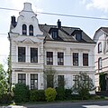
Building from the founding phase of Ückendorf | Ückendorf Bochumer Straße 232 (ensemble) map |
Historicism residence | 1896 | 02/26/1987 |
93
|

|
Building from the founding phase of Ückendorf | Ückendorf Bochumer Strasse 235 (ensemble) map |
Historicism residence | 1899 | 03/27/1987 |
109
|

|
bourgeois House from the turn of the century | Neustadt Bokermühlstrasse 25 map |
1902 | 06/01/1988 |
170
|
|

|
Shop pavilion | Neustadt Bokermühlstrasse 67 map |
1958 | 02/22/2001 |
314
|
|

|
formerly the Ressemann farm | Resse Böningstrasse 166 map |
1817 | 02/12/1990 |
242
|
|

|
former Oberschuir shaft of the Consolidation colliery | Feldmark Boniverstrasse 32 map |
Operation building of the Oberschuir shaft (shaft 8 of the former Consolidation colliery), sunk in 1906, set up for cable travel and ventilation in 1908, inaugurated in 1909 and used for a long time as a training shaft for the next generation of miners; Operation as a weather shaft ended in 1981. | 1907-1909 | April 24, 1985 |
19th
|
 more pictures |
Spinnstuhl settlement | Hassel Brakestrasse 13, 15 / Marler Strasse 8, 10 / Spinnstuhl 1, 2, 3, 3a, 4, 4a, 5, 6, 8 / Rockenstrasse 15, 18, 20 / Flachsstrasse 8, 10 map |
1926-1928 | 04/17/1989 |
218
|
|

|
Sellhorst farm | Resse Brauckstrasse 145 map |
1825 | 02/12/1990 |
240
|
|

|
Hof Holz (building complex consisting of a residential building, three-wing commercial section, bakery and enclosure) | Beckhausen Braukämperstraße 80 map |
2nd half of the 18th century | 13/01/2006 |
335
|
|

|
Leibniz Gymnasium | Buer Breddestraße 21 map |
1907-1908 | December 27, 1988 |
202
|
|

|
Row of houses | Buer Breddestraße 24, 26, 28 map |
1926-1927 | 09/14/1984 |
11
|
|

|
Administration building, pay hall, laundry , lamp room and health center of the former Hugo 2/5/8 colliery | Buer Brößweg map |
1952-1955 | 05/20/2003 |
321
|
|

|
former school building with monument | Buer Brößweg 16 map |
1924 | 06/02/1993 |
274
|
|

|
Settlement of the Hugo colliery | Buer Brößweg 33–39 (odd) / Düppelstrasse 14–28 (even) / Franzstrasse 2–14 (even) / Hüchtebrockstrasse 2–12, 1–7 / Steinmetzstrasse 28–38, 29–39 Map |
1908-1910 | 09/13/1993 |
283
|
|
 more pictures |
Spectator grandstand Glückauf-Kampfbahn, playing field with wall, running track, memorial | Schalke-Nord Caubstrasse / Kurt-Schumacher-Strasse 145 map |
1936 | 10/31/1986 |
60
|
|

|
former station building Schalke-Nord | Schalke-Nord Caubstrasse 27, 29 map |
Entrance building of the station | 1930-1931 | 05/31/1985 |
21st
|

|
Facades of the group of houses with house entrance doors | Bulmke-Hüllen Chattenstrasse 33–43 (odd), 61–71 (odd), 38, 42/44, 58/60, 66/68 / Ilsestrasse 2, 4, 5, 7, 9 / Wanner Strasse 193, 195 map |
1894 | 03/05/1998 |
302
|
|
|
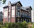
Tenement houses from the end of the 19th century | Ückendorf Claire-Waldoff-Straße 6a, 6b map |
Apartment buildings | 1892 | 10/02/1987 |
135
|

|
Tenement houses from the end of the 19th century | Ückendorf Claire-Waldoff-Straße 6c, 6d map |
Apartment buildings | 1892 | 10/02/1987 |
136
|
|
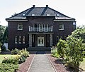
former department store director's villa | Buer Cranger Strasse 46 map |
1927-1928 | 08/25/1989 |
228
|
|

|
former bank director's villa | Buer Cranger Strasse 51 map |
1923 | 07/01/1988 |
154
|
|
 more pictures |
kiosk | Buer Cranger Strasse 51a map |
1938 | 06/02/1993 |
275
|
|

|
Single-family house with caretaker's house | Buer Cranger Strasse 74, 74a map |
1952-1953 | 08/11/1997 |
298
|
|

|
former Kötterhaus | Alder Cranger Street 188a map |
1803 | 08/31/1988 |
184
|
|

|
former villa of the director of the Graf Bismarck colliery | Alder Cranger Street 228 map |
1906-1907 | December 27, 1989 |
236
|
|

|
One man bunker | Erle Grünweg between Cranger Straße 246 and 248 map |
1942-1943 | 04/08/2005 |
331
|
|
| Wall inscription in the former room of the NSDAP local group leader | Alder Cranger Street 323 map |
1986 rediscovered party program of the NSDAP as a wall inscription in the former room of the NSDAP local group leader. In 1994 the building is now the documentation center "Gelsenkirchen under National Socialism" | 1920 | 04/05/1989 |
216
|
|

|
Ev. Trinity Parish Church | Alder Cranger Street 327 map |
Evangelical Dreifaltigkeitskirche by architect Karl Siebold | 1902-1903 | 10/14/1993 |
285
|

|
Row of houses | Erle Cranger Strasse 377–383, 395–401 (odd) card |
⊙ | 1927 | 07/04/1988 |
176
|

|
former forester's house | Alder Cranger Street 406 map |
1878 | December 15, 1983 |
4th
|
|

|
villa | Buer De-la-Chevallerie-Strasse 15 map |
1913 | 04/11/1988 |
162
|
|
| Underground bunker | Buer De-la-Chevallerie-Strasse / Springestrasse / Springemarkt map |
1939 | December 16, 1998 |
307
|
||

|
Devensstrasse settlement | Horst Devensstraße 40–50 (even) / Hesterkampsweg 1–7 (odd) and 2–24 (even) / Harthorststraße 2–18 (even) map |
1953-1954 | 06/16/1994 |
289
|
|

|
Villa for the former head physician of the Marienhospital | Buer Dorstener Strasse 2 map |
Correct: former service villa of the chief doctor | 1910 | 11/19/1987 |
148
|
 more pictures |
Stone arch bridge over the Fleuthe | Bismarck (between Dorstener Straße and Willy-Brandt-Allee) map |
1853 | 04/02/1992 |
259
|
|

|
old Buer cemetery with a Jewish cemetery | Buer Dorstener Strasse / Mühlenstrasse map |
1886 | March 16, 1995 |
292
|
|

|
former civil servants' houses | Buer Droste-Hülshoff-Strasse 1–21 / Hermann-Löns-Strasse 5 and 7–15 map |
1926-1929 | 01/10/1991 |
251
|
|
 more pictures |
Facades of the Hans Sachs House | Altstadt Ebertstrasse 15 / Munckelstrasse 4 / Vattmannstrasse 7 Map |
1924-1927 | 05/06/1986 |
23
|
|
 more pictures |
Colliery Westerholt of mine lip | Hassel Egonstrasse 4 map |
from 1909 | 08/30/2016 |
341
|
|

|
Tenement architecture from the turn of the century | Old town Elisabethstraße 19 map |
Apartment building around 1900 | 1885 | 07/12/1988 |
179
|
|
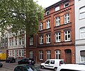
Tenement architecture from the turn of the century | Altstadt Elisabethstrasse 21 map |
Apartment building around 1900 | 1900 | 07/12/1988 |
180
|

|
former Ballin House | Bulmke-Hüllen Elisenstrasse 19 map |
Former home of the architect Josef Franke ( Expressionism ) with the studio of the painter Andreas Wilhelm Ballin | 1924-1925 | 10/17/1988 |
190
|

|
Half-timbered house | Buer Emil-Zimmermann-Allee 27 map |
Former outbuilding of Haus Berge | 1850 | 08/31/1988 |
183
|

|
Community grave and memorial (disaster 09/29/1947) | Bismarck Erdbrüggenstrasse map |
Grave field with memorial for the victims of the mine disaster of September 29, 1947 | 1949 | 07/13/2005 |
332
|
 more pictures |
Former workers settlement of the Consolidation colliery | Bismarck Erdbrüggenstrasse 1–12 / Kanalstrasse 6–10 map |
⊙ | 1898 1907 |
06/26/1987 |
121
|
 more pictures |
Catholic parish church of St. Hippolytus including 4 confessionals | Horst Essener Strasse 11 map |
1896-1899 | 12/15/1992 |
270
|
|

|
Building from the founding phase of the Resse district | Resse Ewaldstrasse 42 map |
1907 | 01/23/1990 |
237
|
|

|
Residential building with indoor and outdoor facilities | Hessler heel fracture 38/40 card |
1949-1950 | 07/06/2018 |
342
|
|

|
Courtyard | Hessler broken heel 142 card |
from 1895 | 11/29/2018 |
346
|
|

|
former doctor's residence | Ückendorf Festweg 4 map |
1910 | 06/02/1993 |
276
|
|

|
Ensemble with house no.11 | Ückendorf Festweg 9 map |
1894 | 03/12/1987 |
94
|
|

|
House from the turn of the century | Ückendorf Festweg 10 map |
1902 | 08/08/1986 |
34
|
|

|
Ensemble with house no.9 | Ückendorf Festweg 11 map |
1901 | 03/12/1987 |
95
|
|

|
former rectory of the Nicolai Church | Ückendorf Flöz Sonnenschein 60 card |
1898-1899 | 05.12.1986 |
69
|
|

|
"Timpert House" | Erle Frankampstrasse 27a map |
around 1832 | 11/28/1986 |
64
|
|

|
bourgeois Residential / commercial building from the turn of the century | Schalke Franz-Bielefeld-Strasse 35 map |
1905 | 07/04/1988 |
175
|
|
 more pictures |
Catholic parish church St. Georg | Schalke Franz-Bielefeld-Strasse 38 map |
1906-1908 | 09/01/1988 |
185
|
|
|
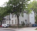
Rectory of the parish of St. Georg | Schalke Franz-Bielefeld-Strasse 40 map |
1907 | 01/28/1987 |
80
|
|

|
Liebfrauenstift | Schalke Franz-Bielefeld-Strasse 42 map |
1913-1915 | 01/28/1987 |
79
|
|
|
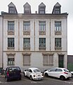
high quality design from the turn of the century | Schalke Franz-Bielefeld-Strasse 44 map |
Residential building | 1905-1906 | 02/23/1987 |
84
|

|
Catholic Parish Church of St. Francis | Bismarck Franziskusstrasse 7 map |
1903-1904 | 08/23/1993 |
282
|
|

|
Residential building | Alder Friedenstrasse 8 map |
1900 | 08/30/1989 |
230
|
|

|
Rohmann farm | Scholven Fünfhäuserweg 20a map |
1836 | 03/15/1990 |
244
|
|

|
Part of the former workers' settlement "Colony Funkenburg" of the Consolidation colliery | Schalke Funkenburg 3 card |
1885 | 12/14/1989 |
235
|
|

|
Pay hall, laundry, administration building, coach house, retirement home with porter's lodge, green area with retaining walls and stairs of the former Consolidation 1/6 colliery | Schalke Handwerkenstrasse 30, 32 card |
1930s / 1940s | 12/10/2002 |
319
|
|

|
former Becks farm | Beckhausen Giebelstrasse 99a map |
in the middle of the 19th century | 08/02/1989 |
225
|
|
 more pictures |
Town hall Buer (old building with entrance hall) | Buer Goldbergstrasse 12 / Rathausplatz 2 map |
1912 | 11/23/1988 |
200
|
|
| paternoster | Buer Goldbergstrasse 12 / Rathausplatz 2 map |
Paternoster elevator in the town hall | 1953 | 11/23/1988 |
199
|
|

|
Former Reichsbank | Buer Goldbergstrasse 14 map |
Building of the former Reichsbank branch Buer | 1926-1927 | 05/21/1986 |
26th
|

|
Bronze sculpture in the green area (Olympia) Fritz Klimsch-Berlin | Buer Goldbergstrasse map |
Women's sculpture "Olympia" by the sculptor Fritz Klimsch , set up in the green area opposite the Buer town hall | 1937 | 06/19/1990 |
248
|

|
War memorial | Hessler Grawenhof map |
West Cemetery | 1926 | 11/10/1988 |
191
|

|
Mourning hall | Hessler Grawenhof 25 card |
West Cemetery | 1912 | January 16, 1985 |
15th
|

|
former agricultural Grimberg courtyard | Bismarck Greitenstieg 8 card |
1834 | 05/02/1984 |
7th
|
|

|
Vittinghoff settlement | Schalke Grillostrasse 131–137 (odd) / Wilhelminenstrasse 84–90 (even) card |
1926-1928 | 03/17/1989 |
215
|
|

|
Grillodenkmal | Schalke Grillostrasse / Kurt-Schumacher-Strasse map |
1954 | 07/19/1993 |
279
|
|

|
Roundhouse and various buildings | Bismarck Grimbergstrasse 18 and others map |
1920 | 07/25/1991 |
250
|
|

|
Volkshaus | Rotthausen Grüner Weg 3 map |
by architect Alfred Fischer | 1920 | 05/07/1984 |
6th
|

|
Jewish Cemetery | Ückendorf Günnigfelder Straße / Am Dördelmannshof map |
1926-1927 | 04/07/1995 |
294
|
|

|
Buer indoor swimming pool | Buer Gustav-Bär-Platz 1 (formerly: Maelostraße 17) map |
1955-1958 | 04/02/1992 |
254
|
|
|
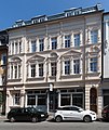
bourgeois Turn-of-the-century commercial building | Buer Hagenstrasse 34 map |
1900 | 05/23/1989 |
222
|
|
|
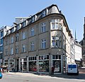
bourgeois Pre-war commercial building | Buer Hagenstrasse 48 map |
1913 | 03/15/1990 |
243
|
|

|
formerly Paul Gerhardt School | Feldmark Hans-Böckler-Allee 53 map |
1955 | 06/05/2001 |
317
|
|

|
bourgeois Pre-war residential / commercial building | Altstadt Hauptstrasse 7, 9 map |
1912-1913 | 08/11/1987 |
127
|
|

|
facade | Altstadt Hauptstrasse 16 map |
Residential and commercial building, historicist architecture | 1893 | 05/13/1993 |
273
|

|
one of the oldest houses in the old town | Altstadt Hauptstrasse 30 map |
1811 | 05/06/1986 |
25th
|
|

|
urban architecture from old GE at the turn of the century | Altstadt Hauptstrasse 50 map |
Residential and commercial building around 1900 | 1899 | 08/08/1986 |
31
|

|
Tram depot with administration | Altstadt Hauptstrasse 55 map |
Depot and administration building by architect Josef Franke ( brick expressionism ) | 1926 | 10/16/1987 |
142
|

|
Grillo high school | Altstadt Hauptstrasse 60 map |
1909 | 08/08/1986 |
30th
|
|

|
War memorial of the TCG 1874 | Altstadt Hauptstrasse 60 map |
War memorial at the Grillo-Gymnasium | 1924 | 07/03/1986 |
28
|
| Parish house Mariae Himmelfahrt s. also Beethovenstrasse 11 | Rotthausen Haydnstrasse 16/18 map |
see above | 1893-1894 | 08/23/1993 | 280 ( specified above )
|
|

|
former Lindemann farm complex | Beckhausen Hegemannsweg 97 map |
from 1881 | 04/05/2011 |
338
|
|

|
Study seminar | Resser Mark Herforder Strasse 7 map |
1954 | 06/08/2000 |
311
|
|

|
"Bauhaus" villa | Buer Hermann-Löns-Strasse 6 map |
Classical Modern House | 1927-1929 | April 15, 1985 |
18th
|

|
Building from the founding phase of Resses | Resse Hertener Strasse 23 map |
Example of historicism | 1896-1897 | 10/30/1989 |
233
|

|
Residential building with shop fittings | Resse Hertener Strasse 105 map |
1840 | 11/23/1988 |
195
|
|
| Grave field and memorial (accident 23.08.1943) | Rotthausen Hilgenboomstrasse map |
Memorial to the victims of the mine disaster of 23 August 1943 | 1943 | 11/14/2003 |
323
|
|

|
Grave field and memorial (disaster May 20, 1950) | Rotthausen Hilgenboomstrasse map |
Memorial to the victims of the May 20, 1950 mine disaster | 1953 | 11/14/2003 |
324
|
| Grave field and memorial (disaster August 3rd, 1955) | Rotthausen Hilgenboomstrasse map |
Memorial to the victims of the mine disaster on August 3, 1955 | 1955 | 11/14/2003 |
325
|
|
|
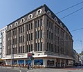
Facades of the former department store Weiser | Buer Hochstraße 2/4 map |
1927 | 08/27/1987 |
128
|
|

|
Facades of the former department store Weiser | Buer Hochstrasse 7 map |
1927 | 08/27/1987 |
129
|
|
 more pictures |
Catholic parish church St. Urbanus | Buer Hochstrasse 37a map |
1891-1893 | 08/03/1992 |
261
|
|

|
Facades of the Karstadt department store | Buer Hochstrasse 40-44 map |
1912 1928 |
08/02/1989 |
224
|
|

|
representative Residential / commercial building from the turn of the century | Buer Hochstrasse 48 map |
1906 | March 22, 1988 |
157
|
|

|
Document for housing conditions at the beginning of the 20th century. | Buer Hochstrasse 50 map |
Residential and commercial building | 1904 | May 24, 1988 |
168
|

|
urban development. Connection with adjacent architectural monuments | Buer Hochstrasse 52 map |
Residential and commercial building | 1898 | May 24, 1988 |
169
|

|
built as a house and tax office for city, country and empire | Buer Hochstrasse 66 map |
Residential and commercial building | 1897 | 11/24/1987 |
147
|

|
former mayor's villa | Buer Hochstrasse 68 map |
Residential and commercial building | 1876 | 07/02/1986 |
27
|

|
Alma School | Uckendorf Hohenfriedberger Strasse 2 map |
1909-1910 | 04/14/1987 |
114
|
|

|
former Wilmshof | Bulmke-Hüllen Hohenstaufenallee 2 map |
1807 | 03/03/1986 |
22nd
|
|
 more pictures |
Switching house, bunker system, two gatehouses, former Schalke club | Bulmke-Hüllen Hohenzollernstrasse / between Wanner Strasse 166/168 and 180 map |
⊙ ⊙ ⊙ | 1923 1928 1930 |
07/13/2005 |
333
|

|
Police Headquarters | Buer Hölscherstraße 3 / Rathausplatz 4 map |
⊙ | 1926-1927 | 09/14/1984 |
10
|
 more pictures |
Community center m. cath. St. Thomas More Church, hall, group rooms, etc. a. | Ückendorf Holtkamp 40 map |
1964-1966 | 07/06/2004 |
329
|
|
| Former miners' settlement Dahlbusch colliery | Feldmark Hördeweg 45-60, 62, 64 / Am Eichenbusch 1–16 map |
1873 1882 |
03/30/1987 |
96
|
||

|
Residential and commercial building with cinema (supplement: interior structures, wall-mounted equipment from the construction period) | Buer Horster Strasse 6 map |
1927 | 23.11.1988 02.09.2008 |
194
|
|
 more pictures |
City Museum Buer | Buer Horster Strasse 7 map |
Former Residential building, used as an art exhibition room since 1957, today part of a larger museum architecture. Since 2008 the museum has been called the " Art Museum Gelsenkirchen ". Admission is free. | 1893 | January 16, 1985 |
14th
|

|
Facades of the residential and commercial building | Buer Horster Strasse 20 map |
1858 | 05/11/1988 |
164
|
|

|
"Iron" house | Buer Horster Strasse 22 map |
Residential and commercial building | 1910 | 04/28/1987 |
116
|

|
Residential and commercial building from the turn of the century | Buer Horster Strasse 24 map |
1898 | 04/28/1987 |
117
|
|

|
Ev. Apostle Church | Buer Horster Strasse 35 map |
1892-1893 | 02/04/1987 |
87
|
|
 more pictures |
Catholic parish church St. Ludgerus | Buer Horster Strasse 122 map |
1915 | 07/20/1992 |
263
|
|

|
Facades and roof | Buer Horster Strasse 130 map |
1924 | March 16, 1995 |
290
|
|

|
former mine director's residence | Buer Horster Strasse 163 map |
1890 | 05/23/1989 |
223
|
|

|
Former civil servants' double house of the Hugo colliery with a former stable building | Buer Horster Strasse 165, 167 map |
1911 | April 24, 1990 |
246
|
|

|
former miners' house | Buer Horster Strasse 169 map |
1890 | 08/08/1986 |
36
|
|

|
former miners' house | Buer Horster Strasse 171 map |
1890 | 08/08/1986 |
37
|
|

|
Former home of the director of the Hugo I colliery | Buer Horster Strasse 192 map |
1887 | 11/02/1987 |
144
|
|

|
former casino of the Hugo I colliery with enclosure | Buer Horster Strasse 196–198 map |
1888-1890 | 01/08/1986 |
32
|
|
 more pictures |
Former brand control building of the Hugo I colliery with enclosure | Buer Horster Strasse 200 map |
1908 | 08/08/1986 |
35
|
|

|
former workers' settlement of the Hugo colliery | Buer Hugostraße 11-41 (odd) card |
1890-1900 | 10/30/1989 |
232
|
|

|
former Lohmühle (watermill) | Buer Hugostraße 64a map |
Early 19th century | 11/23/1988 |
193
|
|

|
bourgeois Architecture before the outbreak of the First World War | Old town Husemannstrasse 41 map |
Residential and commercial building by architect Josef Franke | 1911 | March 31, 1988 |
160
|

|
bourgeois Architecture before the outbreak of the First World War | Old town Husemannstrasse 43 map |
Residential and commercial building | 1912 | March 31, 1988 |
161
|
 more pictures |
Former Ladies' monastery "Aloysianum" (1st secondary school in Gelsenkirchen) | Old town Husemannstrasse 52 map |
1895 | 07/07/1987 |
123
|
|
 more pictures |
Social welfare office | Old town Husemannstraße 69 / Zeppelinallee 4 map |
1939-1945 | 11/23/1988 |
197
|
|

|
Building of the bourgeoisie in the 1st quarter of the 20th century | Old town Husemannstrasse 71 map |
bourgeois row house | 1907 | 10/16/1986 |
55
|

|
external dimensions and facades effective to the street | Altstadt Husemannstrasse 73 (ensemble) map |
bourgeois row house by architect Josef Franke | 1908-1909 | 10/16/1986 |
56
|

|
Building of the bourgeoisie in the 1st quarter of the 20th century | Altstadt Husemannstrasse 75 (ensemble) map |
bourgeois row house by architect Josef Franke | 1921-1923 | 10/16/1986 |
57
|

|
Residential buildings from the time at the beginning of industrialization | Uckendorf Hüssener Strasse 11 map |
1887 | 11/28/1986 |
61
|
|

|
Residential buildings from the time at the beginning of industrialization | Ückendorf Hüssener Strasse 13 map |
1887 | 11/28/1986 |
62
|
|

|
former workers' house | Uckendorf Hüssener Strasse 14 map |
1897 | 07/05/1988 |
177
|
|

|
former workers' house | Uckendorf Hüssener Strasse 16 map |
1897 | 07/05/1988 |
178
|
|

|
House shortly after the turn of the century - facades | Bismarck Hüttweg 29 map |
1903 | 11/26/1987 |
149
|
|
|
|
Gatehouses of the main cemetery Buer and access road | Buer Immermannstrasse 47/49 map |
⊙ | 1923 | 02/12/1993 |
271
|

|
Ev. church | Hessler Jahnstrasse 23 map |
Heßler Evangelical Church, built by the architect Arno Eugen Fritsche | 1910-1911 | 11/03/1993 |
286
|
 more pictures |
Ev. Church of the Resurrection | Neustadt Josefstrasse 22 map |
Built by architect Arno Eugen Fritsche | 1910-1911 | 09/05/1986 |
41
|

|
Wiehagen School | Neustadt Josefstrasse 26/28 map |
1900 1908 |
10/26/1987 |
143
|
|
|
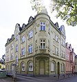
bourgeois Housing development shortly after the turn of the century | Neustadt Josefstrasse 31 map |
1906 | December 27, 1988 |
208
|
|
 more pictures |
Leithe House | Neustadt Junkerweg 30 map |
1565 1753 |
05/06/1986 |
24
|
|
|
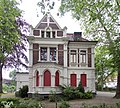
former villa, now youth home | Hessler Kanzlerstrasse 23 map |
former villa of the landowner Ernst Schalke | 1898 | 09/24/1987 |
132
|

|
Residential group | Feldmark Karolinenstrasse 13 map |
1906 | 07/22/1992 |
264
|
|

|
Residential group | Feldmark Karolinenstrasse 15 map |
1905 | 07/22/1992 |
265
|
|

|
Residential group | Feldmark Karolinenstrasse 16 map |
1908 | 07/22/1992 |
266
|
|

|
Residential group | Feldmark Karolinenstrasse 17 map |
1905 | 07/22/1992 |
267
|
|

|
Residential group | Feldmark Karolinenstrasse 18 map |
1905-1906 | 07/22/1992 |
268
|
|
|
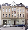
Residential group | Feldmark Karolinenstrasse 20 map |
1906 | 07/22/1992 |
269
|
|
 more pictures |
" Musiktheater " theater building | Schalke Kennedyplatz 1 card |
1957-1959 | 12/16/1997 |
296
|
|

|
Former Miners' Union Hospital | Ückendorf Knappschaftsstraße 5 map |
1903-1905 | 05/10/1987 |
137
|
|

|
Facades and stairwells of several buildings | Ückendorf Knappschaftsstraße 15, 17, 19, 21, 25 / Virchowstraße 29–35 (odd) card |
1910-1911 | 03/17/1988 |
156
|
|

|
formerly "Tewes-Hof" | Scholven Koesfeld 5 card |
1st half of the 19th century | 05/31/1985 |
20th
|
|
 more pictures |
Ev. Friedenskirche | Schalke Koenigsberger Strasse 122 map |
1957 | 04/16/1992 |
262
|
|

|
Main Post Office Buer | Buer Königswiese 1 card |
Main post office building in the style of brick expressionism | 1927 | 02/22/1993 |
272
|

|
former civil servants' residence | Ückendorf Krahwinkel 17 / 17a map |
1902 | 03/07/1989 |
214
|
|

|
Testimony to an important phase in Gelsenkirchen's building history at the turn of the century | Feldmark Küppersbuschstraße 6 map |
Residential building | 1900 | 05/29/1987 |
120
|

|
Former Thyssen-Draht administration building | Schalke-Nord Kurt-Schumacher-Straße 100 map |
erected as the administration building of the wire works of Hüttenwerke Oberhausen AG (later Thyssen-Draht) | 1952 | 05/10/1994 |
288
|

|
Hall of the former Thyssen wire rope factory | Schalke-Nord Kurt-Schumacher-Straße 100 map |
originally wire rope factory Boecker & Co. (later Thyssen Draht) | 1915 | 02/14/2008 |
336
|
 more pictures |
Gas plant (former Rheinelbe coking plant) | Ückendorf Leithestraße map |
1880-1890 | 05/29/1987 |
118
|
|

|
Community elementary school with caretaker's house | Bismarck Lenaustraße 5 map |
1898 | 07/30/1987 |
125
|
|
|
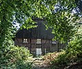
former farm "Grothof" | Buer Löchter 8 card |
1783 | 07/20/1988 |
173
|
|
 more pictures |
House Lüttinghof | Hassel Lüttinghofallee 3 map |
15th century | 02/04/1987 |
86
|
|
 more pictures |
War memorial in front of the social welfare office | Old town Machensplatz map |
1934 | 07/19/1993 |
278
|
|

|
former doctor's residence | Buer Maelostraße 5 map |
1903 | December 15, 1989 |
234
|
|

|
Catholic parish church Hl. Dreifaltigkeit u. Rectory | Bismarck Magdalenenstrasse 47 map |
by architect Josef Franke | 1924-1926 | 08/23/1993 |
281
|

|
Residential house with restaurant | Buer Marienstraße 6 map |
in the middle of the 19th century | March 22, 1988 |
158
|
|

|
facade | Ückendorf Markgrafenstraße 1 / 1a (ensemble) map |
Group of houses by architect Josef Franke | 1906 | March 24, 1987 |
97
|

|
facade | Ückendorf Markgrafenstraße 3 / 3a (ensemble) map |
Group of houses by architect Josef Franke | 1904–1905 changed around 1909 |
March 24, 1987 |
98
|

|
facade | Ückendorf Markgrafenstraße 4 (ensemble) map |
Group of houses by architect Josef Franke | 1905 | March 24, 1987 |
99
|

|
facade | Ückendorf Markgrafenstraße 7 (ensemble) map |
Group of houses by architect Josef Franke | 1902-1903 | 07/20/1987 |
100
|

|
facade | Ückendorf Markgrafenstraße 8 (ensemble) map |
Group of houses by architect Josef Franke | 1902 | March 24, 1987 |
101
|

|
facade | Ückendorf Markgrafenstraße 9 (ensemble) map |
Group of houses by architect Josef Franke | 1902 | March 24, 1987 |
102
|

|
facade | Ückendorf Markgrafenstraße 10 (ensemble) map |
Group of houses by architect Josef Franke | 1923-1924 | March 24, 1987 |
103
|

|
facade | Ückendorf Markgrafenstraße 15 (ensemble) map |
Home of the architect Josef Franke | 1923-1924 | March 24, 1987 |
104
|

|
facade | Ückendorf Markgrafenstraße 17 (ensemble) map |
Home of the architect Josef Franke | 1923-1924 | March 24, 1987 |
105
|
 more pictures |
Entrance area of the former Hassel coking plant (administration, chewing and laboratory building with Prometheus wall relief, bicycle shed and hose tower) | Hassel Marler Strasse 100, 102 map |
1953 | 09/28/2001 |
318
|
|

|
Leythe house | Erle Middelicher Strasse 72 map |
18th century | 28.10.1983 20.07.1988 |
3
|
|

|
Part of a former small courtyard | Resse Middelicher Strasse 150 map |
1st half of the 19th century | January 16, 1985 |
16
|
|
 more pictures |
bourgeois Architecture from the founding phase of old GEs | Old town Munckelstrasse 20 map |
Historicism architecture | 1893 | 01/30/1987 |
85
|

|
facade | Ückendorf Munscheidstraße 9 map |
Residential building | 1906 | 09/25/1987 |
133
|
|
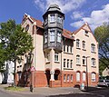
facade | Ückendorf Munscheidstraße 11a map |
Residential building | 1906 | 09/25/1987 |
134
|

|
bourgeois Residential / commercial building shortly before the turn of the century | Neustadt Neustadtplatz 2 map |
1895 | 12/30/1988 |
204
|
|

|
bourgeois Corner house at the turn of the century | Neustadt Neustadtplatz 6 map |
formerly Moltkeplatz 6, 1942 Judenhaus | 1907 | 01/30/1989 |
205
|

|
School building with the former caretaker's residence | Erle Neustraße 7, 9 map |
⊙ | 1897-1898 | 06/08/2000 |
312
|

|
urban kindergarten | Buer Niefeldstrasse 18 a map |
1911-1912 | 11/19/2002 |
320
|
|

|
villa-like house | Buer Nienhofstrasse 18 map |
1915 | 03/06/1992 |
255
|
|

|
former vet house | Buer Nienhofstrasse 25 map |
1929 | 03/06/1992 |
256
|
|

|
Single family house with attached garage | Ückendorf Niermannsweg 11 map |
1955-1956 | 07/29/1997 |
300
|
|
 more pictures |
Surface structures of the former Nordstern I / II colliery | Horst Nordsternplatz 1 map |
1920-1960 | 02/20/1995 |
291
|
|

|
bourgeois Single-family home from the industrial boom | Buer Ophofstrasse 33 map |
1898 | 08/25/1989 |
229
|
|

|
former boathouse with city forest and former Emil Zimmermann home | Buer Ortbeckstraße 59 (see also Ressestraße 40) map |
⊙ ⊙ | 1924 1951 |
26.10.1999 01.10.2001 |
308
|

|
oldest Jewish cemetery in the city | Bulmke-Hüllen Oskarstrasse / Wanner Strasse map |
1874 | March 16, 1995 |
293
|
|

|
Formerly Prussian normal school with a wall at the back and a toilet block | Ückendorf Parkstrasse 3 map |
1899 | 06/04/1993 |
277
|
|

|
House at the turn of the century | Ückendorf Parkstrasse 12 map |
1901 | 10/06/1987 |
138
|
|

|
bourgeois representative House at the turn of the century | Ückendorf Parkstrasse 14 map |
1901 | 01/21/1987 |
81
|
|

|
Residential building with double garage | Ückendorf Parkstrasse 24 map |
⊙ | 1954-1955 | 07/29/1997 |
299
|

|
Factory villa for the waterworks for the northern Ruhr area | Ückendorf Parkstrasse 25 map |
Director's villa by architect Josef Franke | 1911 | 04/21/1992 |
257
|

|
Factory villa for the waterworks for the northern Ruhr area | Ückendorf Parkstrasse 27 map |
Director's villa by architect Josef Franke | 1911 | 04/21/1992 |
258
|

|
Ev. Pauluskirche (with furnishings, forecourt and wall with stairs) | Bulmke-Hüllen Pauluskirchplatz 1 map |
1955-1959 | 04/08/2005 |
330
|
|

|
former school with caretaker's house | Bismarck Paulstrasse 4 map |
1898 | 07/30/1987 |
126
|
|

|
Catholic parish church St. Theresia | Hassel Polsumer Strasse 104 map |
built according to plans by the architect Karl Band , closed in 2007 | 1958-1960 | 01/08/1999 |
306
|

|
GE-Nord tax office | Buer Rathausplatz 1 map |
built in 1925 as Buer tax office, then Gelsenkirchen-Nord tax office, dissolved on May 1, 2015, has been vacant since then; The ground floor facade has changed significantly in the meantime | 1925 | 10/15/1984 |
12
|

|
former official residence for the mining industry | Ückendorf Rheinelbestraße 62 / Virchowstraße 110 map |
Official residence of the Rheinelbe colliery | 1903-1904 | 07/09/1986 |
29
|
| Chaplaincy Assumption s. also Beethovenstrasse 11 and Haydnstrasse 16/18 | Rotthausen Richard-Wagner-Strasse 1 map |
see above | 1893-1894 | 08/23/1993 | 280 ( specified above )
|
|
 more pictures |
bourgeois Brick architecture of the interwar period | Altstadt Ringstrasse 93 / Weberstrasse 70-72 map |
"Ring-Eck" residential and commercial building by architect Josef Franke ( brick expressionism ) | 1927 | 06/22/1988 |
172
|
 more pictures |
former “Franke” residential building | Old town Robert-Koch-Strasse 18 map |
Home of the architect Josef Franke | 1909 | 03/25/1982 |
2
|
 more pictures |
formerly "Schule im Mausepott"; now music school | Schalke Rolandstrasse 3 map |
1908 | 01/06/1988 |
153
|
|

|
Angle bungalow | Buer Romanusstraße 15 map |
1958 | 08/25/1997 |
305
|
|

|
Gertrud Bäumer secondary school | Altstadt Rotthauser Straße 2 / Zeppelinallee 1 map |
by City Planning Officer Max Arendt and City Builder Ernst Bode | 1913-1914 | 07.10.1987 |
140
|

|
former town hall coat of arms of the city of Gelsenkirchen | Altstadt Rotthauser Strasse 2 / Zeppelinallee 1 (since October 28, 1998 - previously Ahstrasse 22) map |
Large-format representation of the old city coat of arms of Gelsenkirchen (facade decoration of the former town hall on Machensplatz, built in 1894 and demolished in 1970) | 1894 | 01/24/1989 |
210
|

|
Former Official residences | Horst Sandstrasse 15/17 and 19/21 map |
⊙ | 1921-1922 | 04/26/1994 |
287
|

|
Residential building with practice | Altstadt Schultestrasse 4 map |
1912 | 06/06/1988 |
171
|
|

|
bourgeois House at the turn of the century | Altstadt Schultestrasse 10 map |
1898 | October 21, 1988 |
186
|
|

|
Official houses of the former mining company Hibernia / coal mine Zweckel | Scholven Schwedenstraße 19-37 (odd) card |
1912-1923 | May 18, 1988 |
166
|
|

|
Residential and office building | Buer Springestrasse 8 map |
Former residential building of the lawyer Pöppinghaus with offices | 1911 | December 27, 1988 |
206
|

|
secondary school | Hassel St.-Michael-Strasse 1 map |
1911 | 10/14/1993 |
284
|
|
| Ev. Rotthausen Church | Rotthausen Steeler Strasse 48 map |
1896 | 06/09/1987 |
119
|
||
| former director's villa Dahlbusch colliery | Rotthausen Steeler Strasse 61 map |
1882 | 10/16/1986 |
51
|
||

|
Catholic parish church of Liebfrauen | Neustadt Stolzestraße 1 map |
1894 | 09/05/1986 |
42
|
|

|
former Theodor Fliedner School | Erle Surkampstrasse 27/29 map |
1959 | 02/27/2001 |
315
|
|
|
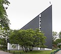
Ev. Thomaskirche with kindergarten and rectory | Erle Surkampstrasse 31 map |
⊙ ⊙ | 1963-1965 | 11/14/2003 |
322
|
 more pictures |
Road bridge over the Emscher | Horst Sutumer Bridge Card |
1908 | 02/29/1988 |
155
|
|

|
former Otte-Hof | Beckhausen Theodor-Otte-Strasse 17a map |
1798 1824 |
10/10/1989 |
231
|
|

|
"Melchers-Hof" | Beckhausen Theodor-Otte-Strasse 42a map |
1801 | 08/07/1989 |
227
|
|
|
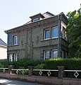
former civil servants' residence | Buer Tossestraße 4 map |
1927 | 08/03/1989 |
226
|
|

|
Ev. Christ Church | Bismarck Trinenkamp 46 map |
1899-1901 | 11/18/1986 |
65
|
|

|
Row of houses | Bismarck Trinenkamp 57-75 (odd) card |
before 1930 | 10/25/1988 |
189
|
|
 more pictures |
Horst Castle | Horst Turfstrasse 21 map |
1552-1578 | December 15, 1983 |
5
|
|

|
Tenement house after the turn of the century | Uckendorf Uckendorfer Strasse 68 map |
Apartment building | 1905-1906 | 04/08/1987 |
111
|

|
Ev. Nicolai Church | Uckendorf Uckendorfer Strasse 106 map |
1893-1894 | 05.12.1986 |
68
|
|

|
Catholic parish church St. Josef with rectory | Uckendorf Uckendorfer Strasse 124 map |
1894-1896 | 04/08/1987 |
110
|
|

|
Factory hall, double Malakow tower, fan building, director's villa, machine hall of the former Holland colliery | Ückendorf Ückendorfer Strasse 237 map |
1870-1927 | 10/16/1986 |
52
|
|

|
Railway bridge | Uckendorf Uckendorfer Strasse map |
1910 | 01/22/1991 |
252
|
|

|
Facades of the former director's residence of the glass and mirror factory | Schalke-Nord Uechtingstrasse 1 map |
1890 | 09/21/1987 |
130
|
|

|
Former Waschkaue (Sozialwerk St. Georg) "Schacht Bismarck" of the Graf Bismarck colliery | Schalke-Nord Uechtingstraße 75 map |
now St. Georg welfare agency | 1900 | 02/23/1987 |
82
|

|
Former Laundromat of the Bismarck colliery, Emschermulde 2 shaft | Erle Ulrichstraße 4b map |
1882-1884 | 05/11/1988 |
165
|
|

|
kindergarten | Buer Urnenfeldstrasse 2 map |
1923 | 11/10/1988 |
192
|
|

|
former civil servants' houses | Buer Urnenfeldstrasse 15, 17, 19, 21 map |
1914 | 01/24/1990 |
238
|
|

|
Half-house | Buer Velsenstrasse 16 map |
1918-1919 | 06/26/2019 |
348
|
|

|
Half-house | Buer Velsenstrasse 16a map |
1918-1919 | 06/26/2019 |
349
|
|

|
Half-house | Buer Velsenstrasse 18 map |
1918-1919 | 07/06/2018 |
344
|
|

|
Half-house | Buer Velsenstrasse 18a map |
1918-1919 | 07/06/2018 |
343
|
|

|
Single-family house with double garage | Horst Vogelsangstraße 10 map |
⊙ | 1956-1957 | 07/29/1997 |
301
|

|
Row of upper-class buildings in Art Nouveau - urban architecture shortly after the turn of the century | Old town Von-der-Recke-Straße 3 map |
Art Nouveau or reform architecture houses, typical urban house architecture around 1910 | 1910 | 09/22/1986 |
44
|

|
Row of upper-class buildings in Art Nouveau - urban architecture shortly after the turn of the century | Old town Von-der-Recke-Straße 9 map |
Art Nouveau or reform architecture houses, typical urban house architecture around 1910 | 1911 | 09/22/1986 |
45
|

|
Row of upper-class buildings in Art Nouveau - urban architecture shortly after the turn of the century | Old town Von-der-Recke-Straße 11 map |
Art Nouveau or reform architecture houses, typical urban house architecture around 1910 | 1911 | 09/22/1986 |
46
|

|
Row of upper-class buildings in Art Nouveau - urban architecture shortly after the turn of the century | Old town Von-der-Recke-Straße 13 map |
Art Nouveau or reform architecture houses, typical urban house architecture around 1910 | 1910 | 09/22/1986 |
47
|

|
Row of upper-class buildings in Art Nouveau - urban architecture shortly after the turn of the century | Old town Von-der-Recke-Straße 15 map |
Art Nouveau or reform architecture houses, typical urban house architecture around 1910 | 1910 | 09/22/1986 |
48
|

|
Row of upper-class buildings in Art Nouveau - urban architecture shortly after the turn of the century | Old town Von-der-Recke-Straße 17 map |
Art Nouveau or reform architecture houses, typical urban house architecture around 1910 | 1910 | 09/22/1986 |
49
|

|
Row of upper-class buildings in Art Nouveau - urban architecture shortly after the turn of the century | Old town Von-der-Recke-Straße 19 map |
Art Nouveau or reform architecture houses, typical urban house architecture around 1910 | 1912 | 09/22/1986 |
50
|

|
Housing development from the late 1920s | Bulmke-Hüllen Wanner Straße 22 map |
1928 | 01/26/1989 |
212
|
|

|
Housing development from the late 1920s | Bulmke-Hüllen Wanner Strasse 24 map |
1928 | 01/26/1989 |
211
|
|

|
Housing development from the late 1920s | Bulmke-Hüllen Wanner Strasse 26 map |
1928 | 01/26/1989 |
213
|
|

|
primary school | Bulmke-Hüllen Wanner Straße 125 map |
1907 | 06/05/1990 |
247
|
|

|
Complex with ev. Stephanus church, tower, chapel, etc. | Buer Westerholter Strasse 92/94 map |
1968-1970 | 07/06/2004 |
327
|
|

|
Row of houses | Erle Wilhelmstrasse 94-108 (even) map |
1907-1908 | 11/23/1988 |
196
|
|
|
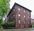
Tax office Gelsenkirchen-Süd | Altstadt Wittekindstraße 18 / Zeppelinallee 9–13 map |
was dissolved on May 1, 2015 | 1928 | 09/14/1984 |
9
|

|
Catholic parish church of St. Laurentius with crypt, chapel, tower, etc. | Horst Zum Bauverein 34 map |
1953-1954 | 07/06/2004 |
328
|
|

|
Facades of the residential group m. House entrance doors | Horst Zum Bauverein 53–63 (odd) card |
1929-1930 | 03/05/1998 |
304
|
|

|
War memorial | Buer memorial card |
Fallen Memorial at Buerschen Berg (lakeside) | 1933 | 11/29/1991 |
253
|

|
Single-family house with office wing and attached garage | Buer zum Ehrenmal 8 card |
1953 | 07/29/1997 |
295
|
|

|
Meat factory water tower (Vestia) | Buer zum Vestiaturm 30 card |
Sausage factory no longer exists | 1907-1908 | December 27, 1988 |
203
|
Former architectural monuments
Unassigned number: 53, 54, 58, 77, 88, 89, 112, 113, 115, 146, 150 (see below), 167, 198 (see below), 201, 207, 245, 309, 345, 347
| image | designation | location | description | construction time | Registered since |
Monument number |
|---|---|---|---|---|---|---|
| Wrought iron gate | Neustadt Bokermühlstrasse 23 map |
not available anymore | 1905 | 11/23/1988 |
|
|
| Health house (formerly Lahrshof) | Bismarck Franziskusstrasse 18 map |
Tore off. | 1836 | December 01, 1987 |
|
|
 more pictures |
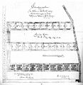
Klapheckenhof settlement | Heßler Klapheckenhof 1–30 card |
Klapheckenhof settlement on the site of the former Klaphecke farm | 1873-1885 | 09/30/1988 |
|
See also
Web links
-
City of Gelsenkirchen - monument protection
- List of monuments of the city of Gelsenkirchen (PDF; 85 kB), as of May 17, 2011.
- Digital monument register of the city of Gelsenkirchen
