List of architectural monuments in Haltern am See
The list of architectural monuments in Haltern am See contains the listed buildings in the area of the city of Haltern am See in the Recklinghausen district in North Rhine-Westphalia (as of August 25, 2011). These architectural monuments are entered in the monuments list of the city of Haltern am See; The basis for the admission is the Monument Protection Act North Rhine-Westphalia (DSchG NRW).
Architectural monuments are "monuments that consist of structures or parts of structures". The list of monuments of the city of Haltern am See includes 74 monuments, including 30 small monuments such as church furnishings, stations of the cross or war memorials, 15 residential houses, nine chapels, six churches, four courtyards and fortifications each, two residential and commercial buildings as well as a cemetery, an industrial plant, a mill and a public building. In addition, a monument has been removed from the list of monuments. Of the total of 74 monuments, 35 are in the town of Haltern-Mitte, nine in Lippramsdorf , seven each in Hamm-Bossendorf and Hullern , six in Sythen , four each in Flaesheim and Lavesum and two in Holtwick .
Architectural monuments
The list includes a photograph of the monument, if available, the name as a description, otherwise the type of building in italics, the location in which the monument is located and the address, if known, the construction time, the date of protection and the registration number of the lower monument authority of the city Haltern am See. The name corresponds to the designation by the lower monument authority of the city of Haltern am See. Abbreviations have been resolved for better understanding, the typography has been adapted to that used in Wikipedia and typos have been corrected.
| image | designation | location | description | construction time | Registered since |
Monument number |
|---|---|---|---|---|---|---|

|
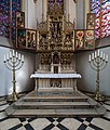
Church with altar candlestick Erlöserkirche, Protestant church |
Haltern-Mitte Hennewiger Weg 8 map |
05/09/1983 | 1 |
||

|
Old town hall with ciborium and votive plaque | Haltern-Mitte Markt 1 / Rekumer Straße map |
06/23/1983 | 2 |
||

|
Siebenteufelsturm tower |
Map of Haltern-Mitte Turmstrasse |
06/23/1983 | 3 |
||

|
chapel | Lavesum Kapellenstrasse map |
07/08/1983 | 4th |
||

|
Chapel with epitaph | Map of Hamm-Bossendorf Kapellenweg |
07/12/1983 | 5 |
||

|
Church Catholic Church of St. Andrew |
Hullern Hauptstrasse 47 map |
07/12/1983 | 6th |
||

|
Altar wing Catholic Church of St. Andrew | Hullern Hauptstrasse 47 map |
07/12/1983 | 6/1 |
||

|
Residential and commercial building | Haltern-Mitte Merschstraße 11 map |
07/27/1983 | 8th |
||

|
Pilgrimage Chapel Annaberg | Haltern-Mitte Annaberg map |
08/23/1983 | 9 |
||

|
Miraculous image pilgrimage church Annaberg | Haltern-Mitte Annaberg map |
08/23/1983 | 9/1 |
||

|
Reliefs of the Annaberg pilgrimage chapel | Haltern-Mitte Annaberg map |
08/23/1983 | 9/2 |
||

|
Church Catholic town church St. Sixtus |
Haltern-Mitte market map |
08/23/1983 | 10 |
||

|
Altarpiece parish church St. Sixtus | Haltern-Mitte market map |
08/23/1983 | 10/1 |
||

|
Epitaph parish church of St. Sixtus | Haltern-Mitte market map |
08/23/1983 | 10/2 |
||

|
Fork crucifix parish church St. Sixtus | Haltern-Mitte market map |
08/23/1983 | 10/3 |
||

|
Votive plaque parish church St. Sixtus | Haltern-Mitte market map |
08/23/1983 | 10/4 |
||

|
Ciborium parish church of St. Sixtus | Haltern-Mitte market map |
08/23/1983 | 10/5 |
||

|
Altar candlestick parish church St. Sixtus | Haltern-Mitte market map |
08/23/1983 | 10/6 |
||

|
Collegiate church | Flaesheim Stiftsplatz map |
08/23/1983 | 11 |
||

|
Altar parish church Flaesheim | Flaesheim Stiftsplatz map |
08/23/1983 | 11/1 |
||
 more pictures |
Holy Cross Parish Church in Hamm-Bossendorf | Hamm-Bossendorf Kirchweg map |
08/23/1983 | 12 |
||
| Ciborium parish church Hamm-Bossendorf | Hamm-Bossendorf Kirchweg map |
08/23/1983 | 12/1 |
|||

|
Gatehouse and chapel of the former Sythen house |
Sythen Stockwieser Damm map |
coll. "Sythen Castle", correct name "Sythen House" | 09/08/1983 | 13 |
|

|
Castle house Ostendorf |
Lippramsdorf Ostendorfer Strasse 47 map |
October 18, 1983 | 14th |
||

|
Residential building | Haltern-Mitte Lippstraße 13 map |
03/20/1984 | 15th |
||

|
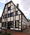
House | Haltern-Mitte Markt 7 card |
Residential building | around 1800 | 03/20/1984 | 16 |

|
Residential building | Haltern-Mitte Gaststiege 15 ticket |
March 22, 1984 | 17th |
||

|
Courtyard | Sythen Dorfstrasse 28 map |
05/02/1984 | 18th |
||

|
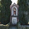
statue | Sythen Stockwieser Damm / Blumenstrasse map |
09/27/1984 | 19th |
||

|
Relief stone | Lippramsdorf Dorstener Strasse 765 map |
09/27/1984 | 20th |
||

|
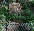
Spartakist tomb | Hamm-Bossendorf on the Hassel map |
12/12/1984 | 21st |
||

|
Wayside cross | Haltern-Mitte Munsterstrasse / Johannesstrasse map |
12/12/1984 | 22nd |
||

|
Warrior Memorial | Map of Hamm-Bossendorf Marler Strasse |
12/12/1984 | 23 |
||

|
Warrior Memorial | Haltern-Mitte Römerstraße map |
May 22, 1985 | 24 |
||

|
Residential building, former farm house |
Haltern-Mitte Lippmauer 6 map |
07/30/1985 | 25th |
||

|
Residential building | Haltern-Mitte Wehrstraße 1 map |
07/31/1985 | 26th |
||

|
Remnants of the city wall in the garden plot |
Haltern-Mitte Südwall 23 map |
Semicircular bulge built with quarry stone. These are the remains of a city tower, which can still be found in the original cadastre from 1823. The side connections of the tower are unfortunately largely buried today due to the rising terrain and can only be seen in rudiments. | 07/31/1985 | 27 |
|

|
House | Haltern-Mitte Münsterstrasse 8 map |
December 19, 1985 | 28 |
||

|
Wayside chapel | Lavesum Sundernweg / Heidbrink map |
04/09/1986 | 29 |
||

|
Courtyard house | Lavesum Rekener Strasse 223 map |
07/10/1986 | 30th |
||

|
Court chapel | Lavesum Buchenstrasse 38 map |
07/10/1986 | 31 |
||

|
crucifix | Haltern-Mitte at St. Sixtus Church Card |
07/10/1986 | 32 |
||

|
fifth and sixth station of the Way of the Cross Annaberg | Holtwick Kapellenplatz Annaberg Map |
Has been moved from its original location to Kapellenplatz on Annaberg. Works by the Münster sculptor Heinrich Fleige from 1873 | 07/10/1986 | 33 |
|

|
Station of the cross | Holtwick Mühlenweg map |
December 15, 1986 | 35 |
||

|
Wayside shrine | Lippramsdorf Tannenberger Weg map |
December 15, 1986 | 36 |
||

|
Wayside shrine | Lippramsdorf Antoniusweg map |
December 15, 1986 | 37 |
||

|
Wayside cross | Flaesheim Örter Pütt Map |
06/05/1987 | 38 |
||

|
Stone cross | Lippramsdorf Dorstener Strasse 730 map |
06/09/1987 | 39 |
||

|
Kleine-Kappenberg farm | Lippramsdorf Bornweg 1 map |
06/09/1987 | 40 |
||

|
Station of the cross | Haltern-Mitte Lavesumer Straße / Nordwall map |
07/13/1987 | 42 |
||

|
crucifix | Lippramsdorf Sandstrasse 59 map |
09/23/1987 | 43 |
||

|
Court chapel | Lippramsdorf Dorstener Strasse 540 map |
09/23/1987 | 44 |
||

|
Warrior Memorial | Hullern Hauptstrasse / Alter Postweg map |
10/22/1987 | 45 |
||

|
Sythen mill | Sythen Stockwieser Damm map |
02/19/1988 | 46 |
||

|
Wayside cross | Sythen at Dorfstrasse 32 map |
02/22/1988 | 47 |
||

|
Crucifixion group | Flaesheim Zum Dachsberg map |
06/14/1988 | 48 |
||

|
Courtyard house | Hullern Westruper Strasse 170 map |
07/05/1988 | 49 |
||

|
Courtyard house | Lippramsdorf Dorstener Strasse 540 map |
07/07/1988 | 50 |
||
| House | Sythen Am Wehr 75 map |
Former barn, now demolished. The removal from the list of monuments is imminent. | 07/21/1988 | 51 |
||

|
House | Haltern-Sythen Am Wehr 81 map |
09/01/1988 | 52 |
||

|
Residential and commercial building | Haltern-Mitte Mühlenstraße 18 map |
06/21/1989 | 52/2 |
||

|
trigonometric fixed point | Haltern-Mitte Waldbeerenweg 51 ° 45 '59.56 " 7 ° 7' 4.93 map |
Fixed point no. 4208000301, eastward value: 2577227.38 Upper value: 5737521.98 The point was one of five new fixed points of the network Munster connection network 1880-1883 |
1881 | 01/24/1991 | 53 |

|
former courtyard house | Hamm-Bossendorf Kirchweg 10 map |
08/15/1996 | 54 |
||

|
Half-timbered house | Hamm-Bossendorf Marler Strasse 145 map |
11/18/1993 | 55 |
||

|
Gut Borkenberge "Heuershof" | Hullern An der Stever 102 map |
11/18/1993 | 56 |
||

|
Wayside chapel | Hullern Hullerner Reservoir map |
1914 | 10/29/1996 | 57 |
|

|
Wayside chapel | Hullern Hullerner Reservoir, map |
Early 20th century | 10/29/1996 | 58 |
|

|
Old pastorate | Haltern-Mitte Markt 9 card |
02/11/1997 | 59 |
||

|
Virgin Mary statue at the St. Sixtus Church | Haltern-Mitte market map |
04/21/1997 | 60 |
||

|
Courtyard | Haltern-Mitte Lünzumer Weg 127 map |
08/10/1990 | 61 |
||

|
Wayside chapel | Map of Haltern-Mitte Dorstener Straße |
06/05/2000 | 62 |
||

|
Half-timbered construction | Haltern-Mitte Waldwinkel 14 card |
08/01/2001 | 63 |
||

|
Jewish Cemetery | Haltern-Mitte Judendannen card |
07.09.2007 | 64 |
||

|
Transformer house | Haltern-Westrup Westruper Straße between the peasant communities Westrup and Antrup Flur 70, parcel 128, map |
08/25/2011 | 65 |
||

|
House | Haltern-Mitte Richthof 9 card |
66 |
Former architectural monuments
| image | designation | location | description | construction time | Registered since |
Monument number |
|---|---|---|---|---|---|---|
| Courtyard house | Lippramsdorf Weseler Strasse 800 map |
06/10/1987 | 41 |
literature
- Albert Ludorff : The architectural and art monuments of the Coesfeld district. (= The architectural and art monuments of Westphalia. Volume 36) Ferdinand Schöningh, Münster (Westphalia) 1913, pp. 99–106 and plates 66–73.
- Annual statistical report 2006 . (PDF; 880 kB) City of Haltern am See, p. 120 ff.
Web links
Individual evidence
- ↑ § 2 (2) DSchG NRW
- ↑ Monument database of the Recklinghausen district ( Memento of the original from January 7, 2016 in the Internet Archive ) Info: The archive link has been inserted automatically and has not yet been checked. Please check the original and archive link according to the instructions and then remove this notice.
- ^ Geodata portal of the Recklinghausen district administration .
- ^ Monument database in the Recklinghausen district
- ↑ Archived copy ( memento of the original dated November 29, 2016 in the Internet Archive ) Info: The archive link was inserted automatically and has not yet been checked. Please check the original and archive link according to the instructions and then remove this notice.
- ↑ wiki.muenster.org
- ^ The connection triangulation - Title - Digital Collections - Portal .
- ↑ The transformer station is entered in the list of monuments .
