List of architectural monuments in Recklinghausen
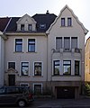
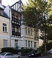
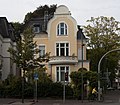
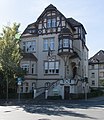
The list of monuments in Recklinghausen contains the listed buildings in the area of the city of Recklinghausen in the Recklinghausen district in North Rhine-Westphalia (status: December 2015). These architectural monuments are entered in the list of monuments of the city of Recklinghausen; The basis for the admission is the Monument Protection Act North Rhine-Westphalia (DSchG NRW).
| image | designation | location | description | construction time | Registered since |
Monument number |
|---|---|---|---|---|---|---|

|
Salary hall of the König Ludwig colliery 1/2 | Old border road 153 | 122 TKD
|
|||

|
Residential and farm buildings | Althochlar 19 map |
151
|
|||

|
Grain distillery and restaurant with living area | At the old church square | 143
|
|||

|
Holy House | Am Siechenkotten | 112
|
|||

|
Harbor crane | At the city port map |
114 TKD
|
|||

|
Telecommunications office, former telegraph office | At the stone gate 3 | 1928-1929 | 5th November 1990 | 83
|
|

|
former Jewish school | At the stone gate 5 | 104
|
|||

|
Brüggemannshof | At the thorn hedge 12 | 48
|
|||
 more pictures |
catholic parish church St. Paulus (Pauluskirche) |
Paulusviertel At the Pauluskirche 11 / Paulusstraße map |
Architects: Franz Lohmann (Recklinghausen) and Wilhelm Rincklake | 1905-1906 | 42
|
|

|
"Franz-Bracht-Haus" (baroque town house) | Anton-Bauer-Weg 6 | 1736 | 18th
|
||

|
Parish and community center (former custody school for small children) | Antoniusstrasse 8-10 | 1905 and 1908 | 164
|
||
 more pictures |
catholic parish church of St. Anthony of Padua | Antoniusstrasse 12 | Architect: Josef Franke | 1929-1930 and 1935-1938 | 163
|
|

|
Villa Boente | Augustinessenstrasse 4 | 1897 | 52
|
||
 more pictures |
Castel Sant'Angelo | Augustinessenstrasse 10 map |
3
|
|||

|
Locomotive shed of the General Blumenthal colliery 1/2/6 | Beckbruchweg / Herner Strasse | 1905 | 172 TKD
|
||

|
House for the bank director Kurt Krauße | Bismarckstrasse 7 | Architect: Cuno Pohlig (Recklinghausen) | 1927 | 170
|
|
|
more pictures |
Reitwinkel colony (with a total of 162 buildings) | Blücherstrasse, Bülowstrasse, Gneisenaustrasse, Hochstrasse, Theodor-Körner-Strasse | 84
|
|||

|
Schlueter House | Bochumer Strasse 84 | 74
|
|||
 more pictures |
Evangelical Luther Church | Bochumer Strasse 161 map |
Architect: probably Heinrich Bramesfeld (Wuppertal-Elberfeld) | 1886-1888 | 95
|
|
 more pictures |
Rectory of the Luther Church | Bochumer Strasse 161 a | 1905 | 96
|
||
 more pictures |
Protestant parish hall | Bochumer Strasse 163 map |
1894 | 97
|
||
 more pictures |
Protestant parish hall | Bochumer Strasse 165 / Magdalenenstrasse 1–5 map |
1900 and 1927 | 98
|
||
 more pictures |
Recklinghausen substation | Bochumer Strasse 253 map |
Architect: Lill (VEW construction department) | 1927-1928 | 119 TKD
|
|

|
Old customs house | Bochumer Strasse 258 map |
90
|
|||

|
Administration building of the Westphalian Farmers' Association, called "Breukerhaus" | Börster Weg 20–22a / Hardtstrasse 1 | 1925 | 121
|
||

|
Breloer residential and commercial building | Brandstrasse 9 | 1893 | 161
|
||

|
Hettlage department store | Broad Street 2 | 1907-1909 | 29
|
||

|
Agricultural bourgeoisie | Breite Strasse 12 | probably 18th century; Facade renewed in 1909 | 140
|
||
 more pictures |
Old pharmacy | Broad Street 14 map |
2nd half of the 18th century | 32
|
||

|
House and garden pavilion | Bruchweg 10 | Builder: Voermann (Bochum) | 1902 | 67
|
|

|
Residential building | Bruchweg 20 | 75
|
|||

|
Field barn | Brüninghoff 55 | 91
|
|||

|
Tax office | Cäcilienhöhe 6 / Beisinger Weg map |
1927 | 134
|
||

|
Half-timbered house | Christophstrasse 21 | 158
|
|||

|
villa-like apartment building | Dorstener Strasse 45 / Zum Nonnenberg | 1921 | 130
|
||

|
Homrighausen house | Dorstener Strasse 46 | Architect: Cuno Pohlig (Recklinghausen) | 1903 | 111
|
|

|
Administration building of the former Recklinghausen mine directorate with director's house | Elper Weg 16-18 / Limperstrasse | 1904-1907 | 82
|
||

|
Double dwelling for officials of the mine management | Elper Weg 19/21 | 1912 | 113
|
||

|
Residential building | Elper Weg 23 | 1911 | 167
|
||

|
Residential building | Elper Weg 25 | 1906 | 168
|
||

|
Residential building | Elper Weg 27 | 1908 | 169
|
||

|
Residential building | Elper Weg 37 | 1911 | 157
|
||

|
Residential building | Elper Weg 41 | 1905 | 149
|
||

|
Residential building | Elper Weg 49 | 1906 | 146
|
||

|
Residential building | Elper Weg 88 | 1925 | 135
|
||

|
Stuckenbusch Monastery | Friedrich-Ebert-Strasse 231 | 58
|
|||

|
former Railway Machine Office Recklinghausen | Görresstrasse 6 | 1911 | 76
|
||

|
Town houses | Grafenwall 1–2 | 1st half of the 19th century; Rebuilt in 1859 | 110
|
||

|
Community center | Big Money Street 23 | 1799-1803 | 41
|
||

|
Villa Stalherm | Halterner Strasse 4 | 1894 | 100
|
||

|
Evangelical cemetery with chapel | Halterner Strasse / Clausiusstrasse | Land acquired in 1898, inauguration on November 5, 1903, expanded several times | 145
|
||

|
Wulff's house | Holy Spirit Street 3 | 2nd half of the 18th century | 4th
|
||
 more pictures |
Guest Church (Hospital) | Holy Spirit Street 7a | 15th century; Remodeling in 1736 | 1
|
||

|
Cramer's house | Heilige-Geist-Strasse 14 | 9
|
|||
 more pictures |
High school church | Holy Spirit Street 18 map |
1666/1838/1927 | 14th
|
||

|
Courtyard | Henrichenburger Strasse 131 | 94
|
|||
 more pictures |
Evangelical Gustav Adolf Church | Herner Strasse 6 | 1845–1847, tower 1878/1879, extension 1886 | 120
|
||

|
Villa Still with outbuilding | Herner Strasse 22 | 1900 | 59
|
||

|
Residential and commercial building | Herner Strasse 39a | Architects: Boesebeck and Schwieters (Recklinghausen) | 1912 | 180
|
|

|
Former stable of the General Blumenthal colliery 1/2/6 | Herner Strasse 89-91 | 1890s | 116 TKD
|
||
 more pictures |
Agricultural bourgeoisie | Herrenstrasse 12-14 | 37
|
|||

|
Old Vicariate | Herrenstrasse 17 | 27
|
|||

|
Residential building | Hertener Strasse 12 | 1896 | 171
|
||

|
former Marist monastery of St. Josef | Hertener Strasse 64 | 1904 | 152
|
||

|
villa | Herzogswall 6 | 1902 | 54
|
||

|
Residential building | Herzogswall 16 | 1902 | 123
|
||

|
former county hall | Herzogswall 17 | 1901 | 6th
|
||

|
villa | Herzogswall 18 | 44
|
|||

|
former mayor's service villa | Herzogswall 20 | 1907 | 45
|
||

|
villa | Herzogswall 22 | 1903 | 8th
|
||

|
Petrinum high school | Herzogswall 29 map |
1911 | 15th
|
||

|
Main fire station with hose tower | Herzogswall 31 | 1909 | 17 TKD
|
||

|
Stein's villa | Herzogswall 46 | 1901 | 7th
|
||

|
Knüver farm | Hillen 57 | 77
|
|||

|
Farmhouse | Hillen 60 | 53
|
|||
 more pictures |
Administration and chew building of the Recklinghausen I colliery | Hochlarmarkstrasse 65-67 map |
1902 | 73 TKD
|
||

|
Residential building | Hohenzollernstrasse 4 | 1905 | 132
|
||

|
Community center | Holzmarkt 5 card |
38
|
|||

|
Craftsman House | Holzmarkt 15 | 2nd half of the 18th century | 142
|
||

|
Seilermeisterhaus | Holzmarkt 17 | 36
|
|||

|
former nurses' home | Hukesteinstrasse 2 | 1920s | 78
|
||
 more pictures |
classicist house | In Rome 2 | 1859 | 26th
|
||
 more pictures |
District administration villa and coach house | In Rome 6 and 8 | 1896-1905 | 5
|
||

|
former Rheinisch-Westfälische Disconto-Gesellschaft AG, later the Still administration building | Old town Kaiserwall 21 |
Architect: Otto Müller-Jena ; Monument protection limited to the south-east facade and south-west facade | 1906-1907 | 51
|
|
 more pictures |
Headframe and machine house of the "Konrad-Ende-Schacht" (shaft 4) of the Recklinghausen II colliery | Hochlarmark Karlstrasse 55 map |
1963-1964 | 115 TKD
|
||

|
former cartwright | Kellerstrasse 8 | 1848 | 25th
|
||

|
Altstadtschmiede | Kellerstrasse 10 | 1850 | 34
|
||

|
former calibration office | Kemnastraße 15 | 1936 | 79
|
||

|
Hittorf high school | Kemnastraße 38 | Architect: Peter Heil (Recklinghausen) | 1908 | 133
|
|

|
Icon Museum (former school building) | Church square 2a | 1795-1798 | 16
|
||
 more pictures |
Petruskirche | Church square 7 | 13th Century | 13
|
||

|
catholic parish church of St. John the Baptist |
Suderwich Kirchstrasse |
Architect: Lehmann (Recklinghausen) | 1902-1904 | 99
|
|

|
Agricultural bourgeoisie | Small Money Road 4 | 19th
|
|||

|
Residential and commercial building | Königswall 8 | Architect: Cuno Pohlig (Recklinghausen) | 1900 | 61
|
|

|
Bank building of the former Essen Creditanstalt AG | Königswall 24 | Architect: Cuno Pohlig (Recklinghausen) | 1898 | 62
|
|

|
Residential building | Königswall 26 | 1898 | 63
|
||

|
Wilhelm Jansen residential and commercial building | Kunibertistraße 4 | Architect and contractor: Hugo Stalhem (Recklinghausen) | 1905 | 129
|
|

|
House Verstege | Old town Kunibertistraße 14 |
1557 | 102
|
||

|
Ackerbürgerhaus (deleted) |
Old town Kunibertistraße 15 |
before 1900 |
128 (deleted)
|
||

|
Gravemann's court | Old town Kunibertistraße 16 |
around 1700 | 117
|
||
 more pictures |
Catholic Church of Our Lady |
Hillen Liebfrauenstrasse 1 |
Architect: Franz Lohmann (Recklinghausen) | 1902-1903 | 89
|
|
 more pictures |
Protestant Christ Church with rectory | Limperstrasse 11/13 / Elper Weg | Architect: Arno Eugen Fritsche | 1909-1911 | 55
|
|

|
Residential building | Limperstrasse 31 | 1900-1901 | 162
|
||

|
District Court and Prison | Reitzensteinstrasse 17-21 / Limperstrasse 32 / 32a | 1905-1907 | 80
|
||

|
Agricultural bourgeoisie | Löhrgasse 2 | 1853 | 49
|
||

|
Fallen memorial with crucifixion group | Lohtor / Beisinger Weg map |
Architect: Stadtbaumeister Pflitsch (Stadtbauamt); partly made of stones from the historic city wall | 1928 (crucifixion group from 1720) | 141
|
|

|
Farmhouse | Lülfstrasse 1 | 1741 | 46
|
||

|
Residential and commercial building couple | Recklinghausen_Monument_Nr_070_Marienstr_8.jpg Marienstraße 8/10 |
1893 and 1897 | 70
|
||

|
Residential building | Marienstraße 14 / 14a | 1899 | 69
|
||

|
Catholic Marienkirche | Sedanstrasse 27 / Marienstraße 33 | Architect: Wilhelm Rincklake | 1893 | 71
|
|

|
former Althoff department store | Market 1 | Architect: Fritz Niebel (Düsseldorf) | 1910-1911 | 30th
|
|

|
House Albers | Market 3 | before 1776, facade before 1884 | 33 |
||

|
Residential and commercial building | Market 6 | 1900 | 174
|
||
| Hof Kleverbeck (deleted) |
Marler Strasse 220 | 1797 and around 1840/1850 |
125 (deleted)
|
|||

|
Old post | Martinistraße 9 | before 1782 | 35
|
||

|
Half-timbered house | Münsterstrasse 4 | Late 18th century | 72
|
||

|
Half-timbered house | Münsterstrasse 6 | 2nd half of the 18th century | 31
|
||

|
Residential and commercial building | Munsterstrasse 12 | 1910 | 68
|
||
 more pictures |
Half-timbered house with outbuildings | Münsterstrasse 14 / Wiethofstrasse 6 | 2nd half of the 18th century; Facade Münsterstrasse around 1870/1880 | 64
|
||

|
Agricultural bourgeoisie | Munsterstrasse 22 | 1782 | 10
|
||

|
Agricultural bourgeoisie | Münsterstrasse 26 | between 1799 and 1803 | 40
|
||

|
Lackmann farm | Nonnenbuschweg 26 | 1813 | 103
|
||

|
Jewish Cemetery | Nordcharweg (at No. 50) | 138
|
|||

|
Courtyard | Ortlohstrasse 246 | 18th century | 24
|
||

|
East water tower | Ostcharweg 160 map |
1903 | 66 TDK
|
||

|
House, coach house, coach house, arbor and retaining wall | Overbergstrasse 71 / 71a | 1908 | 147
|
||

|
Agricultural bourgeoisie | Paulsorte 8 | before 1782 and late 19th century | 50
|
||

|
Half-timbered house | Paulsorte 22 | Mid 18th century | 22nd
|
||

|
Half-timbered house | Paulsört 30 | Mid 18th century | 20th
|
||

|
Half-timbered house | Paulsört 31 | Mid 18th century | 21st
|
||

|
Half-timbered house | Paulsört 33 | Mid 18th century | 23
|
||

|
Residential and commercial building | Paulusstrasse 4 | Early 20th century | 155
|
||

|
House with workshop | Paulusstrasse 13 | 1905-1906 | 156
|
||

|
former chemical investigation office, called "Herbert-Wehner-Haus" | Paulusstrasse 45 | 1910 | 56
|
||

|
Protestant Reformation Church | Pestalozzistraße 14 | Architect: Karl Siebold ; only exterior building under monument protection, interior greatly changed in 1958 | 1911 | 60
|
|

|
Ehlinghof | Poststrasse 7 | 1836 and 1910 | 109
|
||
 more pictures |
town hall | Rathausplatz 3 map |
Architect: Otto Müller-Jena ; Sculptor: Georg Grasegger / Erwin Haller (Cologne) or Hermann Haller (Paris) | 1904-1908 | 43
|
|

|
Residential building | Reitzensteinstrasse 18 | Architect: Cuno Pohlig (Recklinghausen) | 1902 | 118
|
|

|
Limper House | Reitzensteinstrasse 24 | Architect: Cuno Pohlig (Recklinghausen) | 1902 | 159
|
|

|
former residential building, used by the mining authority | Reitzensteinstrasse 30 | 1924 | 81
|
||

|
Farmhouse | Röllinghäuser Strasse 193 | 1830s | 127
|
||
| Half-timbered house (now demolished) | Suderwich Sachsenstrasse 1 |
18th century | 105
|
|||

|
Half-timbered house | Suderwich Sachsenstrasse 6 |
1750 | 107
|
||

|
Wetterkamp farm | Suderwich Sachsenstrasse 20 |
1758 | 101
|
||

|
Courtyard | Suderwich Sachsenstrasse 23 |
1889 | 108
|
||

|
Farmhouse | Suderwich Sachsenstrasse 26 |
around 1800 | 65
|
||

|
Courtyard | Suderwich Sachsenstrasse 59 |
1908-1912 | 153
|
||

|
Former "community inn" of the old colony colliery settlement | Suderwich Schulstrasse 85 |
88
|
|||

|
Hof Sanders (deleted 2003) |
Seven sources 6 | 1826 |
92 (deleted in 2003)
|
||

|
Höwing farm |
Speckhorn Speckhorner Strasse 233 |
2nd half of the 19th century | 87
|
||
 more pictures |
Westphalian public observatory and planetarium Recklinghausen | Stadtgarten 6 card |
People's observatory , small planetarium, uranium temple and meridian house | 2nd half of the 20th century | 179 TKD
|
|

|
Half-timbered house | Steinstrasse 1 / 1a | 1st half of the 19th century | 11
|
||

|
Half-timbered house | Steinstrasse 9 | around 1900 | 12
|
||

|
Half-timbered house | Steinstrasse 15 | early 19th century | 85
|
||
 more pictures |
House Fegeler | Steinstrasse 17 | 1846 | 28
|
||

|
"Villa Trautheim" | Stenkhoffstrasse 6 | 1914 | 148
|
||
| Wilhelminian style residential house | Deep Path 33 | 181
|
||||

|
Timperthof | Unterstrasse 11 | 1787 | 47
|
||

|
Kenkmannshof | Under street 14 map |
1847 | 2
|
||

|
Residential building | Vockeradtstrasse 9 | 1904 | 160
|
||

|
Police headquarters in Recklinghausen | Westviertel Westerholter Weg 27 |
Administrative building in the style of brick expressionism | 1926-1928 | 86
|
|
|
more pictures |
Knappschaft's hospital with a doctor's villa | Westerholter Weg 80 and 82 | Architect: Blohm | 1904-1906 | 57
|
|
 more pictures |
Mine the coal mine General Blumenthal (shaft 7) | Westcharweg / Dorstener Straße map |
1940s, 1950s and 1960s | 166 TKD
|
||

|
Residential building | Wickingstrasse 5 | at the end of the 19th century | 154
|
||

|
Agricultural bourgeoisie | Wiethofstrasse 1 | 1749 | 39
|
||

|
Agricultural bourgeoisie | Wiethofstrasse 2 | around 1800, remodeled in 1878 | 131
|
||

|
Courtyard | Zechenstrasse 18 | 1804 | 93 |
Web links
Commons : Cultural heritage monuments in Recklinghausen - Collection of images


