List of architectural monuments in Mandelbachtal
In the list of architectural monuments in Mandelbachtal , all architectural monuments of the Saarland municipality of Mandelbachtal and its districts are listed. The basis is the publication of the state monuments list in the Saarland official gazette of December 22, 2004 and the current list of sub-monuments of the Saarpfalz district in the version of August 9, 2017.
Bebelsheim
| location | designation | description | image |
|---|---|---|---|
| Old Graefinthaler Weg |
Wayside cross | 1767 | |
| On the Brudermannsfeld location |
Wayside cross | Only a cross from the year 1695 is preserved from the former hermitage. A crucifix rests in the lower part of a scene with the Lamentation of Christ on a wide rectangular base with an almost illegible inscription . |

|
| Kaiserstrasse 1 location |
farm | around 1940 | |
| Kaiserstraße 3 location |
farm | around 1940 | |
| Kaiserstraße 56 location |
so-called "Red Cross", wayside cross | 18th century | |
| Kaiserstraße 56 location |
Wayside cross | 18th century | |
| Margarethenstrasse location |
Catholic Church of St. Margaretha with furnishings | From the original church from the 12th century only the round tower made of plastered quarry stone masonry has been preserved. Instead of the Romanesque nave, a new building was erected on the west side of the tower in 1737 and expanded in 1831. The baroque hall church with a three-sided end and hipped roof has a high and a side altar from the 18th century. |

|
Blown quantity bolts
| location | designation | description | image |
|---|---|---|---|
| Graefinthal location |
Ensemble Gräfinthal Monastery | The Gräfinthal monastery was established in the middle of the 13th century as a foundation by Countess Elisabeth von Blieskastel to support the pilgrimage to Our Lady with the Arrows . After the Wilhelmitenkloster was dissolved in 1785, the monastery facilities increasingly fell into disrepair, and the valuable interior furnishings were distributed among churches in the region. Since the beginning of the 1980s, the Diocese of Speyer has been trying to revive the monastery and renovate the buildings. | |
| Gräfinthal, wayside shrine, 16./17. Century (single monument) |

|
||
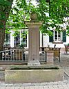
| Graefinthal, fountain (part of the ensemble): The sandstone running fountain consists of an elongated basin and a vertical column. A shaft with a water drain sits enthroned above a base, and above it a cantilevered base with a baroque peg. The fountain dates from the 18th century. |
|
||
| Gräfinthal 3, courtyard gate Gasthaus "Klosterschenke", 1733 (individual monument): An old wall with a round arched gate from 1733 runs between the courtyard house and the monastery tavern. The wooden gate is framed by a sandstone reveal, the wedge stone is emphasized and bears a face. The wall is closed with a brick covering. |

|
||
| Graefinthal 4, so-called courtyard house, residential building, 1732 (single monument): The two-storey plastered building with an approximately square floor plan was built in 1732. The simple portal is framed with sandstone and has a skylight in the closing field. The building is completed by a mansard hipped roof. | |||
| Gräfinthal 6, “Gräfinthaler Hof” restaurant (individual monument): The former wine press and servants' house with vaulted cellar was built around 1710/20. The two-storey plastered building on the eaves has a curved half-hip roof. In the middle of the five window axes on the ground floor is the entrance portal with a profiled reveal and straight roof . The windows are surrounded by sandstone reveals with accentuated sole banks. |

|
||
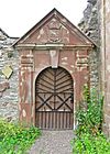
| Graefinthal 7, cloister gate, terrace garden, enclosing wall, 18th century, residential building, largely new building (part of the ensemble) The terraced garden is enclosed on the street side by a mighty wall. The sandstone cloister gate is framed by pilasters and has a clearly emphasized wedge stone above the door. A triangular gable with a profiled frame is located above a narrow profiled cornice, in the field of which there is the year 1714 and a coat of arms in between. The monks' house is largely a new building from 1969. |
|
||
| Graefinthal 8, terrace garden and surrounding wall east of the former convent building (part of the ensemble): The terrace garden and the surrounding wall east of the convent building are also under monument protection. The garden was one of the few locations in the southern Saarland where viticulture was once practiced. The walls date from the 18th century. | |||
| Graefinthal 8, convent building, ruin with vaulted cellar (individual monument): The former convent building is only preserved today as a ruin. It was built in 1714 by Jonas Erikson Sundahl . | |||
| Graefinthal 8, ruins of the monastery church (individual monument): The monastery church was built in 1719 by the architect Jonas Erikson Sundahl from Zweibrücken, who came from Sweden . Only the surrounding walls of the former nave have been preserved. On the west side there is still a round arched portal with strong pilasters. On the north side, a late Romanesque portal with a rosette in the gable field is still visible, but it was walled up. The former polygonal choir was converted into an octagonal chapel in 1809 by the architect JB Matthieu. The elongated building with a gable roof and rider was originally well equipped. Today's altar is an altar made of Rococo and Neo-Baroque parts. |

|
||
| Graefinthal 9, brewery, 1723, renovation 19th century (individual monument) | |||
| Graefinthal 10, horse pond, 18./19. Century (part of the ensemble) | |||
| Graefinthal 11, pigeon house (single monument): The pigeon house from 1766 is a baroque building on four high columns in the former monastery district. |

|
||
| Graefinthal 11, Sehn estate, barn, 1709, conversion to a 19th century farmhouse (part of the ensemble) | |||
| Out of town location |
Quantum Castle , ruins of the moated castle (individual monument) | The moated castle, founded in the 12th century, was built around 1289 and first mentioned in 1294. In 1362 the fortress in the Bliesaue was destroyed by the von Bitsch family, rebuilt a few years later and in the 17th century it was owned by the von der Leyen family. Today only a few remains of the wall are visible. | |
| Bliestalstrasse location |
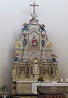
High altar of the cath. Parish Church of St. Paul | The high altar of the St. Paulus Church from the 1960s was created by Johann Martersteck around 1734 . The high altar is considered a successful example of baroque altars. It comes from the Gräfinthal monastery church and was brought to Blies Mengen in 1785. |
|
| Bliestalstrasse 29 location |
Farmhouse | ||
| Bliesweg |
Wayside cross | 18th century | |
| Graefinthal |
Way Cross, 1759 | 1759 | |
| In the upper amount of location |
Catholic Church of St. Peter in chains with furnishings, cemetery chapel | The oldest parts of the church come from a building from the 14th century and can be found in the two basement floors of the tower. Today's cemetery chapel served as a place of worship for the local parish until the 1960s. It was built to the north in 1752 and 1866. The portal is located in the squat tower on a square floor plan. |

|
| In the upper amount 5 layers |
Old school | The former school is a long, eaves-standing sandstone building with two floors. It was built in the 19th century. The building now serves as a residential and commercial building. | |
Erfweiler-Ehlingen
| location | designation | description | image |
|---|---|---|---|
| On the Hüwel 15 location |
Wayside cross | 1778 | |
| Ballweilerstraße 6 location |
Farmhouse, enclosing wall with vaulted cellar and chicken coop | 1850 | |
| Ballweilerstraße 11 location |
so-called shoemaker's house, residential building | 1729 | |
| Rubenheimerstraße 49 location |
Farmhouse | around 1870 | |
| Rubenheimerstraße 52 |
farm | Built in 1816 | |
| Street at the Roman tower location |
Catholic Church of St. Mauritius | All that remains of the Romanesque church is the round tower, which tapers slightly towards the top. The rectangular choir with ribbed vault dates from the 14th century. In 1824 a long house was added on the south side, but it was replaced by a new neo-Gothic building in 1904. The hall building with an open roof structure is entered via the rectangular tower integrated into the facade. Externally, the church is determined by Gothic windows and portal. The quarry stone building is adorned with sandstone blocks on the masonry and buttresses. |

|
| Straße am Römerturm 7 location |
Old school | The gable, two-story sandstone building was built in 1878/79 with classical elements. The ground floor and first floor are separated by a cornice, as are the upper floor and the gable. The six windows on the upper floor are framed by pilasters , which are supported by a cornice at the bottom and end with a wide architrave with cornice. |

|
| Straße am Römerturm 19 location |
Day laborer's house, 19th century (individual monument) |
Habkirchen
| location | designation | description | image |
|---|---|---|---|
| Blieskasteler Straße |
Old Bliesbrücke between Habkirchen and Frauenberg | There is said to have been a stone bridge in Habkirchen as early as the 16th century. In 1760, after lengthy negotiations with the administration of the French kingdom, the Counts von der Leyen had a stone bridge built between Habkirchen and Frauenberg. French revolutionary troops blew up the bridge in 1792, and it was rebuilt in 1832/33. In 1939, French troops blew up the structure again during World War II. Only an arch and an abutment remain from the old construction. | |
| Prälat-Roth-Strasse location |
Gravestones in the churchyard | 18th century | |
| Prälat-Roth-Strasse location |
Wayside cross at the cath. Anna Chapel | The sandstone wayside cross dates from 1811. It stands on a wide base with a cantilevered cornice. The actual crucifix is supported by a base and shaft with a figure. |

|
| Prälat-Roth-Strasse location |
Sculptures in the cath. Anna Chapel | In the modern high altar there are figures of St. Anna and Maria from the 18th century and a figure of St. Rudolph with chains from the 15th century. |

|
| Prälat-Roth-Strasse location |
Catholic parish church of St. Martin with furnishings | From the original church from the 12th century, only the former choir tower with a gable roof has been preserved. A tabernacle from the 15th century has been preserved in the basement of the tower. The simple baroque hall building with three window axes was built in 1785. The only decoration is an eaves cornice made of sandstone, as well as an Ortqauderung and a sandstone plinth. The lavishly designed portal with blinds has a scene from the life of St. Martin. |

|
| Zweibrücker Straße 3 location |
Leon Jaunez's summer residence | The summer residence of the “pottery manufacturer” Leon Jaunez from Sarreguemines consists of a residential building with three farm buildings surrounded by a wall. The villa was built in 1876. The two-storey plastered building has a protruding corner projecting with two axes and a gable cornice. The rest of the building has three axes. |

|
| Zweibrücker Straße 6 |
Wayside shrine, 1664 (individual monument) |
Heckendalheim
| location | designation | description | image |
|---|---|---|---|
| St. Ingberter Straße 64 location |
Wayside cross | 1743 |
Ommersheim
| location | designation | description | image |
|---|---|---|---|
| District street location |
Servants' house and vaulted cellar of Philippsburg Palace | Philippsburg Palace was built between 1782 and 1788 as a magnificent pleasure palace above the Niederwürzbacher Weiher . The castle was destroyed by French revolutionary troops as early as 1792 and demolished in the 19th century. Only the former servants' house, which is now used as a forester's house, is preserved. The building with pointed arched windows and the remains of a Gothic roof balustrade still gives an idea of the castle's early neo-Gothic forms. | |
| Hofstrasse 4 location |
cath. Rectory | Built in 1769 |

|
| Saar-Pfalz-Straße / Ensheimer Straße |
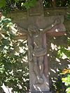
so-called hunger cross, wayside cross | When in 1773 all the springs in the village dried up except for one in the center, the residents erected the hunger cross. The sandstone wayside cross is a classic crucifix on a base. |
|
| Saar-Pfalz-Strasse location |
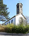
Catholic Church of the Visitation of the Virgin Mary with equipment | The classicist building was realized in 1829 based on designs by the royal Bavarian district civil engineer Paul Camille von Denis . The hall church has a high roof turret as a bell tower. The elongated arched portal with skylight and heavily profiled frame is striking. |
|
| Saar-Pfalz-Strasse 36 location |
Farmhouse | 19th century | |
| Talstrasse 7 location |
Residential building | around 1890 |
Ormesheim
| location | designation | description | image |
|---|---|---|---|
| Adenauerstraße 40 location |
Wayside cross | 18th century | |
| Adenauerstraße 60 location |
Wayside cross | 18th century | |
| Adolf-Graf-Straße |
Wayside cross | 1753 by Johann Madersteck | |
| Gypsum pit 3 layers |
farm | around 1940 | |
| Kapellenstrasse location |
cath. Marienkapelle, so-called "Strudelpeter Chapel" | The cath. Marienkapelle, also popularly known as the "Strudelpeter Chapel", was built in the 1st quarter of the 19th century. The hall building with a three-sided choir closure and roof turret over the arched portal stands on a small hill south of the village. |

|
| Kapellenstraße 2 |
Wayside cross | The wayside cross from the 18th century stands next to the "Strudelpeter Chapel". The sandstone cross stands on a massive, high base and has a profiled shaft. | |
| Mauritiusstrasse location |
Catholic Church of St. Mauritius with furnishings | The church was built in 1932 according to plans by Albert Boßlet in the neo-Romanesque style. Spolia can be found in the churchyard wall . The building, modeled on a basilica, has a high extension on the southwest side and a tower reaching into the facade on the northeast side. The low side aisles are separated from the central nave by arcades. The choir has a barrel vault, the central nave has a flat wooden ceiling, the side aisles have flat roofs. |

|
| Neumühle location |
so-called Sulgerhof, mill farm | The mill farm comes from the second half of the 16th century and was rebuilt in 1838. The mill with the so-called "Sulgerhof" from 1563 was the official seat of the Elector of Trier Sulger. | |
| Lower road 3 |
Wayside cross | 1798 |
Wittersheim
| location | designation | description | image |
|---|---|---|---|
| Gartenstraße 2 |
Lintel | 1761 | |
| Merowingerstraße 2 |
Wayside cross | 18th century, new production 1953 | |
| Remigiusstraße 5 |
Wayside cross before the cath. church | 18th century | |
| Saargemünder Straße 60 |
Wayside cross | 1761 |
Web links
Commons : Architectural monuments in Mandelbachtal - Collection of images, videos and audio files
- List of monuments of the Saarland: List of monuments in the Saarpfalz district (PDF file; 11.9 MB)