List of architectural monuments in Nettersheim
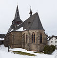
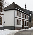
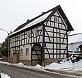
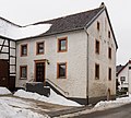
The list of architectural monuments in Nettersheim contains the listed buildings in the area of the municipality of Nettersheim in the Euskirchen district in North Rhine-Westphalia (status: November 2011). These monuments are entered in the list of monuments of the municipality of Nettersheim; The basis for the admission is the Monument Protection Act North Rhine-Westphalia (DSchG NRW).
| image | designation | location | description | construction time | Registered since |
Monument number |
|---|---|---|---|---|---|---|
| Half-timbered courtyard |
Bouderath Hardtstrasse 2 map |
07/03/1986 | 27
|
|||
| Cemetery cross |
Bouderath Heldweg / Tannenstrasse map |
11/12/1987 | 49
|
|||
| Chapel "To the Sorrowful Mother of God" |
Bouderath Münstereifeler Strasse map |
11/12/1987 | 50
|
|||
| Courtyard |
Bouderath Münstereifeler Straße 17 map |
07/03/1986 | 28
|
|||

|
Catholic parish church St. Gertrud |
Bouderath Münstereifeler Straße 19 map |
06/06/1989 | 147
|
||
| Catholic rectory |
Bouderath Münstereifeler Straße 24 map |
07/05/1988 | 132
|
|||
| Small three-wing courtyard |
Bouderath Münstereifeler Straße 26 map |
04/16/2008 | 183
|
|||

|
Catholic branch chapel St. Bartholomäus |
Buir Quellenstrasse 16 map |
06.06.1989 / 14.09.1993 | 148
|
||
| Former school |
Buir Zur Feldscheid 2 map |
11/12/1987 | 52
|
|||
| Cemetery with cemetery wall |
Buir Zur Feldscheid Map |
11/12/1987 | 51
|
|||
| Wayside shrine |
Buir on the B 51 map |
12/20/1982 | 2
|
|||
| Wayside cross, so-called "Hagelkreuz" |
Buir hallway 4, parcel 213 map |
11/12/1987 | 53
|
|||
| Wayside cross, so-called "Metzenkreuz" |
Buir corridor 4, parcel 40/2 map |
06/20/1994 | 168
|
|||
 more pictures |
Ahekapelle |
Engelgau map |
07/14/1986 | 35
|
||
| Two-part Winkelhof system |
Engelgau Ahestraße 6 map |
11/12/1987 | 54
|
|||
 more pictures |
Catholic branch chapel St. Luzia |
Engelgau Ahestraße 10 map |
06/06/1989 | 149
|
||
| Wayside cross |
Engelgau Dürener Strasse / Ahestrasse map |
05.03.1995 | 180
|
|||
| Half-timbered Winkelhof complex |
Engelgau Dürener Strasse 7 map |
07/03/1986 | 29
|
|||
| Half-timbered Winkelhof complex |
Engelgau Dürener Strasse 9 map |
07/03/1986 | 30th
|
|||
| Old school |
Engelgau Dürener Strasse 34 map |
March 24, 1986 | 14th
|
|||
| Two-part Winkelhof system |
Engelgau Goldgasse 4 map |
11/12/1987 | 55
|
|||
| Half-timbered Winkelhof complex |
Engelgau Goldgasse 6 map |
02/20/1990 | 158
|
|||
| Living / stable house |
Frohngau Birkenhecker Strasse 1 map |
March 24, 1986 | 15th
|
|||
| Wayside cross |
Frohngau Birkenhecker Strasse (before 9 b) / Hornstrasse map |
09/19/1995 | 179
|
|||
| Quarry stone house, former rectory |
Frohngau Buirer Strasse 1 map |
09/11/1986 | 37
|
|||
| Two-part courtyard system |
Frohngau Greussstrasse 6 map |
11/12/1987 | 58
|
|||
| Quarry stone house m. adjoining barn |
Frohngau Helterstrasse 7 map |
04/25/1990 | 159
|
|||
| Three-wing courtyard |
Frohngau Holzgasse 2 map |
11/12/1987 | 57
|
|||
| Quarry stone eaves house |
Frohngau Holzmuelheimer Strasse 2 map |
07/03/1986 | 31
|
|||
| Half-timbered residential building |
Frohngau Holzmülheimer Strasse 3 map |
March 24, 1986 | 16
|
|||
| Old school |
Frohngau Holzmülheimer Strasse 4 / Heltenstrasse map |
11/12/1987 | 59
|
|||
| Gable-independent, two-storey residential building |
Frohngau Holzmuelheimer Strasse 7 map |
11/12/1987 | 60
|
|||

|
Catholic parish church of St. Margareta |
Frohngau Holzmuelheimer Strasse 9 map |
06/06/1989 | 150
|
||
| Youth home (oldest school) |
Frohngau Holzmuelheimer Strasse 9 map |
07/05/1988 | 133
|
|||
| Two-wing courtyard |
Frohngau Hornstrasse 6 map |
04/25/1990 | 160
|
|||
| Quarry stone house |
Frohngau Hornstrasse 12 map |
March 24, 1986 | 17th
|
|||
| Roman bridge |
Frohngau map |
02/29/1984 | 12
|
|||
| Path chapel "On the White Cross" |
Frohngau Staffenberg / Helterstrasse map |
11/12/1987 | 56
|
|||

|
Chapel of the Exaltation of the Cross |
Map of Holzmuelheim Schleidstrasse |
06/06/1989 | 151
|
||
| Half-timbered house |
Holzmülheim Erftstraße 17 map |
October 18, 1988 | 142
|
|||
| Two-storey half-timbered house |
Holzmülheim Erftstraße 19 map |
11/12/1987 | 61
|
|||
| Winkelhofanlage |
Holzmülheim Erftstraße 28 map |
03/01/1988 | 126
|
|||
| Winkelhofanlage |
Holzmülheim Erftstraße 30 map |
11/12/1987 | 62
|
|||
| Half-timbered house |
Holzmülheim Erftstraße 33 map |
03/01/1988 | 127
|
|||
| Plastered quarry stone building |
Holzmülheim Erftstraße 34 map |
03/01/1988 | 128
|
|||
| Two-story half-timbered house attached to the eaves |
Holzmülheim Erftstraße 35 map |
11/12/1987 | 63
|
|||
| Former Elementary school |
Holzmülheim Erftstraße 38 map |
11/12/1987 / 10/01/1991 | 64
|
|||

|
Memorial cross "Acorn Garden" |
Marmagen card |
11/12/1987 | 68
|
||
| Surroundings of the castle complex |
Marmagen Burgstrasse map |
07/04/1984 | 13
|
|||

|
Eifel half-timbered corner homestead |
Marmagen Burgstrasse 4 map |
03/08/1983 | 7th
|
||
 more pictures |
Marmagen Castle |
Marmagen Burgstrasse 12 and 12a card |
03/08/1983 | 8th
|
||

|
Well room |
Marmagen Buschgasse map |
06/22/1994 | 177
|
||

|
Former school |
Marmagen Buschgasse 1 map |
07/05/1988 | 134
|
||

|
Former Residential stable house |
Marmagen Buschgasse 3 map |
October 18, 1988 | 143
|
||
 more pictures |
Wayside chapel |
Marmagen Kapellenstrasse map |
1937 | 07/14/1992 | 165
|
|

|
Well room |
Marmagen Celtic Ring Card |
06/22/1994 | 176
|
||

|
Villa building "Haus Hubertus" |
Marmagen Koelner Strasse 30 map |
November 12, 1987 / December 5, 1989; 10/01/1991 | 65
|
||
 more pictures |
Catholic parish church St. Laurentius |
Marmagen Koelner Strasse 39 map |
06/06/1989 | 152
|
||
 more pictures |
Rectory |
Marmagen Koelner Strasse 41 map |
06/22/1994 | 170
|
||

|
Eifeler Hof |
Marmagen Koelner Strasse 42 map |
11/12/1987 | 66
|
||

|
Steinfelder Hof |
Marmagen Koelner Strasse 55 map |
12/20/1982 | 3
|
||

|
Half-timbered eaves house |
Marmagen Koelner Strasse 56 map |
07/03/1986 | 32
|
||

|
Winkelhofanlage |
Marmagen Koelner Strasse 58 map |
11/18/1986 | 38
|
||

|
Two-storey half-timbered house |
Marmagen Laurentiusweg 1 map |
11/12/1987 | 67
|
||

|
Half-timbered corner homestead |
Nettersheim Am Kirchberg 3 map |
11/17/1986 | 39
|
||
 more pictures |
Catholic parish church St. Martinus |
Nettersheim Am Kirchberg 10 map |
06/06/1989 | 153
|
||

|
Youth home (former rectory) |
Nettersheim Am Kirchberg 7 map |
07/05/1988 | 135
|
||
| Wayside cross |
Nettersheim on the watch house map |
11/12/1987 | 71
|
|||

|
Representative residential and commercial building |
Nettersheim Bahnhofstrasse 1 map |
08/28/2001 | 182
|
||

|
Half-timbered eaves house |
Nettersheim Bahnhofstrasse 4 map |
11/15/1983 | 10
|
||

|
Former school |
Nettersheim Bahnhofstrasse 8 map |
11/12/1987 | 69
|
||
| Railway operations building |
Nettersheim Bahnhofstrasse 14 map |
03/04/1998 | 166
|
|||

|
Station reception building |
Nettersheim Bahnhofstrasse 16 map |
03/04/1998 | 166
|
||
| Former Castle, later castle mill |
Nettersheim Bahnhofstrasse 30 map |
09/10/1987 | 48
|
|||

|
Former Castle, later castle mill |
Map of Nettersheim Bahnhofstrasse 32 |
12/11/1990 | 164
|
||

|
Half-timbered gabled house |
Nettersheim Blankenheimer Strasse 2 map |
March 24, 1986 | 18th
|
||

|
Half-timbered gabled house |
Nettersheim Blankenheimer Strasse 3 map |
March 24, 1986 | 19th
|
||

|
Half-timbered gabled house with jamb |
Nettersheim Blankenheimer Strasse 4 map |
08/29/1976 | 36
|
||

|
Half-timbered gabled house |
Nettersheim Blankenheimer Strasse 11 map |
March 24, 1986 | 20th
|
||

|
Half-timbered gabled house |
Nettersheim Blankenheimer Strasse 13 map |
March 24, 1986 | 21st
|
||

|
Two-part Winkelhof system |
Nettersheim Blankenheimer Strasse 18 map |
December 13, 1988 | 144
|
||

|
Forest cemetery |
Map of Nettersheim Engelgauer Weg |
11/12/1987 | 77
|
||

|
Quarry stone gabled house |
Nettersheim Grafschaftsgasse 1 map |
11/17/1986 | 40
|
||

|
Two-storey quarry stone house |
Nettersheim Grafschaftsgasse 22 map |
11/12/1987 | 73
|
||

|
Two-storey quarry stone house |
Nettersheim Grafschaftsgasse 23 map |
11/12/1987 | 74
|
||

|
Lime kilns |
Nettersheim rabbit hedge map |
12/20/1982 | 4th
|
||
| Werkhäuser |
Nettersheim rabbit hedge map |
11/12/1987 | 75
|
|||

|
Single storey half-timbered house |
Nettersheim Kleingasse 13 map |
11/17/1986 | 41
|
||

|
Half-timbered homestead |
Nettersheim Kleingasse 14 map |
07/03/1986 | 33
|
||

|
Wayside cross |
Map of Nettersheim Klosterstrasse |
11/12/1987 | 76
|
||

|
Wayside cross |
Nettersheim Klosterstrasse / Rosenthalstrasse map |
06/22/1994 | 169
|
||
 more pictures |
former Sacred Heart Monastery |
Nettersheim Klosterstrasse 12 map |
December 13, 1988 | 145
|
||
| Former Cemetery area |
Nettersheim Martinusstrasse / Kleingasse map |
04/25/1990 | 161
|
|||
| Two-storey half-timbered house |
Nettersheim Martinusstrasse 3 map |
11/17/1986 | 42
|
|||

|
Quarry stone / half-timbered house |
Nettersheim Römerplatz 6 map |
March 24, 1986 | 22nd
|
||
| Memorial cross |
Nettersheim Rosenthal, at the railway bridge map |
06/22/1994 | 174
|
|||

|
Two staggered Winkelhof systems |
Nettersheim Rosenthalstrasse 1 map |
07/23/1981 | 1
|
||

|
Two staggered Winkelhof systems |
Nettersheim Rosenthalstrasse 3 map |
07/23/1981 | 1
|
||

|
Former Elementary school |
Nettersheim Schulstrasse 22 map |
05.12.1989 | 157
|
||

|
Wayside cross "Marxkreuz" |
Nettersheim Steinfelder Straße / Zur Klosterquelle 1 map |
06/22/1994 | 175
|
||

|
Two-storey quarry stone house |
Nettersheim Steinfelder Strasse 2 map |
03/04/1998 | 181
|
||

|
Winkelhofanlage quarry stone house |
Nettersheim Steinfelder Strasse 9 map |
09/14/1993 | 167
|
||

|
Half-timbered Winkelhof complex |
Nettersheim Steinfelder Strasse 10 map |
07/05/1988 | 136
|
||

|
Half-timbered corner house |
Nettersheim Steinfelder Strasse 12 map |
11/17/1986 | 43
|
||

|
Remnants of a lime kiln |
Map of Nettersheim Urftstrasse |
06/22/1994 | 173
|
||
| Three-wing half-timbered courtyard |
Pesch Auf dem Stucks 4 card |
11/12/1987 | 78
|
|||
| Three-wing half-timbered residential complex |
Pesch Auf dem Stucks 5 card |
11/12/1987 | 79
|
|||
| Wayside cross |
Pesch Auf dem Stucks (next to No. 6) card |
11/12/1987 | 82
|
|||
| Three-wing courtyard |
Pesch Auf dem Stucks 8 card |
11/12/1987 | 80
|
|||
| Half-timbered Winkelhof complex |
Pesch Auf dem Stucks 9 card |
11/12/1987 / 12/11/1990 | 81
|
|||
| Wayside shrine |
Pesch on the Jücht / Jakob-Kneip-Straße map |
11/12/1987 | 83
|
|||
| Large, representative, three-winged courtyard |
Pesch Burggasse 2 map |
11/12/1987 | 84
|
|||
| Wayside cross |
Pesch southeast Flax mountain |
11/12/1987 | 101
|
|||
| So-called. "Harzheimer Cross" |
Pesch Jakob-Kneip-Straße, exit towards Harzheim map |
11/12/1987 | 85
|
|||
| Wayside cross |
Pesch Jakob-Kneip-Straße / On the Stuck map |
11/12/1987 | 90
|
|||
| Wayside shrine |
Pesch extension to Jakob-Kneip-Straße map |
11/12/1987 | 91
|
|||
| Wayside cross |
Pesch Jakob-Kneip-Straße, south of the Catholic Church map |
05/02/1995 | 178
|
|||
| Wayside cross |
Pesch Jakob-Kneip-Straße / Lindenweg map |
11/12/1987 | 92
|
|||
| Two-part half-timbered Winkelhof installation |
Pesch Jakob-Kneip-Strasse 13 map |
11/12/1987 | 86
|
|||
| Two-storey residential building |
Pesch Jakob-Kneip-Strasse 14 map |
11/12/1987 | 87
|
|||
| Two-storey half-timbered house |
Pesch Jakob-Kneip-Strasse 15 map |
11/12/1987 | 88
|
|||
| Two-storey half-timbered house |
Pesch Jakob-Kneip-Strasse 17 map |
11/12/1987 | 89
|
|||

|
Catholic parish church of St. Cäcilia |
Pesch Jakob-Kneip-Strasse 26 map |
06.06.1989 / 07.12.1993 | 154
|
||
| Rectory |
Pesch Jakob-Kneip-Strasse 29 map |
07/05/1988 | 137
|
|||
| Former school-building |
Pesch Jakob-Kneip-Strasse 34 map |
12/20/1982 | 5
|
|||
| Cemetery with cemetery wall |
Pesch Lindenweg map |
11/12/1987 | 98
|
|||
| Cemetery chapel |
Pesch Lindenweg map |
05/11/1983 | 11
|
|||
| Two-part half-timbered Winkelhof installation |
Pesch Lindenweg 1 map |
11/12/1987 | 93
|
|||
| Two-storey half-timbered house |
Pesch Lindenweg 2 map |
11/12/1987 | 94
|
|||
| Three-wing courtyard |
Pesch Lindenweg 6 map |
11/12/1987 | 95
|
|||
| Two-part half-timbered courtyard |
Pesch Lindenweg 8 map |
11/12/1987 | 96
|
|||
| Two-part Winkelhof system |
Pesch Lindenweg 9 map |
07/05/1988 | 138
|
|||
| Two-part courtyard system |
Pesch Lindenweg 10 map |
11/12/1987 | 97
|
|||
| Two-storey half-timbered house |
Pesch Nöthener Straße 4 map |
11/12/1987 | 99
|
|||
| Half-timbered house attached to the eaves |
Pesch Nöthener Straße 6 map |
11/12/1987 | 100
|
|||
| Two-part half-timbered Winkelhof installation |
Pesch Nöthener Straße 10 map |
07/05/1988 | 139
|
|||
| Eifeler Winkelhofanlage made of half-timbered houses |
Pesch Zum Heidentempel 5 card |
07/19/1983 | 9
|
|||

|
Catholic chapel to St. Maternus et al. Antony |
Roderath Bouderather Strasse 2 map |
06/06/1989 | 155
|
||
| Three-wing courtyard |
Roderath Bouderather Strasse 4 map |
07/05/1988 | 140
|
|||
| Single storey quarry stone house |
Roderath Münstertalstrasse 1 map |
03/01/1988 | 129
|
|||
| Two-storey quarry stone house |
Roderath Münstertalstrasse 3 map |
11/12/1987 | 102
|
|||
| Half-timbered Winkelhof complex |
Roderath Münstertalstrasse 7 map |
07/03/1986 | 34
|
|||
| Two-storey quarry stone house |
Roderath Pescher Strasse 15 map |
03/01/1988 | 130
|
|||
| Two-storey half-timbered house |
Roderath Pescher Strasse 17 map |
11/17/1986 | 44
|
|||
| Eaves, two-storey, three-axle quarry stone house |
Roderath Pescher Strasse 19 map |
07/05/1988 | 141
|
|||
| Two-part half-timbered Winkelhof installation |
Tondorf Euskirchener Strasse 9 map |
11/12/1987 | 103
|
|||
| Two-storey half-timbered house |
Tondorf Euskirchener Strasse 30 map |
11/12/1987 | 104
|
|||
 more pictures |
Catholic parish church St. Lambertus |
Tondorf Kirchweg map |
01/05/1983 | 6th
|
||
| Two-storey half-timbered house |
Tondorf Klosberg 5 map |
11/12/1987 | 105
|
|||
| Two-part half-timbered Winkelhof installation |
Tondorf Klosberg 6 map |
11/12/1987 | 106
|
|||
| Gable-independent, 1 1/2 storey half-timbered house |
Tondorf Klosberg 7 map |
11/12/1987 | 107
|
|||
| Half-timbered house |
Tondorf Mechernicher Straße 2 map |
December 13, 1988 | 146
|
|||
| Half-timbered corner homestead |
Tondorf Mechernicher Straße 4 map |
March 24, 1986 | 23
|
|||
| Two-storey quarry stone house |
Tondorf Mechernicher Straße 6 map |
11/12/1987 | 108
|
|||
| Half-timbered corner homestead |
Tondorf Mechernicher Straße 9 map |
March 24, 1986 | 24
|
|||
| Eaves house in quarry stone u. Truss |
Tondorf Mechernicher Strasse 14 map |
March 24, 1986 | 25th
|
|||
| Two-part Winkelhof system |
Tondorf Mechernicher Straße 24 map |
11/12/1987 | 109
|
|||
| Two-part Winkelhof system |
Tondorf Mechernicher Strasse 25 map |
11/12/1987 | 110
|
|||
| Former school |
Tondorf Spielstrasse 1 (formerly Rohrer Strasse 19) map |
11/12/1987 | 111
|
|||
| Half-timbered house |
Tondorf Spielstrasse 18 map |
03/18/1987 | 112
|
|||
| Two-part Winkelhof system |
Tondorf Tonstrasse 1 map |
11/12/1987 | 113
|
|||
| Well room |
Zingsheim Brunnenstrasse map |
11/12/1987 | 119
|
|||
| Small Winkelhof facility |
Zingsheim Brunnenstrasse 12 map |
11/12/1987 | 114
|
|||
| Two-part Winkelhof system |
Zingsheim Brunnenstrasse 16 map |
11/12/1987 | 115
|
|||
| Two-storey duplex house |
Zingsheim Brunnenstrasse 17 map |
11/12/1987 | 116
|
|||
| Barn and stable building |
Zingsheim Brunnenstrasse 17 a map |
12/11/1990 | 163
|
|||
| 1 1/2 storey half-timbered house |
Zingsheim Formegey 3 card |
11/12/1987 | 117
|
|||
| Wayside cross |
Zingsheim Kirchstrasse / Weidenstrasse map |
11/12/1987 | 124
|
|||
 more pictures |
Rectory |
Zingsheim Kirchstrasse 24 map |
06/22/1994 | 171
|
||
 more pictures |
Catholic parish church of St. Peter |
Zingsheim Kirchstrasse 26 map |
06/06/1989 | 156
|
||
| Well room |
Zingsheim Krausstrasse / Willenbergerstrasse map |
11/12/1987 | 120
|
|||
| Wayside cross |
Zingsheim Krausstrasse map |
11/12/1987 | 118
|
|||
| Two-storey gabled house |
Zingsheim Krausstrasse 11 map |
11/17/1986 | 45
|
|||
| Wayside cross |
Zingsheim Nürburgstrasse / Petrusstrasse map |
11/12/1987 | 121
|
|||
| Half-timbered corner homestead |
Zingsheim Petrusstrasse 14 map |
05.12.1989 | 26th
|
|||
| Sandstone cross |
Zingsheim Pfalzstrasse (an der Linde) / Nürburgstrasse map |
11/17/1986 | 47
|
|||
| Two-storey half-timbered corner homestead |
Zingsheim Pfalzstrasse 1 map |
11/17/1986 | 46
|
|||
| Well room |
Zingsheim Pfalzstrasse (between No. 6 and 8) map |
11/12/1987 | 123
|
|||
| Half-timbered corner courtyard |
Zingsheim Pfalzstrasse 9 map |
09/04/1990 | 162 |
|||
| Small half-timbered Winkelhof complex |
Zingsheim Pfalzstrasse 13 map |
11/12/1987 | 122
|
|||
| Two-part half-timbered Winkelhof installation |
Zingsheim Weidenstrasse 2 map |
03/01/1988 | 131
|
|||
| Half-timbered house |
Zingsheim Weidenstrasse 22 map |
11/12/1987 | 125
|
|||
| Wayside cross |
Zingsheim am Willenberg map |
06/22/1994 | 172
|
Web links
Commons : Cultural monuments in Nettersheim - collection of images
- List of monuments of the Eifel community Nettersheim (as of October 31, 2011)
