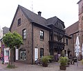
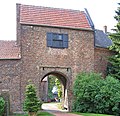
List of architectural monuments in Schermbeck
The list of architectural monuments in Schermbeck contains the listed buildings in the area of the community Schermbeck in the Wesel district in North Rhine-Westphalia (as of September 2011). These architectural monuments are entered in the monuments list of the community Schermbeck; The basis for the admission is the Monument Protection Act North Rhine-Westphalia (DSchG NRW).
| image | designation | location | description | construction time | Registered since |
Monument number |
|---|---|---|---|---|---|---|
 more pictures |
Evangelical village church Gahlen |
Gahlen Kirchstrasse 80 hall 10 parcel 782 map |
Schermbeck's oldest building (900 AD), west tower from the 12th century, pulpit 1654 | 900/1654 | Apr 4, 1984 | 1
|

|
Windmill in the Damm district |
Dam On the cream 2 hallway 5 parcel 73 map |
The Holtmann tower windmill is the easternmost windmill in the Lower Rhine. | 1863? | Apr 12, 1984 | 2
|

|
Half-timbered house (local history museum) |
Schermbeck Steintorstraße 17 hall 1 parcel 2169 map |
Oldest residential building in the town center, former Acherbürger- or craftsman's house, today a local museum. | 1566/69 | Apr 12, 1984 | 3
|
| Pebble mosaic floor |
Schermbeck Steintorstraße 17 hall 1 parcel 2169 |
4th
|
||||
 more pictures |
Catholic parish church St. Ludgerus |
Altschermbeck Mittelstrasse 76, corridor 23, parcel 496 map |
1915 | July 31, 1986 | 5
|
|
| Gut Voshövel |
Weselerwald Am Voshövel 1 corridor 6 parcel 106 map |
Former manor, today a wellness country hotel | July 31, 1986 | 6th
|
||

|
city wall |
Schermbeck Steintorstraße (way to Bösenberg) Corridor 1 parcel 2242 map |
Remains of the old city wall, restored in 1986 | 1416 | July 31, 1986 | 7th
|
| Woodpecker yard |
Loosenberge dam 10 hall 7 parcel 39, 40 map |
July 31, 1986 | 8th
|
|||

|
Gahlen watermill |
Gahlen Kirchstrasse 78 Corridor 10 Parcel 111 Map |
Benninghoff watermill. The water mill at the entrance to Gahlen dates back to the 17th century. Operations ceased in 1958. | Oct 28, 1986 | 9
|
|
| Courtyard |
Altschermbeck Im Espel 80 Corridor 13 Parcel 73 Map |
Nov 11, 1986 | 10
|
|||

|
Pastor Gahlen |
Gahlen Widemweg 70 hall 9 parcel 418 map |
Dec 18, 1986 | 11
|
||

|
former Reformed Church |
Schermbeck Burgstrasse 5 Corridor 1 Parcel 2222 Map |
Octagonal central building, seat of the Schermbecks Cultural Foundation since 2004. | 1786 | Feb. 4, 1987 | 12
|
 more pictures |
Evangelical parish church |
Schermbeck Georgstraße 15 Corridor 1 Parcel 2120 Map |
The late Gothic, Protestant parish church of St George dates from the 14th / 15th centuries. Century. The building was damaged in the city fires in 1425, 1483, 1742 and 1945. | 14th Century | Feb. 4, 1987 | 13
|

|
Hall house |
Altschermbeck Kettches Hee 9 Corridor 22 Parcel 186 Map |
Feb. 4, 1987 | 14th
|
||

|
Residential and commercial building |
Schermbeck Mittelstrasse 46, hall 1, parcel 2132 |
May 27, 1987 | 15th
|
||

|
Residential building |
Schermbeck Mittelstr. 84 hall 1 parcel 2253 |
May 27, 1987 | 16
|
||

|
Outbuildings |
Schermbeck Mittelstr. 82 hall 1 parcel 2253 |
May 27, 1987 | 17th
|
||
| barn |
Damm Weseler Straße 100 hall 5 parcel 360 map |
June 29, 1987 | 18th
|
|||
| Farmhouse |
Damm Klein-Else-Weg 17 hallway 8 parcel 96 map |
21 Sep 1987 | 19th
|
|||

|
Old Town Hall building |
Schermbeck Mittelstrasse 30 hallway 8 parcel 1476 map |
The town halls of the community of Schermbeck stood at this place until 1910 | 1755 | Dec. 28, 1987 | 20th
|

|
doctor's office |
Schermbeck Am Rathaus 2 hallway 8 parcel 1475 |
Dec. 28, 1987 | 21st
|
||

|
Residential and commercial building |
Schermbeck corridor 1 parcel 2140 |
June 14, 1988 | 22nd
|
||

|
Untermühle mill gate |
Schermbeck Mühlentor 5 / footpath Lichtenhagen corridor 1 parcel 2303 map |
The Untere Burgmühle is a water mill. It was in operation until the mid-1950s. | 14th century | Jan. 27, 1997 | 23
|

|
Residential building |
Schermbeck corridor 1 parcel 2213 |
Feb. 4, 1997 | 24
|
||

|
Obermühle |
Schermbeck located at the upper mill pond Corridor 1 parcel 2245 map |
The former upper castle mill was first mentioned in 1640 as the "new mill". | 1640 | 21 Mar 1997 | 25th
|

|
Castle ( Castle Schermbeck ) |
Schermbeck Burgstrasse 10 hall 1 parcel 2245 map |
The moated castle was built around 1300 as a Klevische Landesburg. Over the centuries the castle has been destroyed or damaged and rebuilt several times. The castle has been privately owned since 1662. | around 1300 | 21 Mar 1997 | 26th
|
| Residential building |
Weselerwald Alte Raesfelder Straße 2 hall 1 parcel 129 map |
19 Mar 1997 | 27
|
|||
| Residential house / stable building |
Dusk forest corridor 6 parcel 63/1 |
26 Sep 1997 | 28
|
|||
| Luhlerheim |
Weselerwald Marienthaler Str. 10 hall 4 parcel 79 u. a. map |
The chapel was built according to a design by government architect Karl Neuhaus and inaugurated in 1912. The chapel of the Rhenish Evangelical workers' colony in Lühlerheim is on the access road. The colony came into being almost 150 years ago. | 1912 | Dec 11, 1997 | 29
|
|
| Residential stable house |
Altschermbeck hallway 13 parcel 34 |
Dec 8, 1998 | 30th
|
|||
| former school dam |
Embankment hallway 12 parcel map |
June 16, 1999 | 31
|
|||
| cenotaph |
Weselerwald Am Voshövel corridor 2 parcel 226 map |
Memorial at Voshövel | Oct 13, 1999 | 32
|
||

|
former stable house |
Altschermbeck Lippeweg 3, Dorstener Straße 108 Corridor 26 Parcel 194 Map |
June 3, 2003 | 33
|
||

|
Jewish Cemetery |
Schermbeck Bösenberg / Gartenstrasse corridor 10 parcel 45 map |
1681 | Apr 5, 2007 | 34
|
|

|
water pump |
Altschermbeck At the old village pump / Mittelstrasse 93, hall 23, parcel 486 map |
Water pump at the fire department | Oct 26, 2007 | 35
|
|

|
water pump |
Schermbeck at the corner of Steintorstraße 26, corridor 1, parcel 2182 map |
The “Op den Hoff” neighborhood pump is the last of 11 public water pumps within the city walls | Oct 26, 2007 | 36
|
|
| old forester's house dam |
Damm Jägerheideweg 12 corridor 3 parcel 41 map |
Oct 26, 2007 | 37
|
|||

|
Residential building |
Altschermbeck Schloßstraße 13 hall 23 parcel 19 map |
Oct 26, 2007 | 38
|
||
| Residential stable house |
Altschermbeck Huxelweg 120, Huxelweg 128, Üfter Mark corridor 3 parcel 29 map |
Aug 27, 2008 | 39
|
|||

|
Villa / residential building |
Gahlen Östricher Strasse 104, hall 12, parcel 93 map |
May 4, 2009 | 40
|
||

|
Mill ponds |
Schermbeck Burgstrasse 10, Hogen Mai 5, corridor 1, parcels 2240, 2288, 1917, 2236, 2241, 2239, 2303 map |
07/05/2001 | 41 |
Web links
Commons : Architectural monuments in Schermbeck - collection of images
