List of architectural monuments in Pritzwalk
In the list of architectural monuments in Pritzwalk , all architectural monuments of the Brandenburg town of Pritzwalk and its districts are listed. The basis is the publication of the state monument list as of December 31, 2019.
Architectural monuments in the districts
The columns contain the following information:
- ID-No .: The number is assigned by the Brandenburg State Office for Monument Preservation . A link after the number leads to the entry about the monument in the monument database. The word Wikidata can also be found in this column ; the corresponding link leads to information on this monument at Wikidata.
- Location: the address of the monument and the geographical coordinates.
Link to a map view tool to set coordinates. In the map view, monuments without coordinates are shown with a red marker and can be placed on the map. Monuments without a picture are marked with a blue marker, monuments with a picture with a green marker. - Official designation: Designation in the official lists of the Brandenburg State Office for Monument Preservation. A link behind the name leads to the Wikipedia article about the monument.
- Description: the description of the monument
- Image: a picture of the monument and, if applicable, a link to further photos of the monument in the Wikimedia Commons media archive
Alt Krüssow
| ID no. | location | Official name | description | image |
|---|---|---|---|---|
|
09161245 |
Dorfstraße Alt Krüssow 17 ( location ) |
Homestead, consisting of a house, two farm buildings, courtyard paving and remnants of the enclosure | ||
|
09161273 |
Dorfstraße Alt Krüssow 29 ( location ) |
Hall construction of the inn | ||
|
09160011 |
Dorfstraße Alt Krüssow 32 ( location ) |
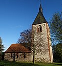
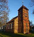
Pilgrimage church | The former pilgrimage church of St. Anna is a hall building made of field stones with an almost square chapel on the north side. The church was donated by Havelberg Bishop Johann von Schlabrendorff and inaugurated in 1520. The neo-Gothic tower was built on the west side between 1879 and 1880. |
Beveringen
| ID no. | location | Official name | description | image |
|---|---|---|---|---|
|
09160049 |
( ) | Grave site for Yugoslav prisoners of war, in the cemetery | ||
|
09160048 |
Dorfstraße Beveringen 11 ( location ) |
Beveringen village church | The church was built at the end of the 15th century. It is a hall building made of field stone with a west tower. Inside there is a baptismal font made of granite from the Middle Ages. |
Bölzke
| ID no. | location | Official name | description | image |
|---|---|---|---|---|
|
09160936 |
At station 1 ( location ) |
Bölzke station, consisting of station reception building with signal box annex and mechanical dispatcher signal box, toilet booth, nine mechanical external tensioning mechanisms including pull wires on the platform, the mechanical barrier system, consisting of two mechanical barriers (red-white), barrier crank in the signal box annex and pull wires, two wing or Form signals as well as paved access road and forecourt | ||
|
09160182 |
Bölzker Strasse ( location ) |
Village church | The church was built in 1825 and rebuilt in 1872 and 1903. A restoration took place from 2009 to 2011. It is a hall building made of half-timbered and a roof tower. Inside is a pulpit altar from the second half of the 18th century. |
Buchholz
| ID no. | location | Official name | description | image |
|---|---|---|---|---|
|
09160059 |
Hauptstraße Buchholz ( location ) |
Village church | The village church was probably built at the beginning of the 14th century. It is a hall building made of field stone with a west tower. The church was renovated in 1961. The altarpiece inside dates from around 1700. | |
|
09160887 |
Hauptstrasse Buchholz 5 ( location ) |
Homestead, consisting of a residential house and four farm buildings with courtyard paving and fencing |
Falkenhagen
| ID no. | location | Official name | description | image |
|---|---|---|---|---|
|
09160084 |
Bahnhofsweg ( location ) |
railway station | ||
|
09160085 |
Bergweg 1 ( location ) |
Farm, consisting of a house and three farm buildings | ||
|
09160087 |
Hauptstrasse Falkenhagen 28 ( location ) |
Farm consisting of a residential house with an enclosure and three farm buildings | ||
|
09160088 |
Main street Falkenhagen 31 ( location ) |
Farm, consisting of a house with fencing and farm buildings | ||
|
09160089 |
Hauptstrasse Falkenhagen 50 ( location ) |
Village church | The village church was built in 1523. It is a hall with a tower. This tower was rebuilt in the neo-Gothic style in 1901/1902. Inside is a pulpit altar from 1769. Next to the altar is a bell from 1487. | |
|
09160086 |
Meyenburger Straße Falkenhagen 42 ( ) |
Farm, consisting of a house and three farm buildings |
Giesensdorf
| ID no. | location | Official name | description | image |
|---|---|---|---|---|
|
09160097 |
( ) | Memorial for Soviet and Polish forced laborers, in the cemetery | ||
|
09160096 |
Dorfstrasse Giesensdorf ( location ) |
Village church | Date: 1451/1500 Rebuilding: 1844 |
Kemnitz
| ID no. | location | Official name | description | image |
|---|---|---|---|---|
|
09160179 |
Dorfstrasse Kemnitz ( location ) |
Village church | The Protestant village church was built in the middle of the 14th century. It is a hall building with a roof tower. Inside is a baroque altarpiece. | |
|
09160180 |
Dorfstrasse Kemnitz 51 ( location ) |
Homestead, consisting of a residential house, two farm buildings, courtyard paving and fencing | ||
|
09160181 |
Dorfstrasse Kemnitz 57 / 57b ( location ) |
Watermill |
cuckoo
| ID no. | location | Official name | description | image |
|---|---|---|---|---|
|
09160556 |
Kuckuckstrasse 1 ( location ) |
Residential building |
Mesendorf
| ID no. | location | Official name | description | image |
|---|---|---|---|---|
|
09160313 |
( Location ) | Castle ruins with ramparts | ||
|
09160920 |
( Location ) | Memorial to the Wars of Liberation, in the Kronsberg Mountains | ||
|
09161211 |
Havelberger Straße Mesendorf ( location ) |
Village church with churchyard and enclosure | The Protestant village church is a neo-Gothic building from around 1900. The west tower is from a previous building and was built around 1707. | |
|
09160315 |
Havelberger Straße Mesendorf ( me ) |
Park | The manor park was created in 1880 and changed around 1910 in the style of the empire. In the park are the remains of a house belonging to the von Quitzow family . | |
|
09160314 |
Havelberger Straße Mesendorf ( me ) |
Grave site for Yugoslav prisoners of war | ||
|
09160109 |
Havelberger Strasse Mesendorf 31, 35-37 ( location ) |
Manor complex, consisting of manor house, inspector's house, farm building, enclosure and paving | The manor is located in the manor. It was built around 1786, it was rebuilt and partially expanded in the 19th century and around 1920. It is a two-story building with seven axes. The entrance is in the central axis, which is highlighted like a risalit. |
New Krüssow
| ID no. | location | Official name | description | image |
|---|---|---|---|---|
|
09160911 |
Neu Krüssower Strasse ( location ) |
Village church | Date: after 1850, extension: 1883 |
|
|
09160912 |
Neu Krüssower Straße ( us ) |
Syringe house | ||
|
09160964 |
Neu Krüssower Straße 17 ( location ) |
Homestead, consisting of a residential house with a gate building, three farm buildings and courtyard paving |
Pritzwalk
| ID no. | location | Official name | description | image |
|---|---|---|---|---|
|
09160496 |
( Location ) | city wall | The city wall dates from the beginning of the 14th century. | |
|
09160497 |
( Location ) | Bismarck Tower | The Bismarck Tower was built from 1904 to 1905 as a lookout tower. The tower consists of three floors. There are exhibition rooms on the first and second floors, the third floor is the viewing platform. | |
|
09160467 |
( ) | Wilhelm Pieck Monument | ||
|
09160466 |
( ) | Memorial plaque for the union of the KPD and SPD to form the SED | The plaque commemorates the forced unification of the SPD and KPD to form the SED. | |
|
09160464 |
( ) | Memorial plaque for the first Soviet command post | ||
|
09160465 |
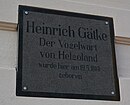
( ) | Memorial plaque for Heinrich Gätke | ||
|
09160799 |
Am Wasserturm 1 ( location ) |
Water tower of the Pritzwalk station | The water tower of the Pritzwalk train station was built in the second half of the 1930s and is a typical example of National Socialist architecture. | |
|
09160800 |
Bahnhofstrasse 1 ( location ) |
Entrance building of the Pritzwalk station | The station building was built in the 1950s and replaced the original building that was destroyed in the explosion of a munitions train in 1945. | |
|
09160450 |
Bürgerplatz ( ) |
Cenotaph for the victims of fascism (OdF) and memorial stone for Ernst Henkel | ||
|
09160449 |
Burgstrasse ( location ) |
Development of Burgstrasse (western part) | ||
|
09160718 |
Burgstrasse 17 ( location ) |
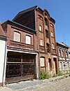
Residential building, through building, warehouse and two transverse buildings | ||
|
09160704 |
Burgstrasse 28 ( location ) |
Residential building with two storage buildings | ||
|
09160127 |
Doerfelstraße 16 ( me ) |
Villa with garden, air raid garage and fence | ||
|
09160683 |
Doerfelstrasse 21 ( location ) |
villa | ||
|
09160453 |
Giesensdorfer Weg 1 ( location ) |
villa | ||
|
09160454 |
Giesensdorfer Weg 3 ( location ) |
Goetheschule II with gym and enclosure | The Goethe School is now a grammar school. The school was built from 1903 to 1904. It is a brick building with a clock tower. | |
|
09160776 |
Grünstraße 24 ( location ) |
School (today residential building) | ||
|
09160455 |
Grünstraße 31 ( location ) |
Residential building | ||
|
09160456 |
Grünstraße 32 ( location ) |
Residential building | ||
|
09160732 |
Grünstraße 49 ( ) |
Residential building | ||
|
09160761 |
Hagenstrasse ( location ) |
Locomotive shed of the Ostprignitzer Kreiskleinbahn, on the premises of the Pritzwalk station | The locomotive shed at Pritzwalk station for the narrow-gauge railway was built in 1909 and has been out of service since 1969. | |
|
09160457 |
Hagenstrasse 1 ( location ) |
Residential building | ||
|
09161043 |
Hagenstrasse 12 ( location ) |
Residential building with side wing | ||
|
09160886 |
Havelberger Straße ( ) |
Water tower | ||
|
09160458 |
Havelberger Straße ( ) |
Soviet cemetery of honor | ||
|
09160122 |
Havelberger Strasse 6 ( location ) |
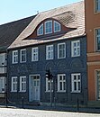
House with a slate facade | ||
|
09160459 |
Havelberger Strasse 19 ( location ) |
front door | ||
|
09160460 |
Havelberger Strasse 30 ( location ) |
Former polyclinic with outbuildings and enclosures | ||
|
09160757 |
Havelberger Strasse 32 ( location ) |
Residential building | ||
|
09160486 |
Im Hagen ( location ) |
Friedrich-Ludwig-Jahn monument | ||
|
09160461 |
Kathfelder Mühle 1 ( me ) |
Kathfeld Mill | ||
|
09160773 |
Kietz 64 ( location ) |
District library | ||
|
09160485 |
Kirchstrasse ( location ) |
Parish Church of St. Nikolai | The Protestant parish church was probably built in the middle of the 13th century, but has been heavily modified since then. The tower was built between 1880 and 1882. Inside, an altar from around 1470 to 1480. | |
|
09160462 |
Kirchstrasse 1 ( location ) |
Rectory | ||
|
09160463 |
Magazine location 5 ( ) |
Memorial plaque for Hermann Lutz | ||
|
09160482 |
Marktplatz 1 ( location ) |
Residential building with shops | ||
|
09160468 |
Marktstrasse 3 ( location ) |
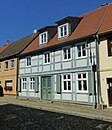
Residential and commercial building | ||
|
09160469 |
Marktstrasse 4 ( location ) |
Residential and commercial building | ||
|
09160470 |
Marktstrasse 5 ( location ) |
Residential and commercial building | ||
|
09160471 |
Marktstrasse 6 ( location ) |
Residential and commercial building | ||
|
09160472 |
Marktstrasse 7 ( location ) |
Residential and commercial building | ||
|
09160473 |
Marktstrasse 23 ( location ) |
Residential and commercial building with side wing | ||
|
09160474 |
Marktstrasse 24 ( location ) |
Residential and commercial building | ||
|
09160128 |
Marktstrasse 25 ( location ) |
Hotel "Stadt Pritzwalk" | ||
|
09160475 |
Marktstrasse 29 ( location ) |
Residential building with side wing and alley | ||
|
09160477 |
Marktstrasse 33 ( location ) |
Residential house with butcher shop and two side wings | ||
|
09160478 |
Marktstrasse 38 ( location ) |
Residential and commercial building | ||
|
09160479 |
Marktstrasse 39 ( location ) |
town hall | The town hall was built in the middle of the 19th century in the late classical style. | |
|
09160115 |
Meyenburger Straße 10 ( ) |
Residential house with business | ||
|
09160483 |
Meyenburger Tor 1, An der Promenade 5, 6 ( location ) |
Cloth factory Draeger (later Quandt), consisting of: administration building (most recently district administration), wool store, warehouse, laundry and drying facility, machine house, boiler house, chimney, dye works, material store, light corridor, old building construction, fulling, press shop, spinning and weaving building construction, stair tower, Staircase, locksmith's shop, storage rooms, gallery, transition and enclosure | The administration building is located on an island in the Dömitz. It was built by Hoffmann from 1936 to 1938. | |
|
09160484 |
Meyenburger Tor 5 ( location ) |
Villa "screw" with enclosure | ||
|
09160008 |
Parkstrasse 16 ( location ) |
District court with prison | The district court at Parkstrasse 16 was built between 1910 and 1911. It is a two-story brick building. The facade of the neo-Gothic building is structured with a three-axis risalit. The former prison is in the backyard. | |
|
09160452 |
Perleberger Strasse ( location ) |
Mausoleum of the Quandt family, in the cemetery | ||
|
09160451 |
Perleberger Straße ( ) |
Grave site for Polish slave laborers in the cemetery | ||
|
09160487 |
Perleberger Tor 10 ( location ) |
villa | ||
|
09160488 |
Peace Square ( location ) |
Memorial to the victims of the explosion in April 1945 | The memorial stone commemorates the explosion of an ammunition train in Pritzwalk station, in which the station was destroyed and several hundred people, mainly visitors to a cinema opposite, were killed. He is in a green area opposite the train station. | |
|
09160489 |
Reepergang 10 ( location ) |
Catholic church with parish hall | The Catholic Church of St. Anna was built in 1905. | |
|
09160698 |
Roßstrasse 18 ( location ) |
Residential building | ||
|
09160490 |
Schützenstrasse ( location ) |
Schützenstraße development | ||
|
09160491 |
Schützenstrasse 4 ( location ) |
front door | ||
|
09160492 |
Schützenstrasse 5 ( location ) |
front door | ||
|
09160493 |
Schützenstrasse 7 ( location ) |
front door | ||
|
09160494 |
Schützenstrasse 11 ( location ) |
front door | ||
|
09160495 |
Schützenstrasse 28 ( location ) |
Residential building | ||
|
09160001 |
Schützenstrasse 29 ( location ) |
Residential building | ||
|
09160867 |
Schützenstrasse 50 ( location ) |
Residential building | ||
|
09160002 |
Wallstrasse 4 ( location ) |
Residential building | ||
|
09160498 |
Wallstrasse 12 ( location ) |
Residential building | ||
|
09160499 |
Wittstocker Chaussee 3a ( location ) |
Villa with remains of the enclosure | ||
|
09160500 |
To the Hainholzmühle 24 ( ) |
Plastic "playing children" |
Sadenbeck
| ID no. | location | Official name | description | image |
|---|---|---|---|---|
|
09160552 |
Dorfstrasse Sadenbeck 27 ( location ) |
Rectory | ||
|
09160555 |
Dorfstraße Sadenbeck 31 ( location ) |
|||
|
09161096 |
Dorfstrasse Sadenbeck 45 ( location ) |
|||
|
09160551 |
Dorfstrasse Sadenbeck 55 ( location ) |
Village church | The village church was probably built in the middle of the 15th century. It is a field stone building with a wide west tower. In 1833 the church was extended. The interior is mainly from the 17th century. | |
|
09160554 |
Mittelmühle 2 ( location ) |
Homestead, consisting of a residential house with a gate building, three farm buildings and courtyard paving |
Sarnow
| ID no. | location | Official name | description | image |
|---|---|---|---|---|
|
09160955 |
Dorfstrasse Sarnow 31 ( location ) |
Homestead, consisting of a residential building with an enclosure and two farm buildings | ||
|
09160060 |
Dorfstrasse Sarnow 38 ( location ) |
Village church | The Protestant church was probably built around 1500. Inside is a Baroque pulpit. |
Schönhagen
| ID no. | location | Official name | description | image |
|---|---|---|---|---|
|
09160501 |
Dorfstrasse Schönhagen 12 ( location ) |
Village church | The Protestant church was built at the end of the 15th century. It is a hall building with a west tower, in the south there is a vestibule. The pulpit altar was probably created around 1694. The baptismal angel dates from the first quarter of the 18th century. | |
|
09160504 |
Dorfstrasse Schönhagen 14 ( location ) |
Rectory | ||
|
09160502 |
Dorfstrasse Schönhagen 15 ( location ) |
Residential house with enclosure | ||
|
09160503 |
Dorfstrasse Schönhagen 31 ( location ) |
Residential building |
Steffenshagen
| ID no. | location | Official name | description | image |
|---|---|---|---|---|
|
09160910 |
Dorfstraße Steffenshagen ( location ) |
Village church | The evangelical church was probably built in the 14th century. It is a rock installation with a roof tower. From 1920 to 1922 the church was rebuilt after a fire, using eclectic shapes. The interior in the neo-baroque style was built in 1921. Painting by Robert Sandfort | |
|
09161099 |
Dorfstrasse Steffenshagen 17 ( location ) |
House and barn | ||
|
09160578 |
Dorfstraße Steffenshagen 38 ( location ) |
Farmhouse and stable building |
Along the way
| ID no. | location | Official name | description | image |
|---|---|---|---|---|
|
09160051 |
Streckenthiner Dorfstraße 19 ( location ) |
Manor house with horse stable and forecourt | The former manor house was built in 1823, rebuilt in 1913 in the classicist style. It is a one-story house with a mansard hipped roof. In front of the entrance there is a flight of stairs and an arbor with columns. | |
|
09160050 |
Streckenthiner Dorfstraße 25 ( location ) |
Streckenthin village church | The Protestant church was built in the late 16th century and rebuilt at the end of the 17th century. It is a rectangular half-timbered building. |
Wilmersdorf
| ID no. | location | Official name | description | image |
|---|---|---|---|---|
|
09160606 |
Dorfstraße Wilmersdorf ( location ) |
Wilmersdorf village church | The Protestant village church was built in 1813. It is a half-timbered house with a tower. Inside a horseshoe gallery and a pulpit altar from around 1813. |
Former architectural monuments
| ID no. | location | Official name | description | image |
|---|---|---|---|---|
|
|
Pritzwalk, Marktstrasse 30 ( location ) |
Residential building with side wing |
Web links
Commons : Kulturdenkmale in Pritzwalk - Collection of pictures, videos and audio files
- List of monuments of the State of Brandenburg: District of Prignitz (PDF) Brandenburg State Office for Monument Preservation and State Archaeological Museum
Individual evidence
- ↑ a b c d e f g h i j k l m n o p q r s t u v w Georg Dehio : Handbuch der deutschen Kunstdenkmäler . Founded by the Day for Monument Preservation 1900, continued by Ernst Gall , revised by the Dehio Association and the Association of State Monument Preservationists in the Federal Republic of Germany, represented by: Brandenburg State Office for Monument Preservation and State Archaeological Museum. Brandenburg: edited by Gerhard Vinken and others, reviewed by Barbara Rimpel. Deutscher Kunstverlag, Munich / Berlin 2012, ISBN 978-3-422-03123-4 .

