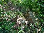
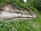
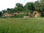
List of geotopes in Stuttgart
This sortable list of geotopes in Stuttgart contains the geotopes of the Baden-Württemberg state capital Stuttgart , the official designations for names and numbers as well as their geographical location.
In Stuttgart, 49 geotopes (as of February 21, 2020) are officially designated by the State Office for Geology, Raw Materials and Mining (LGRB).
| Profile No. (PDF) | Surname | Geotope type | Municipality / city, district | Coordinates | image | Remarks |
|---|---|---|---|---|---|---|
| 4583 | Road between Stg.-Schönberg and Stg.-Riedenberg in the valley W of Riedenberg | Landscape element | Stuttgart district Birkach |
48 ° 44 '4.7 " N , 9 ° 12' 25.1" E | Geological unit: Marl Status: with protected (NSG Eichenhain ) |
|
| 4584 | Mombach spring in Stuttgart-Bad Cannstatt | source | Stuttgart district Bad Cannstatt |
48 ° 48 ′ 41.5 " N , 9 ° 12 ′ 52.2" E | Geological unit: travertine Status: protected (natural monument 81110001304 ) |
|
| 4585 | Aufschluss SE from Bad Cannstatt train station in Heinrich-Ebner-Straße | Exposure | Stuttgart district Bad Cannstatt |
48 ° 47 '59.3 " N , 9 ° 13' 18.5" E | Geological unit: loess over travertine Status: protected (natural monument 81110001303 ) |
|
| 4586 | Outcrop at the Mo / ku border in Bad Cannstatt | Exposure | Stuttgart district Bad Cannstatt |
48 ° 49 '5.6 " N , 9 ° 13" 49.6 " E | Geological unit: Upper Muschelkalk / Lettenkeuper Status: protected (natural monument 81110001306 ) |
|
| 4587 | Exposure at the Kursaal in Bad Cannstatt N from the Quellenhof | Exposure | Stuttgart district Bad Cannstatt |
48 ° 48 ′ 32.7 " N , 9 ° 13 ′ 25" E | Geological unit: travertine over Neckarnagelfluh Status: protected (natural monument 81110001305 ) |
|
| 4588 | Outcrops in the Schwälblesklinge at the forest cemetery | Exposure | Stuttgart district Degerloch |
48 ° 44 '49.8 " N , 9 ° 8' 25.4" E | Geological unit: Stubensandstein Status: protected (natural monument 81110001902 ) |
|
| 4589 | Outcrop on the Horn (open. Mergelgrube) E von Weil im Dorf | Exposure | Stuttgart district Feuerbach |
48 ° 49 '0.7 " N , 9 ° 7' 46.9" E | Geological unit: Gipskeuper Status: with protected (NSG Greutterwald ) |
|
| 4590 | Source Salzlöchle on the eastern outskirts of Stg.-Heumaden | source | Stuttgart district Heumaden |
48 ° 44 '41.1 " N , 9 ° 14' 16.8" E | Geological unit: Arietenkalk formation Status: protected (natural monument 81110001804 ) |
|
| 4591 | Hollow fountain with stream E from Stuttgart-Hofen | source | Stuttgart district Hofen |
48 ° 50 '22.3 " N , 9 ° 14' 20.4" E | Geological unit: Lower Keuper Status: protected (natural monument 81110001102 ) |
|
| 4592 | Dautenfelsen on the Rößle-Rundweg NNW from Stg.-Untertürkheim | Rock formation | Stuttgart district Obertürkheim |
48 ° 46 '21.9 " N , 9 ° 15' 56.2" E | Geological unit: Stubensandstein Status: protected (natural monument 81110001401 ) |
|
| 4593 | Jaißerklinge N by Stg.-Rohracker | Landscape element | Stuttgart district Rohracker |
48 ° 45 '32 " N , 9 ° 13' 26.6" E | Geological unit: crossing of colored marl Stubensandstein Status: protected (natural monument 81110001701 ) |
|
| 4594 | Bußbachklinge with Hülenstein spring and tuff rock E from Stg.-Sillenbuch | Landscape element | Stuttgart district Sillenbuch |
48 ° 44 '46.7 " N , 9 ° 13' 21.5" E | Geological unit: tufa status: protected (natural monument 81110001801 ) |
|
| 4595 | Stone blade E from Stg.-Heumaden | Landscape element | Stuttgart district Heumaden |
48 ° 44 '38.1 " N , 9 ° 14' 38.8" E | Geological unit: Stubensandstein Status: protected (natural monument 81110001803 ) |
|
| 4596 | Exposure at the E-foot of the artificial. Heaped rubble mountain Birkenkopf | Exposure | Stuttgart | 48 ° 45 '50.6 " N , 9 ° 8' 2.5" O | Geological unit: Marl / Stubensandstein Status: protected (natural monument 81110000502 ) |
|
| 4597 | Exposure Heslacher Wand W from Heslach | Exposure | Stuttgart | 48 ° 45 '38.3 " N , 9 ° 8' 33.8" E | Geological unit: Stubensandstein Status: protected (natural monument 81110004011 ) |
|
| 4598 | Task Quarry on Killesberg in the Feuerbacher Heide | Exposure | Stuttgart | 48 ° 47 '53.5 " N , 9 ° 10' 16.1" E | Geological unit: border area reed sandstone colorful marl Status: protected (natural monument 81110000203 ) |
|
| 4599 | Exposure to Rote Wand E from the main train station at Uhlandhöhe | Exposure | Stuttgart | 48 ° 46 '53.1 " N , 9 ° 11' 38.7" E | Geological unit: Colorful marl Status: protected (natural monument 81110000302 ) |
|
| 4600 | Task Quarry near Waldheim on Staibhöhe in Stg.-Gaisburg | Exposure | Stuttgart | 48 ° 46 '27.1 " N , 9 ° 13' 12.2" E | Geological unit: Stubensandstein Status: protected (natural monument 81110000303 ) |
|
| 4601 | Outcrops in Stg.-Gaisburg in the Staibhöhe area and the DRK sports field | Exposure | Stuttgart district Wangen |
48 ° 46 ′ 40 " N , 9 ° 13 ′ 31.8" E | Geological unit: reed sandstone Status: protected (natural monument 81110001601 ) |
|
| 4602 | Hollow road at the Kräherwald between Stuttgart and Stg.-Botnang | Exposure | Stuttgart Stuttgart-West |
48 ° 47 '0.5 " N , 9 ° 8' 36.5" E | Geological unit: Colorful marl Status: protected (natural monument 81110000504 ) |
|
| 4603 | Outcrop in the Egelseer Heide E von Rotenberg | Exposure | Stuttgart Uhlbach |
48 ° 47 '5.4 " N , 9 ° 17" 7.5 " E | Geological unit: Stubensandstein Status: protected (natural monument 81110001403 ) |
|
| 4604 | Outcrop on Pfaffenwaldstrasse in Vaihingen | Exposure | Stuttgart Vaihingen |
48 ° 44 '44.1 " N , 9 ° 6' 10.3" E | Geological unit: Angulate sandstone Status: protected (natural monument 81110002305 ) |
|
| 4605 | Exposure in the Upper Heidenklinge SW of Stuttgart-Sonnenberg | Exposure | Stuttgart Vaihingen |
48 ° 45 '25.1 " N , 9 ° 7' 23.8" E | Geological unit: Stubensandstein Status: protected (natural monument 81110002301 ) |
|
| 4606 | Embankment outcrop at the Zuffenhausen cemetery | Exposure | Stuttgart Zuffenhausen |
48 ° 50 ′ 13 " N , 9 ° 10 ′ 48.5" E | Geological unit: Upper Muschelkalk Status: protected (natural monument 81110000901 ) |
|
| 4607 | Stephan quarry | Exposure | Stuttgart Hofen |
48 ° 49 '35.7 " N , 9 ° 13' 17.1" E | Geological unit: Upper Muschelkalk Status: protected (natural monument 81110001104 ) |
|
| 4608 | Loess outcrop Freienstein | Exposure | Stuttgart Munster |
48 ° 49 '38.4 " N , 9 ° 12' 28.1" E | Geological unit: loess Status: protected (natural monument 81110001201 ) |
|
| 4609 | Outcrop at Buckenhalde | Exposure | Stuttgart Untertürkheim |
48 ° 46 '55.9 " N , 9 ° 15' 45.4" E | Geological unit: Gipskeuper Status: protected (natural monument 81110001402 ) |
|
| 4610 | Outcrop in the Viereichenhau | Exposure | Stuttgart Degerloch |
48 ° 45 ′ 16.5 " N , 9 ° 8 ′ 30.6" E | Geological unit: Colorful marl Status: protected (natural monument 81110001901 ) |
|
| 4611 | Haas quarry in Bad Cannstatt-Münster | Exposure | Stuttgart Bad Cannstatt |
48 ° 49 '2.5 " N , 9 ° 13' 0.6" E | Geological unit: travertine | |
| 4612 | Task Quarry company Lauster in Stg.-Bad Cannstatt-Münster | Exposure | Stuttgart Bad Cannstatt |
48 ° 49 '1.5 " N , 9 ° 13' 1.1" E | Geological unit: travertine | |
| 4613 | Quarry company Haas in Stg.-Bad Cannstatt-Münster E on Bottroper Strasse | Exposure | Stuttgart Bad Cannstatt |
48 ° 48 '57.6 " N , 9 ° 13' 9.4" E | Geological unit: travertine | |
| 4614 | Task Quarries on the right bank of the Neckar between. Bad Cannstatt and Hofen W von Steinhaldenfeld | Exposure | Stuttgart Hofen |
48 ° 49 '37.8 " N , 9 ° 13" 10.6 " E | Geological unit: Upper Muschelkalk | |
| 4615 | Blade exposure in the Haldenwald near Sonnenberg | Exposure | Stuttgart Moehringen |
48 ° 44 ′ 29.3 " N , 9 ° 9 ′ 2" E | Geological unit: Angulate sandstone over marl |
|
| 4616 | Dornhalde-Weg | Landscape element | Stuttgart Moehringen |
48 ° 44 '56.5 " N , 9 ° 9' 5.1" E | Geological unit: landslide in the marl |
|
| 4617 | Task Quarry on the left bank of the Neckar on the E-slope of Schnarrenberg N of St.-Münster | Exposure | Stuttgart Munster |
48 ° 49 ′ 47.9 " N , 9 ° 12 ′ 25" E | Geological unit: Upper Muschelkalk | |
| 4618 | Task Quarry on the Killesberg | Exposure | Stuttgart | 48 ° 48 '23.9 " N , 9 ° 10' 6.4" E | Geological unit: reed sandstone | |
| 4619 | Blade N by Degerloch | Landscape element | Stuttgart | 48 ° 45 '27.4 " N , 9 ° 10' 42.6" E | Geological unit: transition of colored marl / parlor sandstone |
|
| 4620 | Staibhöhe in Stg.-Gaisburg, SE corner of the sports field next to the Hans-Fuchs-Heim | Exposure | Stuttgart district Stuttgart-Ost |
48 ° 46 '33.5 " N , 9 ° 13' 28.4" E | Geological unit: colorful marls | |
| 4621 | Task Quarry on Karlshöhe | Exposure | Stuttgart district Stuttgart-Süd |
48 ° 46 '1.5 " N , 9 ° 9' 51.3" E | Geological unit: reed sandstone | |
| 4622 | Staibhöhe in Stg.-Gaisburg, home garden of the Marienburg | Exposure | Stuttgart district Wangen |
48 ° 46 '39.3 " N , 9 ° 13' 28.4" E | Geological unit: reed sandstone | |
| 4623 | Solitudeestrasse approx. 400 m NW from Solitude Castle | Landscape element | Stuttgart district Stuttgart-West |
48 ° 47 '17.6 " N , 9 ° 4' 43.9" E | Geological unit: landslide in the marl |
|
| 4624 | Task Quarry (formerly Biedermann'scher Steinbruch) in Stuttgart-Untertürkheim | Exposure | Stuttgart suburb of Untertürkheim |
48 ° 47 '28.4 " N , 9 ° 14' 48" E | Geological unit: travertine | |
| 4625 | Task Quarry in Stg.-Untertürkheim, Strümpfelbacherstr., Neue Kelter | Exposure | Stuttgart suburb of Untertürkheim |
48 ° 46 ′ 57.6 " N , 9 ° 15 ′ 27" E | Geological unit: Lower Keuper | |
| 4626 | Embankment along the Rotenberger Steige approx. 800 m ESE from Stg.-Untertürkheim | Exposure |
Stuttgart suburb of Untertürkheim |
48 ° 47 '7.2 " N , 9 ° 15' 49.1" E | Geological unit: gypsum keuper | |
| 4627 | Loess outcrop on the Neckar SSW Max-Eyth-See | Exposure | Stuttgart district Hofen |
48 ° 49 '37.5 " N , 9 ° 12' 28.9" E | Geological unit: loess | |
| 4628 | Task Marl pit at Viktor-Köchl-Haus | Exposure | Stuttgart | 48 ° 47 '25.1 " N , 9 ° 9' 16.8" E | Geological unit: colorful marls | |
| 4629 | Access on the footpath from the cable car valley station to the Waldfriedhof N Sonnenberg | Exposure | Stuttgart | 48 ° 45 '18.2 " N , 9 ° 8' 32.8" E | Geological unit: colorful marls | |
| 4630 | Task Quarry in Stg.-Gaisburg am Raichberg | Exposure | Stuttgart | 48 ° 46 '32.2 " N , 9 ° 13' 24.4" E | Geological unit: colorful marls | |
| 4631 | Exposure on Mönchberg E from Untertürkheim | Exposure | Stuttgart suburb of Untertürkheim |
48 ° 46 '55.9 " N , 9 ° 15' 45.6" E | Geological unit: gypsum keuper |
Footnotes
- ↑ The Geotope Steinklinge E from Stg.-Heumaden with the profile no. 4595 is in the east of Stuttgart and extends into the Esslingen district. There the geotope bears the profile no. 945 (see list of geotopes in the Esslingen district )
Web links
Commons : Geotopes in Stuttgart - Collection of images, videos and audio files


