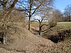
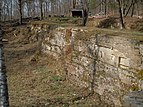
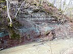
List of geotopes in the Tübingen district
This sortable list of geotopes in the Tübingen district contains the geotopes of the Tübingen district in Baden-Württemberg , the official designations for names and numbers as well as their geographical location.
In the district, 66 geotopes (as of January 3, 2020) are officially designated by the State Office for Geology, Raw Materials and Mining (LGRB).
| Profile No. (PDF) | Surname | Geotope type | Municipality / city, district | Coordinates | image | Remarks |
|---|---|---|---|---|---|---|
| 4632 | Task Gypsum pit in the Härensloch between Breitenholz and Entringen | Exposure |
Ammerbuch district Entringen |
48 ° 33 '55.8 " N , 8 ° 57' 57.8" E | Geological unit: Gipskeuper Status: with protected (NSG Schönbuch-Westhang / Ammerbuch ) |
|
| 4633 | Task Gypsum pit u. Landfill 1000 m N of Entringen | Exposure |
Ammerbuch district Entringen |
48 ° 33 '43.8 " N , 8 ° 58' 4.1" E | Geological unit: Gipskeuper Status: with protected (NSG Schönbuch-Westhang / Ammerbuch ) |
|
| 4634 | Task Kornberg quarry with water surface between Reusten and Poltringen | Exposure |
Ammerbuch district Poltringen |
48 ° 32 '26 " N , 8 ° 55' 43.3" E | Geological unit: Upper Muschelkalk Status: with protected (NSG Kochhartgraben and Ammertal slopes ) |
|
| 4635 | Task Quarry little NW of Poltringen | Exposure |
Ammerbuch district Poltringen |
48 ° 32 '13.8 " N , 8 ° 56" 14.5 " E | Geological unit: Upper Muschelkalk Status: with protected (NSG Kochhartgraben and Ammertal slopes ) |
|
| 4636 | Pond and wetland Hinterer See NE of Reusten | Landscape element |
Ammerbuch district Reusten |
48 ° 33 '9.8 " N , 8 ° 55' 53.4" E | Geological unit: Lettenkeuper Status: protected ( Hinterer See natural monument ) |
|
| 4637 | Weiher u. Wetland Vorderer See NE of Reusten | Landscape element |
Ammerbuch district Reusten |
48 ° 32 '51.3 " N , 8 ° 55' 45.2" E | Geological unit: Lettenkeuper Status: protected (natural monument Vorderer See ) |
|
| 4638 | Task Quarry Burgstall S von Reusten | Exposure |
Ammerbuch district Reusten |
48 ° 32 '26 " N , 8 ° 55' 3.8" E | Geological unit: Upper Muschelkalk Status: with protected (NSG Kochhartgraben and Ammertal slopes ) |
|
| 4639 | Source "Heilbrunnen" approx. 1500 m NW of Immenhausen | source |
Kusterdingen district Immenhausen |
48 ° 29 '7.4 " N , 9 ° 4' 57.7" E | Geological unit: Lower Jurassic Status: protected (natural monument source and circular area with a radius of 10 m ) |
|
| 4640 | Mountain slide on the Hirschkopf approx. 3000 m SSE from Mössingen | Landscape element |
Mössingen district Talheim |
48 ° 22 '34.3 " N , 9 ° 4' 2.7" E | Geological unit: White Jura Status: with protected (NSG Bergrutsch am Hirschkopf ) National geotope |
|
| 4641 | Filsenberg-Meisenbühl | Landscape element |
Mössingen district Öschingen |
48 ° 24 '4.4 " N , 9 ° 7' 17" E | Geological unit: White Jura Status: protected (NSG Filsenberg ) |
|
| 4642 | Doline Küblers Loch approx. 1300 m ENE from Wolfenhausen | Sinkhole |
Neustetten district Remmingsheim |
48 ° 29 '33.6 " N , 8 ° 51' 55.6" E | Geological unit: Upper Muschelkalk Status: protected ( Küblersloch sinkhole natural monument ) |
|
| 4643 | Ofterdinger Schneckenpflaster (Arietenpflaster) in the stream bed of the Steinlach in the local area of Ofterdingen | Stream bed | Ofter things | 48 ° 29 '33.6 " N , 8 ° 51' 55.6" E | Geological unit: Arietenkalk formation Status: protected (natural monument Schneckenpflaster on the Steinlach ) National geotope |
|
| 4644 | Sieben-Täler-Höhle SSE from Bad Niedernau | cave |
Rottenburg am Neckar district Bad Niedernau |
48 ° 26 '33.8 " N , 8 ° 54'24" E | Geological unit: Upper Muschelkalk Status: protected (natural monument Sieben-Täler-Höhle in Katzenbachtal ) |
|
| 4645 | Funnel-Ehehalde W von Rottenburg | Exposure | Rottenburg am Neckar | 48 ° 28 '58.8 " N , 8 ° 55' 23.6" E | Geological unit: Upper Muschelkalk Status: with protected (NSG Trichter-Ehehalde ) |
|
| 4646 | Task Quarry at Märchensee, Wendelsheim | Exposure |
Rottenburg am Neckar district Wendelsheim |
48 ° 30 '52.2 " N , 8 ° 56' 21.9" E | Geological unit: reed sandstone Status: protected ( Märchensee natural monument ) |
|
| 4647 | Task Quarry in Olgahain approx. 1100 m SSE from Bebenhausen | Exposure |
Tübingen district Bebenhausen |
48 ° 33 '17.8 " N , 9 ° 4' 23" E | Geological unit: Rhätkeuper Status: protected (natural monument quarry in Olgahain ) |
|
| 4648 | Task Quarry on the western slope of the Goldersbach valley in the northern part of Lustnau | Exposure |
Tübingen district Lustnau |
48 ° 32 '8.7 " N , 9 ° 4' 44.4" E | Geological unit: reed sandstone Status: protected (natural monument reed sand quarry Salzwasen ) |
|
| 4649 | Task Weihershalde quarry above the Lustnau sewage treatment plant | Exposure |
Tübingen district Lustnau |
48 ° 31 '54.7 " N , 9 ° 5' 50.2" E | Geological unit: Stubensandstein Status: protected (natural monument Stubensandsteinbruch Weihershalde ) |
|
| 4650 | Impact slope of the Bettelbach approx. 1250 m WSW from Bebenhausen | Bulging slope | Tübingen | 48 ° 33 '19.2 " N , 9 ° 2' 48.9" E | Geological unit: Lower Jurassic Status: protected (natural monument of the Bettelbach Dam ) |
|
| 4651 | Task Gypsum pit between Kayh and Altingen | Exposure |
Ammerbuch district Altingen |
48 ° 34 '6.4 " N , 8 ° 55' 10.9" E | Geological unit: gypsum keuper | |
| 4652 | Task Gypsum pit at the eastern end of the village of Breitenholz | Exposure |
Ammerbuch district of Breitenholz |
48 ° 34 '17.5 " N , 8 ° 57' 44.1" E | Geological unit: gypsum keuper | |
| 4653 | Task Old mountain gypsum pit | Exposure |
Ammerbuch district Pfäffingen |
48 ° 32 '8.6 " N , 8 ° 58' 8.6" E | Geological unit: Gipskeuper Status: with protected (NSG Schönbuch-Westhang / Ammerbuch ) |
|
| 4654 | Butzensee | Landscape element | Bodelshausen | 48 ° 23 '6.4 " N , 8 ° 59" 27.1 " E | Geological unit: Posidonia schist formation | |
| 4655 | Layer level and waterfall in the bed of the Steinlach stream at the southern exit of Dußlingen | waterfall | Dusslingen | 48 ° 26 '47.8 " N , 9 ° 3' 13.9" E | Geological unit: Arietenkalk formation | |
| 4656 | Street embankment 1100 m W from Stockach | Exposure | Dusslingen | 48 ° 28 '24.9 " N , 9 ° 3' 54.9" E | Geological unit: parlor sandstone | |
| 4657 | Road embankment 1100 m NW of Gomaringen, W of Hinterweiler | Exposure | Gomaringen | 48 ° 27 '33 " N , 9 ° 5' 7.8" E | Geological unit: Black Jura | |
| 4658 | Task Quarry between Gomaringen and Hinterweiler | Exposure | Gomaringen | 48 ° 27 '27.9 " N , 9 ° 4' 57.1" E |
more pictures |
Geological unit: Black Jura |
| 4659 | Task Aidelberg quarry near Gomaringen between Gomaringen and Hinterweiler | Exposure | Gomaringen | 48 ° 27 '16.5 " N , 9 ° 5' 12.7" E | Geological unit: Posidonia schist formation | |
| 4660 | Waterfall and layer level approx. 1200 m E of the local border of Gomaringen | waterfall | Gomaringen | 48 ° 27 '15.7 " N , 9 ° 7' 28.9" E | Geological unit: Opalinus Clay Formation | |
| 4661 | Schlierbach tunnel | stollen | Kirchentellinsfurt | 48 ° 33 '9.2 " N , 9 ° 8' 56.1" E | Geological unit: Stubensandstein 20 m long tunnel from the 16th century. |
|
| 4662 | Quarry 1300 m south of Ofterdingen, at point 461 | Exposure | Mössingen | 48 ° 24 '28.9 " N , 9 ° 2' 2.7" E | Geological unit: Posidonia schist formation | |
| 4663 | Slope embankment on the Bukensteig approx. 1200 m NNW from Beuren | Exposure | Mössingen | 48 ° 22 '20.4 " N , 9 ° 1' 20.9" E | Geological unit: frond sandstone formation | |
| 4664 | Öschinger Klufthöhle on Rafnachberg approx. 700 m SSE of the Öschingen swimming pool | cave |
Mössingen district Öschingen |
48 ° 24 '20.2 " N , 9 ° 8' 2.5" E | Geological unit: Well-stratified limestone formation | |
| 4665 | Task Quarry at the edge of the eaves 2000 m N of Salmendingen | Exposure |
Mössingen district Talheim |
48 ° 22 '28.3 " N , 9 ° 7' 14.6" E | Geological unit: Well-stratified limestone formation | |
| 4666 | Farrenberg between Mössingen and Talheim | Landscape element |
Mössingen district Talheim |
48 ° 23 '10.5 " N , 9 ° 4' 28.5" E | Geological unit: Well-layered limestone formation Zeugenberg Swabian Alb |
|
| 4667 | Hammelhansquellen | source |
Neustetten district Nellingsheim |
48 ° 28 '11.3 " N , 8 ° 50' 43.2" E | Geological unit: border area Middle Muschelkalk Upper Muschelkalk |
|
| 4668 | Dolinenfeld Kohlgrube | Sinkhole |
Rottenburg am Neckar district Baisingen |
48 ° 30 '53.2 " N , 8 ° 51' 45.1" E | Geological unit: Upper Muschelkalk | |
| 4669 | Task Vogelherd gravel pit | Exposure |
Rottenburg am Neckar, Bieringen district |
48 ° 27 '13 " N , 8 ° 50' 45.8" E | Geological unit: Pleistocene Neckar gravel | |
| 4670 | Quarry Frommenhausen Company Heinz on the S-slope of the Starzeltal | Exposure |
Rottenburg am Neckar district Frommenhausen |
48 ° 25 '19.8 " N , 8 ° 52' 6.9" E | Geological unit: Trigonodus dolomite | |
| 4671 | Tiefstein (Kapf rocks) | Exposure |
Rottenburg am Neckar district Frommenhausen |
48 ° 25 '6.2 " N , 8 ° 52' 12.3" E | Geological unit: Trigonodus dolomite | |
| 4672 | Swabian gate little SW of Rottenburg | Landscape element | Rottenburg am Neckar | 48 ° 28 '3.8 " N , 8 ° 55' 18.8" E | Geological unit: Upper Muschelkalk | |
| 4673 | Task Breitenhart quarry | Exposure | Rottenburg am Neckar | 48 ° 28 '16.7 " N , 8 ° 54' 44.7" E | Geological unit: Trigonodus dolomite | |
| 4674 | Doline and shaft cave Elbenloch |
Doline shaft cave |
Rottenburg am Neckar district Schwalldorf |
48 ° 26 '29.2 " N , 8 ° 54' 8.4" E | Geological unit: Trigonodus dolomite | |
| 4675 | Bad Niedernau sulfur spring | source |
Rottenburg am Neckar district Schwalldorf |
48 ° 26 '40.2 " N , 8 ° 53' 53.8" E | Geological unit: trochitic limestone | |
| 4676 | Task Quarries and Sand pit at Spielberg approx. 1100 m SE of the center of Seebronn | Exposure |
Rottenburg am Neckar district Seebronn |
48 ° 29 '58.6 " N , 8 ° 53' 9.5" E | Geological unit: Lettenkeuper | |
| 4677 | Doline Obtained birch trees | Sinkhole |
Rottenburg am Neckar district Seebronn |
48 ° 30 '13.7 " N , 8 ° 51' 7.2" E | Geological unit: Upper Muschelkalk | |
| 4678 | Task Gypsum mine Viehweg little N of Wurmlingen | Exposure |
Rottenburg am Neckar, Wurmlingen district |
48 ° 30 '36.4 " N , 8 ° 57' 54.5" E | Geological unit: gypsum keuper | |
| 4679 | Task Gypsum pit little N of wormlings | Exposure |
Rottenburg am Neckar, Wurmlingen district |
48 ° 30 '31 " N , 8 ° 58' 1.6" E | Geological unit: gypsum keuper | |
| 4680 | Doline in the Gewann Hebsack between Felldorf and Starzach | Sinkhole |
Starzach district Bierlingen |
48 ° 25 '43.5 " N , 8 ° 47' 40.3" E | Geological unit: Lower Keuper | |
| 4681 | Hülbe Ammelsbrunnen in the community forest approx. 2300 m SSW from Starzach | Sinkhole |
Starzach district Bierlingen |
48 ° 24 ′ 45.2 " N , 8 ° 48 ′ 12.6" E | Geological unit: Lower Keuper | |
| 4682 | Doline in Großholz approx. 2400 m E from Bad Imnau | Sinkhole |
Starzach district Bierlingen |
48 ° 24 '30.9 " N , 8 ° 48' 33.1" E | Geological unit: Upper Muschelkalk | |
| 4683 | Task Sauerbrunnen quarry | Exposure |
Starzach district of Börstingen |
48 ° 26 ′ 43.5 " N , 8 ° 46 ′ 58.7" E | Geological unit: Middle Muschelkalk | |
| 4684 | Karst spring Kohlbrunnen in the Neckar valley approx. 2000 m E in the center of Börstingen | source |
Starzach district Sulzau |
48 ° 26 '58.1 " N , 8 ° 49' 51.4" E | Geological unit: Middle Muschelkalk | |
| 4685 | Task Lower Mill Quarry | Exposure |
Starzach district Wachendorf |
48 ° 24 '57.5 " N , 8 ° 51' 54.3" E | Geological unit: Upper Muschelkalk | |
| 4686 | Goldersbach-Bebenhausen | Exposure |
Tübingen district Bebenhausen |
48 ° 33 '31.5 " N , 9 ° 3' 30.4" E | Geological unit: colorful marls | |
| 4687 | Impact slope of the student pool in Goldersbachtal approx. 1800 m W of Bebenhausen | Exposure |
Tübingen district Hagelloch |
48 ° 33 '43.8 " N , 9 ° 2' 9.4" E | Geological unit: colorful marls | |
| 4688 | Prallhang Jungfernhäule | Exposure |
Tübingen district Hagelloch |
48 ° 34 '25.2 " N , 9 ° 2' 1.2" E | Geological unit: reed sandstone | |
| 4689 | Task Spitzberg-Buß marl pit | Exposure |
Tübingen district Hirschau |
48 ° 30 '38 " N , 9 ° 1' 4.5" E | Geological unit: marl | |
| 4690 | Quarries 2200 m W of Pfrondorf in Gewann Hägnach | Exposure |
Tübingen district Lustnau |
48 ° 32 '59.4 " N , 9 ° 4' 58.6" E | Geological unit: Rhätkeuper Psilonotenton-Formation |
|
| 4691 | Quarries 1400 m SW of Pfrondorf | Exposure |
Tübingen district Lustnau |
48 ° 32 '19.5 " N , 9 ° 5' 59.5" E | Geological unit: Rhätkeuper | |
| 4692 | Haldenbach waterfall | waterfall |
Tübingen district Pfrondorf |
48 ° 32 '37.3 " N , 9 ° 6' 48.8" E | Geological unit: parlor sandstone | |
| 4693 | Prallhang Closed fountain in Goldersbachtal approx. 1300 m W of Bebenhausen | Exposure | Tübingen | 48 ° 33 '30.8 " N , 9 ° 2' 33.3" E | Geological unit: colorful marls | |
| 4694 | Task Quarry on the Geißhalde approx. 1300 m west of Bebenhausen | Exposure | Tübingen | 48 ° 33 '22.4 " N , 9 ° 2' 36.3" E | Geological unit: Rhätkeuper | |
| 4695 | Blade to the Bettelbachtal approx. 1100 m WSW from Bebenhausen | Exposure | Tübingen | 48 ° 33 '15.9 " N , 9 ° 2' 55.3" E | Geological unit: parlor sandstone | |
| 4696 | Chess tree embankment | Exposure | Tübingen | 48 ° 33 '16.6 " N , 9 ° 2' 52.3" E | Geological unit: parlor sandstone | |
| 4697 | Task Quarry in the Forchenwald approx. 2000 m NE of the center of Unterjesingen | Exposure |
Tübingen suburb Unterjesingen |
48 ° 32 '31.6 " N , 8 ° 59" 42.6 " E | Geological unit: reed sandstone |
Individual evidence
Web links
Commons : Geotopes in the Tübingen district - collection of images, videos and audio files


