Kusterdingen
| coat of arms | Germany map | |
|---|---|---|

|
Coordinates: 48 ° 31 ' N , 9 ° 7' E |
|
| Basic data | ||
| State : | Baden-Württemberg | |
| Administrative region : | Tübingen | |
| County : | Tübingen | |
| Height : | 405 m above sea level NHN | |
| Area : | 24.24 km 2 | |
| Residents: | 8597 (Dec. 31, 2018) | |
| Population density : | 355 inhabitants per km 2 | |
| Postcodes : | 72127, 72138 | |
| Area code : | 07071 | |
| License plate : | TÜ | |
| Community key : | 08 4 16 023 | |
| LOCODE : | DE KTD | |
| Community structure: | 5 districts | |
| Address of the municipal administration: |
Kirchentellinsfurter Str. 9 72127 Kusterdingen |
|
| Website : | ||
| Mayor : | Jürgen Soltau (independent) | |
| Location of the municipality of Kusterdingen in the Tübingen district | ||
Kusterdingen is a municipality in the Tübingen district , above the Neckar valley between Tübingen and Reutlingen . It belongs to the Neckar-Alb region and the European metropolitan region of Stuttgart .
geography
Geographical location
Kusterdingen is located on the hardnesses , immediately southeast of Tübingen.
landscape
The hardnesses form a plateau between Steinlach , Neckar and Echaztal , which is surrounded by a mixed beech forest. The intensively used arable land and orchards are typical . The highest point of the municipality is located on a forest-free plateau west of the Wankheim Aspenhau settlement and is 455 m above sea level. NHN .
In the north of the municipality is the nature reserve Blaulach . It is a tributary of the Neckar .
West of Immenhausen is extending the conservation area Ehrenbachtal with Cold fountain .
Neighboring communities
The following cities and municipalities border the municipality of Kusterdingen, they are named starting in clockwise direction in the north and belong to the district of Tübingen or the district of Reutlingen ¹
Kirchentellinsfurt , Wannweil¹ , Reutlingen¹ , Gomaringen and Tübingen
Community structure
The municipality of Kusterdingen consists of the districts Immenhausen (712 inhabitants on December 31, 2018), Jettenburg (1144), Kusterdingen (3623), Mähringen (1442) and Wankheim (1667). The districts are officially named in the form "Kusterdingen- ...", they are spatially identical to the earlier communities of the same name. The local elections carried out in Kusterdingen according to the system of the loggerhead part choice of location , thus forming the districts as residential areas designated constituencies . With the exception of the district of Kusterdingen, all districts are localities within the meaning of the Baden-Württemberg municipal code with their own local council and a local mayor as its chairman.
Only the villages of the same name belong to the districts of Immenhausen, Jettenburg and Kusterdingen. The Mähringen village and the Mähringen train station houses belong to the district of Mähringen. The Wankheim district includes the village of Wankheim, the Aspenhau settlement and the Bläsikelter homestead.
In the east of the district Mähringen was the abandoned , no longer existing hamlet of Weiler. Weiler was first mentioned in 1522 as an der wyler . The discovery of a ceramic fragment, which was dated and documented by the State Monuments Office in the 8th century AD, indicates an early settlement. At the same place there was a Schwaige in the 15th century , which is called 1562 ( in schwaig priel ).
history
middle Ages
The place Kusterdingen emerged as a settlement in the time of the Alemannic conquest. During the tribal duchies that existed in the High Middle Ages , the place was in the Duchy of Swabia . For the 12th and 13th centuries, noble free von Kusterdingen were named. Already at the beginning of the 12th century a gentleman named Marquart bequeathed a farm to the Blaubeuren monastery in Kusterdingen. The year of this event was not specified in the document, but in the 1880s it was narrowed down to 1108 through a comparison of various documents by Pastor Casper, which is therefore assumed to be the year Kusterdingen was first mentioned.
After the non-noble family of Kusterdingen died out, the Counts of Aichelberg - Merkenberg , the Bebenhausen monastery and the Lords of Stoffeln took over rulership rights on the site.
In the late Middle Ages, the lower aristocratic family of the Pflumen had their seat in Kusterdingen from 1270 to the late 15th century and exercised local rule there. Since 1484 Kusterdingen belonged to the county (or since 1495 to the duchy) of Württemberg . The place was assigned to the Tübingen office.
Modern times
Duke Ulrich von Württemberg pushed through the Reformation in Württemberg in 1534, so that the community of Kusterdingen also became Protestant. Since 1758 Kusterdingen belonged to the Oberamt Tübingen , with which the place remained even after the establishment of the Kingdom of Württemberg . During the administrative reform during the Nazi era in Württemberg , Kusterdingen came to the enlarged district of Tübingen in 1938 . In 1945 the place became part of the French zone of occupation and was thus assigned to the newly founded state of Württemberg-Hohenzollern , which in 1952 became the administrative district of Südwürttemberg-Hohenzollern in the state of Baden-Württemberg.
In the course of the community reform in the 1970s, the formerly independent communities had to enter into a connection with Kusterdingen. So the merger was forced against the will of Immenhausen, Mähringen and Wankheim. A complaint from these communities to the State Court was unsuccessful. Jettenburg, which was already working voluntarily with Kusterdingen at the time, had nothing to object to the merger.
In 2008 the district of Kusterdingen celebrated its 900th anniversary.
religion
54% of the residents of Kusterdingen are Protestant, 16% Catholic.
In the 18th and 19th centuries there was a Jewish community in what is now Wankheim , to which a cemetery that still exists today belonged.
politics
In Kusterdingen, the municipal council is elected using the spurious selection process . The number of local councils can change due to overhang mandates . The local elections on May 26, 2019 led to the following preliminary final result. The municipal council consists of the elected voluntary councilors and the mayor as chairman. The mayor is entitled to vote in the municipal council.
| Parties and constituencies |
% 2019 |
Seats 2019 |
% 2014 |
Seats 2014 |
||
| FWV | Free electoral association | 45.6 | 8th | 58.5 | 11 | |
| HUD | List of hardships environmental protection and democracy eV | 32.4 | 6th | 27.6 | 5 | |
| SPD | Social Democratic Party of Germany | 8.5 | 1 | 9.2 | 2 | |
| FDP | Free Democratic Party | 4.6 | 1 | 4.7 | 1 | |
| NL | New list | 8.9 | 2 | - | - | |
| total | 100.0 | 18th | 100.0 | 19th | ||
| voter turnout | 69.2% | 57.5% | ||||
mayor
The mayor is elected for an eight-year term. On April 15, 2018, Jürgen Soltau was re-elected for the next term of office, which begins on July 1, 2018, with 87.3 percent of the votes.
- 1958–1978: Gerhard Kindler
- 1978–2002: Günter Müller
- since 2002: Jürgen Soltau
coat of arms
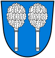
The municipality of Kusterdingen has neither a coat of arms nor a flag. The five districts continue to use the coats of arms of the former municipalities. Since today's municipality was newly founded during the territorial reform and never received a coat of arms, it is one of only three communities in Baden-Württemberg that are still without a coat of arms.
Culture and sights
Buildings
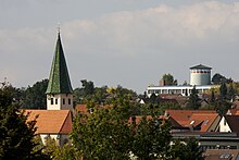
- The Kusterdinger Marienkirche
- Radio tower on the Hohen Mark (geographical coordinates: 48 ° 30 ′ 46 ″ N , 9 ° 6 ′ 0 ″ E )
- The old town hall, a renovated building that houses the registry office and other offices
- The water tower at the Sportheim (geographic coordinates: 48 ° 31 ′ 32.5 ″ N , 9 ° 6 ′ 49.1 ″ E )
- The renovated cloister courtyard serves as a cultural building in which events take place regularly.
- The METROPOL cinema run by Filmfreunde Kusterdingen e. V., a small cinema with 32 seats in a barn from 1773.
- The Mähringer Stephanskirche
- Mähringen Castle (removed)
nature and landscape
- The Eduard Lucas model orchard by pomologist Eduard Lucas with the educational trail, starting from the Mähringen cemetery
- The Heilbrünnele in the Ehrenbachtal nature reserve with Kaltem Brunnen
- The linden tree at the cemetery in Mähringen
Economy and Infrastructure
traffic
The federal road 28 crosses the municipality and connects it with Reutlingen and Tübingen .
The Public transport is by the Verkehrsverbund Neckar-Alb-Donau guaranteed (NALDO). The community is located in honeycomb 111.
Since December 2009 there has been a roundabout at the entrance to Kusterdingens and Wankheim.
The district of Mähringen was on the Gönninger Bahn from Reutlingen from 1902 to 1982 . The train station there is still standing today. The former embankment can still be seen today.
education
- Hardening school Mähringen (primary school) for pupils from the suburbs of Mähringen, Wankheim, Jettenburg and Immenhausen
- August-Lämmle-Schule Kusterdingen (elementary and secondary school with Werkrealschule) for students from Kirchentellinsfurt, Wannweil and the suburbs of the hardship community.
- ev. Firstwald-Gymnasium - Kusterdingen branch
Personalities
Sons and daughters of the church
- Johann Ulrich Pregizer I , also called the Elder (1577–1656), Protestant theologian, professor and chancellor of the University of Tübingen
- Georg Alfred Stockburger (1907–1986), doctor and painter of Expressionism
Persons connected with Kusterdingen
- Anke Laufer (* 1965), writer
Trivia
The SWR documentary entitled "Country Life 4.0 in Kusterdingen" broadcast on April 8, 2016 shows modern village life using the example of Kusterdingen.
literature
- Herbert Raisch u. a .: 900 years of Kusterdingen , municipality of Kusterdingen 2008.
Web links
- Wikisource: Kusterdingen in the description of the Oberamt Tübingen from 1867
- Official website of the municipality
- Website of the hardship list environmental protection and democracy e. V.
Individual evidence
- ↑ State Statistical Office Baden-Württemberg - Population by nationality and gender on December 31, 2018 (CSV file) ( help on this ).
- ↑ UNEP World Conservation Monitoring Center World Database on Protected Areas Site Sheet ( page can no longer be accessed , search in web archives ) Info: The link was automatically marked as defective. Please check the link according to the instructions and then remove this notice.
- ↑ State Institute for the Environment, Measurements and Nature Conservation Baden-Württemberg 4.16.003 Ehrenbachtal with Kaltem Brunnen [1]
- ↑ Main statute of the municipality of Kusterdingen dated May 6, 1982, last amended on July 22, 2009 (PDF; 98 kB) accessed on June 25, 2010
- ^ The state of Baden-Württemberg. Official description by district and municipality. Volume VII: Tübingen administrative region. Kohlhammer, Stuttgart 1978, ISBN 3-17-004807-4 . Pp. 129-131
- ↑ 900 years of Kusterdingen
- ↑ 2011 census
- ↑ Ines Stöhr: Jürgen Soltau re-elected in Kusterdingen - Region of Tübingen - Reutlinger General-Anzeiger - gea.de . In: gea.de . ( gea.de [accessed on April 16, 2018]).
- ↑ Ev. Marienkirche on the official website of the parish , accessed on September 1, 2018
- ↑ Honeycomb plan on www.naldo.de
- ↑ Article in Gea: At the roundabout, things are now going well
- ^ David Spaeth: Country Life 4.0 in Kusterdingen. SWR, April 8, 2016, accessed December 29, 2016 .


