
Hirrlingen
| coat of arms | Germany map | |
|---|---|---|

|
Coordinates: 48 ° 25 ' N , 8 ° 53' E |
|
| Basic data | ||
| State : | Baden-Württemberg | |
| Administrative region : | Tübingen | |
| County : | Tübingen | |
| Management Community : | Rottenburg am Neckar | |
| Height : | 423 m above sea level NHN | |
| Area : | 12.82 km 2 | |
| Residents: | 3093 (December 31, 2018) | |
| Population density : | 241 inhabitants per km 2 | |
| Postal code : | 72145 | |
| Area code : | 07478 | |
| License plate : | TÜ | |
| Community key : | 08 4 16 018 | |
| LOCODE : | DE HIG | |
| Address of the municipal administration: |
Schloßhof 1 72145 Hirrlingen |
|
| Website : | ||
| Mayor : | Christoph Wild ( CDU ) | |
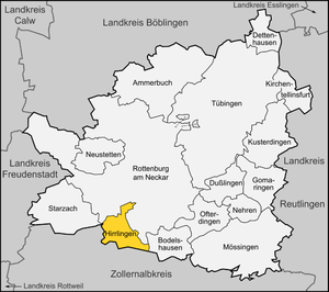
| Location of the municipality of Hirrlingen in the Tübingen district | ||
  |
||

Hirrlingen is a municipality in the district of Tübingen in Baden-Wuerttemberg ( Germany ). In terms of population, Hirrlingen is the smallest independent municipality in the Tübingen district.
geography
Geographical location
Hirrlingen is located approximately nine kilometers southwest of Rottenburg am Neckar and around nine kilometers northwest of Hechingen on the edge of protected landscape Rammert above the Starzeltals . Parts of the nature reserves Espenloch-Hintere Halde and Kapfhalde are in the Hirrlingen district.
Expansion of the municipal area
The district area of the municipality of Hirrlingen is 1281 hectares .
Neighboring communities
The following cities and municipalities border on the municipality of Hirrlingen, they are named starting in clockwise direction in the north and belong to the district of Tübingen or the Zollernalb district ¹
Rottenburg am Neckar , Bodelshausen , Hechingen ¹, Rangendingen ¹ and Starzach
Community structure
The village of Hirrlingen and the houses Obere Mühle and Untere Mühle belong to the community.
In the municipality there are several abandoned , no longer existing villages; Bossenhausen in the east of the district was first named as Bossenhusen in 1289 and was probably uninhabited before 1332. The town of Marbach, mentioned in the first half of the 12th century as Marpach , was located in today's Flur Harbach .
history


The first documentary mention was on a document from the Allerheiligen monastery in Schaffhausen from 1091.
Around 1100 the Lords of Hirrlingen appeared in historical sources , who lived in and around Hirrlingen, in the Duchy of Swabia , or who owned property and rights there. After the Hirrlingen family died out, their goods in Hirrlingen came to the Counts of Hohenberg in the 13th century , who enfeoffed the Lords of Ow ( Obernau ). Through acquisitions in the 15th and 16th centuries, the Ower local rule over Hirrlingen emerged, which as a manor was part of the Upper Austrian regional rule. The Lords of Ow built the Hirrlinger Castle in 1557/1558, a parish church of St. Martin is attested in 1606, a St. Sebastianus brotherhood in the 18th century. A Dominican convent developed from a community of religious women in the 14th century . The Bebenhausen monastery also had property in Hirrlingen at times.
The Hirrlinger line of the Lords of Ow died out in 1709. a. the Counts of Attems between 1749 and 1790 over Hirrlingen. The Dominican convent was secularized in 1789.
In 1805 the place fell to the Electorate of Württemberg , from which the Kingdom of Württemberg emerged in 1806 . When the new administrative structure was implemented , Hirrlingen was assigned to the Rottenburg District Office in 1810 .
The castle was sold to the municipality of Hirrlingen in 1821, which uses it as a town hall.
During the district reform during the Nazi era in Württemberg , the community came to the Tübingen district in 1938 . In 1945 the village became part of the French zone of occupation and thus became part of the newly founded state of Württemberg-Hohenzollern , which was incorporated into the state of Baden-Württemberg in 1952.
politics
Municipal council
The municipal council in Hirrlingen has 14 members. The local elections on May 26, 2019 led to the following preliminary final result. The municipal council consists of the elected voluntary councilors and the mayor as chairman. The mayor is entitled to vote in the municipal council.
| Parties and constituencies |
% 2019 |
Seats 2019 |
% 2014 |
Seats 2014 |
Local elections 2019
% 50 40 30th 20th 10
0
49.9%
40.9%
9.1%
UFL
BfH
WvH
Gains and losses
compared to 2014
% p 10 8th 6th 4th 2
0
-2 -4 -6 -8th -6.5 % p
-2.7 % p
+ 9.1 % p
UFL
BfH
WvH
|
|
| UFL | Independent Free List | 49.9 | 7th | 56.4 | 7th | |
| BfH | Citizens for Hirrlingen | 40.9 | 6th | 43.6 | 5 | |
| WvH | Voter Association Hirrlingen | 9.1 | 1 | - | - | |
| total | 100.0 | 14th | 100.0 | 12 | ||
| voter turnout | 64.8% | 53.5% | ||||
mayor
In February 2016, Christoph Wild was elected as the new mayor.
Community partnerships
Culture and sights

Buildings
- Baroque church, built in the 18th century
- Hirrlingen Castle , built in the 16th century
Regular events
- Mutton dance , tradition since 1578
- The Swabian-Alemannic carnival is celebrated in Hirrlingen . The masked fool figure "Butz" can be traced back to the 18th century. The driving force behind today's carnival is the Hirrlingen Butzenzunft, founded in 1962, which continues the tradition of the “Butzen”. She is a member of the Association of Swabian-Alemannic fools' guilds . The original Hirrlinger Schloßhexen with their different groups have also been active for over 40 years.
Economy and Infrastructure
traffic
The Public transport is by the Verkehrsverbund Neckar-Alb-Donau guaranteed (NALDO). The community is located on the honeycomb border 112/329.
Personalities
Born in Hirrlingen
- Josef Zimmermann (1871–1929), politician of the SPD, district administrator and chief of police
- Vinzenz Stehle (1901–1967), politician (NSDAP), member of the Reichstag
literature
- Michael Buhlmann: The Lords of Hirrlingen and the St. Georgen Monastery in the Black Forest . (= Vertex Alemanniae, H. 15) St. Georgen 2005
- Hans Jänichen , Gerhard Kittelberger: Hirrlingen. In: Max Miller , Gerhard Taddey (Hrsg.): Handbook of the historical sites of Germany . Volume 6: Baden-Württemberg (= Kröner's pocket edition . Volume 276). 2nd, improved and enlarged edition. Kröner, Stuttgart 1980, ISBN 3-520-27602-X , p. 341.
- Hans Jänichen: Dominion and territorial relationships around Tübingen and Rottenburg in the 11th and 12th centuries. Part 1: The free lords . (= Writings on Southwest German Regional Studies, Vol. 2) Stuttgart, 1964
Individual evidence
- ↑ State Statistical Office Baden-Württemberg - Population by nationality and gender on December 31, 2018 (CSV file) ( help on this ).
- ^ The state of Baden-Württemberg. Official description by district and municipality. Volume VII: Tübingen administrative region. Kohlhammer, Stuttgart 1978, ISBN 3-17-004807-4 . Pp. 147-148
- ↑ swp.de: Christoph Wild is the mayor of Hirrlingen from February 21, 2016
- ↑ Home Guild Hirrlingen
Web links

Ammerbuch | Bodelshausen | Dettenhausen | Dusslingen | Gomaringen | Hirrlingen | Kirchentellinsfurt | Kusterdingen | Mössingen | Nehren | Neustetten | Ofterdingen | Rottenburg am Neckar | Starzach | Tübingen