List of cultural monuments in Hofheim am Taunus
The following list contains the cultural monuments identified in the monument topography in the area of the municipality of Hofheim am Taunus , Main-Taunus-Kreis , Hesse .
- Note: The order of the monuments in this list is based first on the districts and then on the address; alternatively, it can also be sorted according to the name, the number assigned by the State Office for Monument Preservation or the construction time.
The basis is the publication of the Hessian list of monuments, which was created for the first time on the basis of the Monument Protection Act of September 5, 1986 and has been continuously updated since then.
Diedenbergen
| image | designation | location | description | construction time | Object no. |
|---|---|---|---|---|---|
| 'Red Hollow' | Outside location position location corridor 43, plot: 8 |
46154 |
|||
 |
Casteller Straße 31 Location hall: 10, parcel: 135/1 |
1695 to 1705 |
46129 |
||
 more pictures |
Evangelical parish church | Casteller Straße 35 Location floor: 10, parcel: 361/131, 131/1, 131/2 |
1756 |
46131 |
|
 |
Casteller Straße 39 Location floor: 27, parcel: 250 / 1,250 / 2 |
46132 |
|||
 |
Casteller Straße 49 Location hall: 27, parcel: 245/1 |
Early 18th century |
46133 |
||
 |
Casteller Straße 52 Location hall: 10, parcel: 76/1 |
Late 18th century |
46134 |
||
 |
Casteller Straße 58 Location hall: 10, parcel: 395/79 |
1903 |
46135 |
||
 more pictures |
Casteller Straße 60 Location hall: 10, parcel: 396/80 |
1725 to 1775 |
46136 |
||
 |
Casteller Straße 64 Location floor: 10, parcel: 346/83 |
1675 to 1725 |
46137 |
||
 more pictures |
Casteller Straße 66 Location floor: 10, parcel: 267/82 |
1729 |
46138 |
||
 more pictures |
Casteller Straße 72 Location hall: 10, parcel: 89/1 |
Late 18th century |
46139 |
||
 |
Casteller Straße 74 Location hall: 10, parcel: 436/90 |
1850 to 1860 |
46140 |
||
 more pictures |
Cemetery, fallen memorials and tomb | Friedhofstraße o. No. Location floor: 28, parcel: 277/1, 277/2 |
1871 |
46141 |
|
 |
Entire facility in Diedenbergen |
location |
46128 |
||
 |
Grüne Straße 8 Location hallway: 10, parcel: 208/1 |
1625 to 1675 |
46142 |
||
 |
Grüne Straße 30 Location hallway: 10, parcel: 230/2 |
Early 19th century |
46143 |
||
 more pictures |
Hintergasse 38 Location hall: 10, parcel: 18/8 |
1738 |
46144 |
||
 |
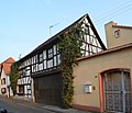
Pfarrgarten Straße 4 position corridor 10, plot: 195/1 |
1625 to 1675 |
46145 |
||
 more pictures |
Pfarrgartenstraße 6 Location hall: 10, parcel: 355/193 |
Late 17th century |
46146 |
||
 more pictures |
Pfarrgartenstraße 10 Location floor: 10, parcel: 420/188 |
1675 to 1725 |
46147 |
||
 |
Pfarrgartenstraße 11 Location hall: 10, parcel: 134 |
Late 17th century |
46148 |
||
 |
Former rectory | Pfarrgartenstraße 12 Location floor: 10, parcel: 186 |
46149 |
||
 |
Philipp-Keim-Straße 1 Location hall: 27, parcel: 231 |
1725 to 1775 |
46150 |
||
 |
Former school / town hall | Because Straße 1 position hall: 10, parcel: 332/240 |
1871 |
46151 |
|
 |
Material part: sandstone cartridge | Weilbacher Straße 1 Location hallway: 10, parcel: 246/4 |
Early 18th century |
46152 |
|
 |
Weilbacher Straße 5 Location hallway: 10, parcel: 203/1 |
Late 18th century |
46153 |
Hofheim am Taunus
| image | designation | location | description | construction time | Object no. |
|---|---|---|---|---|---|
 more pictures |
Albertsweg 1 position hallway: 2, plot: 180-183 |
1905 to 1915 |
46019 |
||
| Am Obertor 18/20 location floor: 16, parcel: 273/2, 272/3 |
1688 |
46022 |
|||
 |
Am Obertor 32 position hall: 16, parcel: 291 |
Early 18th century |
46023 |
||
 |
Forest cemetery, crucifixion group and memorial for the fallen | Outside location position location hallway: 1 and 24, plot: 3/2 and 9/4 |
46126 |
||
 more pictures |
Cohausen Temple | Outside the locality, Kapellenberg location hallway: 24, parcel: 56/6 |
1910 |
46121 |
|
 more pictures |
Lady Chapel | Outside the locality, Kapellenberg location hall: 24, parcel: 75/5 |
1784 |
46123 |
|
 more pictures |
Waterworks | Outside the locality, Kapellenberg location hallway: 24, parcel: 56/6 |
1895 to 1905 |
46124 |
|
 |
crossroads | Outside the locality, Kapellenberg location hallway: 24, parcel: 2 |
1792 |
46122 |
|
 more pictures |
'Hof Hausen in front of the sun' | Outside the locality, Reifenberger Straße, location hall: 8, parcel: 18/1 |
46125 |
||
 |
Bärengasse 2 position hallway: 16, parcel: 257/1 |
1725 to 1775 |
46024 |
||
 |
Bärengasse 4, corridor location : 16, parcel: 251/1 |
1675 to 1685 |
46025 |
||
 |
barn | Bärengasse 6a Location hall: 16, parcel: 293 |
1608 |
46026 |
|
 more pictures |
Bärengasse 8 Location hallway: 16, parcel: 295/2 |
Late 18th century |
46027 |
||
 |
Remnants of the city wall | Bärengasse 12 Location floor: 16, parcel: 317/1, 386 |
Remains of the city wall (quarry stone wall) from the 14th to 18th centuries in front of the south wall of the house at Bärengasse 12. | 1325 to 1375 |
46028 |
| Brühlstraße 2 and 4 position hallway: 18, parcel: 461/132, 462/132 |
46029 |
||||
 more pictures |
City fortifications | Burggrabenstraße 14 Location floor: 17, parcel: 176/1 |
Late 14th century |
46030 |
|
 more pictures |
Burggrabenstraße 22 Location floor: 17, parcel: 171/1 |
Late 17th century |
46031 |
||
 more pictures |
Burggrabenstraße 24/26 Location floor: 17, parcel: 169/2, 170/1 |
1725 to 1775 |
46032 |
||
 |
Burggrabenstrasse 28 location |
438969 |
|||
 |
Burgstraße 2 Location hallway: 17, parcel: 110/1 |
Early 18th century |
46034 |
||
 |
Burgstrasse 4 Location hallway: 17, parcel: 111/1 |
Early 17th century |
46035 |
||
 |
Burgstrasse 7 Location hallway: 16, parcel: 306 |
Early 19th century |
46036 |
||
 |
Former school | Burgstrasse 9 Location hallway: 16, parcel: 315/1 + 2, 316 |
1832 |
46037 |
|
 more pictures |
city Museum | Burgstraße 11 Location hallway: 16, parcel: 315/4 |
Late 18th century |
46038 |
|
| Burgstraße 18 Location floor: 17, parcel: 154 |
1725 to 1775 |
46039 |
|||
 |
Burgstraße 24 Location floor: 17, parcel: 156/1 |
1715 to 1725 |
46041 |
||
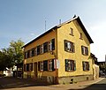 |
Burgstraße 26 Location hallway: 17, parcel: 197/2 |
1825 to 1875 |
46042 |
||
 more pictures |
Former cellar building | Burgstrasse 28 Location hallway: 17, parcel: 202/19 |
1720 |
46043 |
|
 |
'Old Castle' and remnants of the bridge | Burgstrasse o. Nr./Kellereiplatz location floor: 17, parcel: 437/204 |
Late 14th century |
46069 |
|
| Garden shed | Cohausenstraße 2 Location hall: 54, parcel: 34 |
1875 to 1885 |
46044 |
||
| Studio house | Dr.-Heimen-Weg 6 Location corridor: 40, parcel: 131/1, 132 |
46045 |
|||
| Complete old town |
location |
46015 |
|||
| Entire facility at Breckenheimer Strasse, villa area | Breckenheimer Strasse, villa area Lage |
Early 20th century |
46018 |
||
 |
Complete facility at Brühlstrasse / Neugasse | Brühlstrasse / Neugasse location |
1895 to 1905 |
46016 |
|
| Entire facility at Gartenstrasse / Ostendstrasse | Gartenstrasse / Ostendstrasse location |
1902 to 1952 |
46017 |
||
 |
railway station | Hattersheimer Straße 6 Location corridor: 52.53, parcel: corridor: 52: 218/6; Corridor 53: 23/16 |
The train station, built in 1906 in the Heimatschutz style, is a plastered building (an originally existing upper floor in half-timbered construction was later removed) with a distinctive raised structure made of Taunus quartzite in the base area and on the walls . The lintels and sills are made of red Main sandstone . The slate hip roof is structured in many ways. | 1906 |
46046 |
 |
Former 'Nassauer Hof' | Hauptstrasse 11 position hallway: 16, parcel: 231/1 |
Early 18th century |
46047 |
|
 |
Hauptstraße 14, corridor location : 16, parcel: 37/1 |
Late 18th century |
53337 |
||
 more pictures |
Former customs house | Main 20/20 a location hallway: 16, parcel: 182, 183 |
1584 |
46048 |
|
 |
Hauptstraße 21 Location hallway: 16, parcel: 261 |
1745 to 1755 |
46049 |
||
 more pictures |
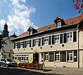
Hauptstraße 22, location floor: 16, parcel: 516/181 |
1475 to 1525 |
46050 |
||
 |
Hauptstraße 23, corridor location : 16, parcel: 274/5, 274/1 |
1643 |
46051 |
||
 |
Hauptstraße 25 Location hallway: 16, parcel: 274/6 |
Early 18th century |
46052 |
||
 more pictures |
Hauptstraße 26, location floor: 16, parcel: 173 |
1695 to 1705 |
46053 |
||
 |
Hauptstrasse 27 position hallway: 16, parcel: 275/2 |
1815 to 1825 |
46054 |
||
 more pictures |
Hauptstrasse 29 position hallway: 16, parcel: 276/1 |
Late 17th century |
46056 |
||
 |
Catholic parish church of St. Peter and Paul | Hauptstraße 30, location floor: 16, parcel: 836 / 168,411 / 169 |
1476 to 1486 |
46057 |
|
 |
Hauptstraße 31 Location hallway: 16, parcel: 277/2 |
1686 |
46058 |
||
 |
Hauptstraße 32/34 Location hall: 16, parcel: 149 to 153 |
1675 to 1725 |
46059 |
||
 |
Hauptstrasse 35 position hallway: 16, parcel: 299/1 |
1725 to 1775 |
46060 |
||
 more pictures |
Hauptstrasse 38 position hallway: 16, parcel: 143/1 |
1725 to 1775 |
46061 |
||
 more pictures |
Old Town Hall | Hauptstraße 40 Location hallway: 17, parcel: 108 |
1529 |
46062 |
|
 |
Hauptstraße 48 Location hall: 17, parcel: 76 |
Early 17th century |
46063 |
||
 |
Hauptstrasse 50 position hallway: 17, parcel: 620/75 |
1626 |
46064 |
||
 more pictures |
Material part: Relief | Hauptstraße 53, location floor: 17, parcel: 131 |
46065 |
||
 |
'Blue House' | Kapellenstraße 11 Location hallway: 2, parcel: 221/2 |
46066 |
||
 |
Kapellenstraße 17 Location hallway: 2, parcel: 202/1 |
1904 |
46067 |
||
 |
Kapellenstraße 37 Location hallway: 2, parcel: 184/2 |
1895 to 1905 |
46068 |
||
 |
Kleine Stephanstraße 1 Location hall: 16, parcel: 103 |
1521 |
46070 |
||
 |
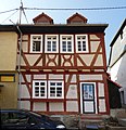
Kleine Stephanstraße 2 Location hall: 16, parcel: 858/130 |
End of the 16th century |
46071 |
||
 |
Kleine Stephanstraße 3 Location hallway: 16, parcel: 104/1 |
1625 to 1675 |
46072 |
||
| Kleine Stephanstraße 7 Location hall: 16, parcel: 109/1 |
1692 |
46073 |
|||
 |
Krebsgasse 3 location hall: 17, parcel: 69 |
1589 |
46075 |
||
 |
Krebsgasse 4/6 location floor: 17, parcel: 83, 84, 85 |
1675 to 1725 |
46074 |
||
 |
Krebsgasse 5 location hall: 17, parcel: 68 |
1525 to 1575 |
46076 |
||
 |
Krebsgasse 8 Location hall: 17, parcel: 86/1 |
Late 17th century |
46077 |
||
 |
Kurhausstraße 4 Location hall: 17, parcel: 98/3 |
1625 to 1675 |
46078 |
||
 |
Kurhausstraße 5 Location hallway: 17, parcel: 601/79 |
1625 to 1675 |
46079 |
||
 more pictures |
Protestant church | Kurhausstraße 22 Location hallway: 43, parcel: 101/3 |
1900 |
46080 |
|
 |
Kurhausstraße 41 Location hall: 2, parcel: 157/3 |
1899 |
46081 |
||
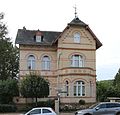 |
Kurhausstraße 43 Location hall: 2, parcel: 156/2 |
1900 |
46082 |
||
 |
Kurhausstraße 62 Location hall: 2, parcel: 188, 189/1 |
Late 19th century |
46083 |
||
 |
Burkart mill | Kurhausstraße 71 Location hallway: 58, parcel: 24,25,27 / 1 |
46084 |
||
 |
Langgasse 1 location floor: 17, parcel: 100/13 |
Late 17th century |
46085 |
||
 |
Langgasse 4 location floor: 16, parcel: 141 |
Late 17th century |
46086 |
||
| Langgasse 5a location floor: 16, parcel: 855/128 |
1725 to 1775 |
46107 |
|||
 |
Long Lane 6 position hallway: 16, parcel: 154/1 |
End of the 16th century |
46087 |
||
| Langgasse 11 Location hall: 16, parcel: 120/1 |
1565 |
46088 |
|||
 more pictures |
Langgasse 12 Location floor: 16, parcel: 157 |
1688 |
68120 |
||
 |
Langgasse 13 Location floor: 16, parcel: 123/2 |
1725 to 1775 |
46089 |
||
 |
Langgasse 15 Location floor: 16, parcel: 122/2 |
1725 to 1775 |
46090 |
||
 |
Langgasse 17 Location floor: 16, parcel: 115/2 |
1686 |
46091 |
||
 |
Langgasse 23 Location floor: 16, parcel: 112/1 |
Late 17th century |
46092 |
||
 more pictures |
Remnants of the city wall | Mauergasse location floor: 16, parcel: 648/50, 510/38 |
Late 14th century |
46093 |
|
 more pictures |
Mauergasse 3 Location floor: 16, parcel: 164 |
1725 to 1775 |
46094 |
||
 more pictures |
Mauergasse 15 Location floor: 16, parcel: 158 |
1688 |
46095 |
||
 more pictures |
Pestalozzi School | Ostendstraße 13 Corridor location : 48, parcel: 9/1 |
Early 20th century |
46096 |
|
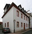 |
Rectory | Pfarrgasse 2 position hallway: 16, parcel: 308/1 |
1755 to 1765 |
46097 |
|
| Pfarrgasse 11 Location hall: 16, parcel: 298/5 |
Late 17th century |
46099 |
|||
| Pfarrgasse 13 Location hall: 16, parcel: 297/3 |
1695 to 1705 |
46100 |
|||
 |
Pfarrgasse 15 Location hall: 16, parcel: 297/1 |
1695 to 1705 |
46101 |
||
| Rheingaustraße 15 Corridor location : 55, parcel: 40/1 |
46102 |
||||
| Rödersteinweg 2 Corridor location : 40, parcel: 8 |
1908 |
46103 |
|||
| Schillerstraße 9 Location hall: 56, parcel: 111/3 |
1885 to 1895 |
46104 |
|||
 |
Residential building | Stephanstraße 7 Location floor: 16, parcel: 70/1 |
68980 |
||
 |
Stephanstraße 10/12 Location floor: 16, parcel: 94, 93 |
1675 to 1725 |
46105 |
||
| Stephanstraße 24/26 Location hall: 16, parcel: 105, 106 |
1688 |
46106 |
|||
 |
Stollbergstraße 4 Location floor: 16, parcel: 857/129 |
1695 to 1705 |
46108 |
||
 |
Stollbergstraße 6/8 Location floor: 16, parcel: 102, 101 |
1695 to 1705 |
46109 |
||
| Factual part: basement | Stollbergstraße 12 Location floor: 16, parcel: 95 |
1716 |
46110 |
||
 |
Taubengasse 4, corridor location : 17, parcel: 133/1 |
1675 to 1725 |
46111 |
||
 |
Vincenzstraße 4 Location hall: 56, parcel: 5/10 |
1885 to 1895 |
46112 |
||
 |
Vincenzstraße 5/7 location corridor: 54, parcel: 24/1, 27/4 |
46113 |
|||
 |
Vincenzhaus | Vincenzstraße 29 Location corridor: 56, parcel: 22 / 14,22 / 17 |
1880 |
46114 |
|
 more pictures |
Vincenzstraße 37 Location hallway: 56, parcel: 6/2 |
Early 20th century |
46115 |
||
 more pictures |
Vincenzstraße 39 Location hall: 56, parcel: 7/1 |
46116 |
|||
 |
Webergasse 1 location hall: 16, parcel: 175 |
Late 17th century |
46117 |
||
 |
Webergasse 2, location floor: 16, parcel: 179 |
1548 |
46118 |
||
 |
Webergasse 4 Location floor: 16, parcel: 178 |
1905 to 1915 |
46119 |
||
| Zanggasse 6 Location hall: 17, parcel: 146/1 |
1725 to 1775 |
46120 |
Langenhain
| image | designation | location | description | construction time | Object no. |
|---|---|---|---|---|---|
 |
Langenhain, Alt Langenhain 1 location hall: 12, parcel: 239/6 |
1625 to 1675 |
46157 |
||
 |
Langenhain, Alt Langenhain 6 Location floor: 12, parcel: 28 |
Late 17th century |
46158 |
||
 more pictures |
Langenhain, Alt Langenhain 8 Location hall: 12, parcel: 42/1 |
1725 to 1775 |
46159 |
||
 |
Langenhain, Alt Langenhain 10 Location floor: 12, parcel: 44/1 |
1675 to 1725 |
46160 |
||
 |
Langenhain, Alt Langenhain 15 Location floor: 12, parcel: 213/6 |
1753 |
46161 |
||
 more pictures |
Langenhain, Alt Langenhain 16 Location floor: 12, parcel: 89/3 |
1715 to 1725 |
46162 |
||
 more pictures |
Langenhain, Alt Langenhain 18 Location floor: 12, parcel: 92/3 |
1715 to 1725 |
46163 |
||
 |
Langenhain, Alt Langenhain 19 Location floor: 12, parcel: 205/3 |
1731 |
46164 |
||
 more pictures |
Langenhain, Alt Langenhain 20 Location floor: 12, parcel: 108 |
1695 to 1705 |
46165 |
||
 |
Langenhain, Alt Langenhain 29/31 Location floor: 12, parcel: 190/3, 184/3 |
1779 |
46166 |
||
 more pictures |
Langenhain, Alt Langenhain 32 Location floor: 12, parcel: 163/2 |
Late 17th century |
46167 |
||
 |
Langenhain, Alt Langenhain 34 Location floor: 12, parcel: 162/1 |
Late 17th century |
46168 |
||
 more pictures |
Langenhain, Alt Langenhain 36 Location floor: 12, parcel: 161/3 |
Late 17th century |
46169 |
||
 more pictures |
Langenhain, Alt Langenhain 37 Location hall: 12, parcel: 175/7 |
1695 to 1705 |
46170 |
||
 more pictures |
Evangelical church, churchyard with gravestones and memorial for the fallen | Langenhain, Alt Langenhain 39 Location floor: 12, parcel: 174, 173/2 |
1750 |
46171 |
|
 |
Former head forester's office | Langenhain, Am Jagdhaus 2 Location hall: 12, parcel: 50/2 |
Two-storey, plastered baroque building with a mansard roof. Built in 1736 as a forest ranger's office, from 1826 school and town hall extension with 2 classrooms in 1903/04, basic renovation in 1975, today used as a branch of the administration and local court | 1736 |
46172 |
 |
Langenhain, Am Jagdhaus 3 Location hall: 34, parcel: 4/1 |
1821 |
46173 |
||
 more pictures |
Langenhain, Enge Straße 3 Location hall: 12, parcel: 51/3 |
Early 18th century |
46174 |
||
 |
Langenhain, Enge Straße 5 Location hall: 12, parcel: 47/1 |
1846 to 1856 |
46175 |
||
 more pictures |
Bahá'i Temple | Langenhain, Eppsteiner Straße 89 Location hall: 35, parcel: 14/1 |
1964 |
46176 |
|
 more pictures |
Entire facility in Langenhain | Langenhain location |
46156 |
||
 more pictures |
[[Martin-Luther-Strasse 1 (Langenhain) |]] | Langenhain, Martin-Luther-Straße 1 Location floor: 12, parcel: 172/6 |
In the fork in the road between Martin-Luther-Straße and Alt Langenhain is the gable-free, plastered half-timbered house with a gable roof as the head building. The older part of the house dates from 1744. The front part of the house in two-storey, undisturbed frame construction is dated to the second half of the 17th century. In 1820 he was moved a few meters back from the road. From 1802 to 1826 the building served as a school house. The teacher's apartment was on the upper floor, and the classroom, in which up to 80 students were taught, in the basement. In 1826 the school was moved to the hunting lodge and this building was used for residential purposes again. The owner was then farmer Jacob R. Löw. | Late 17th century |
46177 |
 more pictures |
Langenhain, Martin-Luther-Straße 4 Location floor: 12, parcel: 119/2 |
1725 to 1775 |
46178 |
||
| Elevated water tank 'Katzenlückstollen' - Won 'Katzenlück' | Long Grove, No Address Location Village: 35 plot: 6 |
1913 |
68124 |
||
| Elevated water reservoir - Won 'parish forests' | Long Grove, No Address Location Village: 39, parcel: 20 |
1901 |
68119 |
||
 |
Langenhain, Oranienstraße 3 Location floor: 12, parcel: 105 |
1760 |
46179 |
Lorsbach
| image | designation | location | description | construction time | Object no. |
|---|---|---|---|---|---|
 |
Alt Lorsbach 10, corridor location : 7, parcel: 29/1 |
1675 to 1725 |
46183 |
||
 |
Rectory | Alt Lorsbach 12, corridor location : 7, parcel: 126/1 |
1715 to 1725 |
46184 |
|
 |
Alt Lorsbach 16 Location corridor: 7, parcel: 136 |
1725 to 1775 |
46185 |
||
 |
Alt Lorsbach 18 Location corridor: 17, parcel: 146/1 |
Early 18th century |
46186 |
||
 |
Alt Lorsbach 22 Location floor: 17, parcel: 143 |
Late 18th century |
46187 |
||
 |
Alt Lorsbach 23 Location hall: 7, parcel: 110/5 |
1675 to 1725 |
46188 |
||
 |
Alt Lorsbach 26 Location floor: 17, parcel: 140/6 |
1821 |
46189 |
||
 |
barn | Alt Lorsbach 35 Location floor: 7, parcel: 119 |
in the meantime collapsed and completely eroded | 1675 to 1725 |
46190 |
|
more pictures |
Lorsbach station | Am Bahnhof 4 Location Village: 6, parcel: 33 / 6.33 / 14 |
1905 |
68992 |
|
 more pictures |
Entire facility at Brückenstrasse | Brückenstrasse location |
Early 20th century |
46182 |
|
 |
Complete plant Former leather factory | In Lorsbachtal 29 location |
Late 19th century |
46194 |
|
| Entire site center |
location |
46181 |
|||
 more pictures |
Old cemetery, memorial to the fallen | Goethestrasse / Hainer Weg Location floor: 17, parcel: 58 |
1945 to 1955 |
46191 |
|
| Gundelhardtstraße 1 Location hallway: 4, parcel: 149/7 |
1905 to 1915 |
46192 |
|||
| Lorsbach waterworks | Hainer Weg o. No. Location floor: 17, parcel: 73/1 |
82456 |
|||
 |
Hofheimer Straße 35 Location hall: 18, parcel: 61/5 |
1895 to 1905 |
46193 |
||
 |
Kirchstraße 4 Location hall: 7, parcel: 210/25 |
Late 18th century |
46195 |
||
 |
Evangelical parish church | Kirchstraße 8 Location hallway: 7, parcel: 18/1 |
1780 |
46196 |
|
 more pictures |
Kirchstraße 19 Location hall: 7, parcel: 165/2 |
1695 to 1705 |
46197 |
||
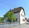 |
Kirchstraße 22 Location hall: 7, parcel: 207/6 |
1771 |
46198 |
||
| Elevated water reservoir 'Reiche Quelle' | Without Address Location hall: 15, parcel: 8/1 |
1926 |
68118 |
||
 more pictures |
Zwergstraße 3, location hall: 7, parcel: 132 |
Eaves half-timbered building from the late 18th century, which connects the barn and living area under a gable roof. As a single house, a rare type of house in a circle. | 1807 |
46199 |
Marxheim
| image | designation | location | description | construction time | Object no. |
|---|---|---|---|---|---|
| Forestry Office | Am Forst House 10 position corridor 21, parcel: 6 / 9,6 / 10 |
46020 |
|||
| Birkenweg 11 Location hall: 5, parcel: 147/2 |
1725 to 1775 |
46202 |
|||
 |
Eichstraße 4 and 4a location hallway: 5, plot: 560 / 136.558 / 136 |
1715 to 1725 |
46203 |
||
 more pictures |
Eichstraße 5 position hallway: 4, plot: 337/239 |
Late 17th century |
46204 |
||
 |
Catholic parish church of St. George | Eichstraße 6 Location floor: 5, parcel: 536/137, 138/1 |
1845 |
46205 |
|
 |
Eichstraße 7 Location hallway: 4, parcel: 240 |
Late 17th century |
46206 |
||
 |
Eichstraße 14 Location floor: 4, parcel: 266/2 |
1675 to 1725 |
46207 |
||
 |
Eichstraße 16 Location hallway: 4, parcel: 264/5 |
1695 to 1705 |
46208 |
||
 |
Rectory | Eichstraße 17 Location floor: 4, parcel: 250/1 |
1675 to 1725 |
46209 |
|
 |
Eichstraße 18 Location floor: 4, parcel: 262/2 |
Late 17th century |
46210 |
||
 |
Cemetery, cemetery cross and tombstones | Eichstrasse o. No. Location floor: 32, parcel: 308 |
1833 |
46213 |
|
 more pictures |
Fallen memorial | Eichstrasse o. No. Location floor: 32, parcel: 119 |
1933 |
46212 |
|
 |
crossroads | Eichstrasse o. No. Location floor: 33, parcel: 67 |
1725 to 1775 |
46211 |
|
| Complete facility in Marxheim |
location |
1675 to 1725 |
46201 |
||
| Catholic Church of St. Bonifatius with rectory (Herderstrasse 17) and community center | Hermann-Löns-Straße 26 Location floor: 21, parcel: 123-134 |
1967 |
53340 |
||
 |
Höhenstraße 2/4 location hall: 4, parcel: 119, 120, 121 |
1745 to 1755 |
46214 |
||
| barn | High Road 7 position hallway: 4, plot: 126, 329/127 |
1756 |
46215 |
||
| Brandweiher (extinguishing water pond) | Kassernstraße o. No. Location floor: 32, parcel: 20 |
1845 to 1855 |
68116 |
||
 |
Pietà | Next to Schulstraße 51, location hall: 5, parcel: 123/3 |
1750 |
46233 |
|
| Elevated water tank 'Pfingstweide' | Without Address Location hall: 35, parcel: 44 |
1920 |
68117 |
||
 more pictures |
Ringstrasse 2, location of hallway: 4, parcel: 425/143 |
1705 to 1715 |
46216 |
||
 |
Ringstraße 3, location floor: 5, parcel: 387/113 |
1695 to 1705 |
46217 |
||
 |
Ringstrasse 13 Location hallway: 5, parcel: 103/2 |
1675 to 1725 |
46218 |
||
 more pictures |
Schloßstraße 6 Location hall: 32, parcel: 28/4 |
1795 to 1805 |
46219 |
||
| Monastery church 'House of the Good Shepherd' | Schloßstraße 119 Location hall: 19, parcel: 2 / 3.3 / 17 |
1825 to 1875 |
53339 |
||
 |
chapel | Schulstraße 19 Location floor: 5, parcel: 251 |
1777 |
46220 |
|
 |
Schulstraße 21 Location floor: 5, parcel: 378/42 |
1695 to 1705 |
46221 |
||
 |
Schulstraße 23 Location hall: 5, parcel: 43/1 |
Late 17th century |
46222 |
||
 |
Schulstraße 28a Location hallway: 5, parcel: 517/164 |
1625 to 1675 |
46223 |
||
 |
Schulstraße 30 Location floor: 5, parcel: 161/2 |
Early 18th century |
46224 |
||
|
more pictures |
School / town hall | Schulstraße 31 Location hall: 5, parcel: 58/2 |
1855 |
46225 |
|
| Schulstraße 32 Location hallway: 5, parcel: 160 |
1675 to 1725 |
46226 |
|||
 more pictures |
Schulstraße 33 Location hall: 5, parcel: 64/5 |
1695 to 1705 |
46227 |
||
 |
Schulstraße 34 Location hallway: 5, parcel: 157/1 |
Late 17th century |
46228 |
||
 |
Schulstraße 42 Location hallway: 5, parcel: 463/150 |
1715 to 1725 |
46229 |
||
| Schulstraße 44 Location hallway: 5, parcel: 149/5 |
1775 to 1785 |
46230 |
|||
 |
Schulstraße 46 Location hallway: 5, parcel: 148/3 |
1675 to 1725 |
46231 |
||
 |
Schulstraße 48 Location floor: 5, parcel: 134/1 |
1725 to 1775 |
46232 |
||
 |
Schulstraße 54 Location hallway: 4, parcel: 224/1 |
1695 to 1705 |
46234 |
||
 more pictures |
barn | Schulstraße 57 Location hallway: 5, parcel: 118 |
1625 to 1675 |
46235 |
|
 more pictures |
Schulstraße 58 Location hallway: 4, parcel: 154/1 |
1675 to 1725 |
46236 |
||
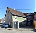 |
Schulstraße 59 Location hallway: 5, parcel: 116/1 |
1695 to 1705 |
46237 |
||
 |
Schulstraße 61 Location hallway: 4, parcel: 333/148 |
Late 17th century |
46238 |
||
 |
Schulstraße 62 Location floor: 4, parcel: 158 |
1715 to 1725 |
46239 |
||
| barn | Schulstraße 67 Location hallway: 4, parcel: 114 |
1725 to 1775 |
46240 |
||
 more pictures |
Schulstraße 69 Location hallway: 4, parcel: 113/1 |
Late 18th century |
46241 |
||
 more pictures |
Schulstraße 70 Location hallway: 4, parcel: 168/2 |
1675 to 1725 |
46242 |
Wallau
| image | designation | location | description | construction time | Object no. |
|---|---|---|---|---|---|
 more pictures |
Cemetery, tombs | Wallau, outside of the local area, corridor: 47, parcel: 23/1 |
Protected are the Rübsamen tomb (artistically valuable bronze relief), Wick tomb (electroplating of a mourner, around 1922), historical grave monuments in the old cemetery chapel (three 18th century tombstones with vanitas motifs (skull, hourglass) and valuable late baroque inscriptions) | Early 20th century |
46285 |
 more pictures |
obelisk | Wallau, outside local situation situation Village: 51 parcel: 26.01 |
Wandersmann is the popular name for a 20-ton sandstone obelisk with a fountain near the Wiesbadener Kreuz on the Bundesautobahn 66 . | 1819 |
46286 |
 |
Wallau, Bleichstraße 2 Location floor: 21, parcel: 105 |
1725 to 1775 |
46246 |
||
 |
Wallau, Bleichstraße 5 Location hallway: 21, parcel: 68 |
1675 to 1725 |
46247 |
||
 |
Wallau, Bleichstraße 6 Location floor: 21, parcel: 119/1 |
Late 17th century |
46248 |
||
 |
Wallau, Bleichstraße 15 Location floor: 21, parcel: 60 |
1725 to 1775 |
46249 |
||
| Wallau, Wallau location as a whole |
The entire complex comprises large parts of the village of Wiesbadener Strasse, Rathausstrasse, Herrnhäuser Strasse, Bleichstrasse and a few side streets, which were formerly surrounded by the Haingraben, and developed in the 18th century. |
46245 |
|||
 |
Former Hattsteiner Hof | Wallau, Herrnhäuser Straße 1 Location hall: 21, parcel: 94/1 |
1733 |
46250 |
|
 more pictures |
Wallau, Herrnhäuser Straße 3 Location hall: 21, parcel: 91/4 |
1695 to 1705 |
46252 |
||
 |
Wallau, Herrnhäuser Straße 4 Location hall: 21, parcel: 103/3 |
Early 18th century |
46253 |
||
 |
Wallau, Herrnhäuser Straße 6 Location hall: 21, parcel: 104/1 |
1695 to 1705 |
46254 |
||
 more pictures |
Wallau, Herrnhäuser Straße 7 Location hall: 21, parcel: 92/5 |
1545 to 1555 |
46255 |
||
 more pictures |
barn | Wallau, parish 2, corridor location : 21, parcel: 169/7 |
1845 to 1855 |
46256 |
|
 more pictures |
Wallau, parish 3 location corridor: 21, parcel: 180 |
1725 to 1775 |
46257 |
||
 more pictures |
Former Wallau waterworks (Whb) | Wallau, Langenhainer Straße o. No. Location hall: 38, parcel: 33/2 |
68125 |
||
 more pictures |
Jewish Cemetery | Wallau, Langenhainer Straße o. No. Location floor: 38, parcel: 108/28 |
Wallau's Jewish cemetery was laid out in the 18th century at the latest. Its size is 3142 m². 185 graves have been preserved. In the older, eastern part there are a number of old, partly illegible gravestones from the 17th and 18th centuries. The newer, western part contains a memorial stone for the Jewish fallen in World War I and a plaque with the names of 34 missing soldiers. | 1675 to 1725 |
46258 |
 more pictures |
Evangelical parish church | Wallau, Pfarrbornstraße 1, location floor: 21, parcel: 172,173 / 3 |
The Evangelical Parish Church from 1741/42 is a simple, plastered baroque building with a rubble stone base and a few sandstone links. The high-quality, uniform interior is from the construction period. The organ from 1753 (Joh. Chr. Köhler, Frankfurt) shows rich baroque ornaments. Several graves, including the grave stone of the Upper mayor of domination Eppstein , Hermann beet King get are the 1624th | 1742 |
46259 |
 |
former high school apartment | Wallau, Pfarrbornstraße 2 Location hall: 21, parcel: 98 |
Late 18th century |
46260 |
|
 |
Wallau, Pfarrbornstraße 4 Location floor: 21, parcel: 97 |
1679 |
46261 |
||
 |
Wallau, Pfarrbornstraße 6 Location floor: 20, parcel: 37 |
68126 |
|||
 |
Wallau, Pfarrbornstraße 9 Location floor: 20, parcel: 14 |
1715 to 1725 |
46262 |
||
 |
Wallau, Pfarrbornstraße 20 Location floor: 20, parcel: 32/2 |
1801 |
46263 |
||
 |
Former town hall | Wallau, Rathausstraße 2 Location hall: 21, parcel: 171/1 |
1730 |
46264 |
|
 |
Former Bleidenstadt monastery courtyard | Wallau, Rathausstraße 4 / 4a Location floor: 21, parcel: 169/3, 169/4 |
1743 |
46266 |
|
 more pictures |
Wallau, Rathausstraße 9 Location floor: 21, parcel: 111 |
1625 to 1675 |
46267 |
||
 |
Wallau, Rathausstraße 10 Location floor: 21, parcel: 165/6 |
1895 to 1905 |
46268 |
||
 |
Wallau, Rathausstraße 12 Location hall: 21, parcel: 163/2 |
1725 to 1735 |
46269 |
||
 |
Wallau, Rathausstraße 14 Location hall: 21, parcel: 158 |
Late 18th century |
46270 |
||
| Wallau, Rathausstraße 16 Location hall: 21, parcel: 157/3 |
1855 |
46271 |
|||
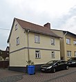 |
Wallau, Rathausstraße 17 Location hall: 21, parcel: 115/1 |
1725 to 1775 |
46272 |
||
 |
Wallau, Rathausstraße 20 Location floor: 21, parcel: 153 |
House number 18 is shown in the picture. The house number 20 is at the back and cannot be seen clearly from the street. It is the corner of a half-timbered house at the top right in the background. | 1675 to 1725 |
46273 |
|
 |
Wallau, Rathausstraße 23 Location floor: 21, parcel: 117 |
1675 to 1725 |
46274 |
||
 |
Wallau, Rathausstraße 24 Location hall: 21, parcel: 146/1 |
1775 to 1785 |
46275 |
||
 |
Former office building | Wallau, Receptur-Hof 3 Location hall: 21, parcel: 100/11 |
1768 |
46251 |
|
 more pictures |
Reception yard | Wallau, Receptur-Hof 4/5 Location hall: 21, parcel: 100/4 |
1425 to 1475 |
46265 |
|
 |
Wallau, Taunusstraße 2 Location floor: 33, parcel: 15/1 |
1904 |
46276 |
||
 |
Evangelical rectory | Wallau, Wiesbadener Straße 1 Location floor: 20, parcel: 174 |
1725 to 1775 |
46277 |
|
 more pictures |
Wallau, Wiesbadener Straße 4 Location hall: 20, parcel: 8/1 |
1725 to 1775 |
46278 |
||
 |
Wallau, Wiesbadener Straße 6 Location floor: 20, parcel: 5 |
Late 18th century |
46279 |
||
| Wallau, Wiesbadener Straße 9 Location floor: 33, parcel: 39/1 |
1795 to 1805 |
46280 |
|||
 |
Wallau, Wiesbadener Straße 10 Location floor: 20, parcel: 2 |
1732 |
46281 |
||
 |
Wallau, Wiesbadener Straße 12 Location floor: 20, parcel: 1 |
1899 to 1909 |
46282 |
||
 |
barn | Wallau, Zur Burg 8 Location hall: 21, parcel: 86/1 |
1725 to 1775 |
46283 |
|
 |
Wallau, Zur Burg 22 Location hall: 20, parcel: 69/1 |
1725 to 1775 |
46284 |
Wild Saxons
| image | designation | location | description | construction time | Object no. |
|---|---|---|---|---|---|
| Half-timbered house | Wildsachsen, Alt Wildsachsen 17 Location floor: 5, parcel: 13/4 |
Gable-independent, plastered and clad two-story half-timbered house of a former two-sided courtyard. The frame construction, presumably in exposed framework, dates from the first half of the 18th century. | Early 18th century |
46288 |
|
| Half-timbered house | Wildsachsen, Alt Wildsachsen 21 Location floor: 5, parcel: 11 |
Small, plastered, gable-independent, two-storey half-timbered house in a central German courtyard with the high, roofed side gate. The house dates from the first half of the 18th century. | Early 18th century |
46289 |
|
| Hook yard | Wildsachsen, Alt Wildsachsen 28a Location floor: 5, parcel: 40 |
Most of the original Hakenhof from the first half of the 18th century. The two-story house is a plastered half-timbered house on a field stone base. | Early 18th century |
46290 |
|
 more pictures |
Protestant church | Wildsachsen, Alt Wildsachsen 33 Location floor: 5, parcel: 3 |
Small, rectangular church building from 1748. Components of the Romanesque chapel, consecrated for the first time in 1145, are included. The galleries and the pulpit with tendril ornaments date from the beginning of the 18th century. The organ was built around 1713 by Georg Friedrich Weißhaupt from Idstein. There are historical tombstones from the 19th century in the churchyard. | 1748 |
46291 |
 |
Half-timbered house | Wildsachsen, Alt Wildsachsen 34 Location floor: 5, parcel: 7 |
Gable-independent, two-story half-timbered house with a crooked hip from around 1700. | 1695 to 1705 |
46292 |
| Cemetery, memorial to the fallen | Wildsachsen, Alt Wildsachsen no. Location floor: 6, parcel: 106, 107 |
The memorial for the fallen of the First World War was built by the community in 1921. It was later dedicated to those who fell in 1914–18 as well as to those who fell in 1939–45. It consists of a statue of a praying soldier in uniform, rifle in his arm, leaning on a high, rusticated plinth. | 1921 |
46293 |
|
 |
Half-timbered house | Wildsachsen, Am Born 7 Location floor: 5, parcel: 28 |
Half-timbered house in an exposed corner of an earlier hooked courtyard from around 1720. Expressive visible framework with many decorative elements. | 1715 to 1725 |
46294 |
Web links
Commons : Cultural monuments in Hofheim am Taunus - collection of images, videos and audio files
- State Office for Monument Preservation Hessen (Ed.): Cultural monuments in Hofheim am Taunus In: DenkXweb, online edition of cultural monuments in Hessen
Individual evidence
- ↑ Blackboard at the house
