List of cultural monuments in Hochheim am Main
The following list contains the cultural monuments identified in the monument topography in the area of the municipality of Hochheim am Main , Main-Taunus-Kreis , Hesse .
- Note: The order of the monuments in this list is based first on the districts and then on the address; alternatively, it can also be sorted according to the name, the number assigned by the State Office for Monument Preservation or the construction time.
The basis is the publication of the Hessian list of monuments, which was created for the first time on the basis of the Monument Protection Act of September 5, 1986 and has been continuously updated since then.
Hochheim am Main
| image | designation | location | description | construction time | Object no. |
|---|---|---|---|---|---|
 more pictures |
Schönborner Hof | Aichgasse 3 location floor: 39, parcel: 171/81 |
The Schönburger Hof is a stately, two-storey courtyard building with an adjoining plastered, partly old surrounding wall. A sandstone plaque with the coat of arms of Schönborn- Boineburg from 1659 is embedded in the wall. | late 18th century |
45831 |
 |
Aichgasse 5 Location hall: 39, parcel: 119 |
Half-timbered house | mid 18th century |
45832 |
|
 more pictures |
Aichgasse 8 Location hall: 39, parcel: 80 |
Half-timbered house with a limestone base | late 18th century |
45833 |
|
 |
Aichgasse 11 and 13 Location floor: 39, parcel: 114/3 + 4 |
Baroque homestead of the Frankfurt Carmelite monastery | 18th century |
45834 |
|
| Daubhaus | On Daubhaus 6 Location Village: 61, parcel: 02.10 |
villa | around 1910 |
45898 |
|
 |
Am Plan 1 position hall: 39, parcel: 233/50 |
Half-timbered corner house | late 18th century |
45835 |
|
| Am Plan 2 position hall: 39, parcel 51 |
Residential building | around 1770 |
45837 |
||
 more pictures |
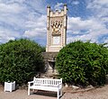
Madonna figure | On the plan or no. Location hall: 40, parcel: 88/2 |
Late baroque life-size sandstone figure | 1770 |
45836 |
 |
Queen Victoria Monument | Outside local situation, Vineyards location hall 25, parcel: 166/8 |
Neo-Gothic memorial for the visit of Queen Victoria | 1854 |
45973 |
 |
Sandstone relief | Outside of the village, vineyards, Neue Bergweg / Steinweg location hallway: 30, parcel: 134/2 |
Holy House | 1729 |
45971 |
 |
Wayside shrine | Outside local situation, vineyards, reinweg / Rossgängerweg able corridor: 35, parcel: 79/4 |
1512 |
45970 |
|
| crossroads | Outside the village, vineyards, Sandweg / Bangertweg location hallway: 31, parcel: 97/1 |
Classicist sandstone cross | 1810 |
45972 |
|
 |
Bahnhofstraße 2 Location hallway: 31, parcel: 396/41 |
Former sparkling wine cellar | 1893 |
45838 |
|
| Bahnhofstraße 8 Location hall: 31, parcel: 144/19 |
Single family home by Helmut Rhode | around 1930 |
45839 |
||
 |
Hochheim station | Bahnhofstraße 9 Location hall: 32, parcel: 239/5 |
Station of the Taunusbahn | 1840 |
45840 |
 |
Bauerngasse 2 position hall: 39, parcel: 63/1 |
Half-timbered house | late 18th century |
45841 |
|
 |
Bauerngasse 8 position corridor 39, parcel: 63/1 |
Half-timbered corner house | from 1752 |
45883 |
|
| Fallen memorial | In Kirchstraße 29 position hall: 39, parcel: 45/37 |
Memorial to the fallen and missing of the world wars | around 1960 |
45895 |
|
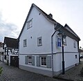 |
Blumengasse 1 position corridor 37, plot 51 |
Half-timbered house | late 18th century |
45842 |
|
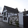 |
Blumengasse 5 position corridor 37, parcel: 101/48 |
Half-timbered house | around 1720 |
45843 |
|
 |
Blumengasse 6 Location floor: 37, parcel: 55 |
Plastered half-timbered house | late 18th century |
45844 |
|
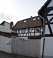 |
Blumengasse 7, location hall: 37, parcel: 46 |
Half-timbered house | around 1720 |
45845 |
|
 |
Blumengasse 8, location floor: 37, parcel: 56 |
Half-timbered house | around 1720 |
45846 |
|
 |
Evangelical parish church | Burgeffstraße 5 Location hall: 41, parcel: 200/81 |
Neo-Romanesque church building on the basis of an older chapel | 1894 |
45847 |
 more pictures |
Wayside shrine | Burgeffstraße 30 / Wilhelmstraße Location floor: 42, parcel: 76/1 |
Column shrine | 1613 |
45848 |
 |
Former wine press house | Burgeffstraße 32 Location floor: 42, parcel: 918/78 |
Brick building | around 1890 |
45849 |
 |
Burgeffstraße 40 Location hall: 42, parcel: 80 |
Brick residential house | around 1890 |
45850 |
|
 |
Water tower | Burgeffstraße 42 Location floor: 61, parcel: 479/8 |
around 1890 |
45851 |
|
 more pictures |
Former electricity company | Flörsheimer Straße 2 Location hallway: 12, parcel: 768/5 |
Brick building, in the shape of a villa | erected in 1904 |
45855 |
 |
Sandstone relief | Flörsheimer Straße / Goethestraße location floor: 14, parcel: 186 |
Holy House | rebuilt in 1964 |
45852 |
 more pictures |
Cemetery, crucifixion group, mausoleum, tombs | Flörsheimer Straße o. No. Location floor: 30, parcel: 12/12 |
1895 to 1905 |
45853 |
|
 |
Imperial Court | Frankfurter Straße 1 position hall: 40, parcel: 1/3 |
Brick building | 19th century |
45856 |
 more pictures |
Factual part: portal | Frankfurter Straße 8 Location hall: 41, parcel: 99/1 |
Baroque gate entrance | Early 18th century |
45858 |
 |
Frankfurter Straße 10 Location floor: 41, parcel: 227/98 |
Community center | 18th century |
45859 |
|
 |
Frankfurter Straße 12 Location hall: 41, parcel: 96/1 |
Plastered half-timbered house | late 18th century |
45860 |
|
 |
Frankfurter Straße 14 Location floor: 41, parcel: 210/94 |
Baroque house | 18th century |
45861 |
|
| Pietà | Frankfurter Straße 68 Location hallway: 13, parcel: 305/3 |
1885 |
45862 |
||
 |
Vineyard cottage | Compared to Mainzer Strasse 35 position hall: 35, parcel: 65/2 |
Neo-Gothic building | last third of the 19th century |
45921 |
 |
Privy Councilor Hummel Platz 1a Location hall: 37, parcel: 28/22 |
neo-classical administration building | 1887 |
45863 |
|
 |
Privy Councilor-Hummel-Platz 4 Location hall: 37, parcel: 13/2 |
late classicist villa | around 1875 |
45864 |
|
 |
Entire facility in Hochheim |
location |
45830 |
||
 |
Hintergasse 2 position hall: 40, parcel: 36/26 |
Inn building | 18th century |
45865 |
|
 |
Hintergasse 6 position corridor 40, plot 40 |
Half-timbered house | around 1730 |
45866 |
|
 |
Behind Gasse 7 position corridor 40, plot 20 |
Half-timbered house | late 18th century |
45867 |
|
 |
Behind Gasse 9 position corridor 40, plot 21 |
Half-timbered homestead | around 1750 |
45868 |
|
 more pictures |
Behind Gasse 10 position corridor 40, parcel: 42/1 |
House and cooperage | 1797 |
45869 |
|
 |
Hintergasse 20, corridor location : 40, parcel: 49/1 |
Small farmhouse | 1674 |
45870 |
|
 |
Hintergasse 21 Location hall: 40, parcel: 109/24 |
Half-timbered house | 1731 |
45871 |
|
 |
Behind Gasse 27 position corridor 40, plot 76 |
plastered half-timbered house | 17th century |
45872 |
|
 |
Hintergasse 34, corridor location : 40, parcel: 56/1 |
Hofreite | 17th century |
45873 |
|
 |
Hintergasse 42 position corridor 40, parcel: 62/2 |
Half-timbered house and barn | late 17th century |
45874 |
|
 |
Hintergasse 44 position corridor 40, parcel: 61/4 |
Half-timbered house | 1709 |
45875 |
|
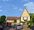 |
Hintergasse 50 position corridor 40, plot 65 |
narrow half-timbered house | 17th century |
45876 |
|
| Hintergasse 54 position corridor 40, plot 67 |
Half-timbered house | probably 17th century |
45877 |
||
| Hintergasse 60 position corridor 40, plot 70 |
Half-timbered house, east of the historic city wall | 17th century |
45878 |
||
 more pictures |
Catholic rectory | Hintergasse 62 position hall: 40, parcel: 71/1 |
around 1730 |
45879 |
|
 |
Material part: figure of Mary | Kirchstraße 2 Location hall: 40, parcel: 112/9 |
1725 to 1775 |
45880 |
|
 |
Kirchstraße 3 Location hall: 39, parcel: 54 |
Late 18th century |
45881 |
||
 |
Kirchstraße 10 Location hall: 40, parcel: 12 |
1796 |
45882 |
||
 |
Kirchstraße 12 Location hall: 40, parcel: 13/3 |
1725 to 1775 |
45884 |
||
 more pictures |
Kirchstraße 13 Location hall: 39, parcel: 67/3 |
1875 |
45885 |
||
 |
Kirchstraße 15 Location hall: 39, parcel: 67/1 |
Early 17th century |
45886 |
||
 |
Former land registry office | Kirchstraße 17 Location hall: 39, parcel: 133/1 |
1745 to 1755 |
45887 |
|
 |
Former customs office and district court | Kirchstrasse 19 location |
1725 |
45888 |
|
 |
Kirchstraße 20 Location hall: 40, parcel: 28/2 |
Late 17th century |
45889 |
||
 more pictures |
District court building with a former youth detention center | Kirchstraße 21 Location hall: 39, parcel: 227/136 |
1912 |
45890 |
|
 |
Former Domdechaney | Kirchstraße 23-25 Location hall: 39, parcel: 224/136 |
1767 |
45891 |
|
 |
Kirchstraße 24 Location hall: 40, parcel: 30/1 |
1725 to 1775 |
45892 |
||
 more pictures |
Catholic parish church of St. Peter and Paul | Kirchstraße 27 Location floor: 39, parcel: 183/140, 138/1 |
1731 |
45893 |
|
 |
Sexton's house | Kirchstraße 29 Location floor: 39, parcel: 141/2, 153/1 |
1746 |
45894 |
|
 more pictures |
Material part: Crescent Madonna | Kirchstraße 34 Location hall: 40, parcel: 125/82 |
1955 |
45896 |
|
 |
Kirchstraße 38 Location hall: 40, parcel: 78, 79 |
1795 to 1805 |
45897 |
||
 |
Lantern Lane 1 position corridor 39, parcel: 9/3 |
1711 |
45899 |
||
 |
Lantern Lane 4.2 Location Village: 39, parcel: 17.01, 01.18 |
1695 to 1705 |
45900 |
||
 |
Mainweg 7 position corridor 32, plot: 124/6 |
1928 |
45901 |
||
| Mainweg 24 Location floor: 31, parcel: 613 |
1815 to 1825 |
45902 |
|||
 |
Mainzer Straße 2 Location floor: 39, parcel: 49 |
1795 to 1805 |
45905 |
||
 |
Mainzer Straße 3 Location floor: 37, parcel: 68/1 |
1608 |
45906 |
||
 |
Mainzer Straße 4 Location floor: 37, parcel: 204/48 |
Early 17th century |
45907 |
||
 |
Mainzer Straße 5 Location floor: 37, parcel: 105/67 |
1795 to 1805 |
45908 |
||
| Mainzer Straße 8 Location floor: 39, parcel: 46 |
1775 to 1785 |
45909 |
|||
 |
Mainzer Straße 10 Location floor: 39, parcel: 162/31 |
1725 to 1775 |
45910 |
||
 |
Mainzer Straße 13 Location floor: 37, parcel: 58/1 |
1675 to 1725 |
45911 |
||
 |
Mainzer Straße 15 Location floor: 37, parcel: 57 |
1725 to 1775 |
45912 |
||
 |
Former Antonite monastery courtyard | Mainzer Straße 18 Location floor: 39, parcel: 15, 16 |
Early 18th century |
45913 |
|
 |
Mainzer Straße 19 Location floor: 37, parcel: 100/42 |
1725 to 1775 |
45914 |
||
 |
Mainzer Straße 20 Location floor: 39, parcel: 14/1 |
Late 18th century |
45915 |
||
 |
Mainzer Straße 21 Location floor: 37, parcel: 140/45 |
Late 18th century |
45916 |
||
 |
Hochheimer / Dalheimer Hof | Mainzer Straße 22-24 Location floor: 39, parcel: 12/5 |
1625 to 1675 |
45917 |
|
 |
Mainzer Straße 23-25,25a, 23a and Neudorfgasse 2-4, 7a-c Location floor: 37, parcel: 140 / 35,140 / 37-39,140 / 41,140 / 43,140 / 44 |
Late 19th century |
45918 |
||
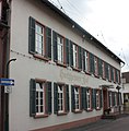 |
Mainzer Straße 26 Location floor: 39, parcel: 12/5 |
1795 |
45919 |
||
| Mainzer Straße 27 Location floor: 37, parcel: 23 |
1625 to 1675 |
45920 |
|||
 |
Villa Burgeff | Mainzer Straße 35 Location floor: 37, parcel: 7/10 |
1895 to 1905 |
45922 |
|
 |
Crucifixion group | Mainzer Straße / privy councilor Hummel-Platz location hall: 37, parcel: 28/22 |
1725 |
45903 |
|
 |
War memorial | Mainzer Straße o. No. Location floor: 37, parcel: 89/9 |
1871 |
45904 |
|
 |
Water tower | Massenheimer Landstraße 3 Location hallway: 7, parcel: 35/5 |
1896 |
45923 |
|
 more pictures |
Neudorfgasse 1 location floor: 37, parcel: 31 |
1695 to 1705 |
45924 |
||
 more pictures |
Factual part: inscription panel | Neudorfgasse 12 Location floor: 38, parcel: 189/12 |
1714 |
45925 |
|
 more pictures |
Neudorfgasse 22 Location floor: 38, parcel: 23, 30/2 |
1675 to 1725 |
45926 |
||
|
|
Railway bridge | Without Address Location Village: 33 plot: 327/4 |
1839 |
68985 |
|
| Nassau marble border column | Without Address Location hall: 34, parcel: 131 |
68988 |
|||
 more pictures |
Material parts: Viewing grid | Rathausstraße 3 Location floor: 39, parcel: 45 |
1825 to 1875 |
45927 |
|
 |
Rathausstraße 8 Location floor: 39, parcel: 209/57 |
1611 |
45928 |
||
 more pictures |
Rathausstraße 9 Location floor: 39, parcel: 191/42 |
1725 to 1775 |
45929 |
||
 more pictures |
Rathausstraße 10 Location hall: 39, parcel: 60/3 |
1850 to 1860 |
45930 |
||
 |
Rathausstraße 13 Location hall: 39, parcel: 40/1 |
Early 18th century |
45931 |
||
| Rathausstraße 14 Location floor: 39, parcel: 84 |
1725 to 1775 |
45932 |
|||
 |
Rathausstraße 15 Location floor: 39, parcel: 39 |
Early 18th century |
45933 |
||
 |
Rathausstraße 18 Location floor: 39, parcel: 107 |
1675 to 1725 |
45934 |
||
 |
Rathausstraße 19 Location floor: 39, parcel: 23 |
1725 to 1775 |
45935 |
||
 more pictures |
Rathausstraße 20 Location floor: 39, parcel: 175/106 |
1609 |
45936 |
||
 |
Rathausstraße 20a Location hallway: 39, parcel: 217/103 |
1695 to 1705 |
45969 |
||
 more pictures |
Rathausstraße 21 Location hall: 39, parcel: 205/22 |
1670 |
45937 |
||
| Rathausstraße 22 Location corridor: 39, parcel: 96/1 |
45938 |
||||
 |
Rathausstraße 23 Location hallway: 39, parcel: 12/5 |
1565 to 1575 |
45939 |
||
| Rathausstraße 24 Location hall: 39, parcel: 99 |
1675 to 1725 |
45940 |
|||
 more pictures |
Rathausstraße 27 Location hall: 39, parcel: 6 |
1625 to 1675 |
45941 |
||
 |
Rathausstraße 29 Location floor: 39, parcel: 5 |
1865 |
45942 |
||
 more pictures |
Rathausstraße 30 Location corridor: 39, parcel: 96/1 |
1863 |
45943 |
||
 |
Rathausstraße 31 Location hallway: 39, parcel: 4 |
Late 17th century |
45944 |
||
 more pictures |
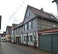
Rathausstraße 32 Location hall: 39, parcel: 94, 95 |
Late 17th century |
45945 |
||
 more pictures |
Rathausstraße 33 Location floor: 39, parcel: 3 |
Early 17th century |
45946 |
||
| city wall | Rathausstraße 34 Location floor: 39, parcel: 95 |
1525 to 1575 |
45947 |
||
 |
Rathausstraße 36 Location floor: 39, parcel: 92 |
Early 17th century |
45948 |
||
 |
Wayside shrine | Steinweg / Flörsheimer Straße location floor: 30, parcel: 377 |
1662 |
45949 |
|
 |
crossroads | Stiehlweg no. Location floor: 35, parcel: 24/1 |
45950 |
||
 |
Chapel and crucifixion group | Before Flörsheimer Straße 2 Location Village: 12 plot: 762/6 |
1715 to 1725 |
45854 |
|
 more pictures |
Material parts: corner stand | Weiherstraße 1 position corridor 41, plot: 109/1 |
1525 to 1575 |
45857 |
|
 |
Weiherstraße 11 Location floor: 41, parcel: 222/105 |
1907 |
45951 |
||
 |
Weiherstraße 13 Location hall: 41, parcel: 189/79 |
1835 to 1845 |
45952 |
||
 |
crossroads | Weiherstraße 25 Location hall: 41, parcel: 13/4 |
1694 |
45953 |
|
 |
Weiherstraße 27 Location hall: 8, parcel: 160/1 |
Early 20th century |
45954 |
||
| Weiherstraße 47 Location hall: 8, parcel: 166/1 |
1905 to 1915 |
45955 |
|||
| Hearthstone | Weinbergstraße o. No. Location floor: 26, parcel: 32 |
45957 |
|||
 |
Jewish Cemetery | Weinbergstraße / Weiler Weg location floor: 27, parcel: 287/238 |
Early 20th century |
45956 |
|
| Hearthstone | Wieserweg no. Location hall: 59, parcel: 165 |
45958 |
|||
 more pictures |
Wilhelmstrasse 1 position corridor 38, parcel: 179/64 |
45959 |
|||
 |
Former children's school | Wilhelmstrasse 4 position corridor 42, parcel: 71/5 |
1899 |
45960 |
|
 |
Wilhelmstrasse 5 position corridor 38, parcel: 206/68 |
1895 to 1905 |
45961 |
||
 |
Wintergasse 2 location hall: 39, parcel: 194/131 |
1740 |
45962 |
||
 more pictures |
Wintergasse 4 ce location hall: 39, parcel: 130/5 |
1737 |
45963 |
||
 |
Wintergasse 6 location hall: 39, parcel: 117/2 |
1675 to 1725 |
45964 |
||
 |
Wintergasse 9 location hall: 39, parcel: 77 |
Early 18th century |
45965 |
||
| Wintergasse 11 Location hall: 39, parcel: 78 |
Early 18th century |
45966 |
|||
 |
Wintergasse 12 location floor: 39, parcel: 203/108 |
1756 |
45967 |
||
 more pictures |
Wintergasse 13 Location corridor: 39, parcel: 88/2, 89 |
1742 |
45968 |
Massenheim
| image | designation | location | description | construction time | Object no. |
|---|---|---|---|---|---|
 more pictures |
Alte Dorfgasse 5, location floor: 11, parcel: 394/139 |
1725 to 1775 |
45976 |
||
 more pictures |
Alte Dorfgasse 7 Location floor: 11, parcel: 140/1 |
Early 18th century |
45977 |
||
 more pictures |
Alte Dorfgasse 11 Location floor: 11, parcel: 436/155 |
1725 to 1775 |
45978 |
||
 |
Alte Dorfgasse 13 Location floor: 11, parcel: 428/151 |
1725 to 1775 |
45979 |
||
 |
Alte Dorfgasse 16 Location floor: 11, parcel: 427/98 |
1564 |
45980 |
||
 more pictures |
Alte Dorfgasse 20 Location floor: 11, parcel: 90/1 |
Early 19th century |
45981 |
||
 more pictures |
Alte Dorfgasse 22 Location floor: 11, parcel: 88/2 |
1725 to 1775 |
45982 |
||
 |
At the church 1 position hall: 11, parcel: 51/1 |
1580 |
45983 |
||
 |
Evangelical parish church | At the church 3 position hall: 11, parcel: 372 / 19,18 / 1, 18/2 |
1725 to 1775 |
45984 |
|
 |
At the church 8 position hall: 11, parcel: 356/52 |
1725 to 1775 |
45985 |
||
 |
Former tithe barn | Gartenstraße 1a, location floor: 11, parcel: 336/118 |
1706 |
45986 |
|
 |
Gartenstraße 3 Location hall: 11, parcel: 358/113 |
1898 |
45987 |
||
| Massenheim as a whole |
location |
45975 |
|||
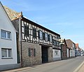 |
Main 4 position corridor 10, parcel: 32/1 |
Early 18th century |
45988 |
||
 more pictures |
Main 6 position corridor 10, parcel: 34/1 |
1803 |
45989 |
||
 more pictures |
associated: Alte Dorfgasse 1a | Hauptstraße 7, location hall: 11, parcel: 124/1 + 2 |
Late 18th century |
45990 |
|
 |
Main 8 position corridor 10, parcel: 37/1 |
1674 |
45991 |
||
 more pictures |
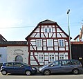
Hauptstraße 12, location floor: 10, parcel: 141/42 |
1695 to 1705 |
45992 |
||
 more pictures |
Hauptstraße 30 position hall: 10, parcel: 61/2 |
1573 |
45993 |
||
 more pictures |
Pfarrgasse 1 position corridor 11, parcel: 40/1 |
1725 to 1775 |
53335 |
||
 more pictures |
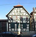
Pfarrgasse 2 position corridor 11, parcel: 363/133 |
1695 to 1705 |
45994 |
||
 |
Pfarrgasse 3 Location hall: 11, parcel: 272/42 |
1725 to 1775 |
45995 |
||
 more pictures |
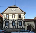
Former rectory | Pfarrgasse 4 position corridor 11, plot: 135/3 |
1772 |
45996 |
|
 more pictures |
Pfarrgasse 6 position corridor 11, parcel: 385/145 |
1745 to 1755 |
45997 |
||
 more pictures |
Pfarrgasse 8 position corridor 11, plot: 144/1 |
1775 to 1785 |
45998 |
||
 |
Pfarrgasse 15 Location hall: 11, parcel: 62/1 |
Early 19th century |
45999 |
||
 more pictures |
Former town hall | Schloßgasse 1 position corridor 10, parcel: 31/1 |
1725 to 1775 |
46000 |
|
 |
Schloßgasse 2 position corridor 10, parcel: 21/1 |
Late 17th century |
46001 |
||
 |
Schloßgasse 4 position corridor 10, parcel: 137/24 |
1675 to 1725 |
46002 |
||
 more pictures |
Massenheim Castle | Schloßgasse 6 Location hall: 10, parcel: 94 / 64.63 |
1735 to 1745 |
46003 |
|
 |
Under alley 1 position corridor 10, parcel: 19/1 |
1675 to 1725 |
46004 |
||
 |
Untergasse 8, location hall: 11, parcel: 453/32 |
1675 to 1725 |
46005 |
||
 |
Under Gasse 9 position corridor 10, plot 10 |
1725 to 1775 |
46006 |
||
 more pictures |
Under Gasse 11 position corridor 10, plot: 130/5 |
1695 to 1705 |
46007 |
||
 more pictures |
Untergasse 12 Location floor: 11, parcel: 28 |
1675 to 1725 |
46008 |
||
 more pictures |
Untergasse 14 Location hall: 11, parcel: 22/3 |
1675 to 1725 |
46009 |
||
 more pictures |
Cemetery, memorial to the fallen | Untergasse no. Location floor: 35, parcel: 227 |
1871 |
46010 |
|
| Ottmühle | Wickerbachmühle 3 location hall: 25, parcel: 21/2 |
1694 |
46012 |
||
 |
Trafostation | Wickerer Straße 2 Location hall: 29, parcel: 41 |
1915 to 1925 |
46011 |
Web links
Commons : Cultural monuments in Hochheim am Main - collection of images, videos and audio files
- State Office for Monument Preservation Hessen (Ed.): Cultural monuments in Hochheim am Main In: DenkXweb, online edition of cultural monuments in Hessen
