List of natural monuments in the Gmünd district
The list of natural monuments in the Gmünd district contains the natural monuments in the Gmünd district .
Natural monuments
| photo | Surname | ID | Location | description
|
surface | date |
|---|---|---|---|---|---|---|
|
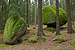
Striezel and Scherzel | GD-102 |
Amaliendorf-Aalfang KG: Aalfang GrStNr: 63/2 location |
07/11/1988 | ||

|
"Hinterpocher" rock formation | GD-022 |
Brand-Nagelberg KG: Steinbach GrStNr: 1038/1 location |
02/23/1927 | ||

|
Rock formations "Pumperskirchen and pulpit" | GD-021 |
Brand-Nagelberg KG: Steinbach GrStNr: 1010 location |
02/23/1927 | ||

|
Granite block group | GD-036 |
Brand-Nagelberg KG: Steinbach GrStNr: 1010 location |
03/15/1989 | ||

|
Kaiblstein | GD-035 |
Brand-Nagelberg KG: Steinbach GrStNr: 1010 location |
03/14/1989 | ||

|
Avenue in Eggern | GD-120 |
Eggern KG: Eggern GrStNr: 1423/1 location |
06/18/1990 | ||
|
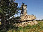
Colomanistein | GD-037 |
Eisgarn KG: Eisgarn GrStNr: 680 location |
08/10/1988 | ||

|
Reitzenschlägerbach | GD-076 |
Eisgarn KG: Eisgarn GrStNr: 552; 470; 1204/6; 474; 554; 1204/7; 513; 724; 514; 723; 521; 707; 708; 522; 705; 706; 529/2; 685; 530; 538/2; 670/1; 539; 545; 658/3; 546; 553/2; 555/1; 555/2; 684; 739/1; 802/1; 802/2; 1296/1; 1296/2; 1296/3; 1297; 1298/1; 184; 468; 796/2 location |
05/27/1982 | ||
|
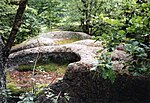
Stone group of 7 electors | GD-085 |
Eisgarn KG: Großradischen GrStNr: 1273 location |
02/06/1986 | ||

|
Allee on the L 8180 at Gr. Radical | GD-112 |
Eisgarn KG: Großradischen GrStNr: 1383/2 location |
11/16/1988 | ||

|
Katzenstein | GD-038 |
Eisgarn KG: Großradischen GrStNr: 602/1; 602/2 location |
Note: location according to FläWi |
02/12/1949 | |

|
Stork meadows and alluvial forest cells close to the nest near the Lainsitz river | GD-142 |
Gmünd KG: Böhmzeil; Gmünd GrStNr: 1143/1; 1144; 1146/1; 1146/2; 1146/3; 1147/2; 1147/3; 1148/2; 1148/3; 1149/2; 1139; 1140/1; 1140/2; 1141/1; 1143/2; 1143/3; 1147/1; 1148/1; 1239/2; 1239/3; 1240; 1241/7 - 53/17; 1328; 1395; 1396/1; 1403; 1404/1; 1404/2; 1405/2; 1417/3; 1424/2; 1430/2; 1465/5; 1466/3; 1466/4; 1467/2; 1468; 1470; 1476/4; 1476/5; 1485/4; 1486/3; 1505; 1665; 1681; 1682; 53/13; 53/17; 53/43; 1620; 1505 location |
05/27/2002 | ||

|
Kas and bread stone | GD-061 |
Gmünd KG: Breitensee GrStNr: 340/10 location |
10/14/1974 | ||

|
Stork meadows and alluvial forest cells close to the nest near the Lainsitz river | GD-140 |
Gmünd KG: Ehrendorf GrStNr: 27/1; 28/1; 28/3; 279/1; 280; 281; 282; 283; 284; 285; 286; 287/1; 288/1; 289/1; 320; 279/2; 286; 287/2; 288/2; 290/1; 290/2; 290/3; 291; 318; 319; 320; 297 location |
05/09/2000 | ||

|
1 red beech (dancing beech) | GD-056 |
Gmünd KG: Eibenstein GrStNr: 534 location |
11/09/1927 | ||

|
Vierharteln rock formation | GD-075 |
Gmünd KG: Eibenstein GrStNr: 139/2; 424/2; 133/1; 146/2; 134/1 location |
02/17/1982 | ||

|
Cone or cobblestone | GD-034 |
Gmünd KG: Eibenstein GrStNr: 774 location |
The cone or cobblestone is a vertically split rock formation with a height of 4 - 5 meters on a base of approx. 4 × 5 meters and a columnar, free-standing rock a little further north. The rock formation and the immediate surrounding area were declared a natural monument in 1991. | 01/08/1991 | |

|
Remnants in Gmünd | GD-062 |
Gmünd KG: Eibenstein GrStNr: 534 location |
01/09/1975 | ||

|
"Christophstein" rock formation | GD-024 |
Gmünd KG: Grillenstein GrStNr: 715; 716 location |
05/12/1927 | ||

|
"Fuchsstein" rock formation | GD-026 |
Gmünd KG: Grillenstein GrStNr: 106/1 location |
03/11/1930 | ||

|
Rock formation "mushroom stone" | GD-023 |
Gmünd KG: Grillenstein GrStNr: 825 location |
03/11/1930 | ||
|
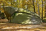
"Devil's Bed" rock formation | GD-025 |
Gmünd KG: Grillenstein GrStNr: 457 location |
06/17/1930 | ||

|
Loaf of bread stone / devil's bread loaf | GD-007 |
Gmünd KG: Grillenstein GrStNr: 457 location |
07/31/1930 | ||

|
Painter's angle | GD-001 |
Gmünd KG: Grillenstein GrStNr: 37/8 location |
03/11/1930 | ||

|
Schullerstein | GD-008 |
Gmünd KG: Grillenstein GrStNr: 455 location |
07/31/1930 | ||

|
Rocking stone | GD-009 |
Gmünd KG: Grillenstein GrStNr: 726 location |
January 16, 1930 | ||

|
2 linden trees near the war memorial, 2 linden trees near St. John Nepomuk | GD-101 |
Großschönau KG: Groß Schönau GrStNr: 185 location |
01/12/1988 | ||
|
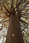
Fox spruce | GD-107 |
Großschönau KG: Wörnharts GrStNr: 1649/2 location |
The fox spruce is the largest spruce in the Waldviertel. Its trunk (meanwhile 5 meters in circumference) divides into 6 trunks at a height of 8 meters and forms a crown with a diameter of approx. 17 meters. | 10/17/1988 | |

|
Stork meadows and alluvial forest cells close to the nest near the Lainsitz river | GD-140 |
Großdietmanns KG: Wielands GrStNr: 1135/2; 1136; 1137; 1280; 1134/2; 1281; 1282 location |
05/09/2000 | ||

|
Northernmost habitat of Crocus albiflorus | GD-044 |
Bad Großpertholz KG: Karlstift GrStNr: 543; 545; 546; 547/1; 547/3; 547/4; 571/3 location |
The only known location of Crocus albiflorus in the Waldviertel at the time it was placed under protection (a second location is now known 4 km south) and the northernmost distribution area of the species (see notification ). | 05/06/1955 | |

|
Pine in Engelstein | GD-118 |
Großschönau KG: Engelstein GrStNr: 898 location |
04/25/1989 | ||

|
Lindenallee in Engelstein | GD-113 |
Großschönau KG: Engelstein GrStNr: 1648/7 location |
10/17/1988 | ||

|
Linden tree in Engelstein Castle Courtyard | GD-114 |
Großschönau KG: Engelstein GrStNr: .3 location |
08/16/1988 | ||
|
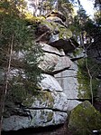
Raven hole | GD-133 |
Großschönau KG: Thaures GrStNr: 644 location |
01/31/1995 | ||
|
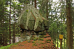
Hutstein | GD-054 |
Haugschlag KG: Haugschlag GrStNr: 90/1 location |
02/23/1962 | ||

|
Geyer-Steine rock group | GD-074 |
Heidenreichstein KG: Altmanns GrStNr: 575/6 location |
11/09/1981 | ||

|
Ahornallee along the LH 61 | GD-098 |
Heidenreichstein KG: Guttenbrunn GrStNr: 436/1 location |
02/20/1987 | ||

|
Avenue along the LH 61 | GD-084 |
Heidenreichstein KG: Haslau; Seyfrieds GrStNr: 984/1 - 813 Location |
02/07/1986 | ||

|
2 linden trees | GD-138 |
Heidenreichstein KG: Heidenreichstein GrStNr: 1400/5 location |
08/31/2000 | ||

|
Row of trees along federal highway 5 | GD-090 |
Heidenreichstein KG: Heidenreichstein GrStNr: 1394/1; 454; 1394/5 location |
Originally there were 59 trees along the road. In the spring of 2015, however, numerous trees had to be cut after inspections, so that the row of trees only comprises 14 trees in total. | 05/14/1986 | |

|
Rock formation shell stone | GD-123 |
Heidenreichstein KG: Heidenreichstein GrStNr: 711 location |
North of Heidenreichstein, on the goods road to Edlau, at the sg. Antoniusmarterl - there is a cup stone. It is approx. 3 × 2.5 meters in size and approx. 1.2 meters high - the size of the recess (bowl) is 1.6 × 1.3 × 0.9 meters. The shell stone was declared a natural monument in 1990. | 11/28/1990 | |

|
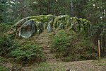
Graselhöhle rock group | GD-073 |
Heidenreichstein KG: Heidenreichstein GrStNr: 1126 Location |
11/09/1981 | ||
|
Gugelhupfstein rock group | GD-077 |
Heidenreichstein KG: Heidenreichstein GrStNr: 660 location |
Note: location according to FläWi |
10/25/1983 | |

|
Stone formations | GD-081 |
Heidenreichstein KG: Heidenreichstein GrStNr: 945 location |
October 31, 1985 | ||

|
Hanging stone | GD-019 |
Heidenreichstein KG: Heidenreichstein GrStNr: 1192 location |
04/01/1927 | ||
|
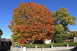
1 old linden tree and 1 old red oak | GD-143 |
Heidenreichstein KG: Heidenreichstein GrStNr: 152/1 location |
01/06/2019 | ||

|
2 trees next to the road 8199 | GD-108 |
Heidenreichstein KG: Wolfsegg GrStNr: 103/2; 475/1 location |
12/12/1988 | ||
|
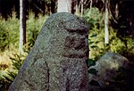
Stone woman | GD-134 |
Heidenreichstein KG: Wolfsegg GrStNr: 168/2 location |
01/31/1995 | ||
|
|
Fox pond | GD-066 |
Hirschbach KG: Hirschbach GrStNr: 1035; 1040; 826; 833; 837; 823; 430; 862; 864; 832; 824; 859; 860/1; 860/2; 861; 828; 829; 858; 840; 819; 822; 838; 839; 846; 863; 865; 935; 936; 946; 827; 929; 938; 1032; 1042; 1046; 1033; 930; 931; 932; 933; 934; 825; 1039; 927; 928; 856; 943; 1038; 937/2; 939; 940; 941; 957; 1031; 1041; 1036; 1037; 1044; 1045 location |
07/20/1977 | ||

|
Rocking stone | GD-027 |
Hoheneich KG: Hoheneich GrStNr: 1371/1 location |
January 16, 1930 | ||

|
Kaspress and surrounding area | GD-041 |
Kirchberg am Walde KG: Frommberg GrStNr: 394/3 location |
04/11/1949 | ||

|
2 linden trees near the Red Chapel | GD-109 |
Kirchberg am Walde KG: Kirchberg am Walde GrStNr: 631/2; 1193 location |
02/03/1989 | ||
|
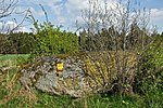
Granite rocks | GD-131 |
Kirchberg am Walde KG: Ullrichs GrStNr: 839 location |
04/22/1993 | ||

|
Groups of trees in Kirchberg am Walde | GD-039 |
Kirchberg am Walde KG: Kirchberg am Walde GrStNr: 1139/1; 1150 location |
02/12/1949 | ||

|
High stone | GD-055 |
Kirchberg am Walde KG: Ullrichs GrStNr: 937 location |
06/23/1966 | ||

|
3 trees at the entrance to Weißenalbern | GD-110 |
Kirchberg am Walde KG: Weißenalbern GrStNr: 185; 188/2; 2931 location |
03/15/1989 | ||

|
Linden group in the local area of Weißenalbern | GD-106 |
Kirchberg am Walde KG: Weißenalbern GrStNr: 2922/1; 18/1 location |
12/02/1988 | ||

|
(Christ) Kindelstein | GD-040 |
Kirchberg am Walde KG: Kirchberg am Walde GrStNr: 945 location |
04/11/1949 | ||
|
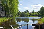
Harrteich | GD-125 |
Litschau KG: Gopprechts GrStNr: 473 location |
01/23/1991 | ||
|
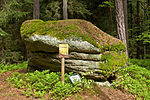
Fiedelstein | GD-050 |
Litschau KG: Hörmanns GrStNr: 141/1 location |
03/21/1958 | ||

|
Graselstein | GD-013 |
Litschau KG: Hörmanns GrStNr: 519 location |
Note: location according to FläWi |
03/04/1927 | |

|
Wild Hunt | GD-014 |
Litschau KG: Hörmanns GrStNr: 140 location |
Note: location according to FläWi (2 points on map) |
03/04/1927 | |
|
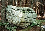
Old stone | GD-047 |
Litschau KG: Litschau GrStNr: 422 location |
06/17/1955 | ||
|
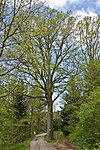
Oak on Wehrleitenweg | GD-095 |
Litschau KG: Litschau GrStNr: 143/1 location |
02/24/1987 | ||
|
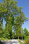
Oak alley | GD-127 |
Litschau KG: Litschau GrStNr: 1535/2; 1539/1; 1944 location |
01/22/1991 | ||

|
Stone and tree group "Three Brothers" | GD-067 |
Litschau KG: Litschau GrStNr: 962 location |
10/10/1978 | ||

|
Föhrenbach-Höllgraben-Höllstein | GD-139 |
Litschau KG: Reichenbach; Schönau GrStNr: 375/1 - 613/1 location |
Note: Entire stream property. Position corresponds roughly to the Höllstein. |
02/26/2001 | |

|
Alley along the federal highway 5 | GD-117 |
Litschau KG: Schandachen GrStNr: 595 location |
Note: location according to FläWi, possibly entire street |
11/14/1989 | |

|
Rock group "Elephant Herd" | GD-072 |
Litschau KG: Schlag GrStNr: 123/1; 124; 133/2; 134/5; 130/1; 134/1; 133/1; 134/2; 134/3; 134/6 location |
04/12/1979 | ||

|
Frog stone | GD-064 |
Litschau KG: Schlag GrStNr: 129/2 location |
04/14/1977 | ||

|
Winter linden and sycamore maple | GD-068 |
Litschau KG: Schlag GrStNr: 242/1 location |
10/12/1978 | ||

|
Allee in Litschau | GD-119 |
Litschau KG: Schönau GrStNr: 608; 546/1 location |
The avenue in Galthof consists of larches, lime trees, oaks, ash trees, robinia and chestnut trees. It was declared a natural monument in 1990. Note: long road |
10/03/1990 | |

|
Occurrence of swamp porst | GD-126 |
Litschau KG: Schönau GrStNr: 351; 357; 358; 362; 379/1; 379/3; 378/1; 378/2; 379/2; 384/2 location |
Note: location according to FläWi |
10/25/1990 | |
|
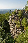
Almond stone | GD-003 |
Moorbad Harbach KG: Harbach GrStNr: 489; 490; 499/2; 502; 514/1; 514/2 location |
03/08/1927 | ||

|
Large summer linden tree in Hirschenwies | GD-124 |
Moorbad Harbach KG: Hirschenwies GrStNr: 163/2 location |
10/30/1990 | ||

|
Linden tree in Hirschenwies | GD-122 |
Moorbad Harbach KG: Hirschenwies GrStNr: 166/2 location |
10/30/1990 | ||

|
Fog stone | GD-004 |
Moorbad Harbach KG: Hirschenwies GrStNr: 256/1 location |
02/23/1927 | ||

|
Sycamore maple | GD-132 |
Moorbad Harbach KG: Lauterbach GrStNr: 16/3; 902/2 location |
January 17, 1995 | ||
|
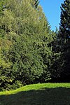
2 yew trees | GD-141 |
Moorbad Harbach KG: Hirschenwies GrStNr: 574/1 location |
While the right yew tree has a trunk diameter of about 65 cm, that of the left yew tree is only about 31 cm, but both trees are about the same height (10 to 12 meters). The age of the trees could not be accurately determined, but it is believed that they are at least 300 years old. Due to their age, size and the fact that yew trees prefer calcareous soil and are therefore rather rare on granite, the two yew trees were declared a natural monument in 2006. | 04/12/2006 | |

|
Alley along the federal highway 5 | GD-117 |
Reingers KG: Illmanns GrStNr: 629; 272 location |
11/14/1989 | ||

|
Baptismal font | GD-016 |
Schrems KG: Gebharts GrStNr: 1122 location |
03/29/1927 | ||

|
Kasiger Loa (cheese loaf) | GD-012 |
Schrems KG: Kiensass GrStNr: 131/1 location |
02/23/1927 | ||

|
Stream meadows | GD-083 |
Schrems KG: Langegg GrStNr: 665/1; 665/2; 680/3; 680/4; 666; 679/3; 672/2; 670/4 location |
11/08/1985 | ||
|
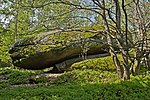
Granite rock group on the forest crest | GD-096 |
Schrems KG: Langegg GrStNr: 240; 222 location |
01/14/1987 | ||
|
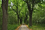
Double-sided avenue of 33 summer linden trees on the road to Anderlfabrik | GD-092 |
Schrems KG: Niederschrems GrStNr: 1509/1 location |
09/23/1986 | ||

|
Breakthrough section of the Braunaubach (Heumühle) | GD-137 |
Schrems KG: Niederschrems GrStNr: 1519/1 location |
10/03/1996 | ||

|
Grafenhäusl | GD-137 |
Schrems KG: Niederschrems GrStNr: 1010/3 location |
10/03/1996 | ||

|
Large granite block (Mamut stone) | GD-137 |
Schrems KG: Niederschrems GrStNr: 67/1 location |
10/03/1996 | ||

|
Pummerluck | GD-137 |
Schrems KG: Niederschrems GrStNr: 66 Location |
10/03/1996 | ||

|
Summer linden tree at the Anderlfabrik | GD-091 |
Schrems KG: Niederschrems GrStNr: 1407 location |
09/26/1986 | ||

|
Rock formation "Wackelstein" | GD-017 |
Schrems KG: Schrems GrStNr: 1504 location |
03/01/1927 | ||

|
Hunter seat | GD-089 |
Schrems KG: Schrems GrStNr: 1500 location |
03/06/1986 | ||

|
Cheese in a loaf stone | GD-057 |
Schrems KG: Schrems GrStNr: 1503 location |
02/24/1969 | ||

|
Oak alley in Schrems | GD-129 |
Schrems KG: Schrems GrStNr: 1800 location |
01/30/1991 | ||
|
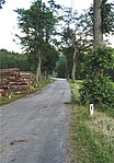
Avenue on both sides of Landesstraße 8296 | GD-130 |
St. Martin KG: Harmannschlag GrStNr: 1633/1; 1696; 1627; 1603; 1597; 1633/1; 1609; 1610/2; 627/1; 627/2 location |
Of the original 52 trees that were declared a natural monument in the cadastral communities of Harmanschlag and Karlstift in 1992, the part of the natural monument in the KG Karlstift was completely abolished in 2011. With the exception of a few remaining trees, the natural monument declaration was also revoked for the trees in the KG Harmanschlag in 2002 and 2011 (see notices ). | 04/30/1992 | |
|
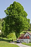
2 linden trees | GD-100 |
St. Martin KG: Harmanschlag GrStNr: .19 / 2 Location |
09/25/1986 | ||

|
Wart stone | GD-002 |
St. Martin KG: Harmanschlag GrStNr: 1150 location |
03/07/1927 | ||

|
maple | GD-070 |
St. Martin KG: Langfeld GrStNr: 1226/1; 1226/2; 1226/3 location |
11/14/1978 | ||

|
Oak | GD-069 |
St. Martin KG: Langfeld GrStNr: 2480 location |
10/20/1978 | ||

|
Gabrielental | GD-103 |
St. Martin KG: Langfeld GrStNr: 2479; 2480 location |
Valley of the Lainsitz | 08/04/1987 | |
|
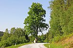
Winter linden | GD-099 |
St. Martin KG: St. Martin GrStNr: 2555 location |
10/27/1986 | ||

|
Maple Avenue | GD-082 |
Unserfrau-Altweitra KG: Altweitra GrStNr: 3826/1 location |
02/06/1986 | ||

|
Double rocking stone | GD-058 |
Unserfrau-Altweitra KG: Heinrichs bei Weitra GrStNr: 3170 location |
05/01/1970 | ||

|
Linden trees | GD-065 |
Unserfrau-Altweitra KG: Heinrichs bei Weitra GrStNr: 3520/11 location |
11/23/1977 | ||

|
Rock formation in Heinrichs | GD-121 |
Unserfrau-Altweitra KG: Heinrichs bei Weitra GrStNr: 2159/50; 2459/51; 2159/52; 2159/53; 2159/54; 2159/55 location |
October 31, 1990 | ||

|
Flow moor, Heinreichs near Weitra | GD-135 |
Unserfrau-Altweitra KG: Heinreichs bei Weitra GrStNr: 2290 location |
11/17/1995 | ||
|
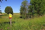
Wetland, bog | GD-104 |
Waldenstein KG: Albrechts GrStNr: 1423/3; 1425/2; 1426; 1427/2; 1434/2; 1460; 1470; 1476; 2236; 2237; 2239; 2240; 2241; 2242; 2243; 2244; 2245; 2246; 2247; 2354; 2355; 2356; 2357; 2358; 2359; 2360; 2361; 2362; 2363; 2364; 2365; 2366; 2367; 2369; 2254; 2255; 2256; 64; 2269; 2271; 2273; 2276; 2277; 2279; 2280; 2282; 2283; 2284; 2285; 2286; 2287; 2288; 2289; 2296; 2297; 2298; 2299; 2300; 2301; 2302; 2303; 2317; 2318; 2319; 2320; 2333; 2334; 2335 location |
09/27/2010 | ||
|
Wetland | GD-136 |
Waldenstein KG: Zehenthöf GrStNr: 239/2 location |
03/19/1996 | ||

|
Old Lainsitz slings | GD-116 |
Weitra KG: Brühl GrStNr: 30; 32; 33; 35; 36; 38; 39; 40; 41/1; 41/2; 824 location |
11/16/1989 | ||

|
Rock formations including the associated trees | GD-071 |
Weitra KG: Brühl GrStNr: 753; 754/1; 757/1 location |
11/16/1978 | ||

|
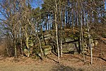
Rock formation "Wackelstein" | GD-018 |
Weitra KG: Brühl GrStNr: 397 location |
06/22/1936 | ||
|
Granite rock formations | GD-006 |
Weitra KG: Walterschlag GrStNr: 124/1 location |
09/21/1935 | ||

|
Avenue of summer linden trees | GD-051 |
Weitra KG: Weitra GrStNr: 1466/1; 1478; 1495; 1497/1; 1510; 1529; 1530; 1543; 1546; 1547; 1552; 1554; 1559/4; 1565/3; 1512; 1497/2; 1448; 128/2; 1443/2; 1467/3; 1467/1; 1467/2; 1467/4; 1494; 3727; 1588/1; 1588/2; 1579; 1586; 1587/1 location |
07/12/1960 | ||

|
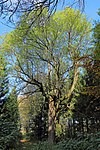
With the large oak - English oak | GD-093 |
Weitra KG: Weitra GrStNr: 1617/1 location |
The pedunculate oak south of Weitra, protected since 1986, is approx. 250-300 years old, has a circumference of 5.10 meters and is approx. 32 meters high. Note: location according to FläWi |
09/02/1986 | |
|
Ash at the Hirschbrunnteichtl | GD-094 |
Weitra KG: Weitra GrStNr: 1587/1 location |
09/02/1986 | ||

|
Gabrielental | GD-103 |
Weitra KG: Weitra GrStNr: 637; 709; 710; 897/2; 898/2; 1120/1; 1120/2; 1170/1; 1167; 1169/3; 1178; 3707 location |
08/04/1987 | ||
|
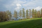
Larch and linden avenue in Weitra | GD-115 |
Weitra KG: Weitra GrStNr: 1600/1; 1604; 1605; 1610/1 location |
11/16/1988 | ||
|
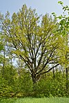
Holm oaks | GD-063 |
Weitra KG: Weitra GrStNr: 3347; 3348 location |
March 31, 1977 |
Former natural monuments
| photo | Surname | ID | Location | description
|
surface | date |
|---|---|---|---|---|---|---|

|
Juniper tree and surroundings | GD-053 |
Brand-Nagelberg KG: Finsternau GrStNr: 249/1 location |
02/23/1962 | ||
| Oak | GD-086 |
Eggern KG: Reinberg-Heidenreichstein GrStNr: 560/1 |
02/06/1986 | |||
| Winter linden | GD-087 |
Eggern KG: Reinberg-Heidenreichstein GrStNr: 650/2 |
02/06/1986 | |||

|
Larch avenue | GD-010 |
Eisgarn KG: Eisgarn GrStNr: 1214/1 location |
05/20/1941 | ||

|
Linden tree | GD-060 |
Großschönau (Lower Austria) KG: Friedreichs GrStNr: 5 location |
After the listed building was lifted, the linden tree was felled in spring 2014. As an ornament, the trunk is slightly offset on property 14/1. | December 20, 1973 | |

|
Avenue along the L 8201 | GD-097 |
Heidenreichstein KG: Haslau GrStNr: 980 location |
09/30/1986 | ||
| 1 linden tree | GD-029 |
Heidenreichstein KG: Heidenreichstein GrStNr: 230 |
December 15, 1941 | |||
|
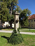
Summer linden tree | GD-059 |
Hirschbach KG: Hirschbach GrStNr: 10 location |
The linden tree, planted in 1879 on the occasion of the silver wedding of Emperor Franz Josef, was badly damaged by a storm in August 2013 and had to be felled. | 02/04/1971 | |

|
Avenue on both sides of Landesstraße 8296 (part of KG Karlstift) | GD-130 |
Bad Großpertholz KG: Karlstift GrStNr: 627/1; 627/2 location |
The 1992 natural monument declaration for the avenue trees in KG Karlstift was revoked on May 11, 2011. The reason given in the notification is that “the characteristic of the formative element of the landscape” is no longer given by the surrounding spruce afforestation (see notifications ). | 04/30/1992 | |

|
Tree alley along the L 68 from Kirchberg to Limbach | GD-111 |
Kirchberg am Walde KG: Kirchberg GrStNr: 384/2; 1221/1 location |
The monument protection was completely lifted on November 24, 2010 after individual trees had been gutted again and again. At the end of 2012 all trees were felled and in summer 2013 the street in the area of the former avenue was slightly widened. | 05/11/1989 | |

|
Linden trees | GD-078 |
Unserfrau-Altweitra KG: Altweitra GrStNr: 288/2 location |
The two 180-year-old lime trees (one summer and one winter linden) at Marterl on the road to Brühl, which have been protected since 1984, were felled at the end of March 2018. | 02/16/1984 | |

|
1 oak in Oberlembach | GD-088 |
Unserfrau-Altweitra KG: Oberlembach GrStNr: 440 location |
03/01/1985 | ||
|
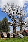
beech | GD-080 |
Waldenstein KG: Großneusiedl GrStNr: 149/1 location |
10/03/1984 |
Notes / legend
| Photo: | Photography of the natural monument. Click the photo generates an enlarged view. There are also two symbols:
|
||||
| Surname: | Designation of the natural monument according to official sources | ||||
| ID | Identifier | ||||
| Location: | The municipality and, if available, the address are given. The cadastral community (KG) and the property number are listed below. By calling up the link Location , the location of the monument is displayed in various map projects. | ||||
| description | Brief description of the natural monument | ||||
| surface | Area of the natural monument in hectares (ha) | ||||
| date | Date or year of protection |
literature
- Province of Lower Austria, Nature Conservation Department (Ed.): List of natural monuments in Lower Austria . ( Notices and pictures [accessed on May 6, 2016]).
Web links
Commons : Natural monuments in Gmünd District - Collection of images, videos and audio files
- Natural monuments of Lower Austria - punctiform and flat at data.gv.at
Individual evidence
- ^ Eva Jungmann: Gmünd district: The last avenues fall in the district sheets of March 10, 2015, accessed on July 27, 2015.
- ↑ Karin Pollak: Linden trees were a danger: 180 year old trees felled on NÖN.at on March 30, 2018, accessed on April 2, 2018.