
Haugschlag
|
Haugschlag
|
||
|---|---|---|
| coat of arms | Austria map | |
 |
|
|
| Basic data | ||
| Country: | Austria | |
| State : | Lower Austria | |
| Political District : | Gmuend | |
| License plate : | GD | |
| Surface: | 22.65 km² | |
| Coordinates : | 48 ° 59 ' N , 15 ° 3' E | |
| Height : | 585 m above sea level A. | |
| Residents : | 481 (January 1, 2020) | |
| Postal code : | 3874 | |
| Area code : | 02865 | |
| Community code : | 3 09 15 | |
| NUTS region | AT124 | |
| UN / LOCODE | AT HAC | |
| Address of the municipal administration: |
Haugschlag 10 3874 Haugschlag |
|
| Website: | ||
| politics | ||
| Mayor : | Adolf Kainz ( ÖVP ) | |
|
Municipal Council : ( 2020 ) (15 members) |
||
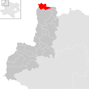
| Location of Haugschlag in the Gmünd district | ||
  |
||
| Source: Municipal data from Statistics Austria | ||

Haugschlag is a municipality with 481 inhabitants (as of January 1, 2020) in the Gmünd district in Lower Austria .
geography


Haugschlag, Austria's northernmost municipality, is located on the Reissbach in the northwest corner of the Waldviertel in Lower Austria, on the border with the Czech Republic . At the confluence of the Rottaler Bach in the Neumühlbach is the northernmost point of Austria opposite the former Czech barracks Peršlák .
At the Stankau pond on the border in the Rottaler Forest there is a meridian stone that marks the intersection of the 15th longitude and 49th parallel.
The area of the municipality covers 22.65 km², 65.58% of the area is forested.
Community structure
The community consists of the cadastral communities
The municipality includes the following four localities (population in brackets as of January 1, 2020):
- Griesbach (94) including the Griesbach-Gramett settlement
- Haugschlag (241) including blank houses, Kreidlsiedlung, Lerchenfeld and forest houses
- Rottal (70) including Lerchenfeld
- Türnau (76) including Alttürnauhäuser
Neighboring communities
| Stráž nad Nežárkou ( CZ ) | Nová Bystřice (CZ) | |
| Staňkov u Třeboně (CZ) |
.svg)
|
Reingers |
| Litschau |
history
.jpg)
Around the year 980, Bishop Pilgrim von Passau sent Franconian settlers to this area, who made the land arable and populated piece by piece. The clearing name "-schlag" indicates the history of the settlement in the high medieval clearing wave between the 11th and 13th centuries. The place first appears in a document in 1369, where it is listed as "Hawslag" in the list of subjects of the Litschau rule and is mentioned there with 14 fiefs and a farmstead. The Haugschlag parish was established in 1784 and the Haugschlag parish church completed in 1787.
Haugschlag was part of the Litschau rule for many centuries. In 1590/91 there were 14 subordinate houses in the village; In 1751 Haugschlag counted 20 subordinate houses.
In the Fifth Coalition War (1809) Haugschlag was heavily damaged. During the Austro-Prussian War (1866) the Prussian army withdrew via the Waldviertel and 600 Prussian soldiers were quartered briefly in Haugschlag.
After the revolution of 1848 , Haugschlag was established as an independent political municipality , was then assigned to the Litschau district and is now in the Gmünd district . Haugschlag was later united with the neighboring community of Griesbach.
Population development
The population has been decreasing continuously for many decades. Both the birth balance and the migration balance have been negative since 1981 , although emigration has decreased in recent years.

politics
The municipal council has 15 members.
- With the municipal council elections in Lower Austria in 1990, the municipal council had the following distribution: 11 ÖVP and 4 SPÖ.
- With the municipal council elections in Lower Austria in 1995, the municipal council had the following distribution: 10 ÖVP, 3 SPÖ and 2 Wahlgemeinschaft Haugschlag.
- With the municipal council elections in Lower Austria in 2000, the municipal council had the following distribution: 10 ÖVP, 3 SPÖ and 2 Wahlgemeinschaft Haugschlag.
- With the municipal council elections in Lower Austria in 2005 , the municipal council had the following distribution: 11 ÖVP, 3 SPÖ and 1 Wahlgemeinschaft Haugschlag.
- With the municipal council elections in Lower Austria in 2010 , the municipal council had the following distribution: 12 ÖVP and 3 SPÖ.
- With the municipal council elections in Lower Austria in 2015 , the municipal council had the following distribution: 12 ÖVP and 3 SPÖ.
- With the municipal council elections in Lower Austria 2020 , the municipal council has the following distribution: 12 ÖVP and 3 SPÖ.
- mayor
- since ? Adolf Kainz (ÖVP)
Culture and sights

- Catholic parish church Haugschlag To the exaltation of the cross: Josephine hall church from 1787.
- Türnau local chapel
economy
In Haugschlag there are 46 agricultural and forestry businesses (as of 2010), twelve of which are full-time farms. There are four non-agricultural workplaces in the secondary and 24 in the tertiary economic sector (as of 2011). These companies employ ten people in the manufacturing sector and 73 people in the service sector.
The "Leading Golfresort Haugschlag" is located in Haugschlag. The Eisenwurzen long-distance hiking trail also runs through the municipality .
Personalities
- Nina Proll (* 1974), actress, singer and dancer
literature
- Stefan René Buzanich: The lifeworld of the village subjects of the Kuefstein rule Litschau as reflected in the legacy treatises of the 1st half of the 18th century (dissertation at the University of Vienna, 2020, 4 volumes).
- Hermine Grabenhofer: Chronicle of the village of Haugschlag. (2 volumes, Haugschlag 2009).
Web links
- 30915 - Haugschlag. Community data, Statistics Austria .
Individual evidence
- ↑ Statistics Austria: Population on January 1st, 2020 by locality (area status on January 1st, 2020) , ( CSV )
- ↑ Stefan René Buzanich: The lifeworld of the village subjects of the Kuefstein rule Litschau as reflected in the legacy treatises of the 1st half of the 18th century (dissertation at the University of Vienna, 2020, 4 volumes) . S. 22 .
- ↑ Statistics Austria, A look at the community Haugschlag, population development. Retrieved August 14, 2019 .
- ^ Result of the local council election 1995 in Haugschlag. Office of the Lower Austrian State Government, March 30, 2000, accessed on May 11, 2020 .
- ^ Election result of the municipal council election 2000 in Haugschlag. Office of the Lower Austrian State Government, February 4, 2005, accessed on May 11, 2020 .
- ^ Election result of the local council election 2005 in Haugschlag. Office of the Lower Austrian State Government, March 4, 2005, accessed on May 11, 2020 .
- ^ Election results for the 2015 municipal council election in Haugschlag. Office of the Lower Austrian State Government, December 1, 2015, accessed on July 3, 2019 .
- ↑ Results of the local council election 2020 in Haugschlag. Office of the Lower Austrian State Government, January 26, 2020, accessed on May 11, 2020 .
- ^ Statistics Austria, A look at the community of Haugschlag, agricultural and forestry operations. Retrieved August 14, 2019 .
- ^ Statistics Austria, A look at the community Haugschlag, workplaces. Retrieved August 14, 2019 .
- ^ Statistics Austria, A look at the community of Haugschlag, employees in workplaces. Retrieved August 14, 2019 .
- ^ Haugschlag municipality. Retrieved August 14, 2019 .
Cadastral communities: Griesbach | Haugschlag | Rottal | Türnau
Locations: Griesbach | Haugschlag | Rottal | Türnau
Villages: Griesbach | Haugschlag settlements: Griesbach-Gramett-Siedlung | Kreidlsiedlung Rotten: Rottal | Waldhäuser Scattered Houses: Alttürnauhäuser | Blank houses | Lerchenfeld | Türnau Other locations: Perzy
Counting section: Haugschlag | Griesbach

Amaliendorf Eel Trapping | Bad Großpertholz | Brand-Nagelberg | Eggern | Ice yarn | Gmünd | Grossdietmanns | Großschönau | Haugschlag | Heidenreichstein | Hirschbach | Hoheneich | Kirchberg am Walde | Litschau | Harbach mud bath | Reingers | Schrems | St. Martin | Unserfrau-Altweitra | Waldenstein | Weitra