List of natural monuments in the Wiener Neustadt-Land district
The list of natural monuments in the Wiener Neustadt-Land district contains the natural monuments in the Wiener Neustadt-Land district .
Natural monuments
| photo | Surname | ID | Location | description
|
surface | date |
|---|---|---|---|---|---|---|

|
3 natural and artificial cavities near the thermal bath | WB-111 |
Bad Fischau-Brunn KG: Bad Fischau GrStNr: 443/10; 138/1; 176; 174/1; 177/3; 443/8; 443/10; 443/16 location |
The natural areas ( cadastral number 1864/25) in the conglomerate were opened up by building an air raid shelter. One of these rooms leads to an episodic hot spring. | 08/25/1997 | |

|
8 black pines | WB-093 |
Bad Fischau-Brunn KG: Bad Fischau GrStNr: 434/651; 434/307; 434/308; 434/550 location |
Note: according to Fläwi ND on Gst. 434/288 (position there) |
03/11/1986 | |

|
1 service tree | WB-050 |
Bad Fischau-Brunn KG: Brunn ad Schneebergbahn GrStNr: 599/1 location |
01/09/1953 | ||

|
1 black pine | WB-042 |
Bad Fischau-Brunn KG: Brunn ad Schneebergbahn GrStNr: 747 location |
Black pine located on a rock slope, special roots in the rock. Protected in 1951. Note: In the FläWi property-specific (forest parcel) |
10/22/1951 | |

|
Dry grass | WB-086 |
Bad Fischau-Brunn KG: Brunn an der Schneebergbahn GrStNr: 457; 528/3; 528/13 location |
07/11/1980 | ||

|
Dry grass | WB-102 |
Bad Fischau-Brunn KG: Brunn an der Schneebergbahn GrStNr: 528/10 location |
December 19, 1990 | ||
| 3 thermal springs Bad Fischau (as well as the stream channel of the Fischabaches) | WB-082 |
Bad Fischau-Brunn KG: Bad Fischau GrStNr: 125; 132/1; 1354/2; 1399/2; 130/3; 1354/1 location |
02/11/1997 | |||
|
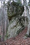
Dolomite rock group "Hanging Stone" | WB-065 |
Bad Fischau-Brunn KG: Brunn ad Schneebergbahn GrStNr: 706 location |
Note: In the FläWi property-specific (forest parcel) |
02/22/1961 | |
| 1 summer linden tree | WB-080 |
Bromberg KG: Schlatten GrStNr: 520/2 location |
10/30/1973 | |||
|
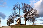
3 beeches | WB-015 |
Bromberg KG: Schlatten GrStNr: 2100 location |
11/17/1926 | ||

|
Fischa origin / occurrence of spring snails | WB-118 |
Ebenfurth KG: Haschendorf GrStNr: 315; 369/2; 369/3; 370 location |
Fischa source with intact timber slaughtering , occurrence of the spring snail Belgrandiella pelerei | 05.12.2000 | |
|
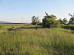
Summer fairy shrimp and dry grass | WB-119 |
Eggendorf KG: Obereggendorf GrStNr: 838; 839 location |
Vegetation strips on both sides of the Wr. Neustädter Canal , including the dirt road in whose fairways the summer fairy shrimp ( Branchipus schaefferi ), a gillfish , occurs temporarily. | 06/07/2010 | |

|
Alta source (Höllerloch) | WB-025 |
Bad Erlach KG: Brunn near Pitten GrStNr: 171/2 location |
The Alta spring ( cadastral number 2871/1, also Höllenloch, Höllerloch, Teufelsloch) is a roughly 255 m long episodic water-bearing cave in the Trias limestone. It was used as a cellar and artificially changed. The cave creek was checked for its usability for the 1st Vienna High Spring Pipeline (around 1865), but a connection was then rejected. The reason for this is assumed to be the heavily fluctuating bed , which has decreased even further due to the installation of factory sewers in the area. Note: The entrance to the spring is on private property |
||

|
1 blood maple | WB-073 |
Gutenstein KG: Gutenstein GrStNr: 457 location |
02/25/1969 | ||
| 1 ash | WB-077 |
Gutenstein KG: Gutenstein GrStNr: 2056 location |
11/22/1972 | |||

|
1 black pine | WB-072 |
Gutenstein KG: Gutenstein GrStNr: 470/1 location |
At the time when it was placed under protection in 1969, black pine, which was around 300 years old, in the Steinapiesting side valley not far from the "Long Bridge". | 01/28/1969 | |

|
2 linden trees | WB-107 |
Gutenstein KG: Gutenstein GrStNr: 601; 605 location |
Two linden trees on Etschenberg in Gutenstein, which are 250 and 300 years old and 28 and 26 meters high. As solitary trees on meadows visible from afar and therefore worth protecting. | 07/09/1993 | |

|
"Long Bridge" rock formation | WB-005 |
Gutenstein KG: Gutenstein GrStNr: 2137/1 location |
07/17/1937 | ||

|
1 summer linden tree | WB-032 |
Hochneukirchen-Gschaidt KG: Hochneukirchen GrStNr: 1888/1 location |
The summer linden tree is around 650 years old and 20 m high. It has a crown diameter of 16 m, its trunk circumference is 5.4 m. | 05/08/1938 | |

|
2 yew trees | WB-045 |
Hohe Wand KG: Stollhof GrStNr: 896/5 location |
Note: the location refers to the yew tree next to the access road to Engelbertkirche. The 2nd yew is located about 25 to 30 meters southeast. |
01/27/1953 | |

|
Quartzite rock group (Hanserlstein) | WB-054 |
Hollenthon KG: Hollenthon GrStNr: 1331/15 location |
07/24/1953 | ||

|
Turk's Cave (quartzite cave) | WB-062 |
Hollenthon KG: Hollenthon GrStNr: 1365 Location |
The Türkenhöhle ( cadastral number 2872/8, also Türkenloch, Zehentwaldhöhle) is an 8 m long cave in quartzitic breccia. | 07/24/1953 | |

|
1 sessile oak | WB-098 |
Kirchschlag in the Bucklige Welt KG: Ungerbach GrStNr: 508; 509 location |
07/06/1989 | ||

|
Summer linden tree | WB-023 |
Kirchschlag in the Bucklige Welt KG: Ungerbach GrStNr: 988/2 location |
03/28/1963 | ||

|
Radigundenstein | WB-100 |
Kirchschlag in the Bucklige Welt KG: Kirchschlag GrStNr: 318/1 location |
The Radigundenstein is a boulder that is located directly on the border with Burgenland. | 08/03/1989 | |

|
Rock formations and stone circle | WB-095 |
Krumbach KG: Krumbach GrStNr: 2936; 2937; 2723; 2724 location |
07/06/1988 | ||

|
1 linden tree | WB-071 |
Lichtenegg KG: Lichtenegg GrStNr: 144 location |
03/20/1969 | ||

|
English oak | WB-117 |
Lichtenwörth KG: Lichtenwörth GrStNr: 3473 Location |
The pedunculate oak with a uniform crown standing free in the fields east of Lichtenwörth next to a chapel is a striking landmark. | 08/11/2000 | |

|
Reeds and wet meadows | WB-112 |
Markt Piesting KG: Dreistetten GrStNr: 763; 775; 780; 781; 786; 787; 790; 575; 565 location |
01/11/1994 | ||

|
Lean grasslands | WB-104 |
Markt Piesting KG: Dreistetten GrStNr: 805/1; 805/2 location |
05/29/1992 | ||

|
Moist biotope on the Piesting | WB-115 |
Markt Piesting KG: Piesting GrStNr: 108/1 location |
12/17/1998 | ||

|
Henningerwiesen | WB-105 |
Markt Piesting KG: Piesting GrStNr: 449/1; 450; 451; 452/1 location |
The rough pasture is due to its high plant diversity for the near and very important. | 03/09/1993 | |

|
1 yew tree | WB-039 |
Miesenbach KG: Miesenbach GrStNr: 1124/1 location |
11/30/1949 | ||
| 1 black pine (Urschlföhre) | WB-010 |
Miesenbach KG: Miesenbach GrStNr: 649/1 location |
||||

|
1 holly | WB-038 |
Miesenbach KG: Miesenbach GrStNr: 1227 location |
11/30/1949 | ||
|
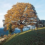
1 sessile oak | WB-075 |
Miesenbach KG: Miesenbach GrStNr: 50/6 location |
04/11/1969 | ||
| 1 sessile oak | WB-109 |
Miesenbach KG: Miesenbach GrStNr: 1320 location |
06/22/1995 | |||
| Moorish meadow | WB-094 |
Miesenbach KG: Miesenbach GrStNr: 48/4; 48/5 location |
07.10.1987 | |||

|
Rocks and ravines, Scheuchenstein and the trees on it | WB-040 |
Miesenbach KG: Miesenbach GrStNr: 638/1; 706/3; 1125/1 location |
December 21, 1949 | ||
| Rock formation natural bridge "Balberstein" | WB-008 |
Miesenbach KG: Miesenbach GrStNr: 956/2 location |
The Balberstein ( cadastral number previously 1862 / 8b, now 1862/8) is a 5 m wide and up to 2.5 m high natural bridge with a low corridor continuation and a resulting total length of 15 m. | 1926 | ||

|
"Tiefenbachfall" waterfall | WB-011 |
Miesenbach KG: Miesenbach GrStNr: 132; 378/1 location |
The Tiefenbachfall ( cadastral number 1862/99) is a 10 m high waterfall on the left feeder to the Miesenbach. Behind it is the approximately 10 m long Tiefenbachfall Cave in the Hallstatt Limestone with tuff formations . | 03/27/1929 | |
| 1 sessile oak | WB-052 |
Muggendorf KG: Muggendorf GrStNr: 714 location |
Note: Assumption of property according to the state of Lower Austria, GstNR certainly wrong - more likely 715/2 |
07/24/1953 | ||

|
2 black pines (including wayside shrine) | WB-076 |
Muggendorf KG: Muggendorf GrStNr: 1411/3 location |
05/25/1970 | ||

|
Miralucke (with lime sinter and clay structures) | WB-035 |
Muggendorf KG: Muggendorf GrStNr: 537/15 location |
December 07, 1955 | ||
|
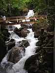
Myra Falls and the immediate surrounding area | WB-101 |
Muggendorf KG: Muggendorf GrStNr: 1526; 148/4; 147/1; 269/2; 269/19; 269/20; 147/8; .35; .37; 148/2; 1500/2; .34 Location |
06/18/1990 | ||
|
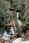
Steinwandklamm with a Turkish hole | WB-026 |
Muggendorf KG: Muggendorf GrStNr: 731/1 location |
11/03/1997 | ||

|
Steinwandklamm with Türkenloch and Wildschützenhöhle | WB-003 |
Muggendorf KG: Muggendorf GrStNr: 731/1; 895/1; 897/3 location |
10/27/1997 | ||
|
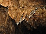
Stalactite cave "unicorn cave" | WB-027 |
Muggendorf KG: Muggendorf GrStNr: 979/1; 979/2 location |
In the cave, which was discovered in 1927, there are stalactite formations, teeth and bones of cave bears and the remains of primeval creatures. In 1930 and 1964 the cave was expanded to allow guided tours. | 09/09/1942 | |
| 1 yew tree | WB-014 |
Pernitz KG: Feichtenbach GrStNr: 112 location |
Note: Assumption of property according to the state of Lower Austria |
|||

|
"Luckerter Stein" limestone quarries (rock formations) | WB-079 |
Pernitz KG: Pernitz GrStNr: 225/1 location |
The Luckerte Stein ( cadastral number 1869/29, also Luckerte Wall) is a 10 m wide and up to 3 m high natural bridge. | 07/12/1973 | |
| Grotto spring "Gargoyle" | WB-064 |
Rohr im Gebirge KG: Rohr im Gebirge GrStNr: 196/1 location |
Note: Assumption of property according to the state of Lower Austria |
07/10/1959 | ||
| 1 winter linden tree | WB-113 |
Schwarzenbach KG: Schwarzenbach GrStNr: 1686 location |
January 17, 2000 | |||
| Sollenauer wet meadows | WB-103 |
Sollenau KG: Sollenau GrStNr: 287/1; 287/2; 287/3; 288/1; 288/2; 288/3; 289; 291; 292; 293; 294; 295; 381/1; 381/2; 381/3; 381/4; 381/5; 385; 386; 387; 388/2; 390; 391; 392; 393; 394; 395; 396; 397; 398; 399; 400; 401; 402; 403; 404; 405; 406; 407; 408; 409; 410; 411; 412; 413; 414; 415; 416; 417; 430/1; 431; 448; 422/2; 1182/1 location |
08/06/1991 | |||

|
2 winter linden trees | WB-110 |
Waidmannsfeld KG: Waidmannsfeld GrStNr: 848; 649/4 location |
02/05/1996 | ||
| 1 yew tree | WB-037 |
Waldegg KG: Dürnbach GrStNr: 242 location |
Note: Assumption of property according to the state of Lower Austria, precisely for the plot |
08/26/1947 | ||

|
Sintered lime channel with source | WB-046 |
Waldegg KG: Waldegg GrStNr: 133/1; 133/2 location |
December 20, 1952 | ||

|
1 copper beech | WB-091 |
Walpersbach KG: Schleinz GrStNr: 68/1 location |
03/29/1984 | ||
|
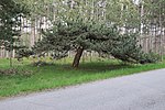
1 umbrella pine | WB-084 |
Weikersdorf am Steinfelde KG: Weikersdorf GrStNr: 569 location |
06/27/1961 | ||

|
2 linden trees | WB-108 |
Wiesmath KG: Wiesmath GrStNr: 106/2 location |
09/20/1993 | ||

|
Boulder (devil stone) | WB-055 |
Wiesmath KG: Wiesmath GrStNr: 897/1 location |
According to legend, the devil took a child after a curse and instead left behind a huge rock. | December 15, 1953 | |

|
1 black pine | WB-049 |
Winzendorf-Muthmannsdorf KG: Muthmannsdorf GrStNr: 856/2 location |
Note: GstNr wrong, GstNr 856/1 is correct |
13/01/1953 | |

|
1 black pine (paraplus) | WB-020 |
Winzendorf-Muthmannsdorf KG: Winzendorf GrStNr: 575/2 location |
Note: Assumption of property according to the state of Lower Austria, precisely for the plot |
||

|
1 service tree | WB-106 |
Winzendorf-Muthmannsdorf KG: Winzendorf GrStNr: 709/2 location |
The service tree has been placed under protection due to the rarity and dominance of the surrounding landscape. Note: GstNr wrong - probably GstNr 708 |
06/07/1993 | |

|
Moist biotope on the Piesting | WB-115 |
Wöllersdorf-Steinabrückl KG: Wöllersdorf GrStNr: 873/2; 878/1; 878/3; 879/1; 879/4; 880/1; 881/1; 883; 884; 885; 886; 887; 888; 889; 890; 891; 892; 893; 894; 895; 896; 897/1; 897/2; 898; 899; 900; 901; 902; 903; 904; 905; 906; 915; 916; 917/2; 918; 920; 921; 922; 923; 924; 925/2; 926; 927; 928; 929/1; 929/2; 930; 931; 932; 933; 934; 935; 936; 937/1; 938/1; 942; 943; 944/1; 944/2; 945/2; 946; 947; 948; 949; 950; 1875 location |
12/17/1998 | ||

|
Rock formation "Teufelsmühle" (Pontic Piesting gravel) | WB-022 |
Wöllersdorf-Steinabrückl KG: Wöllersdorf GrStNr: 1172/154 location |
|||

|
Natural bridge "Steinerner Stadl" | WB-061 |
Wöllersdorf-Steinabrückl KG: Wöllersdorf GrStNr: 1161 location |
The Steinerne Stadl ( cadastral number 1864/18) is a sweeping natural bridge in the Wetterstein limestone with a width of 18 m and a height of 1 to 2 m. The total length is 15 m. The bridge is the remainder of a collapsed cave space. Prehistoric finds from the Neolithic to the Hallstatt period . | 09/28/1957 |
Former natural monuments
| photo | Surname | ID | Location | description
|
surface | date |
|---|---|---|---|---|---|---|
| 1 black pine | WB-092 |
Bad Fischau-Brunn KG: Bad Fischau GrStNr: 434/288 |
03/11/1986 | |||
|
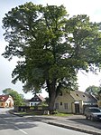
Winter linden | WB-114 |
Lanzenkirchen KG: Kleinwolkersdorf GrStNr: 366/37 Location |
The linden tree was felled in 2017. | 12/20/1999 | |
| 2 plane trees, 2 yew trees | WB-056 |
Lichtenwörth KG: Lichtenwörth GrStNr: 3306/42; 3306/41 |
10/25/1954 | |||
| 1 linden tree, 1 oak | WB-063 |
Miesenbach KG: Miesenbach GrStNr: 24/1 |
08/05/1958 | |||
| 1 plane tree, 2 yew trees | WB-047 |
Sollenau KG: Sollenau GrStNr: 969/4; 969/1 |
11/14/1952 | |||
| 2 plane trees | WB-067 |
Wöllersdorf-Steinabrückl KG: Steinabrückl GrStNr: 103/1; 103/12 |
10/30/1964 | |||
| 1 black pine | WB-041 |
Wöllersdorf-Steinabrückl KG: Wöllersdorf GrStNr: 1007/3 |
06/24/1987 | |||
| 1 black pine | WB-057 |
Wöllersdorf-Steinabrückl KG: Wöllersdorf GrStNr: 1041 |
04/21/1954 |
Notes / legend
| Photo: | Photography of the natural monument. Click the photo generates an enlarged view. There are also two symbols:
|
||||
| Surname: | Designation of the natural monument according to official sources | ||||
| ID | Identifier | ||||
| Location: | The municipality and, if available, the address are given. The cadastral community (KG) and the property number are listed below. By calling up the link Location , the location of the monument is displayed in various map projects. | ||||
| description | Brief description of the natural monument | ||||
| surface | Area of the natural monument in hectares (ha) | ||||
| date | Date or year of protection |
literature
- Province of Lower Austria, Nature Conservation Department (Ed.): List of natural monuments in Lower Austria . ( Notices and pictures [accessed on May 6, 2016]).
Web links
Commons : Natural monuments in Wiener Neustadt-Land District - Collection of images, videos and audio files
- Natural monuments of Lower Austria - punctiform and flat at data.gv.at
Individual evidence
- ^ Helga and Wilhelm Hartmann: The caves of Lower Austria . In: Regional Association for Speleology in Vienna and Lower Austria (ed.): Scientific supplements to the magazine "Die Höhle" . tape 1 . Vienna 1979, p. 25 .
- ^ Helga and Wilhelm Hartmann: The caves of Lower Austria . In: Regional Association for Speleology in Vienna and Lower Austria (ed.): Scientific supplements to the magazine "Die Höhle" . tape 1 . Vienna 1979, p. 245 .
- ^ Helga and Wilhelm Hartmann: The caves of Lower Austria . In: Regional Association for Speleology in Vienna and Lower Austria (ed.): Scientific supplements to the magazine "Die Höhle" . tape 4 . Vienna 1990, p. 467 .
- ^ Helga and Wilhelm Hartmann: The caves of Lower Austria . In: Regional Association for Speleology in Vienna and Lower Austria (ed.): Scientific supplements to the magazine "Die Höhle" . tape 1 . Vienna 1979, p. 262 .
- ↑ The Turkish Cave. In: Hollenthon Weather Trail - in the heart of the Bucklige Welt. Retrieved May 4, 2016 .
- ^ Helga and Wilhelm Hartmann: The caves of Lower Austria . In: Regional Association for Speleology in Vienna and Lower Austria (ed.): Scientific supplements to the magazine "Die Höhle" . tape 1 . Vienna 1979, p. 144 .
- ^ Helga and Wilhelm Hartmann: The caves of Lower Austria . In: Regional Association for Speleology in Vienna and Lower Austria (ed.): Scientific supplements to the magazine "Die Höhle" . tape 5 . Vienna 2000, p. 304 .
- ^ Helga and Wilhelm Hartmann: The caves of Lower Austria . In: Regional Association for Speleology in Vienna and Lower Austria (ed.): Scientific supplements to the magazine "Die Höhle" . tape 5 . Vienna 2000, p. 305 .
- ↑ Unicorn Cave
- ^ Helga and Wilhelm Hartmann: The caves of Lower Austria . In: Regional Association for Speleology in Vienna and Lower Austria (ed.): Scientific supplements to the magazine "Die Höhle" . tape 2 . Vienna 1982, p. 193 .
- ^ Helga and Wilhelm Hartmann: The caves of Lower Austria . In: Regional Association for Speleology in Vienna and Lower Austria (ed.): Scientific supplements to the magazine "Die Höhle" . tape 1 . Vienna 1979, p. 200 .
- ^ Removal of the linden tree in Kleinwolkersdorf. Marktgemeinde Lanzenkirchen, March 2, 2017, accessed on September 2, 2017 .