List of listed objects in Altaussee
The list of listed objects in Altaussee contains the 15 listed , immovable objects of the community Altaussee in the Styrian district of Liezen .
Monuments
| photo | monument | Location | description | Metadata |
|---|---|---|---|---|

|
Shrine Object ID: 115801 |
Fischerndorf location KG: Altaussee |
ObjectID : 115801 Status: § 2a Status of the BDA list: 2020-02-29 Name: wayside shrine GstNr .: 1723/2 wayside shrine at Jagdhaus Seewiese (Altaussee) |
|

|
Catholic parish church hl. Aegyd with former cemetery ObjectID : 56489 |
Fischerndorf location KG: Altaussee |
The Altaussee Church is first mentioned in a document in the general land of the Duchy of Styria, which was laid out under Albrecht I between 1280 and 1295. The church patron, St. Egidius , points to an origin in the 12th century. The current building dates from 1434. In the years 1859–1861, Emperor Franz Joseph I financed an extensive renovation in the neo-Gothic style. From the previous building is u. a. a late Gothic tabernacle still preserved (around 1520). |
ObjectID : 56489 Status: § 2a Status of the BDA list: 2020-02-29 Name: Catholic parish church hl. Aegyd with former cemetery GstNr .: .1 Parish church Altaussee |

|
Alte Gradieranstalt ObjectID : 103006 |
Fischerndorf location KG: Altaussee |
The Gradieranstalt prompt offers. Billboard relief for respiratory complaints. In 1956, the plant was built by miners and pensioners of the salt mining industry based on the idea of the then manager of the Altaussee salt mine. It is the oldest of its kind in Austria. According to the notice board, the facility and the raw brine from the Altaussee salt mine are officially recognized as a spa treatment. The Austrian Federal Forests supplies the fir branches. |
ObjectID : 103006 Status: § 2a Status of the BDA list: 2020-02-29 Name: Alte Gradieranstalt GstNr .: .1207 |

|
Parsonage Object ID: 102741 |
Fischerndorf 36 KG location : Altaussee |
ObjectID : 102741 Status: § 2a Status of the BDA list: 2020-02-29 Name: Pfarrhof GstNr .: .52 |
|

|
Shrine Object ID: 115810 |
near Fischerndorf 36 KG location : Altaussee |
ObjectID : 115810 Status: § 2a Status of the BDA list: 2020-02-29 Name: Bildstock GstNr .: 283 |
|

|
Jagdhaus Seewiese ObjectID : 115802 |
Fischerndorf 55 KG location : Altaussee |
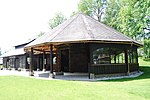
ObjectID : 115802 Status: § 2a Status of the BDA list: 2020-02-29 Name: Jagdhaus Seewiese GstNr .: 1723/1; 1723/2 Jagdhaus Seewiese (Altaussee) |
|

|
Elementary school ObjectID : 115789 |
Fischerndorf 57 KG location : Altaussee |
ObjectID : 115789 Status: § 2a Status of the BDA list: 2020-02-29 Name: Volksschule GstNr .: .795 |
|

|
Kur- und Amtshaus ObjectID : 102742 |
Fischerndorf 61 KG location : Altaussee |
ObjectID : 102742 Status: § 2a Status of the BDA list: 2020-02-29 Name: Kur- und Amtshaus GstNr .: .806 / 1 |
|

|
Trinity Column ObjectID : 102743 |
near Fischerndorf 113 KG location : Altaussee |
The Altaussee Trinity Column is the upper part of the Baroque plague column originally built in Bad Aussee in 1679 . The Bad Aussee column was demolished in 1876 because it was dilapidated and replaced by a new column by the Graz sculptor Jakob Gschiel . The upper part of the old column was set up in Altaussee, the base in the Bad Ausseer Kurpark. |
ObjectID : 102743 Status: § 2a Status of the BDA list: 2020-02-29 Name: Dreifaltigkeitssäule GstNr .: 250/1 |

|
Pflindsberg Castle Ruins ObjectID : 74893 |
Lichtersberg location KG: Altaussee |
The castle Pflindsberg was built in 1250 on behalf of the chosen Salzburg Archbishop Philip of Spanheim as fortification. Between 1460 and 1490 the rule of Pflindsberg was given high jurisdiction and from then on the castle served as a dungeon and place of execution for the regional court. After the last inhabitant left the castle complex in 1755, it was left to decay. In 2000, the Austrian Federal Forests built a lookout point on the site of the former castle complex , of which only sparse remains of the wall remain. |
ObjektID : 74893 Status : Notification Status of the BDA list: 2020-02-29 Name: Burgruine Pflindsberg GstNr .: .362 / 1; 1268 Pflindsberg Castle |

|
Miner's house of the salt mine, Steinberghaus ObjectID : 48963 |
Lichtersberg 25 KG location : Altaussee |
The miner's house "Steinberghaus" is located at 945 m above sea level on the northeast slope of the Sandling massif and is built over the mouth of the Steinberg tunnel of the Altaussee salt mine , which was struck in 1319 . Today it serves as the entrance to the show mine. The Steinberghaus and its outbuildings date from between 1839 and 1961 and served as the central above-ground facilities of the mine: management, workshops and residential buildings. During the Second World War (1943–1945) it served as access to the Altaussee salt mine , a storage site for valuable movable cultural assets to protect against the effects of the war. |
ObjectID : 48963 Status : Notification Status of the BDA list: 2020-02-29 Name: Miner's house of the salt mine, Steinberghaus GstNr .: 1393/1 |

|
Wooden huts, Blaa-Alm ObjectID : 125795 |
east of Lichtersberg 73 KG location : Altaussee |
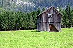
ObjectID : 125795 Status: § 2a Status of the BDA list: 2020-02-29 Name: Holzhütten, Blaa-Alm GstNr .: 1662; 1663 Blaa-Alm (Altaussee) |
|

|
Wooden huts, Altausseer Rettenbach-Alm ObjectID : 125796 |
KG location : Altaussee |
ObjectID : 125796 Status: § 2a Status of the BDA list: 2020-02-29 Name: Holzhütten, Altausseer Rettenbach-Alm GstNr .: 1687; 1688 Rettenbachalm (Altaussee) |
|

|
Roman-era route and Michlhallberg settlement ObjectID : 71899 |
Michlhallberg location KG: Altaussee |
The Roman-era settlement on Michlhallberg was connected to the Roman road network via its own road . The route led on one side via Bad Goisern to the Traun and along this to Wels / Ovilava, on the other side via Lupitsch towards Bad Aussee and Bad Mitterndorf into the Ennstal . The road was laid out as a pure dirt road. It was only fastened with wood in wetlands. This indicates that the road is of mainly local importance. However, the numerous hippo sandals that were found suggest that traffic is brisk. Note: The coordinates refer to the property and were set in the vicinity of the property in KG Lupitsch. |
ObjectID : 71899 Status : Notification Status of the BDA list: 2020-02-29 Name: Roman-era route and settlement Michlhallberg GstNr .: 1257/1 |

|
Roman-era route and Michlhallberg settlement ObjectID : 71898 |
Michlhallberg location KG: Lupitsch |
The Roman settlement on Michlhallberg was discovered in 1993. It is located on the southern slope of the Sandling at 1000 m above sea level. 1997–1999 archaeological excavations were carried out, during which numerous small finds, but no secured remains of Roman buildings were found. According to the finds, the settlement should have existed from the end of the 2nd century AD until the late 4th century. The reason for settlement activity in the remote altitude is assumed to be the nearby salt deposits in the Sandling massif. A salt processing on site could not be proven archaeologically. |
ObjektID : 71898 Status : Notification Status of the BDA list: 2020-02-29 Name: Roman-era route and settlement Michlhallberg GstNr .: 456; 454/1; 454/2; 461/1; 467/1 |
Web links
Commons : Listed objects in Altaussee - collection of images, videos and audio files
Individual evidence
- ↑ a b Styria - immovable and archaeological monuments under monument protection. (PDF), ( CSV ). Federal Monuments Office , as of February 18, 2020.
- ↑ Reinhard Lamer: The Ausseer Land. History and culture of a landscape . Graz 1998, p. 75f.
- ↑ Ausseerlandpfarren: The parish church of St. Giles in Altaussee ( Memento from February 6, 2014 in the Internet Archive )
- ↑ according to GIS Styria; GstNr. .774 according to BDA without building
- ↑ Altaussee Tourist Office: Via Salis: Station 14 ( Memento from September 24, 2014 in the Internet Archive )
- ↑ Gerald Grabherr u. a .: Michlhallberg. The excavations in the Roman settlement 1997–1999 and the investigation of the associated road route (= series of publications of the Kammerhof Museum Bad Aussee . Volume 22 ). Association of Friends of the Kammerhof Museum, Bad Aussee 2001, p. 100, 103 .
- ↑ Gerald Grabherr u. a .: Michlhallberg. The excavations in the Roman settlement 1997–1999 and the investigation of the associated road route (= series of publications of the Kammerhof Museum Bad Aussee . Volume 22 ). Association of Friends of the Kammerhof Museum, Bad Aussee 2001, p. 11, 103 .
- ↑ § 2a Monument Protection Act in the legal information system of the Republic of Austria .