
List of peaks of Prokletije
_sa_Karanfila_(2480).jpg)
The list of peaks of Prokletije contains a selection of high, well-known and prominent mountains and peaks of Prokletije in Albania , Kosovo and Montenegro .
Only the most important of the secondary peaks and pre-peaks could be recorded. Various peaks - even those with heights of more than 2500 meters - were not included in the list because no names are recorded on the maps or no names can be assigned. Only one name was given per summit, even if the names in the various languages differ significantly from each other. Different spellings are often used in the same language. In many cases there are also very different information about the height, the cause of which is not only due to the different height reference systems .
| summit | height | Solid | country | Coordinates |
|---|---|---|---|---|
| Jezerca | 2694 | Jezerca | Albania | 42 ° 27 ' N , 19 ° 49' E |
| Gjeravica | 2656 | Bjeshkët e Namuna e Kosovës | Kosovo | 42 ° 32 ' N , 20 ° 8' E |
| Maja Grykat e Hapëta | 2625 | Grykat e Hapëta | Albania | 42 ° 25 ' N , 19 ° 54' E |
| Poplluk | 2569 | Jezerca | Albania | 42 ° 26 ' N , 19 ° 48' E |
| Radohima | 2568 | Bjeshkët e Namuna | Albania | 42 ° 26 ' N , 19 ° 44' E |
| Maja e Brijasit | 2567 | Grykat e Hapëta | Albania | 42 ° 24 ' N , 19 ° 53' E |
| Maja e Zhaporës | 2561 | Grykat e Hapëta | Albania | 42 ° 24 ' N , 19 ° 52' E |
| Maja e Hekurave | 2559 | Mal i Hekurave | Albania | 42 ° 23 ' N , 19 ° 58' E |
| Maja e Shënikut (e Madhe) | 2553 | Bjeshkët e Namuna | Albania | 42 ° 28 ' N , 19 ° 44' E |
| Maja e Kollatës | 2552 | Collata | Albania | 42 ° 29 ' N , 19 ° 55' E |
| Maja Thatë | 2541 | Bjeshkët e Namuna | Albania | 42 ° 25 ' N , 19 ° 42' E |
| Maja e Gusanit | 2538 | Bjeshkët e Namuna e Kosovës | Albania / Kosovo | 42 ° 32 ' N , 20 ° 7' E |
| Zla Kolata | 2534 | Collata | Albania / Montenegro | 42 ° 29 ' N , 19 ° 54' E |
| Marijaš | 2530 | Bjeshkët e Namuna e Kosovës (Bogićevica) | Kosovo | 42 ° 37 ' N , 20 ° 6' E |
| Dobra Kolata | 2528 | Collata | Albania / Montenegro | 42 ° 29 ' N , 19 ° 54' E |
| Maja Ismet Sali Bruçaj | 2527 | Grykat e Hapëta | Albania | 42 ° 25 ' N , 19 ° 54' E |
| Maja e Langojve | 2525 | Bjeshkët e Namuna | Albania | 42 ° 29 ' N , 19 ° 46' E |
| Maja e Rosit | 2524 | Collata | Albania / Montenegro | 42 ° 29 ' N , 19 ° 51' E |
| Žuti came | 2522 | Bjeshkët e Namuna e Kosovës (Rugova) | Kosovo | 42 ° 40 ' N , 20 ° 8' E |
| Qetat e Harushës | 2522 | Grykat e Hapëta | Albania | 42 ° 26 ' N , 19 ° 54' E |
| Maja e Vishnjës | 2517 | Bjeshkët e Namuna | Albania | 42 ° 26 ' N , 19 ° 44' E |
| Maja e Gavnit | 2509 | Grykat e Hapëta | Albania | 42 ° 24 ' N , 19 ° 55' E |
| Rops | 2502 | Bjeshkët e Namuna e Kosovës (Bogićevica) | Kosovo | 42 ° 34 ' N , 20 ° 7' E |
| Maja Shkurt | 2502 | Bjeshkët e Namuna | Albania | 42 ° 29 ' N , 19 ° 46' E |
| Maja e Kolajet (Maja Majsorës) | 2498 | Jezerca | Albania | 42 ° 27 ' N , 19 ° 48' E |
| Maja e Kokërdhokut | 2495 | Jezerca | Albania | 42 ° 27 ' N , 19 ° 49' E |
| Maja e Livadhit | 2493 | Bjeshkët e Namuna | Albania | 42 ° 26 ' N , 19 ° 42' E |
| Karanfili (Veliki Vrh) | 2490 | Bjeshkët e Namuna | Montenegro | 42 ° 30 ' N , 19 ° 47' E |
| Kučki Kom | 2487 | Komovi | Montenegro | 42 ° 41 ' N , 19 ° 39' E |
| Maja e Ragamit | 2478 | Jezerca | Albania | 42 ° 26 ' N , 19 ° 50' E |
| Maja e Alisë | 2471 | Jezerca | Albania | 42 ° 25 ' N , 19 ° 48' E |
| Ljevoriječki Kom | 2469 | Komovi | Montenegro | 42 ° 41 ' N , 19 ° 39' E |
| Veternik | 2461 | Bjeshkët e Namuna e Kosovës (Koprivnik) | Kosovo | 42 ° 37 ' N , 20 ° 13' E |
| Maja e Bojës | 2461 | Jezerca | Albania | 42 ° 28 ' N , 19 ° 48' E |
| Karanfili (Severni Vrh) | 2460 | Bjeshkët e Namuna | Montenegro | 42 ° 30 ' N , 19 ° 47' E |
| Vasojevićki Kom | 2460 | Komovi | Montenegro | 42 ° 41 ' N , 19 ° 40' E |
| Maja e Prozhmit | 2452 | Bjeshkët e Namuna | Albania | 42 ° 28 ' N , 19 ° 45' E |
| Maja Vukocës | 2450 | Bjeshkët e Namuna | Albania | 42 ° 29 ' N , 19 ° 46' E |
| Karanfili (Južni Vrh) | 2441 | Bjeshkët e Namuna | Montenegro | 42 ° 30 ' N , 19 ° 47' E |
| Velika Podina | 2441 | Bjeshkët e Namuna e Kosovës (Rugova) | Kosovo | 42 ° 39 ' N , 20 ° 7' E |
| Maja e Çeslës | 2433 | Collata | Albania / Montenegro | 42 ° 29 ' N , 19 ° 51' E |
| Starac (Bandera) | 2426 | Bjeshkët e Namuna e Kosovës (Bogićevica) | Montenegro | 42 ° 38 ' N , 20 ° 3' E |
| Maja e Zezë | 2425 | Shkëlzen | Albania | 42 ° 31 ' N , 20 ° 5' E |
| Maja e Boshit | 2414 | Grykat e Hapëta | Albania | 42 ° 23 ' N , 19 ° 50' E |
| Shkëlzen | 2407 | Shkëlzen | Albania | 42 ° 27 ' N , 20 ° 8' E |
| Maja e Thatë | 2405 | Jezerca | Albania | 42 ° 28 ' N , 19 ° 52' E |
| Pasji vrh | 2405 | Bjeshkët e Namuna e Kosovës (Bogićevica) | Kosovo / Montenegro | 42 ° 36 ' N , 20 ° 5' E |
| Maja e Bogiçaj | 2404 | Bjeshkët e Namuna e Kosovës (Bogićevica) | Albania / Kosovo | 42 ° 33 ' N , 20 ° 5' E |
| Hajla | 2403 | Hajla | Kosovo / Montenegro | 42 ° 45 ' N , 20 ° 8' E |
| Kershi i Kocajave | 2397 | Shkëlzen | Albania | 42 ° 32 ' N , 20 ° 4' E |
| Maja e Etheve | 2393 | Jezerca | Albania | 42 ° 28 ' N , 19 ° 50' E |
| Rusulija | 2381 | Žljeb | Kosovo | 42 ° 45 ' N , 20 ° 15' E |
| Strellc | 2377 | Bjeshkët e Namuna e Kosovës | Kosovo | 42 ° 36 ' N , 20 ° 14' E |
| Bogićevica (Veliki krš) | 2374 | Bjeshkët e Namuna e Kosovës (Bogićevica) | Montenegro | 42 ° 36 ' N , 20 ° 5' E |
| Maja e Madhe | 2372 | Bjeshkët e Namuna e Kosovës (Bogićevica) | Kosovo / Montenegro | 42 ° 35 ' N , 20 ° 5' E |
| Tromeđa | 2366 | Bjeshkët e Namuna e Kosovës (Bogićevica) | Albania / Kosovo / Montenegro | 42 ° 33 ' N , 20 ° 5' E |
| Žljeb | 2365 | Žljeb | Kosovo / Montenegro | 42 ° 46 ' N , 20 ° 15' E |
| Maja e Kakisë | 2359 | Kakisë | Albania | 42 ° 20 ' N , 19 ° 50' E |
| Lićenat | 2341 | Bjeshkët e Namuna e Kosovës (Rugova) | Kosovo | 42 ° 39 ' N , 20 ° 6' E |
| Forca | 2340 | Bjeshkët e Namuna | Albania | 42 ° 29 ' N , 19 ° 47' E |
| Qatat e Verlla | 2333 | Jezerca | Albania | 42 ° 27 ' N , 19 ° 47' E |
| Radesha | 2313 | Shkëlzen | Albania | 42 ° 26 ' N , 20 ° 5' E |
| Ljogi i Prelš | 2306 | Bjeshkët e Namuna e Kosovës | Kosovo | 42 ° 34 ' N , 20 ° 9' E |
| Rrasa e Zogut | 2305 | Bjeshkët e Namuna e Kosovës (June) | Kosovo | 42 ° 30 ' N , 20 ° 11' E |
| Rogamski vrh | 2303 | Komovi | Montenegro | 42 ° 41 ' N , 19 ° 38' E |
| Vranovačka Hajla | 2281 | Hajla | Kosovo / Montenegro | 42 ° 46 ' N , 20 ° 7' E |
| Stedim (Ahmica) | 2272 | Hajla | Montenegro | 42 ° 45 ' N , 20 ° 11' E |
| Maja e Rabës | 2250 | Biga e Gimajve | Albania | 42 ° 23 ' N , 19 ° 40' E |
| Maja e Stogut | 2242 | Bjeshkët e Namuna | Albania | 42 ° 27 ' N , 19 ° 44' E |
| Biga e Gimajve | 2231 | Biga e Gimajve | Albania | 42 ° 20 ' N , 19 ° 44' E |
| Maja Raba e Ducajve | 2222 | Biga e Gimajve | Albania | 42 ° 22 ' N , 19 ° 40' E |
| Arapi | 2217 | Bjeshkët e Namuna | Albania | 42 ° 27 ' N , 19 ° 45' E |
| Visitor (Plana) | 2211 | Visitor | Montenegro | 42 ° 37 ' N , 19 ° 53' E |
| Vojuša | 2210 | Bjeshkët e Namuna | Albania / Montenegro | 42 ° 30 ' N , 19 ° 46' E |
| Maja e Madhe | 2195 | Kelmend | Albania | 42 ° 37 ' N , 19 ° 43' E |
| Trojan | 2190 | Kelmend | Albania | 42 ° 33 ' N , 19 ° 45' E |
| Maja e Marlulës | 2186 | Kelmend | Albania | 42 ° 38 ' N , 19 ° 42' E |
| Očnjak | 2185 | Bjeshkët e Namuna | Montenegro | 42 ° 30 ' N , 19 ° 48' E |
| Surdup | 2184 | Kučka Krajina | Montenegro | 42 ° 35 ' N , 19 ° 33' E |
| Maja e Zhihovës | 2174 | Kelmend | Albania / Montenegro | 42 ° 40 ′ N , 19 ° 44 ′ E |
| Pogled | 2154 | Mokra Gora | Kosovo / Serbia | 42 ° 50 ' N , 20 ° 22' E |
| Južni vrh Bora | 2149 | Collata | Albania / Montenegro | 42 ° 30 ' N , 19 ° 54' E |
| receipt | 2142 | Mokra Gora | Kosovo / Montenegro | 42 ° 50 ' N , 20 ° 21' E |
| Maja e Bridashës | 2126 | Bjeshkët e Namuna | Albania | 42 ° 25 ' N , 19 ° 40' E |
| Maja e Ershellit | 2126 | Kakisë | Albania | 42 ° 18 ' N , 19 ° 51' E |
| Dramadol | 2120 | Hajla | Kosovo | 42 ° 47 ' N , 20 ° 5' E |
| Forca e Kelmendit | 2072 | Bjeshkët e Namuna | Albania | 42 ° 27 ' N , 19 ° 43' E |
| Volusnica (Talijanka) | 2057 | Kelmend | Albania | 42 ° 31 ' N , 19 ° 46' E |
| Volujak | 2014 | Bjeshkët e Namuna e Kosovës (Rugova) | Kosovo | 42 ° 41 ' N , 20 ° 14' E |
| Maja e Madhe | 2014 | Dukagjin | Albania | 42 ° 19 ' N , 19 ° 41' E |
| Greben | 1840 | Kelmend | Albania | 42 ° 33 ' N , 19 ° 42' E |
| Maja e Meqithit | 1734 | Cukali | Albania | 42 ° 9 ' N , 19 ° 45' E |
| Maja e Veleçikut | 1724 | Malësia e Madhe | Albania | 42 ° 22 ' N , 19 ° 32' E |
| Maja e Cukalit | 1721 | Cukali | Albania | 42 ° 8 ' N , 19 ° 44' E |
| Maranaj | 1576 | Dukagjin | Albania | 42 ° 11 ' N , 19 ° 36' E |
Remarks
- ↑ Very often also Maja e Roshit or Rosni Vrh ; in Albanian sources 2426 each
- ↑ The assignment of the summit differs in many sources. With Kolajet also a side summit will further west called ( 2418 m above sea A.. , Hiking map North Albania Thethi and Kelmend scale of 1: 50,000 ), which with respect to altitude with the mountain Mali i Kolajt in Gjeografia fizike e Shqipërisë covers. On the maps used as evidence, a northern secondary peak ( 2421 m. In the year according to Topografska karta 1: 25,000. "Jezerce 161-2-1" ) bears the name Maja Majsorës , on other maps the main peak is so referred to, with an altitude of 2490 m is specified.
- ↑ In addition to different spellings of names, there are also very different altitudes of 2495 m above sea level. A. (Gjeografia fizike e Shqipërisë) over 2500 m above sea level. A. (Albanian military map) up to 2508 m. i. J. ( Topografska karta 1: 25,000. "Jezerce 161-2-1" and other Yugoslav and Montenegrin maps). In part, the height of a secondary peak of 2,480 m above sea level is also used. A. stated.
- ↑ On Albanian maps with 2354 m above sea level. A. recorded, on many other maps also with 2365 m. i. J. .
- ↑ In Albanian plants, each with 2194 m above sea level. A. noted.
- ^ Matterhorn of Montenegro
- ↑ The height is often 2066 m above sea level. A. of a minor summit.
Web links
Commons : Prokletije - collection of images, videos and audio files
Individual evidence
- ↑ a b c d e f g h i j k l m n o p q r s t u v w x y z aa ab ac ad ae af ag ah Akademia e Shkencave e RPSSH (ed.): Gjeografia fizike e Shqipërisë . tape 2 . Tirana 1990.
- ↑ Maja Briaset. In: SummitPost. December 7, 2008, accessed August 27, 2013 .
- ↑ a b c d e f Albanian military map 1: 50,000 "K-34-52-D". 2nd edition, Tirana 1988
- ↑ a b c d e f Albanian military map 1: 50,000 "K-34-52-C". 2nd edition, Tirana 1988
- ↑ Mali i Shen Niku / Maja Shnikut (Nikacki vrh). In: SummitPost. January 1, 2008, accessed August 29, 2013 .
- ↑ a b Albanian military map 1: 50,000 "K-34-53-A". Tirana 1979
- ↑ Kosovo in Figures 2010. (PDF) Statistical Office of Kosova, April 2011, accessed on August 29, 2013 (English).
- ^ Dobre Kolata, Montenegro. In: Peakbagger.com. Retrieved August 29, 2013 .
- ↑ Maja Lagojvet. In: SummitPost. November 23, 2010, accessed August 29, 2013 .
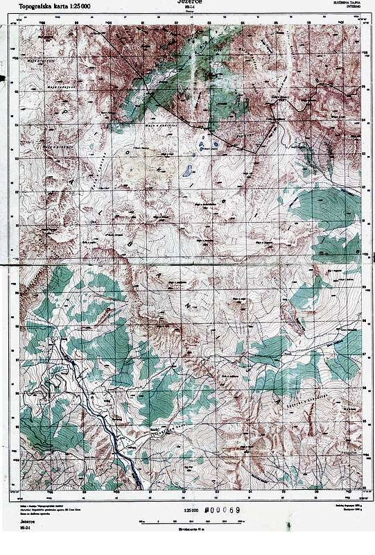
- ↑ a b Topografska karta 1: 25,000 . "Jezerce 161-2-1". Vojnogeografski Institut, Belgrade 1980 ( scan of the map [accessed on 29 August 2013]).
- ^ Former Yugoslavia Topographic Maps 1: 100,000, Series M6010 . "Peć Sheet 3080". US Defense Mapping Agency, Reston 1997 ( PDF of the map [accessed August 29, 2013]).
- ^ Jože Dobnik: Od Prokletij do Durmitorja . In: Planinska zveza Slovenije (ed.): Planinski vestnik . tape 7 . Ljubljana July 1978, p. 438–444 ( scan of the issue (PDF; 25.9 MB) [accessed on September 8, 2013]).
- ↑ a b c d e f Bogićevica / Bogiçevica. In: SummitPost. June 9, 2010, accessed September 8, 2013 .
- ↑ German Society for Technical Cooperation (ed.): Hiking map of Northern Albania Thethi and Kelmend scale 1: 50,000 . Huber, Munich 2008, ISBN 978-3-940686-18-3 .
- ↑ Maja Shkurt. In: SummitPost. October 21, 2011, accessed September 8, 2013 .
- ↑ Albania Topographic Maps 1: 50,000, Series M7020 . "Tamarë Sheet 2979 I". Instituti Gjeografik i Ushtrisë / US Defense Mapping Agency, Tirana / Reston 1998.
- ↑ Maja Kokervhake. In: SummitPost. December 8, 2008, accessed September 7, 2013 .
- ↑ a b c d Vlado Vujisić: Prokletije - južnoevropske Alpe . In: Planinska zveza Slovenije (ed.): Planinski vestnik . tape 4 , April 2007, ISSN 0350-4344 , p. 4–11 ( scan of the issue (PDF; 4.9 MB) [accessed on September 8, 2013]).
- ↑ a b c Karanfili. In: SummitPost. December 23, 2008, accessed September 8, 2013 .
- ↑ a b c Statistical Office of Montenegro MONSTAT (Ed.): Montenegro in Figures 2012 . Podgorica 2012 ( brochure online (PDF; 2.9 MB) [accessed September 8, 2013]).
- ^ A b Rudolf Abraham: The Mountains of Montenegro. A Walker's and Trekker's Guide . Cicerone Press, Milnthorpe 2007, ISBN 978-1-85284-506-3 .
- ↑ a b c Republic of Serbia - Republic Statistical Office (Ed.): Serbia in Figures 2003 . Belgrade September 2003 ( document online (PDF; 221 kB) [accessed on September 10, 2013]).
- ↑ Maja Vukoces. In: SummitPost. December 23, 2008, accessed September 9, 2013 .
- ↑ a b c d e f Peaks of the Balkans Map 1: 60,000 . Huber, Munich 2012, ISBN 978-3-943752-16-8 .
- ↑ Boris Čelebić: Velika Podina, Žuti Kamen i Nedžinat (July 26-28, 2013). In: Visokogorci Crne Gore. September 9, 2013, accessed September 15, 2013 (Montenegrin).
- ↑ a b c d e f Montenegro. Prokletije. Planinarenje i biciklizam. Karta 1: 50,000 . Kartografija Huber, Belgrade 2009, ISBN 978-3-940686-15-2 .
- ↑ Starac January 27, 2008.god. (No longer available online.) In: Planinarskog Drustva “Prokletije”, Plav. Archived from the original on September 27, 2013 ; Retrieved on September 9, 2013 (Serbian): "Samo nedjelju dana poslije uspona na Pasji vrh, nasi planinari su ovog puta imali za cilj propenjanje najvisočijeg vrha u Plavskom dijelu Prokletija, Bandera ili Crni Krš 2426mnv. na planini Info: Der Archiv was used automatically and not yet checked. Please check the original and archive link according to the instructions and then remove this notice.
- ↑ a b Montenegro Biking Panorama Prokletije. (PDF; 1.5 MB) In: National Tourism Organization of Montenegro. Retrieved September 10, 2013 .
- ↑ a b Hajla / Hajle Summit (Vrh Hajle). In: SummitPost. November 5, 2007, accessed September 10, 2013 .
- ↑ a b c d Statistical Office of the Republic of Serbia (Ed.): Statistical Yearbook of Serbia 2010 . 2010, ISSN 0354-4206 ( downloadable document (zip) [accessed September 15, 2013]).
- ↑ Forca (Fortite). In: SummitPost. December 23, 2008, accessed August 27, 2013 .
- ↑ Qatat e Verlla. In: SummitPost. January 10, 2009, accessed August 27, 2013 .
- ↑ a b Topografska karta 1: 25,000 . "Đeravica 150-3-4". Vojnogeografski Institut, Belgrade 1979 ( scan of the map [accessed September 15, 2013]).
- ↑ Topografska karta 1: 25,000 . Vojnogeografski Institut, Belgrade 1980 ( scan of the map [accessed September 15, 2013]). Scan of the card ( Memento of the original from April 28, 2014 in the Internet Archive ) Info: The archive link was inserted automatically and has not yet been checked. Please check the original and archive link according to the instructions and then remove this notice.
- ↑ Montenegro, Komovi Mountains, Tresnjevik Pass south of Kolasin: Disneyland Mountains for switchback freaks with high alpine demands. In: Photoworldwide.de. January 5, 2012, accessed September 15, 2013 .
- ↑ Rogamski Vrh. In: SummitPost. October 25, 2009, accessed September 15, 2013 .
- ↑ a b c d Kosova – Kosovo Touristic Map 1: 100,000 . Albanian Alps – Alpet Shqiptare. Huber, Munich 2012.
- ↑ Visitor / Goles / Zeletin / Greben. In: SummitPost. November 17, 2007, accessed September 15, 2013 .
- ↑ Vojusa (Vojusit). In: SummitPost. December 23, 2008, accessed September 15, 2013 .
- ↑ Trojan. In: SummitPost. December 23, 2008, accessed September 15, 2013 .
- ↑ Očnjak. In: SummitPost. December 23, 2008, accessed September 8, 2013 .
- ↑ SURDUP. In: SummitPost. March 18, 2008, accessed September 15, 2013 .
- ↑ Mokra Gora. (No longer available online.) In: Planinarski klub Oblun. Archived from the original on September 27, 2013 ; accessed on September 15, 2013 (Serbian): "S njima smo se uspeli na Pogled (2154m) drugi vrh Srbije, a onda i na obližnji receipt (2142)." Info: The archive link was inserted automatically and has not yet been checked. Please check the original and archive link according to the instructions and then remove this notice.
- ↑ Albanian military map 1: 50,000 "K-34-64-B Lekbibaj". 2nd edition, Tirana 1988
- ↑ Albanian military map 1: 50,000 "K-34-64-A". 2nd edition, Tirana 1987