Cukali
| Mali i Cukalit | ||
|---|---|---|
|
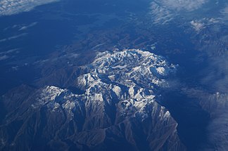
Cukali in winter dress, seen from the east |
||
| Highest peak | Maja e Meqithit ( 1734 m above sea level ) | |
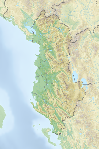
| location | Albania | |
| part of | Albanian Alps | |
|
|
||
| Coordinates | 42 ° 8 ′ N , 19 ° 44 ′ E | |
| rock | Flysch , lime | |
|
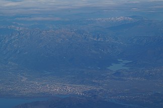
Cukali mountain range from the west with Shkodra in the foreground |
||
The Cukali ( Albanian Mali i Cukalit ) is a massive mountain in northern Albania on the southwestern edge of the Albanian Alps . The summit Maja e Cukalit ( 1721 m above sea level ), the second highest point on the massif, bears the same name as the mountain . The Maja e Meqithit , which is about two kilometers to the northeast, is 1734 m above sea level. A. slightly higher. The massif rises between the valley of the Kir in the northwest and the valley of the Drin in the south and east.
geography
The Cukali falls on all sides at sea levels of 200 m above sea level. A. and less off. A narrow ridge leads only to the north, which separates the Kir valley from the Shala valley. The ridge flows into the main massif of the Albanian Alps around 20 kilometers north of the Maja e Meqithit at the Biga e Gimajve ( 2231 m above sea level ). On this route it only falls slightly below 1000 m above sea level in two neighboring places . A. , but only in the northernmost part reaches heights of over 1400 m above sea level. A. The massif has an extension of around 20 kilometers from west to east, and a little over ten kilometers from south to north.
Due to the relief with steeply sloping walls into the Kir and Drintal valleys, the Cukali mountainous region is only well developed from the west, where it gradually turns into hilly land. In the southwest lies the Vau-Deja reservoir , in the east the Koman reservoir , in the northeast the valley of the Shala river, which is called Lesniqa in the lower reaches. A road winds from the place Drisht northeast of Shkodra into the mountains, around the Cukali and reaches heights of 1400 m above sea level. A. Many settlements in the region can only be reached on foot.
Between the two main peaks Maja e Cukalit and Maje e Meqithit lies at 1323 m above sea level. A. a nearly one kilometer long and up to 300 meter wide flat field, called Fusha e Liqenit , which has been declared a national natural monument .
Population and history
On the terraces of the Cukali high above the surrounding valleys, a few small villages were created. The former municipality of Shllak in the western part of the Cukali had 671 inhabitants in 2011, the former municipality of Temal 1562 inhabitants further east - but some of them also live outside the Cukali in the better developed Drin valley, for example in the village of Koman at the southern foot of the Massive.
The traditional area of Temal comprised three villages with a population of 1012 in 2007, while the five villages of Shllak are said to have lived 2321 inhabitants at that time (the population figures from local authorities often exceed the figures from the 2011 census and underline the low population density of the area).
Cukali is part of the Dukagjin area and was originally inhabited by the Catholic tribes of the Shllaku and the Dushmani. The Dushman were divided into the Bayraks Dushmani and Temali. Alexandre Degrand, consul in Shkodra from 1893 to 1899 , and Edith Durham described the region and its people as very poor. They lived almost exclusively from coal and goat breeding. According to Durham, the Dushman were one of the wildest tribes in northern Albania. The 1918 census counted just over 2000 members of the Shllaku tribe and less than 1000 members of the Dushmani tribe.
In 1925 the writer and albanologist Martin Camaj was born in Temal .
geology
The Cukali belongs to a geological zone made of rock, to which the plutonite and volcanite of the south adjacent Mirdita and the limestone of the Albanian Alps are postponed. In the Albanian literature, this is usually referred to as the Cukali Krasta zone - on a larger scale there is also the designation Pindos- Kukali zone - for which scaly limestone and flysch sediments are typical. In Montenegro this rock layer is also known as the Budva zone .
“The Merdita Mountains and the Dukagjin masses belonging to it […] consist of the serpentine rocks , which tend to have rounded, curved surface shapes. This series of rocks rests on a huge thrust surface on the Cukalibergland. This is built up from a different series of rocks. In it occur Eruptiva very reserved, and shale , chert layers and Kakle Mesozoic and Cenozoic Ater put it together. They are immensely tangled together verfaltet . The limestone has proven to be a rigid mass and is stuck in the more plastic rocks as packages and clods. Therefore, the Cukalibergland shows restless, cliffy surfaces even in poorly modeled areas. "
literature
- Akademia e Shkencave e RPSSH (ed.): Gjeografia fizike e Shqipërisë . tape 2 . Tirana 1991, Mali i Cukalit, p. 46-47 .
- Herbert Louis: Albania. A knowledge of the country mainly because of my own travels . Publishing house of J. Engelhorn's successors in Stuttgart, Berlin / Stuttgart March 1927, Das Cukalibergland, p. 143 f .
- Edith Durham : High Albania . London 1909, VII. Dukaghini - Dushmani, Berisha, Nikaj, Shala ( upenn.edu ).
Web links
- Andrea Kucera: Bike Paradise Albania : Into the wilderness (Neue Zürcher Zeitung of March 4, 2017)
Individual evidence
- ↑ a b Gjovalin Gruda: Fjalor enciklopedik shqiptar . Ed .: Akademia e Shkencave e RPSSH . Tirana 1985, Cukali, p. 144 (here 24 by 8 kilometers).
- ↑ Resurset natyrore. (No longer available online.) In: Keshilli i Qarkut Shkoder. Archived from the original on April 23, 2018 ; Retrieved April 23, 2018 (Albanian). Info: The archive link was inserted automatically and has not yet been checked. Please check the original and archive link according to the instructions and then remove this notice.
- ↑ Ines Nurja: Censusi i popullsisë dhe banesave / Population and Housing Census - Shkodër 2011 . Results Kryesore / Main Results. Ed .: INSTAT . Pjesa / Part 1. Adel Print, Tirana 2013 ( document as PDF [accessed on April 23, 2018]).
- ↑ Zef Gjeta: Dukagjini . Hokatari, Tirana 2008, p. 42 .
- ^ Robert Elsie : The tribes of Albania: history, society and culture . IB Tauris, London 2015, ISBN 978-1-78453-401-1 , pp. 115 ff .
- ↑ Alfred Frasheri1, Salvatore Bushati, Vilson Bare: Geophysical outlook on structure of the Albanides . In: Journal of the Balkan Geophysical Society . Vol. 12, No. 1 , December 2009, p. 9-30 ( researchgate.net ).
- ↑ Cay Lienau: Geographical Basics . In: Klaus-Detlev Grothusen (Hrsg.): Albanien (= Südosteuropa-Handbuch . Volume VII ). Vandenhoeck & Ruprecht, Göttingen 1993, ISBN 3-525-36207-2 , pp. 3 ff .
- ^ Herbert Louis: Albania. A knowledge of the country mainly because of my own travels . Published by J. Engelhorn's successors in Stuttgart, Berlin / Stuttgart March 1927, p. 143 .


