Lithium (Missouri)
| lithium | |
|---|---|
|
Location in Missouri
|
|
| Basic data | |
| Foundation : | 1883 |
| State : | United States |
| State : | Missouri |
| County : | Perry County |
| Coordinates : | 37 ° 50 ′ N , 89 ° 53 ′ W |
| Time zone : | Central ( UTC − 6 / −5 ) |
| Residents : | 89 (as of 2010) |
| Population density : | 556.3 inhabitants per km 2 |
| Area : | 0.16 km 2 (approx. 0 mi 2 ) of which 0.16 km 2 (approx. 0 mi 2 ) is land |
| Height : | 116 m |
| Postal code : | 63775 |
| Area code : | +1 573 |
| FIPS : | 29-43346 |
| GNIS ID : | 0721146 |
Lithium is a village in Perry County in the state of Missouri of the United States . The village is located within the Saline Township and had a total of 89 inhabitants at the 2010 census .
location
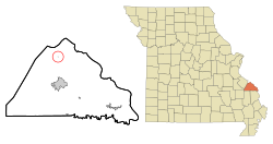
Lithium is located in southeast Missouri on the Falls Branch and Blue Spring Branch Rivers , approximately 12 kilometers north of Perryville and 90 kilometers southeast of St. Louis . The place is near the Mississippi River on the border with Illinois .
history
The area on which lithium lies was first settled in 1882. The first residents were Henry Clay Fish, RP Dobbs, and James B. Christian, who had come to Missouri from Illinois and established a settlement on the Blue Spring Branch after finding lithium salts there . The village got its name because of the lithium deposits. Lithium was incorporated as a Village the following year .
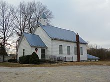
In 1883 a bath house was built in Lithium . In 1885 a Baptist church was established in Lithium and the Lithium Baptist Church was established. In 1896 the St. John Roman Catholic Church was built for the local Catholic parish. In 1912, Lithium had two general stores and two mills. Today Lithium no longer has a post office.
population
| growth of population | |||
|---|---|---|---|
| Census | Residents | ± in% | |
| 1900 | 93 | - | |
| 1910 | 98 | 5.4% | |
| 1920 | 94 | -4.1% | |
| 1930 | 61 | -35.1% | |
| 1940 | 91 | 49.2% | |
| 1950 | 57 | -37.4% | |
| 1960 | 54 | -5.3% | |
| 1970 | 56 | 3.7% | |
| 1980 | 81 | 44.6% | |
| 1990 | 9 | -88.9% | |
| 2000 | 0 | -100% | |
| 2010 | 89 | Division by zero % | |
| US Decennial Census | |||
2010 Census
At the 2010 United States Census, lithium had 89 residents, spread across 28 households and 22 families. 98.88% of the population were white and 1.12% were of other ethnicities. There were married couples in 64.3% of the households and 7.1% of the households were occupied by single women and single men. Children under 18 years of age lived in 53.6% of households and seniors over 65 years of age lived in 3.6% of households.
The median age in lithium at the time of the census was 27.5 years. 34.8% of the residents were under 18 years of age at the time of the census, 9.0% were between 18 and 24, 25.7% between 25 and 44, 20.2% between 45 and 65 and 10.1% of the population were older than 65 years. 57.3% of the population were male and 42.7% female.
Census 2000
According to the United States Census 2000 , lithium was uninhabited at that time. In an Associated Press newspaper article published in March 2001, residents of Lithium finally spoke up that the village had between 50 and 60 residents at the time. Presumably, the residents of lithium were offset against the surrounding population, which was not assigned to a place, so that the number of inhabitants was 0 for lithium, which no longer has an administration or post office.
Infrastructure
Lithium is located about seven kilometers north of US Highway 61 , which connects the village to St. Louis and Perryville. There are connections to Interstate Highway 55, 17 kilometers west-northwest and south of Lithium . North of the village is the Perryville Regional Airport .
Individual evidence
- ↑ PERRY COUNTY PLACE NAMES. The State Historical Society of Missouri, accessed October 4, 2019.
- ^ Profile of General Population and Housing Characteristics. United States Census Bureau, accessed October 4, 2019.
- ^ Census says Missouri town of Lithium has melted away. Associated Press, March 28, 2001, accessed October 4, 2019.


