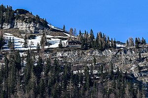
Loserhütte
| Loserhütte ÖAV refuge, category II |
||
|---|---|---|
|
Loserhütte (seen from Altaussee) |
||
| location | Loser; Styria , Austria ; Valley location: Altaussee | |
| Mountain range | Dead Mountains | |
| Geographical location: | 47 ° 39 '22.5 " N , 13 ° 46' 51.9" E | |
| Altitude | 1498 m above sea level A. | |
|
|
||
| owner | OeAV section Ausseerland | |
| Built | 1882 | |
| Construction type | Refuge | |
| Usual opening times | Open all year | |
| accommodation | 25 beds, 75 camps | |
| Hut directory | ÖAV DAV | |
The Loserhütte is a refuge of the Austrian Alpine Club in the Dead Mountains in the Styrian Salzkammergut in Austria .
Location and landscape
The Loserhütte is located at 1,498 m above sea level. A. Altitude on the south side of the Loser massif above Altaussee ( 727 m ) and the Altausseersee . It is located directly below the Hochanger ( 1838 m ). The hut has the best view of the entire Ausseerland (Ausseer basin).
history
The hut was built in 1882 by the Bad Aussee section of the DuOeAV . Already in the beginning of the summer vacation time it was a popular destination.
1954–1958 the hut was expanded. 1970–1975 Loserstraße was built, and as a result the small ski area was created here. Since then, the Loserhütte has been located a little below the middle station on the Hochanger.
In 1986 the Loserhütte was modernized again.
Tour possibilities and winter sports
Approach
- from Altaussee ( 719 m ) in approx. 2 hours
The hut can be reached by car via the Loser Panoramastraße from Altaussee, which leads from Ramsau past the Augstalm and the Loserhütte a little further to the Loseralm am Augstsee . It is used as a toll road operated
Mountaineering
- Loser ( 1837 m ) in about 1 hour
- Hochanger ( 1838 m ) in about 1 hour
- Bräuningzinken ( 1899 m ) in approx. 1½ hours
Transitions
The hut is on the Austrian long-distance hiking trail 01 .
- to the Albert-Appel-Haus ( 1638 m ) via Karl-Stöger-Steig in approx. 5 hours
- to the Wildenseehütte ( 1525 m ) in approx. 4 hours
- to the Pühringerhütte ( 1637 m ) in approx. 8 hours
Other tour destinations
- Augstsee
- Loser window , geotope
Lifts
The chairlift (Loser-Jet) leads from the Skiarena Ramsau to the Augstalm, after a short descent you reach the second Loser chairlift, above the Loserhütte the Loserfenster chairlift begins to the Loserfenster located a little east of the summit of the Hochanger.
Literature & Maps
- Alpine Club Map Bl. 15/1 (Totes Gebirge - West), 1: 25,000; Austrian Alpine Club 2014; ISBN 978-3-928777-29-2 .
- ÖK 50, sheet 96 (Bad Ischl), 1: 50,000; Federal Office for Metrology and Surveying.
- Freytag & Berndt u. Artaria KG Publishing and Distribution Bl. WK 281.
Web links
Individual evidence
- ↑ a b c Loser Hut. In: kreiter.info: namesake of the refuges.
- ↑ Half a century. 50 years of Loser Bergbahnen. ( Memento of the original from April 3, 2018 in the Internet Archive ) Info: The archive link was inserted automatically and has not yet been checked. Please check the original and archive link according to the instructions and then remove this notice. Press release, Loser Bergbahnen GmbH & Co KG, Altaussee, October 6, 2015 (doc, loser.at).
- ↑ Loser - Altaussee - Schneebären ski area. bergfex.at


