Monk (mountain)
| monk | ||
|---|---|---|
|
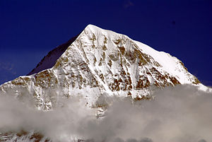
The monk seen from the north |
||
| height | 4107 m above sea level M. | |
| location | Switzerland | |
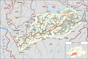
| Mountains | Bernese Alps | |
| Dominance | 3.55 km → Jungfrau | |
| Notch height | 578 m ↓ Unteres Mönchsjoch | |
| Coordinates | 642839 / 156 508 | |
|
|
||
| First ascent | August 15, 1857 by Christian Almer , Christian Kaufmann, Ulrich Kaufmann and Sigismund Porges | |
| Normal way | from Mönchsjochhütte via southeast ridge II / ZS - | |
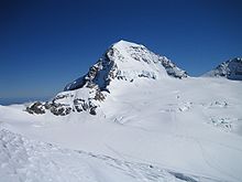
The Mönch is a 4107 m high mountain in the Bernese Alps in Switzerland . Together with the Eiger and Jungfrau , it forms a striking group of three, visible from afar, a so-called “ triumvirate ”.
Its first ascent took place on August 15, 1857 by Christian Almer , Christian Kaufmann, Ulrich Kaufmann and Sigismund Porges.
To the southeast of the Mönch is the Mönchsjochhütte , 3657 m above sea level. High mountain hut a little above the upper Mönchsjoch, which separates the Mönch from the Trugberg .
Height determination
In 1935 the height of the monk was determined to be 4099 m . This number can still be found frequently in the literature today. In 1993, however, measurements by aerial photogrammetry showed an altitude of 4107 m . The value on the national map of Switzerland was then corrected. With a measurement by GPS in 1997 a height of 4109.4 m was determined ; and a new aerial photogrammetric measurement in 1999 even resulted in an altitude of 4110 m . However, these new measurements were not taken into account on the official maps. Not only measurement errors are responsible for these deviating values, but also the fact that the monk has a knoll made of firn , which has grown in recent years.
Surname
At the foot of the Mönch there are alpine meadows, on which geldings , so-called “Münche”, used to summer . This is what the Münchenberg mountain above the Munich Alps was called and ultimately only Münch or Mönch.
Routes
South arm of the east ridge (normal route)
- Difficulty: ZS- , with II. UIAA grade rock climbing
- Time required: 2½ – 3½ hours from the Mönchsjochhütte , 3–4 hours from the Jungfraujoch
- Starting point: Mönchsjochhütte ( 3657 m )
- Valley location: Grindelwald ( 1034 m )
Southwest ridge
- Difficulty: ZS- , with III-. UIAA grade rock climbing
- Time required: 3–4 hours
- Starting point: Jungfraujoch ( 3454 m )
- Valley location: Grindelwald ( 1034 m )
Northeast arm of the east ridge
- Difficulty: ZS , with III +. UIAA grade rock climbing
- Time required: 4–5 hours
- Starting point: Mönchsjochhütte ( 3657 m )
- Valley location: Grindelwald ( 1034 m )
Northeast ridge
- Difficulty: ZS
- Time required: 4–5 hours
- Starting point: Mönchsjochhütte ( 3657 m )
- Valley location: Grindelwald ( 1034 m )
Northwest Bulwark (Nollen)
- Difficulty: S
- Time required: 6–10 hours
- Starting point: Guggihütte ( 2791 m )
- Valley location: Kleine Scheidegg ( 2061 m )
literature
- Daniel Anker (Ed.): Mönch: Center in the triumvirate. Zurich: AS Verlag , 2002. ( Mountain monograph Volume 8). ISBN 3-905111-74-8
- Martin Rickenbacher: On the growing and shrinking mountains - the history of the monk's altitude. In: Cartographica Helvetica Heft 16 (1997) pp. 3–12 full text
Web links
- Martin Rickenbacher: On the growing and shrinking mountains - the history of the monk's altitude. , in Cartographica Helvetica issue 16, July 1997, pp. 3–12.
- Mönch bei 4000er - The four-thousanders of the Alps
- Mönch on GeoFinder.ch
- Monk tour reports
Individual evidence
- ^ Adolf Schaer-Ris: My Thunersee. Fischer, Münsingen 1959.


