
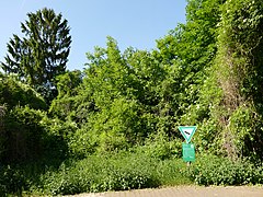
Mühlbachtal from Bergen-Enkheim
|
NSG Mühlbachtal from Bergen-Enkheim
|
||
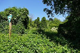
 Path in the south of the nature reserve |
||
| location | Frankfurt am Main , Hessen , Germany | |
| surface | 3.28 ha | |
| Identifier | 1412006 | |
| WDPA ID | 164717 | |
| Geographical location | 50 ° 9 ' N , 8 ° 45' E | |
|
||
| Setup date | 1968 | |

The Mühlbachtal is 3.28 hectares , the smallest nature reserve in Frankfurt . It is located in the eastern part of Bergen-Enkheim on the southern slope of the Berger Ridge .
Where since 1968 designated as a nature reserve Mühlbachtal the place giant horsetail ( Equisetum telmateia ), relic of a former creek floodplain forest . It is the only occurrence in the entire Rhine-Main area . The botany of the Mühlbachtal is also characterized by wet meadows , orchards and semi-arid grasslands .
Mühlbach and Enkheimer Mühle
The Enkheimer Mühlbach , which gives it its name, is around 180 meters long and is one of the shortest streams in Frankfurt and is now a ditch that only carries water at times. The Mühlbach dug a five to eight meter deep valley into the southern slope of the Berger Ridge, which is particularly steep here. In earlier times the brook was fed by the local springs Schelmenborn, Röhrborn, Hessenborn and Jakobsbrunnen, and from 1850 by the Pfingstborn, which was diverted for this purpose . The water from the springs, which was fed to the brook via pipes, was dammed up into a mill pond in order to power the Enkheimer Mühle, a watermill from the 18th century . After passing the mill, the Mühlbach flowed into the Seckbacher Ried southwest of it , an oxbow lake of the river Main in the Frankfurt-Seckbach district . The mill was stopped in operation in 1890 and the mill pond was filled in.
Today the source of the Enkheimer Mühlbach is located below the Heinrich-Bingemer-Weg in Bergen-Enkheim (138 m above sea level) in the Mühlbachtal nature reserve. The stream is after a steep downward slope in Bergen-Enkheim at about 115 m above sea level. NN directed into the local sewerage system. A renaturation of the water and re-introduction into the Seckbacher Ried are planned to improve its water balance.
Both the Enkheimer Mühlbach (station 14) and the Enkheimer Mühle (station 15) are stops on the Quellenwanderweg in Frankfurt's green belt .
Mühlbachtal from Bergen-Enkheim northern part
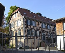
Half-timbered house Alt-Enkheim 9, historical water mill from 1728 (settlement outside the nature reserve)
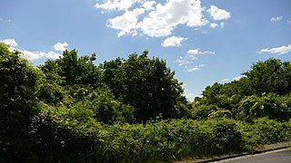
Mühlbachtal from Bergen-Enkheim east view
Mühlbachtal from Bergen-Enkheim west view


literature
- City of Frankfurt am Main, Environment Agency (Ed.): City waters - discover rivers, streams, oxbow lakes . Frankfurt 2004. Therein: Chapter Eastern Main tributaries - Enkheimer Mühlbach, p. 32
Web links
- Mühlbachtal nature reserve on the website of the city of Frankfurt am Main
- Enkheimer Mühlbach on the website of the city of Frankfurt am Main
Individual evidence
- ↑ City of Frankfurt am Main, Environment Agency, Green Belt Project Group: The Quellenwanderweg in the Frankfurt Green Belt . Leaflet, Frankfurt 2007
