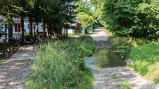
Magdel
| Magdel | ||
|
Magdelfurt, In der Aue |
||
| Data | ||
| location | Weimarer Land district , Thuringia , Germany | |
| River system | Elbe | |
| Drain over | Ilm → Saale → Elbe → North Sea | |
| source | east of Blankenhain 50 ° 50 ′ 24 ″ N , 11 ° 24 ′ 14 ″ E |
|
| Source height | approx. 425 m | |
| muzzle | near Mellingen in the Ilm coordinates: 50 ° 55 ′ 54 ″ N , 11 ° 24 ′ 6 ″ E 50 ° 55 ′ 54 ″ N , 11 ° 24 ′ 6 ″ E |
|
| Mouth height | approx. 232 m above sea level NN | |
| Height difference | approx. 193 m | |
| Bottom slope | approx. 14 ‰ | |
| length | 14 km | |
The Magdel is an approximately 14 km long right tributary of the Ilm in the Weimarer Land district in Central Thuringia .
course
It rises on the 465 meter high Wachenberg on the Ilm-Saale-Platte east of Blankenhain . Then it runs in a northerly direction through Loßnitz , Söllnitz , Tromlitz and Niedersynderstedt to Göttern . There it changes its direction of flow to northwest and runs through the city of Magdala . Below Magdala there are numerous mills in the Magdeltal before it flows into the Ilm from the right in Mellingen .
additional
The federal motorway 4 between the junctions Magdala and Apolda and the state road Mellingen - Magdala - Blankenhain run through the Magdeltal .
Surname
There are no older documented mentions of the brook, they all deal with Magdala . The original name was probably Madel. A folk etymological derivation from maid would be conceivable . The original name is probably derived from the Old High German Madal (place of assembly), the Gothic maþel (market place), Anglo-Saxon mädhel (place of assembly) or the Middle High German mahel (people's court). A derivation from Old High German mad, math (mat, grassland) is also conceivable for the place. For the middle of the 19th century, however, the basic word aha (a variant of -au ) is proven. The name would therefore be court water or meadow water. Since a corresponding naming of the place seems unlikely, the stream is probably the name of the place.
Individual evidence
- ↑ a b http://www.mapcoordinates.net/
- ↑ Elfriede Ulbricht: The river basin of the Thuringian Saale. A name-based investigation (= German-Slavic research on naming and settlement history. No. 2, ISSN 0070-3893 ). Max Niemeyer, Halle (Saale) 1957, (at the same time: Leipzig, University, dissertation, 1954).
