Manheim-new
|
Manheim-new
City of Kerpen
|
|
|---|---|
| Coordinates : | 50 ° 52 ' N , 6 ° 40' E |
| Height : | approx. 90 m |
| Area : | 55 ha |
| Residents : | 1304 (Dec. 31, 2019) |
| Population density : | 2,371 inhabitants / km² |
| Postal code : | 50171 |
| Area code : | 02275 |
|
Location of Manheim-neu in the Rhenish lignite district
|
|


Manheim-neu is a district of the city of Kerpen in the Rhein-Erft district in North Rhine-Westphalia .
location
Manheim-neu lies west of Kerpen. District road 55 runs south of the village and district road 17 on the eastern outskirts. North of the village is the Lörsfelder Busch, which is part of the Bürge forest area . Direct neighbors are Kerpen (in the east), Langenich (in the south) and Bergerhausen (in the west).
history
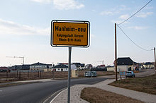
Manheim-neu is being built as the result of the Hambach open-cast lignite mine by the RWE group. The old town of Manheim has to give way by 2022. The groundbreaking ceremony took place on September 17, 2011. The official resettlement start was on April 1, 2012. As of April 2012, the Manheim-new resettlement location was expanded to such an extent that the first plots of land could already be built on. The entrance signs with the inscription Manheim-neu - Kolpingstadt Kerpen - Rhein-Erft-Kreis were put up in August of the same year. The basic road construction was completed in the first half of 2013. In the middle of the same year, the toboggan hill (at the western entrance to the village) and the playground in the center of the new village were completed.
Some of the street names are based on the old street names of Manheim 2011. So was z. B. Tannecker Weg from Tannecker Strasse, Esperantoweg from Esperantostrasse, Germaniaring from Germaniastrasse and St. Albanus Weg from St. Albanus Strasse.
The cemetery was consecrated and opened on February 20, 2014. The reburial work began in March 2014.
In the spring of 2015 the first carnival parade moved through the new village and at the end of August 2015 the new grill hut was inaugurated.
Population development
|
Local community
The local community is shaped and animated by the activities of a number of clubs and associations.
sports clubs
- Turnverein TV Germania Manheim 1887 e. V. - gymnastics, swimming, judo
- Football club FC Viktoria 1919 eV Manheim - football
Carnival clubs Three carnival clubs liven up the Rhenish fifth season and take part in the traditional Carnival Tuesday parade .
- KG United Associations Manheim
- KG Red Hussars
- Erftland dance corps
Other clubs and associations
- St. Albanus & St. Leonhardus Rifle Brotherhood Manheim
- Kerpen volunteer fire brigade, Manheim fire fighting group
- Drum and fanfare corps Blau-Weiß Manheim
- Nature and garden friends Manheim
- May society Funny boys Manheim
Web links
- Resettlement of Manheim on the website of the Kolping City of Kerpen
Individual evidence
- ↑ Distribution to the districts in 2018. In: Website of the city of Kerpen. Retrieved February 9, 2019 .
- ↑ http://www.openstreetmap.de/karte.html
- ↑ http://www.rwe.com/web/cms/de/1140298/umsiedlung/meine-umsiedlung/manheim/verektivenstand/
- ↑ Kölner Stadt Anzeiger Rhein-Erft, August 7, 2012: The place-name sign for Manheim-neu stands.
- ↑ http://www.stadt-kerpen.de/media/custom/1708_5822_1.PDF?1352279170 (accessed on March 11, 2014)
- ↑ Kölner Stadt Anzeiger Region Rhein-Erft, February 5, 2014: New cemetery is almost ready.
- ↑ Sunday Post February 21, 2014: Stones from Manheim will be brought - in a few weeks the resettlement of the deceased will begin.


