Matucana (Peru)
| Matucana | ||
|---|---|---|
|
|
||
| Coordinates | 11 ° 51 ′ S , 76 ° 23 ′ W | |
| Basic data | ||
| Country | Peru | |
| Lima | ||
| province | Huarochirí | |
| ISO 3166-2 | PE-LIM | |
| District | Matucana | |
| height | 2378 m | |
| Residents | 2546 (2017) | |
| founding | 1647 | |
| Website | munimatucana.gob.pe (Spanish) | |
| politics | ||
| mayor | Eveling Geovanna Feliciano Ordoñez (2019-2022) |
|
Matucana is the capital of the Huarochirí province in the Lima region on the western slope of the Western Peruvian Cordillera .
location
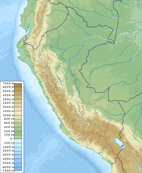
Matucana is located at an altitude of 2378 m above sea level on the left bank of the Río Rímac , which flows into the Pacific Ocean at Callao . Matucana is located 75 kilometers from the metropolis of Lima in a west-southwest direction and the La Oroya railway junction in the Andean highlands in the northeast.
climate
The climate of Matucana is dry and temperate with maximum daily temperatures of 27 ° C in summer and 19 ° C in winter.
population
Matucana had 2546 inhabitants at the 2017 census. Ten years earlier the population was 2674.
Others
Matucana is connected to Lima by a railway line, which is now only used for freight transport.
In January 1998, after heavy rains, parts of Matucana were spilled by a devastating mud and debris avalanche because a mountain lake overflowed its banks and poured into the valley, leaving several hundred people homeless and more than 15 people dead.
The cactus genus Matucana is named after the place.
