Medveditsa (Don)
|
Medveditsa Медведица |
||
|
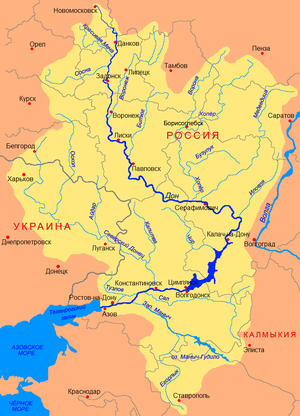
Course of the Medveditsa (Медведица) in the northeast of the Don river basin |
||
| Data | ||
| Water code | RU : 05010300112107000007903 | |
| location | Saratov , Volgograd Oblast ( Russia ) | |
| River system | Don | |
| Drain over | Don → Sea of Azov | |
| source | in Saratov Oblast 52 ° 13 ′ 41 ″ N , 46 ° 14 ′ 23 ″ E |
|
| muzzle | in the Don in the Volgograd Oblast Coordinates: 49 ° 34 ′ 35 " N , 42 ° 38 ′ 19" E 49 ° 34 ′ 35 " N , 42 ° 38 ′ 19" E
|
|
| length | 745 km | |
| Catchment area | 34,700 km² | |
| Drainage location: 66 km above the mouth |
MQ |
69 m³ / s |
| Left tributaries | Idolga , Karamysh , Arscheda | |
| Right tributaries | Balanda , Tersa | |
| Medium-sized cities | Petrovsk , Atkarsk , Zhirnovsk , Michailowka | |
| Navigable | from Atkarsk by canoe | |
|
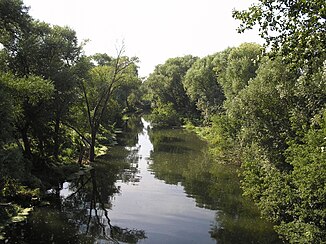
The Medveditsa River near Atkarsk |
||
The Medveditsa River ( Russian Медведица ) is a left tributary of the Don in Saratov Oblast and Volgograd Oblast , Russia . The name translates as "she-bear". According to legend, this name comes from the abundance of bears that used to be found here.
geography
The Medveditsa River has its source in the northern part of Saratov Oblast . Only about 30 kilometers from its source, the river is dammed over a length of five to seven kilometers and a width of one kilometer. The first major city on the river is Petrovsk . In the Volgograd Oblast the Medveditsa finally flows into the Don.
Tributaries
Right tributaries:
Left tributaries:
Individual evidence
- ↑ a b c Article Medveditsa in the Great Soviet Encyclopedia (BSE) , 3rd edition 1969–1978 (Russian)
- ↑ a b Medveditsa in the State Water Register of the Russian Federation (Russian)

