
Melk (river)
| Melk | ||
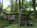
 The Melk in Ruprechtshofen |
||
| Data | ||
| location | Lower Austria | |
| River system | Danube | |
| Drain over | Danube → Black Sea | |
| source | near the Statzberg, Sankt Anton an der Jeßnitz 48 ° 0 ′ 7 ″ N , 15 ° 15 ′ 7 ″ E |
|
| Source height | 802 m above sea level A. | |
| muzzle | in Melk in the Danube Coordinates: 48 ° 14 ′ 7 ″ N , 15 ° 19 ′ 57 ″ E 48 ° 14 ′ 7 ″ N , 15 ° 19 ′ 57 ″ E |
|
| Mouth height | 201 m above sea level A. | |
| Height difference | 601 m | |
| Bottom slope | 17 ‰ | |
| length | 36 km | |
| Catchment area | 292.5 km² | |
| Right tributaries | Deficiency | |
| Small towns | Melk | |
| Communities | St. Anton an der Jeßnitz , St. Georgen an der Leys , Oberndorf an der Melk , Ruprechtshofen , St. Leonhard am Forst , Zelking-Matzleinsdorf | |
The Melk (until the 19th century also Mölk ) is a southern, right tributary of the Danube . It rises near the Statzberg in the municipality of Sankt Anton an der Jeßnitz . But there is also a so-called "Milking Jump" about 4 km south of St. Georgen an der Leys in Waidagraben. The river flows through the towns of St. Georgen / Leys , Oberndorf an der Melk , Diesendorf, Ruprechtshofen and St.Leonhard / Forst and flows into the Danube near the town of Melk . Shortly after Sankt Leonhard am Forst, the Mank flows into the Melk in the so-called "Zwiesel" , which significantly increases the amount of water.
The following fish are native to the Melk: barbel , chub , nose , rainbow trout , brown trout , minnow and huchen . Between St.Leonhard / Forst and Mannersdorf there is a walkout that is not connected to the river (Alte Melk) with pike , carp , roach and rudd populations.
photos
Milking jump approx. 4 km south of St. Georgen an der Leys in Waidagraben

The Melk shortly after St. Leonhard am Forst at the so-called "Zwiesel" where the Mank flows into it

Ancient designation, bridge sign A1


literature
- Roman Josef Hödl: The epigenetic valleys in the lower reaches of the rivers Ybbs, Erlauf, Melk and Mank . Vienna 1904. In: LIV. Annual report on the kk Staatsgymnasium in the 8th district of Vienna for the school year 1903/1904. Digitized
Web links
- Information about the Melk River (history, nature) , accessed on March 24, 2013
- Ecological improvement of the milking facility (PDF, 1 page).
Individual evidence
- ↑ BMLFUW (Hrsg.): Area directory of the river areas: Danube area from the Enns to the Leitha. In: Contributions to Austria's hydrography, issue 62, Vienna 2014, p. 47/148. PDF download , accessed July 8, 2018.