
St. Leonhard am Forst
|
market community St. Leonhard am Forst
|
||
|---|---|---|
| coat of arms | Austria map | |
 |
|
|
| Basic data | ||
| Country: | Austria | |
| State : | Lower Austria | |
| Political District : | Melk | |
| License plate : | ME | |
| Surface: | 43.68 km² | |
| Coordinates : | 48 ° 9 ′ N , 15 ° 17 ′ E | |
| Height : | 249 m above sea level A. | |
| Residents : | 3,042 (January 1, 2020) | |
| Population density : | 70 inhabitants per km² | |
| Postal code : | 3243 | |
| Area code : | 02756 | |
| Community code : | 3 15 39 | |
| NUTS region | AT121 | |
| Address of the municipal administration: |
Hauptplatz 1 3243 St. Leonhard am Forst |
|
| Website: | ||
| politics | ||
| Mayor : | Hans-Jürgen Resel ( ÖVP ) | |
|
Municipal Council : ( 2020 ) (21 members) |
||
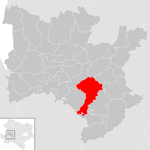
| Location of St. Leonhard am Forst in the Melk district | ||
  |
||
 Municipal Office |
||
| Source: Municipal data from Statistics Austria | ||

St. Leonhard am Forst (also Sankt Leonhard am Forst ) is a market town with 3,042 inhabitants (as of January 1, 2020) in the Melk district in Lower Austria .
geography
St. Leonhard am Forst is located in the Mostviertel in Lower Austria. The area of the market town covers 43.44 square kilometers. 27.27 percent of the area is forested.
Community structure
The municipality includes the following 50 localities (population in brackets as of January 1, 2020):
- Aichbach (23)
- Altenhofen (20)
- Abfaltersbach (18)
- Au (30)
- Brandstatt near Au (11)
- Brandstatt near Oed (13)
- Dangelsbach (52)
- Diesendorf (91)
- Eisguggen (14)
- Donkey ditch (14)
- Fachelberg (47)
- Alleys (153)
- Violin Hill (21)
- Grillenreith (10)
- Grimmegg (69)
- Groß Weichselbach (102)
- Grub near Harbach (15)
- Haindorf (18)
- Harbach (42)
- Haslach (37)
- Hochstraß (24)
- Hohenreith (7)
- Hörgerstall (25)
- Hub at the Mank (13)
- Kerndl (16)
- Klein Weichselbach (11)
- Kuehberg (5)
- Lachau (53)
- Lehenleiten (22)
- Luncheon (19)
- Oed near Haslach (12)
- Pollendorf (24)
- Pühra (39)
- Reith near Vornholz (14)
- Reith near Weichselbach (24)
- Gutter (17)
- Ritzenberg (2)
- Ritzengrub (47)
- Sand plains (38)
- Sankt Leonhard am Forst (1527)
- Schönbuch (27)
- Schweining (47)
- Seimetzbach (45)
- Steghof (33)
- Steinbach (29)
- Strass (7)
- Thal (26)
- Urbach (37)
- Front wood (25)
- Wegscheid (27)
The community consists of the cadastral communities Aichbach, Grimmegg, Ritzengrub and St. Leonhard am Forst.
Neighboring communities
| Zelking-Matzleinsdorf | Melk | Schollach |
| Ruprechtshofen |
.svg)
|
Hürm |
|
Oberndorf an der Melk ( Scheibbs district ) |
Kirnberg on the Mank | Deficiency |
history
In ancient times, the area was part of the Noricum province . Roman gravestones, a milestone, a Roman lion's head and a stone eagle (perhaps part of a tomb) were found in the municipality, the latter two walled in on the farm "(lower) Hub". The names of the rivers Mank and Melk, which flow together in the municipality, are likely to be of Slavic origin. In Franconian times, the area certainly belonged to the "fiscus" of Melk, which probably fell partly to the Archdiocese of Salzburg in the 9th century. In the 12th century, St. Leonhard am Forst belonged to the domain of the Counts of Peilstein, whose ancestors probably acquired property here as bailiffs of Salzburg. They were of the same tribe as the Counts of Burghausen and Schala (modern: Schallaburg). In 1160 the parish of St. Leonhard am Forst was donated by the Counts of Peilstein with the consent of Bishop Konrad von Passau. After the Peilsteiners died out at the beginning of the 13th century, the Dukes of Austria became the owners of the Peilstein rule and patronage over the parish of St. Leonhard am Forst. As early as the 13th century, St. Leonhard am Forst was considered a "market" (forum). The Peilstein Castle stood northeast of St. Leonhard on a hill above the Mank River (KG Thal), opposite the one only in the 19th and 20th centuries. so-called "singer stone". The castle was in ruins as early as the 15th century. The seat of power was the market castle built in the market, which - like the entire "Grafschaft Peilstein - St. Leonhard" - belonged to different owners since the 15th century and for a long time belonged to a branch of the Austrian line of the Counts of Auersperg . In the 19th century, the Habsburg family fund acquired power, which came to private individuals as part of the sale of state property. The castle itself (including the castle park and gardening) was acquired by the community of St. Leonhard am Forst around 1930 and is now used as the official seat of the community and for cultural purposes. In addition to this land and court rule "Grafschaft Peilstein - St. Leonhard", other rulers also had property in the municipality, such as Schallaburg, the Karthausen Mauerbach and Gaming, the Lilienfeld and Melk monasteries and the owners of small, knightly seats such as Weichselbach, Zwerbach, Zinsenhof, etc. A number of trades can be traced back to the 16th century, they served the local supply of the rural residents. For the area of the market court, a wisdom ("Banntaiding") has been preserved from the 15th century, with various penal provisions. The pillory (a pillory of shame) preserved on the main square is an expression of market jurisdiction within a precisely defined legal area . The economic centrality of the market place rarely crossed the parish area, and the first financial institutions (Raiffeisen advance payment association around 1900) remained within this framework. After the late connection to the narrow-gauge local railway Ober-Grafendorf – Gresten (now closed), a warehouse was built for the agricultural cooperative St. Leonhard am Forst-Wieselburg. The numerous road connections via Ruprechtshofen to Wieselburg and to Melk, Mank and Loosdorf (or St. Pölten) were only given a dust-free surface in the 1960s.
Religions
The Roman gravestones walled in at the parish church testify to pre-Christian cults. With the conquest by the Franks (around 800) and the reconquest of the areas east of the Enns (Mark Ostarrîchi) by Otto the Great after 955 AD, Christianity in its Latin version prevailed. The founding of the parish was confirmed in a document in 1160. Then a Romanesque parish church was built, the core of which is contained in the nave of the recent Gothic building from the 14th and 15th centuries. In front of the Romanesque square building, a long and high east choir (with today's baroque main altar, around 1720) was built in front of the choir, a high and bright Lady Chapel to the north. Chapel extensions to the nave vaulted in the late Middle Ages convey the character of a Gothic stacked church for this part. The large westwork with built-in chapels (Loretto chapel with the burial place of Count Auersperg) and organ choir is remarkable. The parish was originally very large, it reached beyond Scheibbs to the south into the northern Limestone Alps (Jessnitztal). Already around 1200 there was a division, now the neighboring village of Ruprechtshofen was also designated as the seat of a parish. In the 14th century, the parish of St. Leonhard am Forst was transferred to the newly founded Karthaus Mauerbach and incorporated, while the parish of Ruprechtshofen was incorporated into Karthaus Gaming. Numerous pastors and chaplains are known by name, and the time of the baroque redesign of the furnishings (2nd decade of the 18th century) is well documented. The vast majority of the inhabitants are still Catholic Christians.
Population development
According to the results of the 2001 census, there were 3,025 inhabitants. In 1991 the market town had 3,043 inhabitants, in 1981 2967 and in 1971 2,986 inhabitants.
politics
The municipal council has 21 members.
- With the municipal council elections in Lower Austria in 1990, the municipal council had the following distribution: 19 ÖVP and 4 SPÖ.
- With the municipal council elections in Lower Austria in 1995, the municipal council had the following distribution: 17 ÖVP, 4 SPÖ and 2 FPÖ.
- With the municipal council elections in Lower Austria in 2000, the municipal council had the following distribution: 16 ÖVP, 4 SPÖ and 3 FPÖ.
- With the municipal council elections in Lower Austria in 2005 , the municipal council had the following distribution: 14 ÖVP, 4 SPÖ, 4 citizens' list St. Leonhard am Forst and 1 FPÖ.
- With the municipal council elections in Lower Austria 2010 , the municipal council had the following distribution: 15 ÖVP, 3 FPÖ, 3 SPÖ and 2 citizens' list St. Leonhard am Forst. (23 members)
- With the municipal council elections in Lower Austria in 2015 , the municipal council had the following distribution: 14 ÖVP, 4 FPÖ, 2 SPÖ and 1 citizens' list St. Leonhard am Forst.
- With the municipal council elections in Lower Austria 2020 , the municipal council has the following distribution: 12 ÖVP, 6 Vision Leonhard, 2 FPÖ, and 1 SPÖ.
- mayor
- since 2003 Hans-Jürgen Resel (ÖVP)
Culture and sights

- Peilstein castle ruins in Thal
- Fortification of Burgstall Vornholz
- Fortification of Burgstall Peillenstein
- Catholic parish church St. Leonhard am Forst
economy
In 2001 there were 108 non-agricultural workplaces, agricultural and forestry operations 193 according to the 1999 survey. According to the 2001 census, the number of people in employment at the place of residence was 1323. The 2001 employment rate was 44.95 percent.
Spatial planning
In 2015 all chestnut trees were removed from the main square due to a fungal infection. As a result, further actions regarding the redesign of the main square were discussed. Since the intersection of Melkerstrasse and Wieselburgerstrasse showed more accidents, a redesign of this intersection was also planned. Six variants were proposed for this in 2016 and presented at various citizen information. The new intersection area should provide traffic safety for pedestrians and a continuous flow of traffic as well as comply with the current regulations regarding traffic planning. According to the traffic planner, a roundabout appeared to be the most efficient solution for this intersection area, and it had the most positive properties. However, this variant caused resentment among the population and led to the foundation of a citizens' initiative (called the Hauptplatzkomitee St.Leonhard / F.). Citizens' meetings were also held for fear that the roundabout would lose the character of an avenue.
At the meeting of the municipal council on December 5, 2016, the roundabout variant was decided with all votes from the ÖVP and one vote from the SPÖ. At this meeting, the local councils of the FPÖ parliamentary group were no longer present when the vote was taken.
societies
Sankt Leonhard am Forst is a community with a strong association. There are a large number of youth, sports and leisure clubs in the portfolio, with many organizations operating across municipalities with the municipality of Ruprechtshofen . These are led under the name "Leonhofen". (Sankt LEON hard am Forst and Ruprechts HOFEN )
- 1. FC Leonhofen
- Sport shooters Leonhofen
- Country youth Leonhofen
- Tractor friends Leonhofen
The clubs are actively involved in community life and are always given the opportunity to take part in the cultural events that take place in the annual cycle (Theresienkirtag, art-culinary culture, festival of a thousand lights).
Personalities
- Sons and daughters of the church
- Alexander Popp (1891 - Linz 1947), architect
- Alois Eder (Aichbach 1919 - Vienna 2006), educator
- Ernst Bruckmüller (* 1945), historian
- Johann Kastenberger also known as Ronnie pump gun (1958–1988), bank robber and murderer
Web links
- http://www.st-leonhard-forst.gv.at
- 31539 - St. Leonhard am Forst. Community data, Statistics Austria .
Individual evidence
- ↑ The official spelling is specified or represented in the law on the division of the State of Lower Austria into municipalities, LGBl.No. 1030–94 of December 9, 2011 and on Statistics Austria: A look at the municipality
- ↑ Statistics Austria: Population on January 1st, 2020 by locality (area status on January 1st, 2020) , ( CSV )
- ^ Result of the local council election 1995 in St. Leonhard am Forst. Office of the Lower Austrian State Government, March 30, 2000, accessed on October 25, 2019 .
- ^ Election result of the municipal council election 2000 in St. Leonhard am Forst. Office of the Lower Austrian State Government, February 4, 2005, accessed on October 25, 2019 .
- ^ Result of the 2005 municipal council election in St. Leonhard am Forst. Office of the Lower Austrian State Government, March 4, 2005, accessed on October 25, 2019 .
- ^ Election result of the municipal council election 2010 in St. Leonhard am Forst. Office of the Lower Austrian State Government, October 8, 2010, accessed on October 25, 2019 .
- ^ Election result of the 2015 municipal council election in St. Leonhard am Forst. Office of the Lower Austrian State Government, December 1, 2015, accessed on October 25, 2019 .
- ↑ Results of the 2020 municipal council elections in St. Leonhard am Forst. Office of the Lower Austrian State Government, January 26, 2020, accessed on October 25, 2019 .
- ↑ Maier: Youth participation means more than lowering the voting age. Retrieved August 12, 2020 .
- ↑ This site requires a frames-compliant browser .: Redesign of the main square . In: St. Leonhard am Forst . ( st-leonhard-forst.gv.at [accessed on January 9, 2017]).
- ^ Regional media Austria: Traffic and disputes revolve around Leonharder Hauptplatz . In: mein district.at . ( mein district.at [accessed on January 9, 2017]).
- ↑ This site requires a frames-compliant browser .: Hauptplatzgestaltung . In: St. Leonhard am Forst . ( st-leonhard-forst.gv.at [accessed on January 9, 2017]).

Artstetten-Pöbring | Mountain country | Bischofstetten | Blind market | Dorfstetten | Dunkelsteinerwald | Emmersdorf an der Donau | Erlauf | Golling an der Erlauf | Court Office Priel | Hürm | Kilb | Kirnberg an der Mank | Klein-Pöchlarn | Curved walnut | Body | Loosdorf | Deficiency | Marbach an der Donau | Maria Taferl | Melk | Münichreith-Laimbach | Neumarkt an der Ybbs | Nöchling | Persenbeug-Gottsdorf | Petzenkirchen | Pöchlarn | Pöggstall | Raxendorf | Ruprechtshofen | Schollach | Schönbühel-Aggsbach | St. Leonhard am Forst | St. Martin-Karlsbach | St. Oswald | Texingtal | Expanses | Ybbs on the Danube | Yspertal | Zelking-Matzleinsdorf
Cadastral communities: Aichbach | Grimmegg | Ritzengrub | St. Leonhard am Forst
Locations: Aichbach | Altenhofen | Apfaltersbach | Au | Brandstatt near Au | Brandstatt at Oed | Dangelsbach | Diesendorf | Eisguggen | Donkey ditch | Fachelberg | Alleys | Violin Mount | Grillenreith | Grimmegg | Groß Weichselbach | Grub near Harbach | Haindorf | Harbach | Haslach | Hochstraß | Hohenreith | Hörgerstall | Hub at the Mank | Kerndl | Klein Weichselbach | Kühberg | Lachau | Lehenleiten | Lunzen | Neusiedl | Oed near Haslach | Pöllendorf | Pühra | Reith bei Vornholz | Reith near Weichselbach | Rinn | Ritzenberg | Ritzengrub | Sand plains | Schönbuch | Schweining | Seimetzbach | St. Leonhard am Forst | Steghof | Steinbach | Strass | Thal | Urbach | Lumber | Wegscheid | Ziegelstadl
Market place: St. Leonhard am Forst Villages: Au | Diesendorf | Fachelberg | Groß Weichselbach | Haslach | Neusiedl | Ziegelstadl Weiler: Altenhofen | Brandstatt near Au | Grillenreith | Haindorf | Lehenleiten | Lunzen | Oed near Haslach | Reith bei Vornholz | Reith near Weichselbach | Rinn | Steinbach (municipality of Sankt Leonhard) Steinbach Rotten: Aichbach | Apfaltersbach | Brandstatt at Oed | Dangelsbach | Eisguggen | Donkey ditch | Violin Mount | Grub near Harbach | Harbach | Hohenreith | Hörgerstall | Hub at the Mank | Kerndl | Klein Weichselbach | Kühberg | Lachau | Pöllendorf | Ritzengrub | Sand plains | Schönbuch | Schweining | Seimetzbach | Steghof | Strass | Thal | Urbach | Lumber | Wegscheid Scattered Houses: Gassen | Grimmegg | Hochstraß | Pühra Other locations: Diemlingmühle
Counting area: St.Leonhard am Forst | Grimmegg | Aichbach | Ritzengrub | Pollendorf