
St. Georgen an der Leys
|
St. Georgen an der Leys
|
||
|---|---|---|
| coat of arms | Austria map | |
 |
|
|
| Basic data | ||
| Country: | Austria | |
| State : | Lower Austria | |
| Political District : | Scheibbs | |
| License plate : | SB | |
| Surface: | 23.83 km² | |
| Coordinates : | 48 ° 2 ' N , 15 ° 14' E | |
| Height : | 377 m above sea level A. | |
| Residents : | 1,330 (January 1, 2020) | |
| Population density : | 56 inhabitants per km² | |
| Postal code : | 3282 | |
| Area code : | 07482 | |
| Community code : | 3 20 12 | |
| NUTS region | AT121 | |
| Address of the municipal administration: |
St. Georgen an der Leys No. 1 3282 St. Georgen an der Leys |
|
| Website: | ||
| politics | ||
| Mayor : | Alois Mellmer ( ÖVP ) | |
|
Municipal Council : ( 2020 ) (19 members) |
||
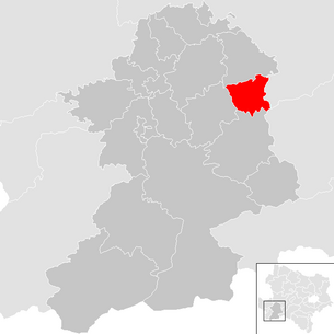
| Location of St. Georgen an der Leys in the Scheibbs district | ||
  |
||
| Source: Municipal data from Statistics Austria | ||

St. Georgen an der Leys (also Sankt Georgen an der Leys ) is a municipality in the Scheibbs district in Lower Austria with 1,330 inhabitants (as of January 1, 2020).
geography
St. Georgen an der Leys is located in the Mostviertel in Lower Austria. The area of the municipality covers 23.87 square kilometers, 31.44 percent of the area is forested.
Community structure
The municipality includes the following 18 localities (population in brackets as of January 1, 2020):
- Ahornleiten (28)
- Bach (26)
- Bichl (37)
- Badger Mountain (64)
- Forest lift (59)
- Semolina (19)
- Kandelsberg (32)
- Kreuzfeld (21)
- Kroell (91)
- Maierhof (27)
- Mitteröd (49)
- Oedwies (63)
- Ramsau (11)
- St. Georgen an der Leys (463)
- Shooter (57)
- Wiesmuehl (123)
- Windhag (127)
- Zwickelsberg (33)
The community consists of the cadastral communities Dachsberg and St. Georgen an der Leys.
Neighboring communities
| Oberndorf an der Melk | ||
| Scheibbs |
.svg)
|
Texingtal , ( Melk district ) |
| St. Anton an der Jeßnitz | Frankenfels , ( St. Pölten-Land district ) |
history
In ancient times, the area was part of the Noricum province .
Population development
According to the results of the 2001 census, there were 1299 inhabitants. In 1991 the community had 1241 inhabitants, in 1981 1109 and in 1971 1036 inhabitants. Current status on March 17, 2013: 1332 inhabitants.
politics
The municipal council has 19 members.
- With the municipal council elections in Lower Austria in 1990, the municipal council had the following distribution: 17 ÖVP and 2 SPÖ.
- With the municipal council elections in Lower Austria in 1995, the municipal council had the following distribution: 18 ÖVP and 1 SPÖ.
- With the municipal council elections in Lower Austria in 2000, the municipal council had the following distribution: 17 ÖVP, 1 SPÖ and 1 list Friedrich Tod electoral party St. Georgen.
- With the municipal council elections in Lower Austria in 2005 , the municipal council had the following distribution: 17 ÖVP, 1 SPÖ and 1 list Friedrich Tod electoral party St. Georgen.
- With the municipal council elections in Lower Austria in 2010 , the municipal council had the following distribution: 17 ÖVP and 2 SPÖ.
- With the municipal council elections in Lower Austria in 2015 , the municipal council had the following distribution: 17 ÖVP and 2 SPÖ.
- With the municipal council elections in Lower Austria 2020 , the municipal council has the following distribution: 18 ÖVP and 1 SPÖ.
- mayor
- since ? Stefan Schuster (ÖVP)
Culture and sights
- There are six hiking routes with different levels of difficulty, supervised by the community and the rural youth. These lead z. For example, you will pass the sights “Bichl Bucha”, “Kendler Wasserfall” and the Melkursprung (which is already in the neighboring municipality of St. Anton an der Jeßnitz ). There are also several places to stop for a break on the hiking routes; among which one offers must that is cooled in a well.
economy
In 2001 there were 28 non-agricultural workplaces, agricultural and forestry operations 122 according to the 1999 survey. According to the 2001 census, the number of people in employment at the place of residence was 607. The 2001 participation rate was 47.26 percent.
education
- kindergarten
- Elementary school
- music school
Sports
The following sports are possible in the municipality:
- Soccer
- tennis
- beach volleyball
- Hiking trails
- Stick shooting
- horse riding
- Ice skating
Web links
- Side of the community
- 32012 - St. Georgen an der Leys. Community data, Statistics Austria .
Individual evidence
- ↑ The official spelling is specified or represented in the law on the division of the State of Lower Austria into municipalities, LGBl.No. 1030–94 of December 9, 2011 and on Statistics Austria: A look at the municipality
- ↑ Statistics Austria: Population on January 1st, 2020 by locality (area status on January 1st, 2020) , ( CSV )
- ^ Result of the municipal council election in 1995 in St. Georgen an der Leys. Office of the Lower Austrian State Government, March 30, 2000, accessed on October 12, 2019 .
- ^ Election result of the municipal council election 2000 in St. Georgen an der Leys. Office of the Lower Austrian State Government, February 4, 2005, accessed on October 12, 2019 .
- ^ Result of the 2005 municipal council election in St. Georgen an der Leys. Office of the Lower Austrian State Government, March 4, 2005, accessed on October 12, 2019 .
- ^ Election result of the municipal council election 2010 in St. Georgen an der Leys. Office of the Lower Austrian State Government, October 8, 2010, accessed on October 12, 2019 .
- ↑ Election result of the 2015 municipal council election in St. Georgen an der Leys. Office of the Lower Austrian State Government, December 1, 2015, accessed on October 12, 2019 .
- ↑ Results of the municipal council election 2020 in St. Georgen an der Leys. Office of the Lower Austrian state government, January 26, 2020, accessed on February 29, 2020 .
- ↑ Hiking map 2010

Cadastral communities: Dachsberg | St. Georgen an der Leys
Locations: Ahornleiten | Bach | Bichl | Dachsberg | Forest lift | Semolina | Kandelsberg | Kreuzfeld | Kröll | Maierhof | Mitteröd | Oedwies | Ramsau | St. Georgen an der Leys | Shooter | Wiesmühl | Windhag | Zwickelsberg
Villages: St. Georgen an der Leys Settlement: Kreuzfeld | Parish ground | Wiesmühl Rotte: Gries | Maierhof | Mitteröd | Shooter | Zwickelsberg Scattered Houses: Ahornleiten | Bach | Bichl | Forest lift | Kandelsberg | Kröll | Oberdachsberg | Oedwies | St. Georgen an der Leys area | Unterdachsberg | Windhag
Counting district: St. Georgen an der Leys